


Long Lake Town Beach
Long Lake
Canoe, Kayak, and Swim
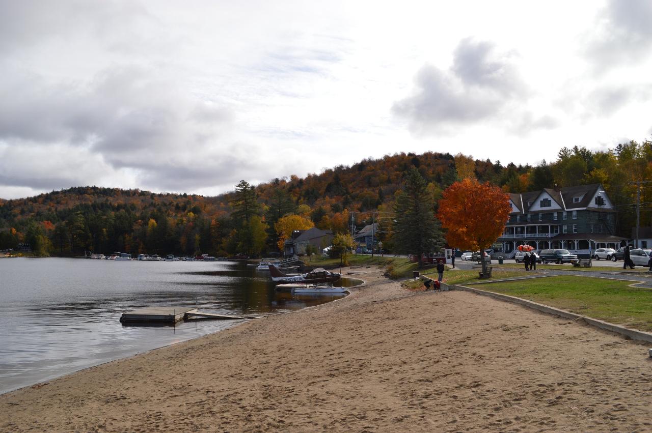
Long Lake Town Beach is the public swimming beach of the Town of Long Lake, run by the town's Parks and Recreation Department in the center of the hamlet of Long Lake in Hamilton County, New York. It sits on the south shore of Long Lake, a 14-mile stretch of the Raquette River that averages about half a mile wide and runs northeast through the middle of the Adirondack Park. The sand faces north up the lake toward the Seward Range, with the Adirondack Hotel directly across the road.
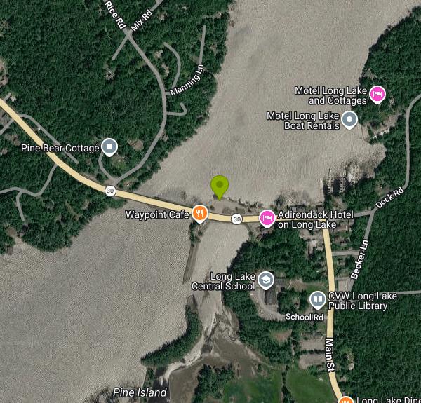
The beach is right on Route 30 (Main Street), listed at 1258 Main Street. Coming from the south or west, you cross the old steel truss bridge over the narrows and the beach is the strip of sand on the lake side of the road just past it. Cars park along the street edge beside the beach and elsewhere in the hamlet. The town's beach page does not mention an entry or parking fee, and Adirondack Life's roundup of Adirondack town beaches lists it as free.
The town describes the designated swimming area as about 28 yards across, running from 1 foot deep at the shore to 15 feet at its deepest. It is split in two. A roped shallow section is for beginners and small children, and the deeper water beyond the buoys leads out to a large floating swim dock with a mini trampoline, a slide and rope swings. Swimmers have to pass a lifeguard's swim test before they can use the deep end or the dock. Inside the shallow area only Coast Guard approved Type III life jackets are allowed, so arm floaties and puddle jumpers are out, and no flotation of any kind is permitted past the buoys. On the dock the rules are simple: let go of the rope swing, one person at a time on the trampoline, no running. The lake sits at about 1,630 feet, and the water stays cold well into summer.
Red Cross certified lifeguards staff the beach in summer. For the 2026 season the town posted hours of 10 a.m. to 6 p.m. seven days a week, with Fridays and July 4 running until 8 p.m., and it warns that hours can change without notice. Swimming is prohibited whenever the lifeguards are off duty, a condition of the beach's state Department of Health permit, and signs at the beach say so. In practice that means no swimming before the guards arrive in late June or after they leave at the end of summer. The town also runs free swim lessons for ages 3 to 13 from early July through August; sign up in person at the beach.
Long Lake is a working lake. The Helms seaplane base sits at the east end of the beach, float planes take off and land close by all day, and motorboats use the narrows by the bridge, so stay inside the buoyed area. The deep end is well over most people's heads, which is the reason for the swim test.
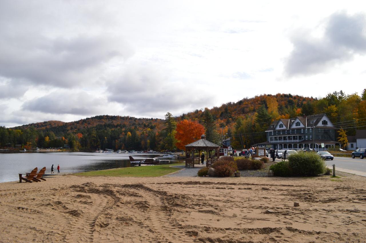
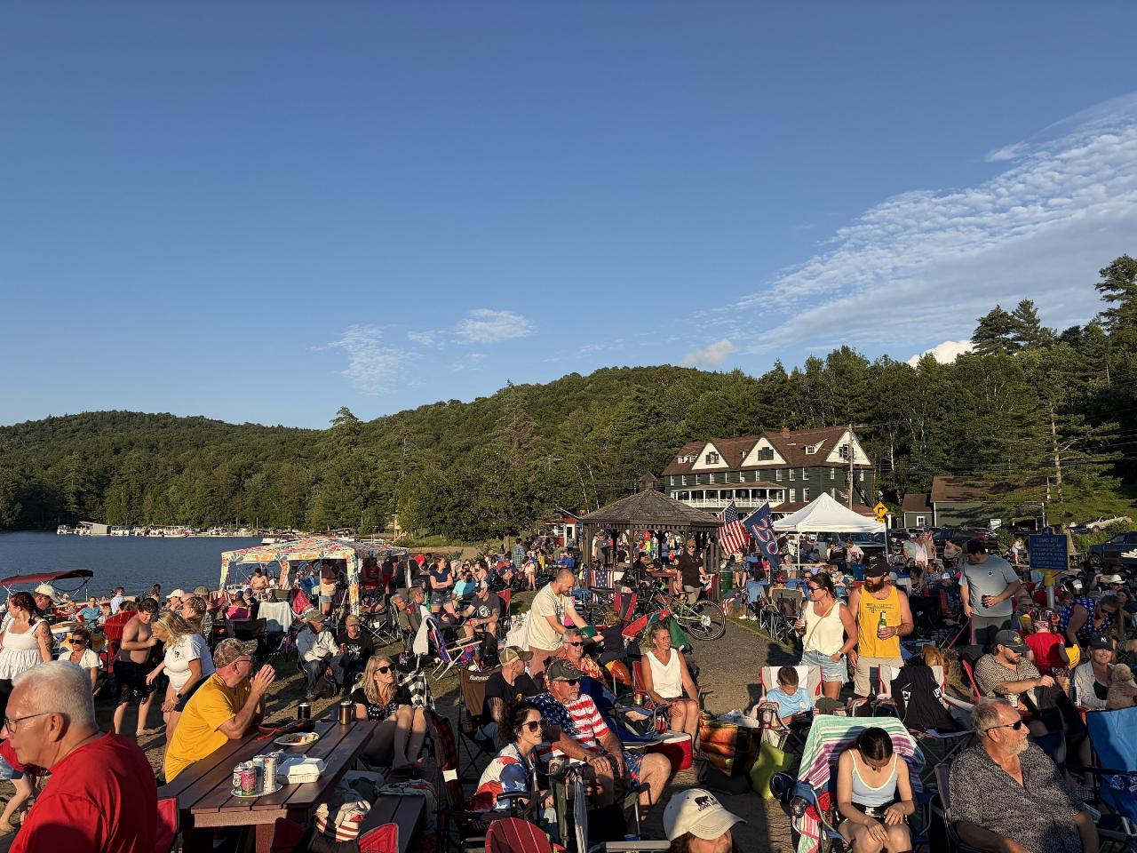
Public restrooms and a gazebo stand on the beach, and the town uses it for summer concerts and its July 4 celebration. Restaurants, a grocery and kayak, canoe, paddleboard and motorboat rentals are within a short walk. Paddlers can put in from the beach area to reach either end of the lake, which is part of the Northern Forest Canoe Trail, and the state boat launch is a little farther along on Dock Road.
More Information

- Plan Ahead and Prepare
- Travel & camp on durable surfaces
- Dispose of waste properly
- Leave what you find
- Minimize campfire impacts
- Respect wildlife
- Be considerate of other visitors
Directions
From Long Lake
- Head southeast on Wayzata Blvd toward Lake St (1.7 mi)
- Take the ramp onto US-12 E (4.6 mi)
- Continue onto I-394 E/
US-12 E (5.3 mi) - Take the exit on the left toward I-394Toll road(0.1 mi)
- Continue onto I-394 (2.4 mi)
- Keep right to stay on I-394 (0.3 mi)
- Take the exit onto I-94 E/
US-12 E (10.9 mi) - Keep right to continue on I-94 E, follow signs for US-10 EEntering Wisconsin(255 mi)
- Keep right to continue on I-90 EToll roadEntering Illinois(103 mi)
- Keep left to stay on I-90 EToll road(24.5 mi)
- Keep left to stay on I-90 EToll road(17.4 mi)
- Keep right to continue on I-90 E/
I-94 E (4.8 mi) - Keep left to continue on I-90 E, follow signs for Indiana Toll RdToll roadPassing through IndianaEntering Ohio(306 mi)
- Continue straight onto I-80 EToll road(9.2 mi)
- Take exit 151 to merge onto I-480 E toward Cleveland (9.8 mi)
- Take exit 11 toward Cleveland (0.8 mi)
- Merge onto Berea Fwy (0.5 mi)
- Merge onto I-71 N (7.4 mi)
- Take the exit toward I-90 E (1.1 mi)
- Continue onto I-90 E (14.3 mi)
- Take the exit toward I-90 E (0.4 mi)
- Continue onto I-90 E (2.6 mi)
- Keep left to stay on I-90 EToll roadPassing through PennsylvaniaEntering New York(344 mi)
- Take exit 33 to merge onto NY-365 E toward Verona/
Rome (7.9 mi) - Keep left to continue on Rome Oneida Rd (0.4 mi)
- Continue onto NY-26 N/
NY-365 E/ State Rte 26 N (1.5 mi) - Keep right to continue on NY-365 E (1.6 mi)
- Take the NY-365 E/
E Dominick St exit toward Barneveld (0.7 mi) - Turn right onto NY-365 E/
E Dominick St Continue to follow NY-365 E(1.9 mi) - Turn left onto NY-365 E/
New Floyd Rd Continue to follow NY-365 E(11.6 mi) - Turn left onto NY-365 E/
Mappa Ave Continue to follow NY-365 E(0.9 mi) - Slight right onto the ramp to Alder Creek/
Old Forge (0.2 mi) - Merge onto NY-12 N/
NY-28 N (9.6 mi) - Exit onto NY-28 N toward Old Forge/
Blue Mt Lake (61.9 mi) - Continue onto NY-28N E/
NY-30 N (10.6 mi) - Turn left onto NY-30 N/
Main St Destination will be on the right(0.6 mi)
 The sand at Long Lake Town Beach with the swim docks pulled in for the off season and the Adirondack courtesy of Idawriter↗ (CC BY-SA 3.0↗)
 Long Lake Town Beach looking east past the gazebo toward the seaplane docks in fall. courtesy of Idawriter↗ (CC BY-SA 3.0↗)
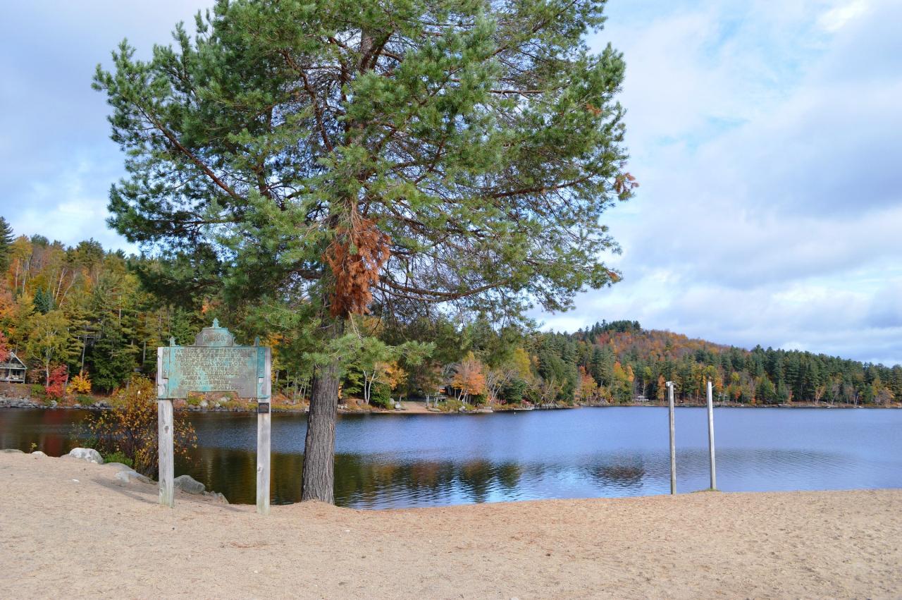
 A pine and the beach sign on the sand at Long Lake Town Beach, with the swim area behind. courtesy of Idawriter↗ (CC BY-SA 3.0↗)
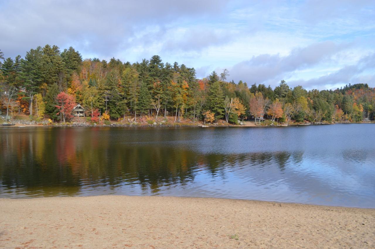
 The sandy shoreline of Long Lake Town Beach and the calm water across the narrows. courtesy of Idawriter↗ (CC BY-SA 3.0↗)
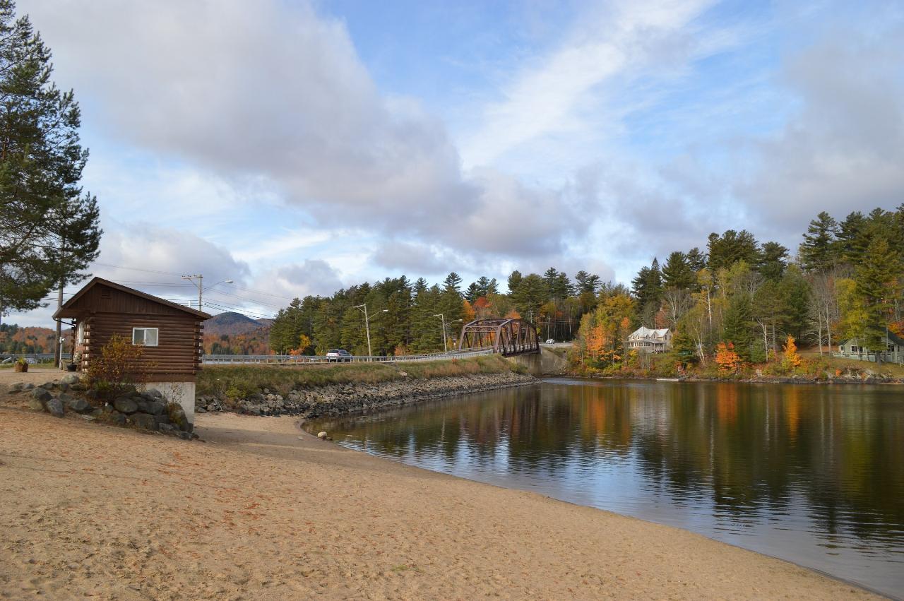
 The west end of Long Lake Town Beach with the restroom building and the Route 30 bridge beyond. courtesy of Idawriter↗ (CC BY-SA 3.0↗)
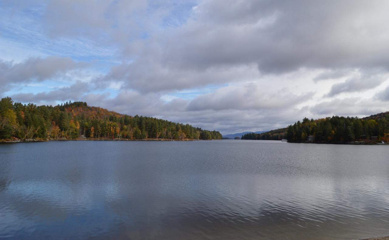
 Long Lake seen from the town beach on an overcast fall day. courtesy of Idawriter↗ (CC BY-SA 3.0↗)
 Crowds on Long Lake Town Beach for the town's July 4 celebration in 2026. courtesy of Dclemens1971↗ (CC BY 4.0↗)
Other Swimming Holes, Canoeing Areas, and Kayaking Areas Nearby
Long Lake Area
Saugerties, New York
13.1 miles NESwim near Saugerties, New York
Swim
Blue Ledges Area
Indian Lake, New York
17.9 miles SESwim near Indian Lake, New York
Swim
Saranac Lakes Area
Salamanca, New York
21.3 miles NESwim near Salamanca, New York
Swim
Lake Placid Area
Saugerties, New York
31.9 miles NESwim near Saugerties, New York
Swim
Speculator Area
Skaneateles, New York
32.4 miles SESwim near Skaneateles, New York
Swim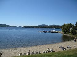
Schroon Lake Town Beach
Schroon Lake
34.5 miles EThe Town of Schroon's lifeguarded public beach in the Town Park off Main Street, with a roped swim area, floating dock and free entry from late June through Labor Day.
Canoe, Kayak, Swim
Black Hole
Wevertown, New York
35.3 miles SESwim near Wevertown, New York
Swim
Keene Area
Saugerties, New York
35.9 miles NESwim near Saugerties, New York
Swim
Split Rock Falls Area
Skaneateles, New York
42.6 miles ESwim near Skaneateles, New York
Swim
Trout Lake
Diamond Point, New York
47.0 miles SEVery limited public access to a scenic lake near Diamond Point — narrow path, minimal parking, and a muddy bottom that rewards a late-evening skinny dip more than a daytime swim.
Swim
Port Henry Beach
Port Henry
48.4 miles EA free town beach on Lake Champlain at the north end of Bulwagga Bay, run by the Town of Moriah with lifeguards on duty from mid June through Labor Day. Free kayaks and paddleboards, a fishing pier and a campground share the same stretch of shore.
Camp, Canoe, Kayak, Swim
Higley Flow Area
Saugerties, New York
49.1 miles NWSwim near Saugerties, New York
Swim


