


Split Rock Falls Area
Skaneateles, New York
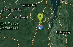
| GPS: |
44°10'13.2"N 73°36'28.8"W Maps | Directions |
| State: | New York |
Swim

- Plan Ahead and Prepare
- Travel & camp on durable surfaces
- Dispose of waste properly
- Leave what you find
- Minimize campfire impacts
- Respect wildlife
- Be considerate of other visitors
Directions
From Skaneateles, New York
- Head west toward Jordan St (69 ft)
- Turn right onto Jordan St (0.1 mi)
- Turn right onto Academy St (0.1 mi)
- Turn left at the 1st cross street onto NY-321 N/State Street RdContinue to follow NY-321 N(8.2 mi)
- Turn right onto NY-5 E (2.2 mi)
- Take the NY-5 E ramp to Syracuse (0.1 mi)
- Continue onto NY-5 E (4.9 mi)
- Take the NY-695 exit on the left toward I-690/Fairgrounds/Syracuse (0.5 mi)
- Continue onto NY-695 N (1.2 mi)
- Take the exit on the left onto I-690 E toward Fairgrounds/SyracuseParts of this road may be closed at certain times or days(9.6 mi)
- Take the Interstate 481 N exit on the left toward Interstate 90/Thruway (0.6 mi)
- Merge onto I-481 N (2.6 mi)
- Take exit 6 to merge onto I-90 EToll road(24.8 mi)
- Take exit 33 for NY-365 toward Verona/RomeToll road(0.5 mi)
- Keep right at the fork and merge onto NY-365 EPartial toll road(9.2 mi)
- Keep right to stay on NY-365 E (1.6 mi)
- Take the NY-365 E/E Dominick St exit toward Barneveld (0.7 mi)
- Turn right onto NY-365 E/E Dominick StContinue to follow NY-365 E(1.9 mi)
- Turn left onto NY-365 E/New Floyd RdContinue to follow NY-365 E(11.6 mi)
- Turn left onto NY-365 E/Mappa AveContinue to follow NY-365 E(15.4 mi)
- Turn left onto NY-8 N (24.8 mi)
- Continue straight to stay on NY-8 N (9.7 mi)
- Turn right onto NY-30 S/NY-8 N (9.7 mi)
- Turn left onto NY-8 N (28.9 mi)
- Slight left toward U.S. 9 N (397 ft)
- Merge onto U.S. 9 N (5.5 mi)
- Turn left onto Stone Bridge Rd (0.4 mi)
- Turn right to merge onto I-87 N (25.7 mi)
- Take exit 30 for US-9 toward NY-73/Keene Valley/Keene (0.2 mi)
- Turn left onto U.S. 9 N (8.7 mi)
- Turn right (433 ft)

Other Swimming Holes Nearby
Keene Area
Saugerties, New York
9.5 miles WSwim near Saugerties, New York
Swim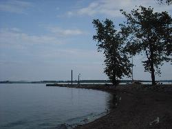
Port Henry Beach
Port Henry
11.3 miles SEA free town beach on Lake Champlain at the north end of Bulwagga Bay, run by the Town of Moriah with lifeguards on duty from mid June through Labor Day. Free kayaks and paddleboards, a fishing pier and a campground share the same stretch of shore.
Camp, Canoe, Kayak, Swim
Lake Placid Area
Saugerties, New York
11.5 miles WSwim near Saugerties, New York
Swim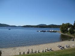
Schroon Lake Town Beach
Schroon Lake
24.3 miles SThe Town of Schroon's lifeguarded public beach in the Town Park off Main Street, with a roped swim area, floating dock and free entry from late June through Labor Day.
Canoe, Kayak, Swim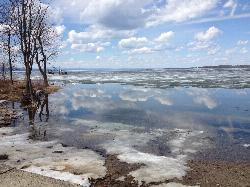
Blanchard Beach at Oakledge Park
Burlington
27.4 miles NESandy, shallow city beach on Lake Champlain in Burlington's Oakledge Park. Free on foot or bike, $3/hour parking May through October, no lifeguards, and frequent algae checks in summer.
Hike, Swim
Leddy Beach
Burlington
28.8 miles NEFree city swimming beach on Lake Champlain at Leddy Park in Burlington's New North End, with free parking, a sandy shore and daily water monitoring in summer, but no lifeguards.
Hike, Swim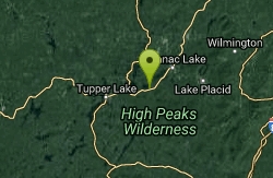
Saranac Lakes Area
Salamanca, New York
32.1 miles WSwim near Salamanca, New York
Swim
Lake Clear Beach
Lake Clear
34.3 miles NWFree, unguarded sand beach on the east shore of Lake Clear in the Saranac Lakes Wild Forest, a mile north of the hamlet of Lake Clear. DEC gravel lot off NY 30, a short walk through the woods, pit privies only.
Canoe, Kayak, Swim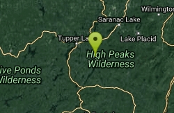
Long Lake Area
Saugerties, New York
35.3 miles WSwim near Saugerties, New York
Swim
Blue Ledges Area
Indian Lake, New York
36.0 miles SWSwim near Indian Lake, New York
Swim
Black Hole
Wevertown, New York
39.9 miles SSwim near Wevertown, New York
Swim
Long Lake Town Beach
Long Lake
42.8 miles WThe Town of Long Lake's free, lifeguarded beach on Route 30 in the hamlet, with a roped shallow area and a floating swim dock with a slide, trampoline and rope swings. Swimming only while guards are on duty in summer.
Canoe, Kayak, Swim
Trout Lake
Diamond Point, New York
43.4 miles SVery limited public access to a scenic lake near Diamond Point — narrow path, minimal parking, and a muddy bottom that rewards a late-evening skinny dip more than a daytime swim.
Swim
Point Au Roche State Park
Plattsburgh, New York
44.8 miles NA secluded Lake Champlain bay has become a beloved clothing-optional retreat for Quebecers — arrive with an open mind and very little else.
Swim
Burton Island State Park
St. Albans
46.5 miles NECar-free Burton Island in Lake Champlain has a rocky, unguarded swim area by the marina, reached by the state's 10-minute Island Runner ferry from Kill Kare State Park. State day-use and ferry fees apply.
Camp, Canoe, Hike, Kayak, Swim
Blue Mountain Lake Public Beach
Blue Mountain Lake
46.6 miles SWA small, lifeguarded town beach on the east shore of Blue Mountain Lake in the Adirondacks, off NYS Route 28 in the hamlet, with a roped swim area, a dock and the lake's only public canoe and kayak launch.
Canoe, Kayak, Swim
Speculator Area
Skaneateles, New York
49.3 miles SWSwim near Skaneateles, New York
SwimNearby Campsites
Port Henry Beach
Port Henry
11.3 miles SEA free town beach on Lake Champlain at the north end of Bulwagga Bay, run by the Town of Moriah with lifeguards on duty from mid June through Labor Day. Free kayaks and paddleboards, a fishing pier and a campground share the same stretch of shore.
Camp, Canoe, Kayak, Swim
Burton Island State Park
St. Albans
46.5 miles NECar-free Burton Island in Lake Champlain has a rocky, unguarded swim area by the marina, reached by the state's 10-minute Island Runner ferry from Kill Kare State Park. State day-use and ferry fees apply.
Camp, Canoe, Hike, Kayak, Swim


