


Melton Hill Dam Swimming Area
Lenoir City
Camp, Canoe, Kayak, and Swim
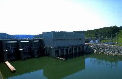
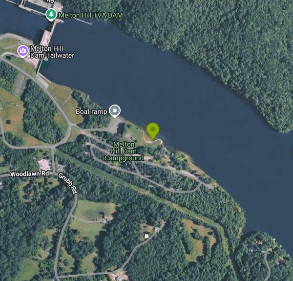
The Melton Hill Dam swim beach is one of the public swim beaches the Tennessee Valley Authority (TVA) keeps on its dam reservations. It sits on Melton Hill Lake, the 5,470-acre Clinch River reservoir, on the south bank less than half a mile upstream of Melton Hill Dam in Loudon County. The beach is part of the Melton Hill Dam Recreation Area, a TVA day-use area that shares the shoreline with a public boat ramp, picnic grounds and the TVA campground run by Go Camp Tennessee under a partnership agreement with TVA.
The reservation is on TVA Melton Hill Dam Road off U.S. 321, roughly six miles north of downtown Lenoir City and about 30 minutes west of Knoxville. Follow the signs for the campground and day-use area. Day visitors park in the day-use lot by the boat ramp and walk a short path down to the water, and campers can reach the same beach on foot from their sites. Nothing published by TVA or the campground operator lists a parking or entry fee for day use.
The swim area is a marked section of the lake on the river's left bank at Clinch River mile 23.5, just upstream of the ramp at mile 23.4. Tennessee boating rules ban every kind of vessel inside the line of No Boating buoys, and boats near the ramp are held to Slow, No Wake, so the water inside the line stays quiet. Melton Hill is a reservoir, so there is no river current at the beach in normal conditions, though the bottom drops off as you move out and visitors have noted soft, muddy patches near the edge. TVA's swim season runs May through October. No lifeguard is mentioned by TVA or the operator, so plan on swimming without one.
Swimming and day use are free. A Maryville family guide lists the swimming area as open sunrise to sunset with free admission. The only listed charge in the day-use area is for reserving a picnic pavilion, $140 on the operator's fee schedule. Unreserved pavilions are first come, first served. Camping is a separate paid service with a two-night minimum. The campground runs from mid-March to mid-November, and office hours vary by day (865-361-0436).
Stay inside the buoy line. Boats launch and land a short distance downstream, and the dam with its powerhouse and navigation lock is close by, so do not drift toward the ramp or the dam. Water conditions can change after heavy rain, when flows on the Clinch are higher and the water turns muddy. If a sign or the campground staff report a closure or an advisory, follow it.
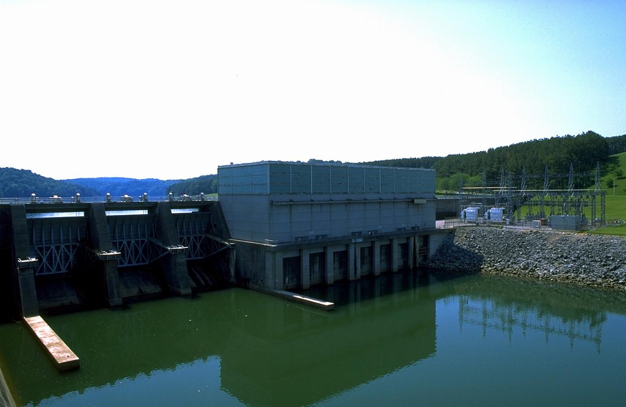
Beyond the beach, the reservation has two pavilions in the day-use area and two more at an overlook with benches and picnic tables, plus paved roads that work for walking and riding. Anglers fish the lake above the dam and the tailwater below it. Melton Hill Dam was finished in 1963, is 103 feet high, and is the only TVA dam on a tributary with a navigation lock. It was added to the National Register of Historic Places in 2017.
More Information
Book Now - Melton Hill Dam Campground — Tennessee Valley Authority (TVA) | Your Perfect Camping
Mobile homesRoute plannerFor CampsitesENLoginHomeAll CampsitesMelton Hill Dam Campground — Tennessee Valley Authority (TVA)Melton Hill Dam Campground — Tennessee Valley Authority (TVA)2009 Grubb Road, Lenoir City, TN 37771, 100+views in the past monthDo you own or manage this campsite?
https://camplinq.com/camps/melton-hill-dam-campground-tennessee-valley-authority-tvaMelton Hill Dam Campground - Go Camp Tennessee
Melton Hill Dam Campground Reserve Your Campsite Today! #text-box-1920055163 { width: 80%; } #text-box-1920055163 .text-box-content { font-size: 100%; } @media (min-width:550px) { #text-box-1920055163 { width: 90%; } } #banner-839770674 { padding-top: 500px; } #banner-839770674 .overlay { background-color: rgba(0, 0, 0, 0.3); } #banner-839770674 .ux-shape-divider--bottom svg { height: 30px; --divider-width: 100%; } @media (min-width:550px) { #banner-839770674 { padding-top: 800px; } #banner-839770674 .overlay { background-color: rgba(0, 0, 0, 0.5); } } Melton Hill Melton Hill Dam Campground is located at TVA’s Melton Hill Dam in Loudoun County, TN. The campground is upstream of Melton Hill Dam on the south bank and has a 10-15% slope with three roads tiered up the hillside.
https://gocamptennessee.com/melton-hill-dam-campground/Melton Hill Dam Campground — Tennessee Valley Authority (TVA) | Lenoir City, Tennessee
Melton Hill Dam Campground — Tennessee Valley Authority (TVA): 31 Reviews, 113 Photos, $18 - $31 per night. "Love the camp ground, easy access for a big...
https://thedyrt.com/camping/tennessee/tennessee-melton-hill-reservoirMelton Hill Dam Campground, Lenoir City | Campendium
Melton Hill Dam Campground is a Campground in Lenoir City. Plan your road trip to Melton Hill Dam Campground in TN with Roadtrippers.
https://maps.campendium.com/us/lenoir-city-tn/camping-rv/melton-hill-dam-campground-lenoir-city-tn--2Melton Hill Dam Recreation Area - Wikidata
park in the United States of America
https://www.wikidata.org/wiki/Q49524637
- Plan Ahead and Prepare
- Travel & camp on durable surfaces
- Dispose of waste properly
- Leave what you find
- Minimize campfire impacts
- Respect wildlife
- Be considerate of other visitors
Directions
From Lenoir City
- Head northwest on US-321 S toward E Broadway StPass by Krystal (on the right in 2.8 mi)(3.8 mi)
- Turn right onto Williams Ferry Rd (118 ft)
- Turn left to stay on Williams Ferry Rd (1.0 mi)
- Turn right to stay on Williams Ferry Rd (1.1 mi)
- Turn left onto Buttermilk Rd (0.7 mi)
- Turn right onto Woodlawn Rd (0.5 mi)
- Turn left to stay on Woodlawn Rd (0.1 mi)
- Turn right (0.2 mi)
- Turn leftDestination will be on the left(164 ft)


Other Swimming Holes, Canoeing Areas, and Kayaking Areas Nearby
The Cove at Concord Park
Knoxville
8.2 miles EKnox County's free public swim beach on a sheltered cove of Fort Loudoun Lake west of Knoxville, with trucked-in sand, sand volleyball and seasonal paddleboard rentals. It is a designated swim area, but there is no lifeguard.
Canoe, Hike, Kayak, Swim
Frozen Head State Park
Wartburg, Tennessee
20.6 miles NWSwim near Wartburg, Tennessee
Swim
Obed Scenic River Area
Kingston Springs, Tennessee
24.2 miles NWRemote swimming holes along Obed Wild and Scenic River hide in and around Wartburg — stop at the visitor center for a map before heading out, as GPS is unreliable here.
Swim
Ozone Falls
Rockwood, Tennessee
28.8 miles WSwim near Rockwood, Tennessee
Swim
Turley Hole
Pioneer, Tennessee
33.7 miles NSwim near Pioneer, Tennessee
Swim
Piney River Area
Rockwood, Tennessee
34.8 miles WTen miles of remote backcountry trail link several swimming holes along the wild Piney River — a true through-hike with very likely optional swimwear in the wilderness.
Swim
Baby Falls
Tellico Plains, Tennessee
38.9 miles SA Tellico River waterfall and swimming hole that's beginner-friendly for kayakers, beautiful for hikers, and especially stunning in fall for picnics and photography.
Hike, Kayak, Swim, Whitewater
Baby Falls Area
Tellico Plains, Tennessee
39.0 miles SSwim near Tellico Plains, Tennessee
Swim
Big South Fork Area
Helenwood, Tennessee
39.6 miles NWMiles of trails, multiple named swimming holes, and five campgrounds spanning the Kentucky-Tennessee border in Big South Fork National Recreation Area — including Gentleman's Swimming Hole and Station Camp.
Camp, Hike, Swim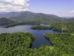
Cheoah Point Beach
Robbinsville
42.7 miles SEForest Service swim beach with a roped swim area on Santeetlah Lake, 6 miles north of Robbinsville, NC. Open April 15 to October 31 with a $5 per vehicle day-use fee.
Camp, Canoe, Hike, Kayak, Swim
Davis Branch
Tellico Plains, Tennessee
43.1 miles SA riverside campground on the Tellico River with six campsites, each with a picnic table — a peaceful Tennessee base camp for hiking, fishing, and campfire nights.
Camp, Hike, Swim 1.0 mi
Gentleman's Swimming Hole
Oneida, Tennessee
46.4 miles NWClear Fork River runs slow and deep through Big South Fork, making Gentleman's Swimming Hole a rare chance for a real swim at the end of an easy 2-mile family trail.
Hike, Swim
Hiwassee
Benton, Tennessee
47.0 miles SSwim near Benton, Tennessee
Swim
Richland Creek
Dayton, Tennessee
47.6 miles SWSwim near Dayton, Tennessee
SwimNearby Campsites
Cades Cove Campground
Townsend, Tennessee
34.9 miles SEOver 2 million visitors a year come to bike, hike, tour the 11-mile loop road, and watch wildlife amid wildflowers in spring and vivid fall colors in this iconic Smoky Mountain valley.
Camp
Big South Fork Area
Helenwood, Tennessee
39.6 miles NWMiles of trails, multiple named swimming holes, and five campgrounds spanning the Kentucky-Tennessee border in Big South Fork National Recreation Area — including Gentleman's Swimming Hole and Station Camp.
Camp, Hike, Swim
Cheoah Point Beach
Robbinsville
42.7 miles SEForest Service swim beach with a roped swim area on Santeetlah Lake, 6 miles north of Robbinsville, NC. Open April 15 to October 31 with a $5 per vehicle day-use fee.
Camp, Canoe, Hike, Kayak, Swim
Davis Branch
Tellico Plains, Tennessee
43.1 miles SA riverside campground on the Tellico River with six campsites, each with a picnic table — a peaceful Tennessee base camp for hiking, fishing, and campfire nights.
Camp, Hike, Swim


