


Mormon Reservoir
Fairfield

Camp, Canoe, and Kayak
Mormon Reservoir is an irrigation reservoir on McKinney Creek at the southern edge of the Camas Prairie in Camas County, Idaho, about five miles south of Fairfield. Mormon Dam, an earthen dam finished in 1908, holds back roughly 19,280 acre-feet of water at an elevation of about 5,050 feet. At full pool Idaho Fish and Game puts the surface at around 1,569 acres. The reservoir was built to store spring runoff for farms, and it is still run by a Fairfield-based irrigation company. Below the dam, McKinney Creek continues north toward Camas Creek. Nobody seems to have written down how the reservoir got its name.
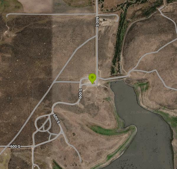
The shoreline is a patchwork of private, state and Bureau of Land Management ground. Public access is at the Idaho Fish and Game fishing and boating access site on the north shore, right beside the dam. There is no fee. The site has a boat ramp, docks, vault toilets (one of them wheelchair accessible) and open ground for primitive camping. There is no drinking water, electricity or trash pickup, so bring what you need and haul everything out. Gravel camp loops lined with concrete posts were built here years ago, and sagebrush has taken most of them back. Motorboats are allowed, and Fish and Game lists no motor restriction.
To get there, turn south off US 20 in Fairfield onto Mormon Reservoir Road. The first mile is paved, then it turns to gravel and runs across farm ground and sagebrush to the dam, about five miles in all. The old bridges on the route were judged unsafe at one point, and two new bridges went in during 2016 to restore access. Expect washboard and spring mud on the gravel. Fairfield is the place for fuel and groceries. There are no services at the water.
Fish and Game manages Mormon as a put-and-take rainbow trout fishery. Trout do not reproduce here, so the fishery depends on stocking, and most years the department has planted several thousand catchable triploid rainbows in spring. Surveys have also turned up yellow perch and suckers. The reservoir had a famous run in 2017 and 2018, when a heavy stocking in 2015 grew into lots of trout over 20 inches and some anglers reported 60 to 80 fish days. Fishing slowed by 2019 as those fish were caught. Idaho's general fishing rules apply, so check the current Fish and Game seasons and rules before you go.
Water level is the big variable. Irrigation draws the reservoir down all summer, and in dry years it drops close to empty. In August 2023 Fish and Game removed bag and possession limits under a salvage order after the reservoir's entire active storage had been delivered and the remaining trout were expected to die. In March 2026 the department announced that it would not stock Mormon at all that season because of low water. Low water also feeds outbreaks of smartweed, and Camas County sprayed several hundred acres from the air in 2017 and 2018 to knock it back. Late spring and early summer usually offer the most water and the best fishing.
The reservoir freezes over in winter, and ice typically goes out in late April or early May. Oxygen can run low under the ice, especially after a low-water year, and winterkill has wiped out most of the trout in some winters, so winter fishing is hit or miss.
Blue-green algae blooms are a recurring problem in late summer. Public health advisories were posted for Mormon in 2016, 2017 and 2020. When an advisory is up, stay out of the water, and keep dogs and kids away from it. There is no designated swimming area, and most people come here to fish, paddle or camp rather than swim.
For kayaks and canoes, the ramp and docks make launching easy. The reservoir sits wide open on the prairie with little to break the wind, so calm mornings are the best time to be out on the water. The Soldier Mountains rise to the north beyond Fairfield, and the country around the water is open sagebrush and farm ground.
More Information
Fish salvage order issued for Mormon Reservoir | Idaho Fish and Game
A fish salvage order is now in place for Mormon Reservoir. The Director of Fish and Game has ordered that bag and possession limits be removed on Mormon Reservoir effective August 18, 2023.
https://idfg.idaho.gov/article/fish-salvage-order-issued-mormon-reservoirFishing and Boating Access Site: Mormon Reservoir | Idaho Fish and Game
Idaho has over 300 fishing and boating access sites. Amenities and facilities are listed for each site.
https://idfg.idaho.gov/visit/location-idfg-fishing-and-boating-access-sites/22315-fishing-and-boating-access-site-mormonFishing has slowed at Mormon Reservoir, but no signs of winter kill found | Idaho Fish and Game
After two great years of fishing, it appears angler harvest greatly limited trout carryover into Spring 2019
https://idfg.idaho.gov/press/fishing-has-slowed-mormon-reservoir-no-signs-winter-kill-foundLittle Camas Reservoir and Mormon Reservoir trout stocking will not occur in 2026 | Idaho Fish and G
Hatchery trout stocking operations will not occur at Mormon Reservoir and Little Camas Reservoir for the 2026 season due to low water levels. Hatchery trout originally intended for Mormon and Little Camas Reservoirs will be stocked elsewhere in the Magic Valley Region to provide additional opportunity for anglers.
https://idfg.idaho.gov/article/little-camas-reservoir-and-mormon-reservoir-trout-stocking-will-not-occur-2026Mormon Res NR Fairfield ID - USGS Water Data for the Nation
Discover water data collected at monitoring location USGS-13141300, located in Camas County, Idaho and find additional nearby monitoring locations.
https://waterdata.usgs.gov/monitoring-location/13141300/Mormon Reservoir Camping | Idaho Campground Review
A guide to Mormon Reservoir Camping including pictures, descriptions and maps of the camping and surrounding area.
https://idahocampgroundreview.com/campgrounds/mormonresMormon Reservoir revival produced great trout fishing and is attracting anglers | Idaho Fish and Gam
Work done at the reservoir greatly improved fishing, but it still faces challenges
https://idfg.idaho.gov/press/mormon-reservoir-revival-produced-great-trout-fishing-and-attracting-anglersMormon Reservoir | Idaho Fishing Planner
Mormon Reservoir in Camas County is 1,569.2 acres.
https://idfg.idaho.gov/ifwis/fishingplanner/water/1148198432510Public Health Advisory Listed on Mormon Reservoir: Blue-Green Algae Related | Idaho Fish and Game
Mormon Reservoir - A Public Health Advisory related to blue-green algae toxins has been issued on June 23, 2017. There were hopes the high water and cooler spring might stave off a repeat of 2016, but it appears as though conditions are such that a hazardous algae bloom in Mormon Reservoir has warranted a Public Health Advisory issued by South Central Public Health District.
https://idfg.idaho.gov/blog/2017/06/public-health-advisory-listed-mormon-reservoir-blue-green-algae-related
- Plan Ahead and Prepare
- Travel & camp on durable surfaces
- Dispose of waste properly
- Leave what you find
- Minimize campfire impacts
- Respect wildlife
- Be considerate of other visitors
Directions
From Fairfield
- Head south toward Thorpe St (397 ft)
- Turn right onto Thorpe St (223 ft)
- Slight left after KeyBank (on the right) (0.3 mi)
- Turn right to merge onto I-95 S toward N.Y. CityEntering New York(25.0 mi)
- Take exit 21 toward White Plains/
Tappan Zee Brg (0.3 mi) - Continue onto I-287 WToll road(29.5 mi)
- Take exit 15 for I-287/
NJ-17 S toward New Jersey Entering New Jersey(0.6 mi) - Continue onto I-287 S/
NJ-17 S (0.6 mi) - Continue straight onto I-287 S (24.8 mi)
- Take exit 41 B to merge onto I-80 W toward Del Water GapToll roadEntering Pennsylvania(44.0 mi)
- Keep left to stay on I-80 WToll road(254 mi)
- Slight left (2.0 mi)
- Merge onto I-80 WEntering Ohio(71.4 mi)
- Take the exit to stay on I-80 WToll road(154 mi)
- Take exit 64 for I-75 S toward DaytonToll road(1.4 mi)
- Take exit 195 A for OH-795 toward Perrysburg/
Millbury (0.2 mi) - Turn left onto OH-795 W (1.5 mi)
- Turn right onto E Boundary St (0.3 mi)
- Turn left onto State Rte 65 S/
E Front St (1.4 mi) - Continue onto US-20 WPass by KFC (on the right in 1.3 mi)(2.7 mi)
- Take the ramp onto I-80 W/
I-90 W Toll road(56.4 mi) - Keep left to stay on I-80 W/
I-90 W Toll roadEntering Indiana(139 mi) - Take exit 21 for I-80 W/
I-94 W toward IN-51 S (0.9 mi) - Merge onto I-94 W/
I 80 E Continue to follow I-80 WToll roadEntering Illinois(22.8 mi) - Keep right to stay on I-80 W, follow signs for IowaToll road(24.3 mi)
- Slight left (4.9 mi)
- Keep left (0.2 mi)
- Continue straight (1.3 mi)
- Merge onto I-80 W (114 mi)
- Take the exit to stay on I-80 W toward DavenportEntering Iowa(192 mi)
- Take exit 124 for University Ave toward Clive (0.5 mi)
- Turn right onto University Ave (3.8 mi)
- Turn left onto Grand Prairie Pkwy (2.0 mi)
- Take the ramp onto I-80 WEntering Nebraska(124 mi)
- Continue straight to stay on I-80 WEntering Wyoming(571 mi)
- Keep left to stay on I-80 WEntering Utah(309 mi)
- Take exit 168 for I-84 W toward Ogden (0.3 mi)
- Continue onto I-84 W (38.5 mi)
- Merge onto I-15 N/
I-84 W (38.7 mi) - Keep left to continue on I-84 W, follow signs for BoiseEntering Idaho(161 mi)
- Take exit 157 for ID-46 toward Wendell/
Gooding (0.4 mi) - Turn right onto ID-46 N (38.2 mi)
- Turn left onto 400 S/
Lazy A Rd (2.4 mi) - Turn right onto Fir Grv Rd (0.9 mi)
- Turn left onto 200 E/
300 S/ Manard Rd (0.3 mi) - Slight right onto 200 E/
300 S (331 ft) - Continue straight (335 ft)
- Slight left onto 300 S/
Manard Rd (2.4 mi) - Turn left (1.0 mi)
- Continue onto 600 S (0.2 mi)
- Continue straightDestination will be on the right(200 ft)


Other Canoeing Areas and Kayaking Areas Nearby
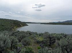
Magic Reservoir
Bellevue
19.0 miles EMagic Reservoir is a big irrigation lake on the Big Wood River surrounded by BLM sagebrush land, with free ramps and primitive camps. It is known for trout, perch and ice fishing, but water levels swing hard with irrigation demand.
Camp, Canoe, Kayak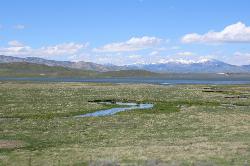
Little Camas Reservoir
Mountain Home
29.9 miles WIrrigation reservoir on the western Camas Prairie northeast of Mountain Home, with a free Forest Service boat ramp, primitive shoreline camping and trout fishing. Water levels swing hard, and there is no trout stocking in 2026.
Camp, Canoe, Kayak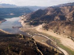
Anderson Ranch Reservoir
Pine
30.9 miles WA 14-mile Reclamation reservoir on the South Fork Boise River northeast of Mountain Home, best known for kokanee fishing. This pin marks the free Fall Creek Boat Ramp on the west shore, with free Forest Service campgrounds a short drive away.
Camp, Canoe, Hike, Kayak, SwimNearby Campsites
Little City of Rocks
Gooding, Idaho
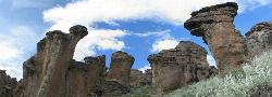
12.6 miles SEA volcanic hoodoo landscape of natural arches, towers, and mushroom-cap formations near Gooding, Idaho — best visited in spring when desert wildflowers bloom and the main loop trail is scenic.
Camp, Hike
McKinney Butte Lava Tubes
Gooding, Idaho
18.3 miles STwo forking lava tubes near Bliss — one open to anyone, the other gated (BLM permit required) — that survived the Bonneville Flood and a 1993 landslide.
Camp, Cave
Magic Reservoir
Bellevue
19.0 miles EMagic Reservoir is a big irrigation lake on the Big Wood River surrounded by BLM sagebrush land, with free ramps and primitive camps. It is known for trout, perch and ice fishing, but water levels swing hard with irrigation demand.
Camp, Canoe, Kayak
Worswick Hot Springs
Fairfield, Idaho
19.6 miles NFree hillside hot spring pools on Worswick Creek in the Sawtooth National Forest, about 20 miles north of Fairfield. The lower pools run about 90 to 105 degrees, and the source water is hot enough to scald.
Camp, Hot Springs
Preis Hot Spring
Fairfield, Idaho
20.5 miles NA small sunken wooden box beside Forest Road 227 north of Fairfield that fits two people in clear, roughly 102 degree water. Pair it with Worswick Hot Springs a couple of miles away.
Camp, Hot Springs 3.4 mi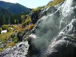
Skillern Hot Springs
Fairfield, Idaho
25.4 miles NA stunning six-mile trail along crystal-clear Big Smoky Creek to a hot spring — spectacular in fall, with two trail options and a sign marking the final three miles.
Camp, Hike, Hot Springs
Little Camas Reservoir
Mountain Home
29.9 miles WIrrigation reservoir on the western Camas Prairie northeast of Mountain Home, with a free Forest Service boat ramp, primitive shoreline camping and trout fishing. Water levels swing hard, and there is no trout stocking in 2026.
Camp, Canoe, Kayak
Anderson Ranch Reservoir
Pine
30.9 miles WA 14-mile Reclamation reservoir on the South Fork Boise River northeast of Mountain Home, best known for kokanee fishing. This pin marks the free Fall Creek Boat Ramp on the west shore, with free Forest Service campgrounds a short drive away.
Camp, Canoe, Hike, Kayak, Swim
Galena Lodge
Ketchum, Idaho
41.5 miles NA community-owned historic lodge 23 miles north of Sun Valley, open summer and winter as a hub for hikers, bikers, Nordic skiers, and snowshoers with rentals and great food.
Camp, Cross-country Ski, Snowshoe


