


Little City of Rocks
Gooding, Idaho
| Address: | Little City of Rocks, Gooding, ID 83330, USA |
| GPS: |
43°7'10.3"N 114°40'59.3"W Maps | Directions |
| State: | Idaho |
Trails Rocks Wildflowers
Camp and Hike
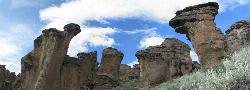
Not to be confused with the City of Rocks National Reserve, Little City of Rocks is located near Gooding, Idaho. There are two portions to the area, the Little City of Rocks and the Gooding City of Rocks. This area was formed when volcanic ash fell and hardened, later being eroded away by the weather. Many hoodoo, natural arches, towers, and mushroom cap formations exist throughout the park, making for interesting pictures and climbing challenges.
The park itself has a main trail that can be explored and will take visitors on a nice loop hike. It includes some nice views of the different rocks and is best done in the spring. Springtime is the best time to visit because the park is not too hot, the grass is still green, and desert flowers are still in bloom. All of this together, makes for a beautiful and refreshing trip for anyone. In addition to the main trail, there are several other side trails that visitors can take. These trails however, will require some hunting in order to find them. They provide additional views of the rocks in the park and a few spots that will give visitors a 360° view of the South Eastern Idaho landscape. Along with rocks, plants, and wildlife, some of the rocks have ancient Native American petroglyphs.
More Information
Add ResourceBe courteous, informed, and prepared. Read trailhead guidelines, stay on the trail, and don't feed the wildlife.
Read More
- Plan Ahead and Prepare
- Travel & camp on durable surfaces
- Dispose of waste properly
- Leave what you find
- Minimize campfire impacts
- Respect wildlife
- Be considerate of other visitors
Directions
From Gooding, Idaho
- Head north on ID-46 N/Main St toward 6th Ave EContinue to follow ID-46 N(12.2 mi)
- Turn left (0.5 mi)
- Continue straightDestination will be on the left(0.7 mi)


Other Hiking Trails Nearby
Two Dog
Hailey, Idaho
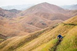
29.5 miles NEThe longest trail in the Croy Creek system, about 7.4 miles of non-motorized singletrack from Bullion Gulch Road over a sage saddle and down into the Croy Creek valley.
Hike, Mountain Bike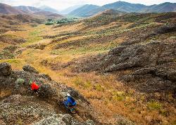
Croy Creek Trail System
Hailey, Idaho
30.0 miles NEAbout 18.5 miles of BLM and Blaine County singletrack in the sage foothills west of Hailey, rebuilt by IMBA after the 2013 Beaver Creek Fire and open early May to mid-November.
Atv/motorcycle, Hike, Mountain Bike
Carbonate Mountain
Hailey, Idaho
32.9 miles NESteep trail up the 6,714-foot hill directly west of downtown Hailey, with a 3.7-mile hiking loop, a six-mile advanced bike loop and wide views of the Wood River Valley.
Hike, Mountain Bike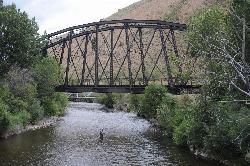
Wood River Trail
Hailey
33.5 miles NEA free paved path of 20-plus miles on the old Union Pacific rail bed, linking Bellevue, Hailey, Ketchum and Sun Valley. It is groomed for Nordic skiing in winter.
Cross-country Ski, Cycle, Hike
Quigley Canyon
Hailey
34.0 miles NEA year-round BCRD trail area in Quigley Canyon east of Hailey. Summer brings a pump track, flow trails, jump lines and a 4-mile loop, and winter brings over 20 km of groomed Nordic trails.
Cross-country Ski, Hike, Mountain Bike 3.4 mi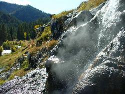
Skillern Hot Springs
Fairfield, Idaho
37.1 miles NA stunning six-mile trail along crystal-clear Big Smoky Creek to a hot spring — spectacular in fall, with two trail options and a sign marking the final three miles.
Camp, Hike, Hot Springs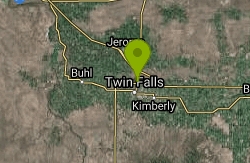
Perrine Bridge
Jerome, Idaho
37.7 miles SA 1,500-foot bridge spanning 486 feet above the Snake River — park, walk to the edge, and watch base jumpers leap with parachutes year-round.
Hike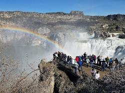
Shoshone Falls Park
Twin Falls, Idaho
39.1 miles SBreathtaking spring runoff views of Shoshone Falls roaring so hard you feel the mist hundreds of feet up — plus a 2.5-mile canyon rim trail to Evel Knievel's 1974 Snake River jump site.
Hike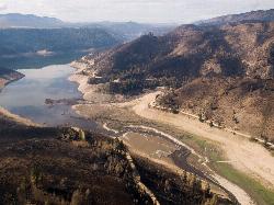
Anderson Ranch Reservoir
Pine
41.0 miles NWA 14-mile Reclamation reservoir on the South Fork Boise River northeast of Mountain Home, best known for kokanee fishing. This pin marks the free Fall Creek Boat Ramp on the west shore, with free Forest Service campgrounds a short drive away.
Camp, Canoe, Hike, Kayak, Swim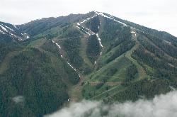
Bald Mountain Trail
Ketchum, Idaho
41.2 miles NThe main hiking and uphill-only biking route up Bald Mountain, climbing about 5.2 miles and 3,200 feet from River Run Plaza in Ketchum. Many hikers stop at the Roundhouse about 4 miles up.
Hike, Mountain Bike
Adams Gulch Loop
Ketchum, Idaho
43.0 miles NKetchum's busiest trail network, with easy loops on Shadyside and Sunnyside, the Griffin Butte intermediate loop and the one-way, bike-only Forbidden Fruit flow trail. The trailhead is less than two miles north of town.
Hike, Mountain Bike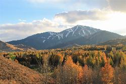
White Cloud Loop
Sun Valley, Idaho
43.0 miles NA 4.2-mile dirt loop around the White Clouds golf course in Sun Valley, maintained by Sun Valley Company and open to hikers, runners, riders and leashed dogs. It dries out early in spring and looks across at Bald Mountain and the Boulder Mountains.
Hike, Mountain Bike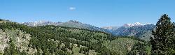
Fox Creek Loop
Ketchum, Idaho
46.2 miles NA 6-mile singletrack loop north of Ketchum that climbs through the 2007 Castle Rock burn, drops through aspen and finishes along the Big Wood River. Bikes ride it one way, counter-clockwise.
Hike, Mountain Bike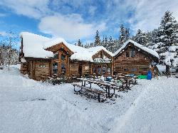
Harriman Trail
Ketchum
48.0 miles NAn 18-mile gravel path from the Sawtooth National Recreation Area headquarters north of Ketchum to Galena Lodge. It is open to bikes, hikers and horses in summer and groomed by BCRD for Nordic skiing in winter.
Cross-country Ski, Cycle, Hike, Mountain Bike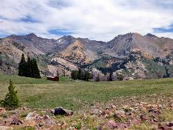
Pioneer Cabin Trail
Sun Valley
48.4 miles NEA steep, switchbacking trail from the Corral Creek trailhead east of Sun Valley to Pioneer Cabin, a 1937 Union Pacific ski hut with close views of the Pioneer Mountains.
Hike, Mountain BikeNearby Campsites

McKinney Butte Lava Tubes
Gooding, Idaho
10.4 miles SWTwo forking lava tubes near Bliss — one open to anyone, the other gated (BLM permit required) — that survived the Bonneville Flood and a 1993 landslide.
Camp, Cave
Mormon Reservoir
Fairfield
12.6 miles NWIrrigation reservoir on McKinney Creek about five miles south of Fairfield, with a free Idaho Fish and Game boat ramp, docks, toilets and primitive camping. It is stocked with rainbow trout, but the water drops hard by late summer and in dry years.
Camp, Canoe, Kayak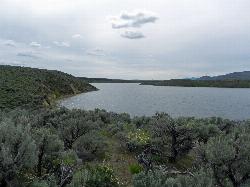
Magic Reservoir
Bellevue
19.5 miles NEMagic Reservoir is a big irrigation lake on the Big Wood River surrounded by BLM sagebrush land, with free ramps and primitive camps. It is known for trout, perch and ice fishing, but water levels swing hard with irrigation demand.
Camp, Canoe, Kayak
Worswick Hot Springs
Fairfield, Idaho
31.2 miles NFree hillside hot spring pools on Worswick Creek in the Sawtooth National Forest, about 20 miles north of Fairfield. The lower pools run about 90 to 105 degrees, and the source water is hot enough to scald.
Camp, Hot Springs
Preis Hot Spring
Fairfield, Idaho
32.4 miles NA small sunken wooden box beside Forest Road 227 north of Fairfield that fits two people in clear, roughly 102 degree water. Pair it with Worswick Hot Springs a couple of miles away.
Camp, Hot Springs 3.4 mi
Skillern Hot Springs
Fairfield, Idaho
37.1 miles NA stunning six-mile trail along crystal-clear Big Smoky Creek to a hot spring — spectacular in fall, with two trail options and a sign marking the final three miles.
Camp, Hike, Hot Springs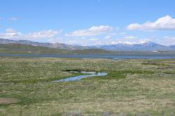
Little Camas Reservoir
Mountain Home
38.9 miles NWIrrigation reservoir on the western Camas Prairie northeast of Mountain Home, with a free Forest Service boat ramp, primitive shoreline camping and trout fishing. Water levels swing hard, and there is no trout stocking in 2026.
Camp, Canoe, Kayak
Anderson Ranch Reservoir
Pine
41.0 miles NWA 14-mile Reclamation reservoir on the South Fork Boise River northeast of Mountain Home, best known for kokanee fishing. This pin marks the free Fall Creek Boat Ramp on the west shore, with free Forest Service campgrounds a short drive away.
Camp, Canoe, Hike, Kayak, Swim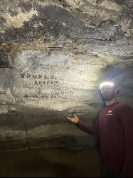
Kimama Wind Caves
Paul, Idaho
47.6 miles SEA labyrinth of lava tubes in the desert north of Paul — tight crawls, varying ceiling heights, and graffiti throughout — strictly for experienced cavers with proper lights.
Camp, Cave


