


Magic Reservoir
Bellevue
Camp, Canoe, and Kayak
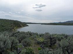
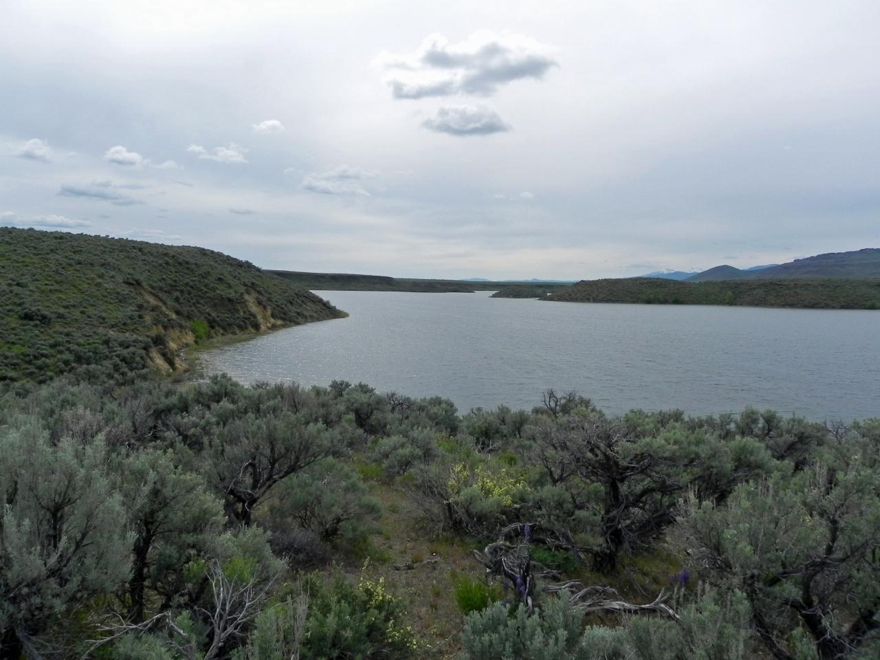
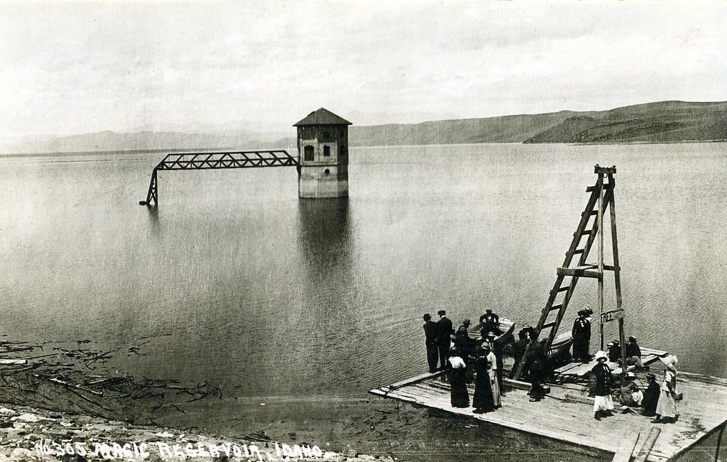
Magic Reservoir sits in open sagebrush country where the Big Wood River and Camas Creek meet, straddling the Blaine and Camas county line north of Shoshone. Magic Dam, an earthen embankment 128 feet high and about 3,100 feet long, was finished in 1910 to store spring snowmelt for farms around Shoshone and Richfield. It still does that job, irrigating roughly 89,000 acres and turning a small hydroelectric plant below the dam. When full the reservoir covers around 3,700 acres and holds about 195,000 acre-feet, with arms reaching six miles up the Big Wood and two and a half miles up Camas Creek.
Almost all of the shoreline is Bureau of Land Management land, and the BLM runs a string of semi-developed sites around the water: Lava Creek, Lava Cove, West Magic, Myrtle Point, Magic Dam, Moonstone Landing and Richfield Diversion. Expect vault toilets, rough gravel and not much else. There is no drinking water and no trash pickup at most of these spots, so pack in what you need and pack it back out.
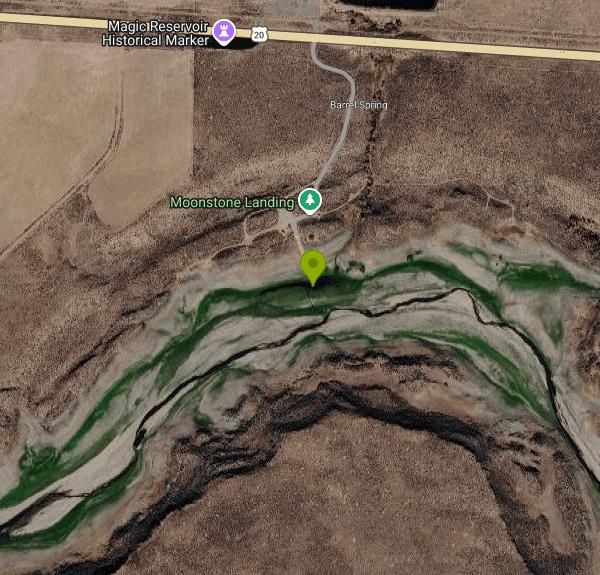
The easiest free place to reach the water is Moonstone Landing on the northwest side, just off US-20 about 13 miles west of the Highway 75 junction. It has a concrete boat ramp, a dock, a toilet and a few free first-come campsites. Both the BLM and Idaho Fish and Game list it as a public site. Because Moonstone sits up the shallow Camas Creek arm, the ramp can end on mud in dry late summers, when the water pulls back toward the dam.
Other access points spread around the shore. Hot Springs Landing, at the mouth of Rock Creek, has a ramp. Sheep Bridge and Stanton Crossing on the upper Big Wood arm are mostly bank-fishing spots, and Stanton Crossing allows primitive camping. On the south end, the West Magic area is reached from Highway 75 near mile marker 92 by about ten miles of West Magic Road, with the Lava Point ramp, a small private resort community and a public state airstrip nearby. Myrtle Point, a mile or two south, is a tiny free BLM site with one covered picnic site and an old toilet. From the east, East Magic Reservoir Road leaves Highway 75 between mile markers 98 and 99 and runs a little under five miles to another ramp.
Idaho Fish and Game lists Magic as a Recommended Fishing Water and a Family Fishing Water. Rainbow trout are the main draw and are stocked in big numbers, including triploid fingerlings in the fall and catchable fish in spring. Brown trout, smallmouth bass and yellow perch round out the catch, and perch have been stocked in recent years. From Magic Dam upstream to a posted boundary east of Hot Springs Landing, bass have no bag, size or possession limits. There are no motor restrictions, so you will share the water with trolling boats and the occasional water skier on summer weekends. Kayaks and canoes do best early in the day before the afternoon wind comes up across the flats.
Winter is busy too. When the ice firms up, Magic is one of the better known ice fishing lakes in south central Idaho, with anglers working perch and trout through the ice. Check ice conditions yourself and stay off thin ice near inlets and the dam.
This is an irrigation reservoir first, and the water level can swing hard. Idaho Fish and Game warns that some access points may be high and dry, depending on irrigation demand. In the drought year of 2026, deliveries ended in early July, more than two months early, with the reservoir down to about 7.6 percent of capacity, and Fish and Game opened a fish salvage order on the Big Wood River below the dam. A wet winter can fill it again, and in big runoff years water pours over the concrete spillway west of the dam.
Warm, shallow water also brings algae. In August 2019 health officials posted a toxic blue-green algae advisory and told visitors to keep people and pets out of the water. Swimming is not really the draw here anyway, since much of the shoreline is weedy or muddy. Look for posted advisories before you let a dog swim or wade in.
There is also a small informal hot spring seep near Hot Springs Landing. The source is on private land, and the pool usually stays underwater until the reservoir drops in late fall, so treat it as a maybe rather than a destination.
Bellevue is the closest town by road, about 18 miles and a little over 20 minutes from Moonstone. Fairfield is about the same distance to the west on US-20, and Hailey is a few miles past Bellevue. Fill up on gas, water and ice before you leave pavement.
More Information
Idaho Hot Springs: Hot Springs Landing (Magic Valley) Hot Springs
Boise Area Public Soaks Public Map Pay Soaks Pay Soak Map Guides Videos Other Areas: GPS
http://www.idahohotsprings.com/destinations/hot_springs_landing/index.htmMagic Dam - Wikipedia
Magic Dam is an earthen embankment dam across the Big Wood River in southwestern Blaine County, Idaho, in the United States, about 40 miles (64 km) north of Twin Falls. The dam was completed in 1910 by Magic Reservoir Hydroelectric, Inc. for irrigation, flood control and hydroelectric generation, and stores up to 195,000 acre-feet (0.241 km3) of water in Magic Reservoir, which lies in both Blaine County and adjacent southeastern Camas County.[1] Water from the reservoir is used to irrigate 89,000 acres (36,000 ha) around and between Shoshone and Richfield.[2] Magic Dam also supports a power station with three turbines totaling a capacity of 9,000 kW.[3]
https://en.wikipedia.org/wiki/Magic_DamMagic Reservoir - | Bureau of Land Management
Remember your OUTDOOR ETHICS when enjoying your public lands. Please RECREATE RESPONSIBLY. Overview This popular site for fishing, boating, water skiing and ice fishing offers semi-developed camping. Nearby commercial facilities offer a range of accommodations and developed campgrounds with RV services. Sites at Magic Reservoir include: Lava Creek, Lava Cove, West Magic, Myrtle Point, Magic Dam, Moonstone Landing and Richfield Diversion.
https://www.blm.gov/visit/magic-reservoirMagic Reservoir drops to 7.6% capacity, prompting fish salvage order
Magic Reservoir has dropped to just 7.6% full — and Idaho Fish and Game needs your help. Bag limits are lifted on the Big Wood River below Magic Dam through Oct. 1.
https://www.kivitv.com/news/magic-valley/magic-reservoir-drops-to-7-6-capacity-prompting-fish-salvage-order-on-big-wood-riverMagic Reservoir irrigation delivery ends | Capital Press
Water supply held up two weeks longer than anticipated Big Wood Canal Co. ended irrigation deliveries from Magic Reservoir July 5 and into the early morning of July 6, more […]
https://capitalpress.com/2026/07/06/magic-reservoir-irrigation-delivery-ends/Magic Reservoir tests positive for toxic blue-green algae bloom
Water quality officials have found a harmful algal bloom at a third south-central Idaho reservoir.
https://www.kmvt.com/content/news/Magic-Reservoir-tests-positive-for-toxic-blue-green-algae-bloom-531051491.htmlMagic Reservoir | Blaine County, ID
Magic Reservoir is fed by the Big Wood River and where the water from the snow capped mountains meets the high desert.
https://www.blainecountyid.gov/236/Magic-ReservoirMagic Reservoir | Idaho Fishing Planner
Magic Reservoir in Blaine and Camas Counties is 3,580.0 acres.
https://idfg.idaho.gov/ifwis/fishingplanner/water/1143740432752Myrtle Point Campground | Idaho Campground Review
A guide to Myrtle Point Campground including pictures, descriptions and maps of the camping and surrounding area.
https://idahocampgroundreview.com/campgrounds/myrtlepoint
- Plan Ahead and Prepare
- Travel & camp on durable surfaces
- Dispose of waste properly
- Leave what you find
- Minimize campfire impacts
- Respect wildlife
- Be considerate of other visitors
Directions
From Bellevue
- Head southeast on Bellevue Way SE toward Main St (2.1 mi)
- Take the ramp to I-90 E (430 ft)
- Slight left to merge onto I-90 E toward Spokane (101 mi)
- Take exit 110 for I-82 E/
US-97 S toward Yakima (1.1 mi) - Continue onto I-82 E/
US-97 S Continue to follow I-82 E(81.4 mi) - Take exit 82 for WA-22 toward WA-221/
Mabton/ Paterson (0.3 mi) - Turn left onto WA-22 W (0.1 mi)
- Turn left to stay on WA-22 W (0.6 mi)
- Turn left onto WA-221 S (12.5 mi)
- Turn left onto Sellards Rd (11.2 mi)
- Continue onto Plymouth Rd (12.8 mi)
- Turn left onto WA-14 E (0.7 mi)
- Turn right to merge onto I-82 E toward UmatillaEntering Oregon(11.4 mi)
- Take the exit onto I-84 E toward PendletonEntering Idaho(293 mi)
- Take exit 95 for US-20 N toward Mountain Home/
Fairfield (0.3 mi) - Turn left onto I-84BL/
US-20 E Continue to follow US-20 E(74.7 mi) - Turn right onto Moonstone Lndg Rd (0.3 mi)



Other Canoeing Areas and Kayaking Areas Nearby

Mormon Reservoir
Fairfield
19.0 miles WIrrigation reservoir on McKinney Creek about five miles south of Fairfield, with a free Idaho Fish and Game boat ramp, docks, toilets and primitive camping. It is stocked with rainbow trout, but the water drops hard by late summer and in dry years.
Camp, Canoe, Kayak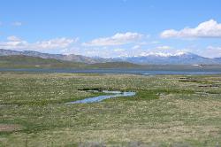
Little Camas Reservoir
Mountain Home
48.2 miles WIrrigation reservoir on the western Camas Prairie northeast of Mountain Home, with a free Forest Service boat ramp, primitive shoreline camping and trout fishing. Water levels swing hard, and there is no trout stocking in 2026.
Camp, Canoe, Kayak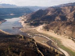
Anderson Ranch Reservoir
Pine
48.3 miles WA 14-mile Reclamation reservoir on the South Fork Boise River northeast of Mountain Home, best known for kokanee fishing. This pin marks the free Fall Creek Boat Ramp on the west shore, with free Forest Service campgrounds a short drive away.
Camp, Canoe, Hike, Kayak, SwimNearby Campsites
Mormon Reservoir
Fairfield
19.0 miles WIrrigation reservoir on McKinney Creek about five miles south of Fairfield, with a free Idaho Fish and Game boat ramp, docks, toilets and primitive camping. It is stocked with rainbow trout, but the water drops hard by late summer and in dry years.
Camp, Canoe, Kayak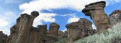
Little City of Rocks
Gooding, Idaho
19.5 miles SWA volcanic hoodoo landscape of natural arches, towers, and mushroom-cap formations near Gooding, Idaho — best visited in spring when desert wildflowers bloom and the main loop trail is scenic.
Camp, Hike
Worswick Hot Springs
Fairfield, Idaho
24.2 miles NWFree hillside hot spring pools on Worswick Creek in the Sawtooth National Forest, about 20 miles north of Fairfield. The lower pools run about 90 to 105 degrees, and the source water is hot enough to scald.
Camp, Hot Springs
Preis Hot Spring
Fairfield, Idaho
26.0 miles NWA small sunken wooden box beside Forest Road 227 north of Fairfield that fits two people in clear, roughly 102 degree water. Pair it with Worswick Hot Springs a couple of miles away.
Camp, Hot Springs 3.4 mi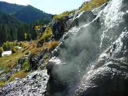
Skillern Hot Springs
Fairfield, Idaho
28.9 miles NWA stunning six-mile trail along crystal-clear Big Smoky Creek to a hot spring — spectacular in fall, with two trail options and a sign marking the final three miles.
Camp, Hike, Hot Springs
McKinney Butte Lava Tubes
Gooding, Idaho
29.9 miles SWTwo forking lava tubes near Bliss — one open to anyone, the other gated (BLM permit required) — that survived the Bonneville Flood and a 1993 landslide.
Camp, Cave
Galena Lodge
Ketchum, Idaho
38.8 miles NA community-owned historic lodge 23 miles north of Sun Valley, open summer and winter as a hub for hikers, bikers, Nordic skiers, and snowshoers with rentals and great food.
Camp, Cross-country Ski, Snowshoe
Lava Flow Campground
Arco, Idaho
44.7 miles EA campground surrounded by a young lava flow near the Craters of the Moon visitor center and popular trails — 42 first-come sites at $15/night during main season.
Camp
Little Camas Reservoir
Mountain Home
48.2 miles WIrrigation reservoir on the western Camas Prairie northeast of Mountain Home, with a free Forest Service boat ramp, primitive shoreline camping and trout fishing. Water levels swing hard, and there is no trout stocking in 2026.
Camp, Canoe, Kayak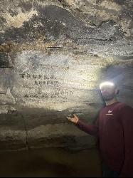
Kimama Wind Caves
Paul, Idaho
48.2 miles SEA labyrinth of lava tubes in the desert north of Paul — tight crawls, varying ceiling heights, and graffiti throughout — strictly for experienced cavers with proper lights.
Camp, Cave
Anderson Ranch Reservoir
Pine
48.3 miles WA 14-mile Reclamation reservoir on the South Fork Boise River northeast of Mountain Home, best known for kokanee fishing. This pin marks the free Fall Creek Boat Ramp on the west shore, with free Forest Service campgrounds a short drive away.
Camp, Canoe, Hike, Kayak, Swim


