


57 Mountain Bike Trails near Cashiers Area
first prev 1 2 3 next lastShowing Mountain Bike Trails within 50 miles Distance miles of 2451 Whiteside Cove Rd, Highlands, NC 28741, USA City, Zip, or Address
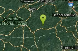
Blackrock #447
Glenville, North Carolina
7.4 miles NEA steep challenging climb over a miniature mountain in Panthertown Valley, rewarded by a bomber descent down the backside — one of the better efforts-to-payoff ratios in the area.
Mountain Bike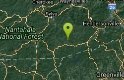
Panthertown Valley
Glenville, North Carolina
7.5 miles NEA 35-mile trail network in Panthertown Valley near Glenville with 19 miles of mountain biking, granite cliff vistas, mixed terrain from fire roads to tight singletrack, and rock climbing on the cliffs.
Mountain Bike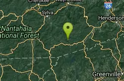
Devils Elbow #448
Lake Toxaway, North Carolina
8.4 miles NEA mountain bike trail connecting to Panthertown Valley's main thoroughfare, with sections of old forest road and narrow singletrack climbing to Devils Elbow Knob.
Mountain Bike
Snaggy Creek Trail
Cullowhee, North Carolina
15.9 miles NA 5-mile mountain bike climb from 2,300 to 5,500 feet near Cullowhee, descending halfway back before branching onto ATV trails back to town.
Mountain Bike
WCU Trails
Cullowhee, North Carolina
16.7 miles NAn intermediate mountain bike trail on steep WCU campus hillside near Cullowhee with lots of ups and downs despite a modest overall elevation change.
Mountain Bike
New Vista Rd
Brevard, North Carolina
17.7 miles EA general fire road with a nice view across the valley near Brevard, NC.
Mountain Bike
Buckhorn Gap / 103
Brevard, North Carolina
17.7 miles EClassic Pisgah singletrack with technical sections, creek crossings, and old road beds — a 5.2-mile one-way trail combinable with nearby routes like Avery Creek.
Mountain Bike
Buckwheat Knob / 122
Brevard, North Carolina
17.7 miles EThe final pitch of Satan's Staircase near Brevard — a 1.5-mile crazy-steep push to Buckwheat Knob, then a fast and furious descent to Avery Creek.
Mountain Bike 1.8 mi
Flat Laurel Creek
20.7 miles NE
A 3.18-mile multi-use trail following Flat Laurel Creek through colorful rock formations and forest, with distant views of Sam Knob and a small waterfall — open year round.
Hike, Horseback, Mountain Bike, Swim 7.1 mi
Daniel Ridge Loop
Canton, North Carolina
21.4 miles NEA classic short Pisgah loop with moderate technical riding, a rocky downhill roller coaster, two waterfalls, and multiple route options to tailor the adventure.
Hike, Mountain Bike 3.1-4.3 mi
Farlow Gap
Canton, North Carolina
21.4 miles NEOne of Pisgah's most technical downhills — a minefield of boulders dropping 2,000 feet in 3 miles, best ridden as part of the Fish Hatchery loop.
Hike, Mountain Bike
Coontree
Brevard, North Carolina
21.7 miles NEA gnarly 3.7-mile one-way trail near Brevard — a steep hike-a-bike one direction and a steep, technical descent the other; prepare to get your legs worked.
Mountain Bike 2.3 mi
Cove Creek
Canton, North Carolina
22.8 miles NEA fast, fun descent on Cove Creek Trail near Canton after a gravel forest road climb — cool rock sections at the top and rustic log bridges midway down.
Mountain Bike 0.8 mi
Daniel Ridge Falls
Brevard, North Carolina
22.9 miles NEAn easy half-mile hike in Pisgah National Forest near Brevard to a 150-foot waterfall known by three names — most impressive after rain, modest in dry spells, with an optional 4-mile loop to the top.
Hike, Mountain Bike, Swim 13.5 mi
Horse Cove Gap Loop / FS 475C
Brevard, North Carolina
22.9 miles NEA 12-mile round-trip mountain bike ride near Brevard on forest road and singletrack through Horse Cove Gap, with views of Looking Glass Rock, Pilot Rock, and the Blue Ridge Parkway.
Mountain Bike
Brushy Creek
Brevard, North Carolina
23.0 miles NEWell-built singletrack deep in a mountain cove forest near Pisgah, looping off Bracken Mountain with fun flow in any direction.
Mountain Bike 2.6 mi
Bracken Preserve
Brevard, North Carolina
23.0 miles NETight switchbacks and 1,000 ft of elevation gain lead to a high ridge in Pisgah National Forest, followed by about 4 miles of flowing downhill singletrack.
Mountain Bike
Butter Gap / Trail #123
Brevard, North Carolina
23.0 miles NEButter Gap Trail in Pisgah Forest climbs about 1,000 feet and connects to FS 471D — the western fork is open to mountain bikes, with seasonal bike access on part of the route.
Hike, Mountain Bike
Coontree Recreation Area
Brevard, North Carolina
24.4 miles NEA scenic picnic area on the Davidson River with direct access to calm, deep water for swimming and fishing — plus the 3.7-mile Coontree Loop Trail through Pisgah National Forest.
Hike, Mountain Bike, Swim

Avery Creek / 327
Brevard, North Carolina
25.9 miles NEClassic Pisgah-style singletrack: 3.2 miles of rutted, technical descent from a four-way junction with stream crossings, muck, and hidden flowy sections under a massive tree canopy.
Hike, Mountain Bike


