


Devils Elbow #448
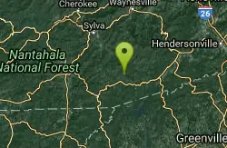
Lake Toxaway, North Carolina
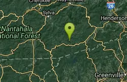
| Address: | ~Hogback Spur A, Lake Toxaway, NC 28747, USA |
| GPS: |
35°9'27.8"N 82°59'55.7"W Maps | Directions |
| State: | North Carolina |
| Trail Length: | 2.00 miles |
| MTB Difficulty: | Intermediate |
| Trail Type: | Network |
| MTB Trail Type: | Singletrack |
Mountain Bike
Devils Elbow trail #448 runs up to the knob of the same name and connects to trail #450 and trail #474, the main Panthertown Valley thoroughfare. Some sections are old forest road while others are narrow singletrack. Courtesy of Singletracks.com
More Information
Add ResourceNever modify trail features. Ride trails when they're dry enough that you won't leave ruts. Speak up when you see others on the trail and always yield to hikers, horses, and others coming uphill. Always ride on the established trail.
Read More- Plan Ahead and Prepare
- Travel & camp on durable surfaces
- Dispose of waste properly
- Leave what you find
- Minimize campfire impacts
- Respect wildlife
- Be considerate of other visitors
Directions
From Lake Toxaway, North Carolina
- Head northwest on NC-281 N toward Breedlove Rd (0.4 mi)
- Turn left onto Cold Mountain Rd (0.8 mi)
- Turn left to stay on Cold Mountain Rd (1.6 mi)
- Turn left to stay on Cold Mountain Rd (3.3 mi)
- Turn left onto Hogback Rd (0.1 mi)
- Turn right onto Hogback Spur A (0.1 mi)
Other Mountain Bike Trails Nearby
Panthertown Valley
Glenville, North Carolina
2.5 miles WA 35-mile trail network in Panthertown Valley near Glenville with 19 miles of mountain biking, granite cliff vistas, mixed terrain from fire roads to tight singletrack, and rock climbing on the cliffs.
Mountain Bike
Blackrock #447
Glenville, North Carolina
2.7 miles WA steep challenging climb over a miniature mountain in Panthertown Valley, rewarded by a bomber descent down the backside — one of the better efforts-to-payoff ratios in the area.
Mountain Bike
New Vista Rd
Brevard, North Carolina
10.4 miles EA general fire road with a nice view across the valley near Brevard, NC.
Mountain Bike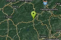
Buckhorn Gap / 103
Brevard, North Carolina
10.4 miles EClassic Pisgah singletrack with technical sections, creek crossings, and old road beds — a 5.2-mile one-way trail combinable with nearby routes like Avery Creek.
Mountain Bike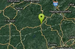
Buckwheat Knob / 122
Brevard, North Carolina
10.4 miles EThe final pitch of Satan's Staircase near Brevard — a 1.5-mile crazy-steep push to Buckwheat Knob, then a fast and furious descent to Avery Creek.
Mountain Bike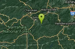
Snaggy Creek Trail
Cullowhee, North Carolina
12.4 miles NWA 5-mile mountain bike climb from 2,300 to 5,500 feet near Cullowhee, descending halfway back before branching onto ATV trails back to town.
Mountain Bike 1.8 mi
Flat Laurel Creek
12.8 miles NE
A 3.18-mile multi-use trail following Flat Laurel Creek through colorful rock formations and forest, with distant views of Sam Knob and a small waterfall — open year round.
Hike, Horseback, Mountain Bike, Swim 7.1 mi
Daniel Ridge Loop
Canton, North Carolina
13.0 miles NEA classic short Pisgah loop with moderate technical riding, a rocky downhill roller coaster, two waterfalls, and multiple route options to tailor the adventure.
Hike, Mountain Bike 3.1-4.3 mi
Farlow Gap
Canton, North Carolina
13.0 miles NEOne of Pisgah's most technical downhills — a minefield of boulders dropping 2,000 feet in 3 miles, best ridden as part of the Fish Hatchery loop.
Hike, Mountain Bike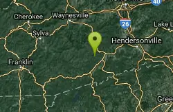
Coontree
Brevard, North Carolina
13.4 miles NEA gnarly 3.7-mile one-way trail near Brevard — a steep hike-a-bike one direction and a steep, technical descent the other; prepare to get your legs worked.
Mountain Bike 2.3 mi
Cove Creek
Canton, North Carolina
14.4 miles NEA fast, fun descent on Cove Creek Trail near Canton after a gravel forest road climb — cool rock sections at the top and rustic log bridges midway down.
Mountain Bike 0.8 mi
Daniel Ridge Falls
Brevard, North Carolina
14.5 miles NEAn easy half-mile hike in Pisgah National Forest near Brevard to a 150-foot waterfall known by three names — most impressive after rain, modest in dry spells, with an optional 4-mile loop to the top.
Hike, Mountain Bike, Swim 13.5 mi
Horse Cove Gap Loop / FS 475C
Brevard, North Carolina
14.6 miles NEA 12-mile round-trip mountain bike ride near Brevard on forest road and singletrack through Horse Cove Gap, with views of Looking Glass Rock, Pilot Rock, and the Blue Ridge Parkway.
Mountain Bike
Butter Gap / Trail #123
Brevard, North Carolina
14.6 miles NEButter Gap Trail in Pisgah Forest climbs about 1,000 feet and connects to FS 471D — the western fork is open to mountain bikes, with seasonal bike access on part of the route.
Hike, Mountain Bike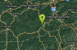
Brushy Creek
Brevard, North Carolina
14.9 miles NEWell-built singletrack deep in a mountain cove forest near Pisgah, looping off Bracken Mountain with fun flow in any direction.
Mountain Bike 2.6 mi
Bracken Preserve
Brevard, North Carolina
14.9 miles NETight switchbacks and 1,000 ft of elevation gain lead to a high ridge in Pisgah National Forest, followed by about 4 miles of flowing downhill singletrack.
Mountain Bike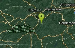
WCU Trails
Cullowhee, North Carolina
15.4 miles NWAn intermediate mountain bike trail on steep WCU campus hillside near Cullowhee with lots of ups and downs despite a modest overall elevation change.
Mountain Bike
Coontree Recreation Area
Brevard, North Carolina
16.0 miles NEA scenic picnic area on the Davidson River with direct access to calm, deep water for swimming and fishing — plus the 3.7-mile Coontree Loop Trail through Pisgah National Forest.
Hike, Mountain Bike, Swim
Avery Creek / 327
Brevard, North Carolina
17.6 miles NEClassic Pisgah-style singletrack: 3.2 miles of rutted, technical descent from a four-way junction with stream crossings, muck, and hidden flowy sections under a massive tree canopy.
Hike, Mountain Bike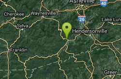
Thrift Cove
Brevard, North Carolina
17.7 miles NEAbout 750 feet of elevation, red-blazed trail through Thrift Cove, and five back-to-back jump whoops that are among the best you'll find anywhere — worth lapping repeatedly.
Hike, Mountain BikeNearby Campsites

Davidson River Campground
Pisgah Forest, North Carolina
17.8 miles NEA year-round campground in Pisgah National Forest just four miles from Brevard and less than an hour from Asheville, with shaded loops, hiking trails, waterfalls, and fishing spots nearby.
Camp, Hike, Swim
Mt. LeConte Lodge
Sylva, North Carolina
21.9 miles NWThe highest guest lodge in the eastern United States at 6,400 feet, with spectacular Smokies views from an open glade just below the Mt. LeConte summit in Great Smoky Mountains NP.
Camp, Hike, Horseback, Rock Climb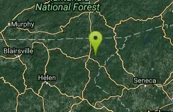
War Woman Dell Wildlife Management Area
Clayton, Georgia
27.6 miles SWA short 0.8-mile out-and-back hike near Clayton, Georgia through a nature trail to a waterfall — good for all skill levels and accessible year-round.
Camp, Hike, Horseback
Cosby Campground
Cosby, Tennessee
43.1 miles NCamp and Swim near Cosby, Tennessee
Camp, Swim
Rocky Bluff
Hot Springs, North Carolina
49.4 miles NPlay in water in creek, shallow at times.
Camp, Hike, Swim


