


Nicole Park
Missoula, Montana

| Address: | ~5899 Linda Vista Blvd, Missoula Montana 59803 |
| GPS: |
46°48'40.4"N 114°3'27.2"W Maps | Directions |
| State: | Montana |
Sled
Slope: ~45°
Length:~100-200ft
More Information
Add Resource
- Plan Ahead and Prepare
- Travel & camp on durable surfaces
- Dispose of waste properly
- Leave what you find
- Minimize campfire impacts
- Respect wildlife
- Be considerate of other visitors
Directions
From Missoula, Montana
- Head southeast on N 1st St W toward Northside Overpass (112 ft)
- Turn left onto Grand Ave (325 ft)
- Turn right at the 1st cross street onto N 2nd St W (367 ft)
- Turn right at the 1st cross street onto Old U.S. 93 W/N Orange StContinue to follow Old U.S. 93 W(2.2 mi)
- Turn right onto Brooks St (2.2 mi)
- Turn left onto Miller Creek Rd (0.5 mi)
- At the traffic circle, take the 1st exit onto Lower Miller Creek Rd (0.8 mi)
- Turn left onto Linda Vista Blvd (0.7 mi)

Other Sledding Hills Nearby

Rainbow Park
Missoula, Montana
0.3 miles SWRainbow Park is one of Missoula's best-kept sledding secrets, a neighbourhood park up on the Linda Vista bench southwest of town where the hill does exactly what a sledding hill should. Locals...
Sled
Gaten Hill/Upper Miller Creek Hill
Missoula, Montana
6.4 miles SEgentle slope
SledNearby Campsites
River Point Campground
Seeley Lake
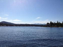
36.5 miles NEFree roped swim beach at a Lolo National Forest campground on the west shore of Seeley Lake, where the Clearwater River leaves the lake, about 2 miles from the town of Seeley Lake.
Camp, Canoe, Hike, Kayak, Swim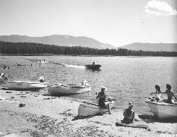
Seeley Lake Campground
Seeley Lake
36.5 miles NEFree Lolo National Forest day-use beach with a roped swim area and boat launch on the west shore of Seeley Lake, reached from the north end of Boy Scout Road since the south bridge closed.
Camp, Canoe, Kayak, Swim
Morrell Falls National Recreation Trail
Condon, Montana
43.0 miles NEThe Morrell Falls trail is an easy, popular ~5-mile Swan Valley hike to a spectacular 90-foot double waterfall near Seeley Lake, Montana.
Backpack, Camp, Hike


