


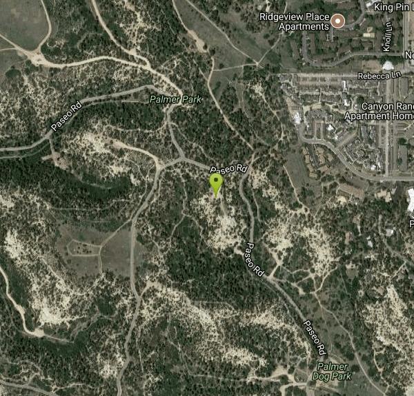
Palmer Park
Colorado Springs, Colorado

| Address: | 3650 Maizeland Rd, Colorado Springs, CO 80917, USA |
| GPS: |
38°52'35.5"N 104°46'0.6"W Maps | Directions |
| State: | Colorado |
| MTB Difficulty: | Intermediate |
| Hike Difficulty: | Beginner |
| Trails/Routes: | 0.5-1.5 mi |
Restrooms Picnic Tables Trails Rocks Pet Friendly Bicycles State Park
Hike, Horseback, and Mountain Bike
A popular park, Palmer Park is located in Colorado Springs and has over 25 trails for hiking, horseback riding or mountain biking. These trails are generally singletrack but there are also double-tracks and dirt roads along the way. The park has unique rock formations and wildlife with rabbits, coyotes, foxes and occasionally bears at the park. At the trail, there's a bird-watching park with hawks, ravens, towhees and chickadees.
The park has two baseball/softball fields, a dog park to walk animals (make sure to have a leash and to clean up the mess), a community playground for kids, horse stables for horse back riding, several picnic grounds for couples and large groups, a football/soccer field and three volleyball courts.
Once owned by Matt France in the 1800s, he sold the land in 1873 to Henry Austin; he changed the name to Austin Bluffs and raised sheep. Then in 1902, William Jackson Palmer (the founder of Colorado Springs) donated the 692 acres to Colorado Springs for the park. With it, he improved the roads leading to the park (Paseo Dr. and Palmer Park Blvd.) Eventually, activities were added for attraction later in the century. Overall, Palmer Park is an adventurous and beautiful place for all visitors to explore the outdoors while enjoying the views of the wildlife.
Mapped Route/Trail Distances
| Grandview trail | 1.5 miles |
| Kinnickinnick Trail | 1.0 miles |
| Cheyenne Trail | 0.5 miles |
| Grandview Trail | 0.6 miles |
| Cheyenne Trail | 1.0 miles |
| Kinnickinnick Trail | 0.8 miles |
More Information
Never modify trail features. Ride trails when they're dry enough that you won't leave ruts. Speak up when you see others on the trail and always yield to hikers, horses, and others coming uphill. Always ride on the established trail.
Read MoreBe courteous, informed, and prepared. Read trailhead guidelines, stay on the trail, and don't feed the wildlife.
Read More- Plan Ahead and Prepare
- Travel & camp on durable surfaces
- Dispose of waste properly
- Leave what you find
- Minimize campfire impacts
- Respect wildlife
- Be considerate of other visitors
Directions
From Colorado Springs, Colorado
- Head north toward N Nevada Ave (92 ft)
- Turn left toward N Nevada Ave (233 ft)
- Turn right onto N Nevada Ave (0.3 mi)
- Turn right onto E Platte AvePass by Taco Bell (on the right in 0.2 mi)(2.5 mi)
- Turn left onto N Circle Dr (1.7 mi)
- Turn right onto Maizeland Rd (0.8 mi)
- Turn left onto Paseo Rd (0.8 mi)
- Turn left to stay on Paseo Rd (226 ft)
From I-25 take exit 145 to E Filmore St. Keep driving east and after crossing Union the road becomes N Circle Dr. Turn left on Maizeland Rd and continue to the park entrance on the left.Courtesy of cospringstrails.com


Trails
Distance ?
1.5 milesElevation Gain ?
56 feetReal Ascent ?
217 feetReal Descent ?
161 feetAvg Grade (0°)
1%Grade (-13° to 17°)
-24% to 30%Distance ?
1.0 milesElevation Gain ?
62 feetReal Ascent ?
263 feetReal Descent ?
201 feetAvg Grade (1°)
1%Grade (-21° to 22°)
-39% to 41%Distance ?
0.5 milesElevation Gain ?
17 feetReal Ascent ?
97 feetReal Descent ?
80 feetAvg Grade (0°)
1%Grade (-12° to 15°)
-21% to 27%Distance ?
0.6 milesElevation Gain ?
188 feetReal Ascent ?
229 feetReal Descent ?
41 feetAvg Grade (3°)
6%Grade (-20° to 18°)
-36% to 32%Distance ?
1.0 milesElevation Gain ?
7 feetReal Ascent ?
276 feetReal Descent ?
269 feetAvg Grade (0°)
0%Grade (-19° to 25°)
-35% to 46%Distance ?
0.8 milesElevation Gain ?
-44 feetReal Ascent ?
142 feetReal Descent ?
186 feetAvg Grade (-1°)
-1%Grade (-16° to 20°)
-29% to 37%Elevation differences are scaled for emphasis. While the numbers are accurate, the cut-away shown here is not to scale.
Other Mountain Bike Trails, Hiking Trails, and Horseback Trails Nearby
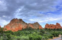
Garden of the Gods
Colorado Springs, CO
5.6 miles WGarden of the Gods is a public park located in Colorado Springs, Colorado, US. It was designated a National Natural Landmark in 1971.
Hike, Rock Climb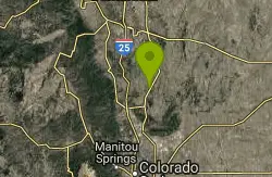
Lincoln Mountain
Larkspur, Colorado
20.5 miles NTwo lollipop loops on Douglas County Open Space — one climbing Lincoln Mountain and one on the Palmer Divide — with wide singletrack, some rocky sections, and views throughout.
Mountain Bike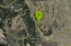
Greenland Open Space
Larkspur, Colorado
21.5 miles NA lollipop-shaped trail through Larkspur's Greenland Open Space — mostly doubletrack, about 500 feet of elevation gain, and a dry surface that makes it rideable even in winter.
Mountain Bike
Columbine Open Space
Castle Rock, Colorado
28.8 miles NTwo beginner lollipop loops — a 1-mile South loop and a 1.5-mile North loop — with moderate climbs, packed gravel, and easy access right off the interstate.
Mountain Bike
Dawson's Butte
Castle Rock, Colorado
30.0 miles NA simple, hard-to-get-lost loop through ponderosa forest and open meadows, just over 5 miles with about 300 feet of elevation — run it counter-clockwise for the better downhill.
Mountain Bike
Memmen Ridge Open Space
Castle Rock, Colorado
34.3 miles NA peaceful, close-to-town trail at Memmen Ridge Open Space near Castle Rock with great views and good trails — a nice option for a relaxed ride.
Mountain Bike
Phillip S. Miller Park
Castle Rock, Colorado
34.6 miles NA 220-acre mountain bike trail system in Castle Rock featuring twisting singletrack, 200-step stair climbs, impressive overlook views, and rewarding quick downhills.
Mountain Bike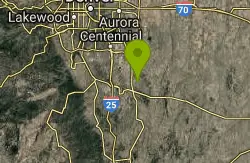
Bayou Gulch Bike Park
Parker, Colorado
38.4 miles NA dedicated bike park near Parker with a beginner loop, an intermediate loop, and three intermediate flow trails — a great place to build skills.
Mountain Bike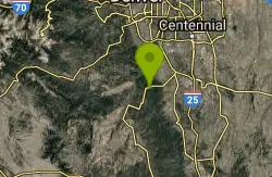
Devil's Head Stretch
Sedalia, Colorado
38.7 miles NWMoto-carved berms, chutes, dips, and rollers on a multi-use trail shared heavily with dirt bikes on weekends — best ridden on a quiet weekday after a good rain firms things up.
Mountain Bike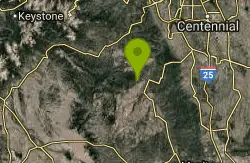
Little Scraggy
Sedalia, Colorado
39.9 miles NWA new intermediate singletrack south of Sedalia with meandering terrain, technical options, a 100-foot slab rock, and one solid mid-ride climb.
Mountain Bike
Colorado Trail: Buffalo Creek To Lost Creek Wilderness Boundary
Pine, Colorado
41.6 miles NWA beautiful point-to-point Colorado Trail ride from FR 550 through Buffalo Creek to the Lost Creek Wilderness boundary — bikes must turn back at the wilderness line.
Mountain Bike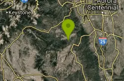
Chair Rocks
Pine, Colorado
41.6 miles NWA seldom-used trail through the Buffalo Creek burn area with smooth tread, gentle hills, endless singletrack, rock formations, wildlife, and expansive mountain vistas.
Mountain Bike
Colorado Trail: Green Mountain
Pine, Colorado
41.6 miles NWSweet, smooth singletrack with a great mix of climbs and descents through beautiful scenery — described as the Front Range's answer to the Tsali trails.
Mountain Bike
Colorado Trail: Morrison Creek / Lunar Loop
Pine, Colorado
41.7 miles NWA loop through burned-out forest and open terrain climbing about 800 feet, with Morrison Creek singletrack connecting the Shingleman trail — more exposed than the Green Mountain option.
Mountain Bike
North Fork
Littleton, Colorado
42.6 miles NWA smooth, nearly rock-free machine-made singletrack running along the mountainside from South Platte River — gradual climbing on Hummingbird leads to a flowing North Fork descent.
Mountain Bike
Glendale Open Space Trail
Castle Rock, Colorado
42.8 miles NA 160-acre open-space trail in Castle Rock winding through chokecherry shrubs, Gambel oak, and grasslands with views of Pikes Peak and the Front Range — plus a five-acre off-leash dog area.
Mountain Bike
Buffalo Creek
Pine, Colorado
44.0 miles NWAn epic mountain bike loop near Pine with a steady climb up Buffalo Creek Road, slickrock on Baldy Trail, and screaming singletrack descents on Charlie's Cutoff and Sandy Wash.
Mountain Bike
Baldy Trail
Pine, Colorado
44.4 miles NWA loop trail that pairs with Gashouse Gulch for a 6-mile ride from the Gashouse trailhead or stretches to 9 miles via Redskin Creek Trail from Meadows Campground.
Mountain Bike
Bluffs Regional Park Trail
Lone Tree, Colorado
45.5 miles NA 2.7-mile crushed-gravel loop with two scenic overlooks — great for a quick lunchtime spin or an easy family ride on dirt.
Mountain Bike
Highlands Point
Highlands Ranch, Colorado
45.8 miles NA roller-coaster mix of narrow and wide singletrack climbs through open trails and private HR terrain to Highlands Point, where summit markers point out Devil's Head Peak, Mt. Evans, and Chatfield.
Mountain Bike


