


Sandy Island Beach State Park
Pulaski
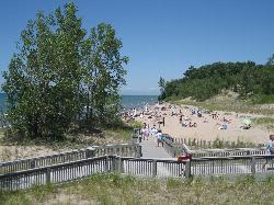
Canoe, Hike, Kayak, and Swim
Sandy Island Beach State Park is a New York State Office of Parks, Recreation and Historic Preservation park on the eastern shore of Lake Ontario, in the Town of Richland in Oswego County, about 5.6 miles northwest of the village of Pulaski. It sits on the narrow barrier of sand that separates the lake from North and South Sandy Ponds, near the southern end of the Eastern Lake Ontario Dunes and Wetlands, a 17-mile run of beach, dunes and marsh that the state calls the only significant freshwater dune system in the northeastern United States. The park grew to 229 acres in 2011 when two neighboring state unique areas were added, but swimmers come for the roughly 1,500-foot natural sand beach.
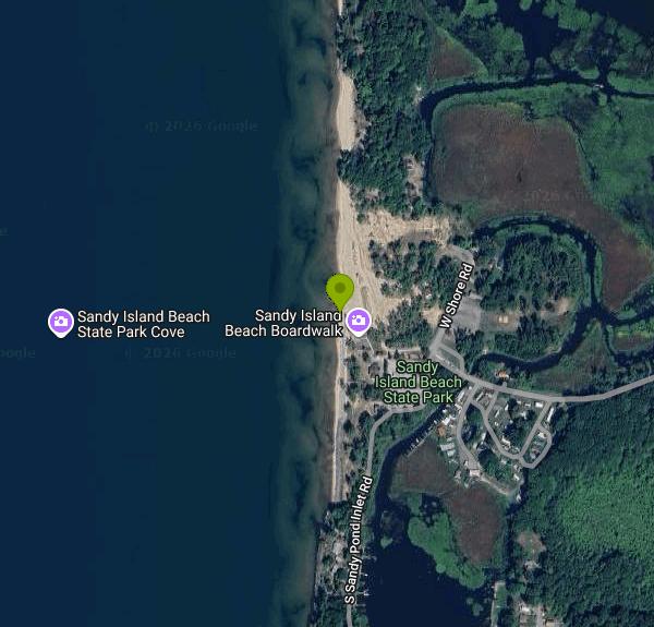
From Interstate 81, take exit 37 and head west on County Route 15, crossing State Route 3 and continuing to the park entrance at 3387 County Route 15 (Pulaski mailing address). Pay at the entrance booth and park in the visitor lot. A boardwalk walkover crosses the restored dune to the sand. The park has two beaches, and this listing is the southern one, the guarded day-use beach next to the bathhouse. The northern beach, nicknamed the boater's beach, is reached only by canoe, kayak or boat, and sits beside a protected bird nesting area that closes during shorebird nesting season.
The swim area is open lake with a sandy bottom and real waves, so conditions change with the wind. Lake Ontario's surface usually warms into the upper 60s or low 70s F by late July and August, but an offshore breeze can pull cold water up to the beach within a day. Lifeguards cover the beach during the swimming season, which usually runs from mid-June through Labor Day, daily from 11 a.m. to 7 p.m. (check the State Parks page for this year's dates) There are changing rooms, restrooms and a concession stand. Pets are not allowed on the guarded beach; elsewhere in the day-use area the limit is two per party on a leash no longer than 6 feet.
The park is open year round from sunrise to sunset. It is not free in season: the vehicle entrance fee is $7, and beach use is included in it. The $80 Empire Pass covers entry at most state parks, though it is not sold at this park. The single pavilion and a community room rent for $50 to $125 through ReserveAmerica. The park office is (315) 387-2657; after hours, call the Selkirk Shores office at (315) 298-5737.
Wind-driven waves and longshore currents are the main hazard here, and the National Weather Service issues beach hazard statements for this stretch of shore when they build. Swim during guarded hours. The park has closed the beach for a few days early in the season when it could not staff lifeguards, and State Parks posts water quality results for its beaches, so check before a long drive, especially after heavy rain. Lake level matters too: in high-water years the beach is much narrower than usual. The dunes are fenced and fragile, so stay on the walkovers.
Beyond the beach, a nature trail follows the edge of the Sandy Pond marsh, and a car-top launch on the channel between the two ponds lets paddlers reach either pond (non-motorized boats only, with a parking fee). Birders watch for piping plover, black tern and Caspian tern. There is no camping in the park, but Selkirk Shores State Park, a few miles south, has a campground.
More Information
Be courteous, informed, and prepared. Read trailhead guidelines, stay on the trail, and don't feed the wildlife.
Read More
- Plan Ahead and Prepare
- Travel & camp on durable surfaces
- Dispose of waste properly
- Leave what you find
- Minimize campfire impacts
- Respect wildlife
- Be considerate of other visitors
Directions
From Pulaski
- Head west toward Vance St (121 ft)
- Turn right onto Vance St (276 ft)
- Turn right onto E Broadway St (0.2 mi)
- Turn left to stay on E Broadway StPass by Little Caesars Pizza (on the left)(1.5 mi)
- Turn left onto Jacksonville HwyPass by Taco Bell (on the left in 0.8 mi)(0.8 mi)
- Merge onto I-40 E via the ramp to Memphis (123 mi)
- Keep left to stay on I-40 E, follow signs for Memphis/
Nashville Entering Tennessee(9.9 mi) - Continue straight to stay on I-40 E (signs for Nashville) (8.1 mi)
- Keep left to stay on I-40 E, follow signs for Nashville (198 mi)
- Take exit 208B on the left for I-65 N toward Louisville (0.4 mi)
- Continue onto I-65 N (1.8 mi)
- Keep left to stay on I-65 N, follow signs for I-24 W/
Clarksville/ Louisville Parts of this road may be closed at certain times or daysEntering Kentucky(165 mi) - Take exit 131A to merge onto I-264 E (11.5 mi)
- Take exit 23A to merge onto I-71 N toward CincinnatiEntering Ohio(91.0 mi)
- Slight right to stay on I-71 N (signs for Columbus/
US-50 E) (0.8 mi) - Keep right to stay on I-71 N (1.3 mi)
- Continue onto I-71 N (103 mi)
- Take the I-71 N/
I-70 E exit toward Airport/ Cleveland/ Wheeling (0.4 mi) - Merge onto I-70 EParts of this road may be closed at certain times or days(1.1 mi)
- Continue onto Exit 101BParts of this road may be closed at certain times or days(0.2 mi)
- Take the I-71 N ramp to I-670/
Cleveland (0.6 mi) - Continue onto I-71 N (112 mi)
- Take exit 220 for I-271 N toward Erie Pa (0.3 mi)
- Continue onto I-271 N (25.1 mi)
- Keep left to stay on I-271 N, follow signs for 271 N/
Erie Pa (15.0 mi) - Merge onto I-90 EToll roadPassing through PennsylvaniaEntering New York(314 mi)
- Take exit 36 for I-81 N toward WatertownToll road(1.1 mi)
- Merge onto I-81 (32.9 mi)
- Take exit 125 for NY-13 toward Pulaski (0.2 mi)
- Turn left onto NY-13 N/
Rome Rd Pass by Advance Auto Parts (on the right in 0.4 mi)(0.8 mi) - Turn right onto Salina St (0.3 mi)
- Turn right onto Jefferson St (0.1 mi)
- Turn left onto Park St (197 ft)
- Turn right onto North St (0.8 mi)
- Continue onto N Street Rd (2.8 mi)
- Continue onto North St (0.7 mi)
- Turn left onto County Rte 15 (3.3 mi)
- County Rte 15 turns right and becomes W Shore Dr (236 ft)
- Turn left onto S Sandy Pond Inlet Rd (203 ft)
- Turn right (200 ft)
- Turn right (69 ft)
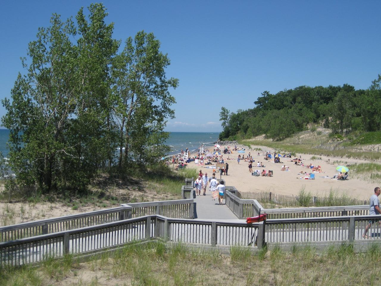
 The boardwalk walkover leading onto the guarded beach on a July day, with lifeguard chairs and Lake courtesy of Easchiff↗ (CC BY-SA 3.0↗)
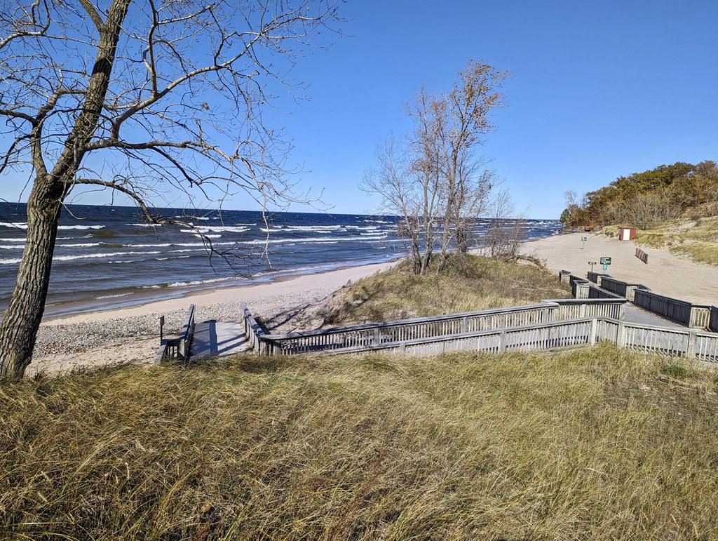
 Dune walkovers and the beach in autumn, with Lake Ontario on the left. courtesy of PunkToad↗ (CC BY 2.0↗)
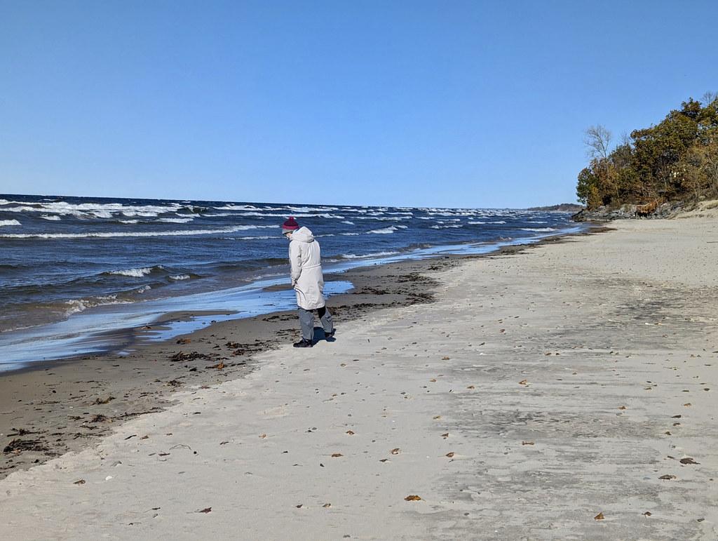
 A visitor walking the sand at the water's edge on a windy fall day. courtesy of PunkToad↗ (CC BY 2.0↗)
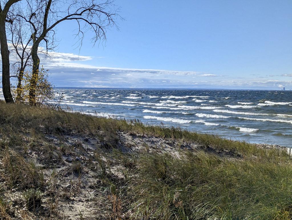
 Lake Ontario seen from the dune grass above the beach. courtesy of PunkToad↗ (CC BY 2.0↗)
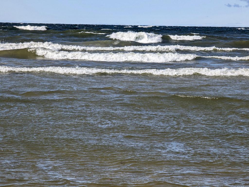
 Breakers rolling in from Lake Ontario off the beach. courtesy of PunkToad↗ (CC BY 2.0↗)
Other Swimming Holes, Hiking Trails, Canoeing Areas, and Kayaking Areas Nearby
Lakeview Wma
Saugerties, New York
9.2 miles NAbout five miles of undeveloped Lake Ontario sand beach extending south from Southwick Beach State Park — clothing-optional and traditionally nude near the southern end.
Swim
Salmon River Falls
Salamanca, New York
13.9 miles SESwim near Salamanca, New York
Swim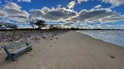
Fair Haven Beach
Fair Haven
32.2 miles SWFair Haven Beach State Park keeps 1,500 feet of sand on the southeastern shore of Lake Ontario, with 600 feet of it guarded, split into West Beach and East Beach by the channel draining Sterling Pond. Entry is $9 a vehicle, the beach season runs late May
Camp, Canoe, Hike, Kayak, Swim
Point Rock
Utica-Rome, NY, New York
36.3 miles SESwim near Utica-Rome, NY, New York
Swim
Verona Beach State Park
Verona Beach
39.1 miles SEGuarded sand beach on the east shore of Oneida Lake at Verona Beach State Park, open for swimming in summer with a $7 per car state park entry fee. Late-summer algae blooms sometimes close the swim area.
Camp, Canoe, Hike, Kayak, Swim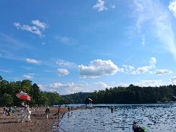
Green Lake Beach
Fayetteville
41.4 miles SThe lifeguarded sand beach at the north end of Green Lake, a meromictic lake near Fayetteville whose calcite whiting events turn the water a milky turquoise. It is the only legal place to swim in Green Lakes State Park, and the vehicle fee is $10 in seaso
Camp, Canoe, Hike, Kayak, Swim
Skaneateles
Skaneateles, New York
48.8 miles SSwim near Skaneateles, New York
SwimNearby Campsites
Fair Haven Beach
Fair Haven
32.2 miles SWFair Haven Beach State Park keeps 1,500 feet of sand on the southeastern shore of Lake Ontario, with 600 feet of it guarded, split into West Beach and East Beach by the channel draining Sterling Pond. Entry is $9 a vehicle, the beach season runs late May
Camp, Canoe, Hike, Kayak, Swim
Verona Beach State Park
Verona Beach
39.1 miles SEGuarded sand beach on the east shore of Oneida Lake at Verona Beach State Park, open for swimming in summer with a $7 per car state park entry fee. Late-summer algae blooms sometimes close the swim area.
Camp, Canoe, Hike, Kayak, Swim
Green Lake Beach
Fayetteville
41.4 miles SThe lifeguarded sand beach at the north end of Green Lake, a meromictic lake near Fayetteville whose calcite whiting events turn the water a milky turquoise. It is the only legal place to swim in Green Lakes State Park, and the vehicle fee is $10 in seaso
Camp, Canoe, Hike, Kayak, Swim


