


St. George Skate Park
St. George, Utah
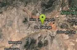
| Address: | 171 E. 1160 S. St. George, UT 84770, St. George, UT, 84770 |
| GPS: |
37°5'21.7"N 113°34'47.4"W Maps | Directions |
| State: | Utah |
Skateboard
More Information
City of St. George, UT
St. George is a city in southwestern Utah. Nearby Snow Canyon State Park offers trails, dunes and red sandstone cliffs. Sand Hollow State Park features a large reservoir. Stately 19th-century buildings such as the Pioneer Courthouse and Brigham Young Winter Home dot downtown. The St. George Art Museum houses historical photos and work by regional artists. Zion National Park, with canyons and streams, lies northeast.
https://sgcityutah.gov/
- Plan Ahead and Prepare
- Travel & camp on durable surfaces
- Dispose of waste properly
- Leave what you find
- Minimize campfire impacts
- Respect wildlife
- Be considerate of other visitors
Directions
From St. George, Utah
- Head south on S 700 E (92 ft)
- Turn right at the 1st cross street onto E 700 S (0.3 mi)
- Turn left onto S 400 E (0.4 mi)
- S 400 E turns right and becomes E 1160 SDestination will be on the right(0.3 mi)

Nearby Campsites

Sand Hollow State Park
Hurricane, Utah
11.1 miles EA desert reservoir near Hurricane with a cliff-jumping area, a sandy beach for swimming and paddleboarding, and vast sand dunes for ATVs — southern Utah's desert playground.
Camp, Canoe, Dive, Kayak, Swim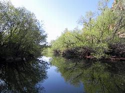
Quail Creek Reservoir
Hurricane
12.5 miles NEA 600-acre reservoir in the red rock west of Hurricane holding some of the warmest swimming water in Utah, with a cobble west-shore beach inside the no-wake zone and a $20 resident day-use fee per vehicle.
Camp, Canoe, Hike, Kayak, Swim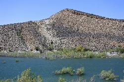
Gunlock State Park
Gunlock
15.6 miles NWGunlock Reservoir is a 266-acre Utah state park lake on the Santa Clara River about 15 miles northwest of St. George, with a sandy east shoreline, a boat ramp and a 30-site hookup campground. A Utah Division of Water Quality warning advisory posted August
Camp, Canoe, Hike, Kayak, Swim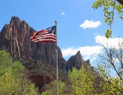
Zion National Park
Hurricane, Utah
33.8 miles EWind, water, and ice sculpted Zion's iconic red sandstone buttes, bends, and mounts into one of the most breathtaking and irreplaceable landscapes on Earth.
Camp, Hike, Mountain Bike, Swim


