


Sutton Bluff Recreation Area
Centerville

Camp, Hike, and Swim
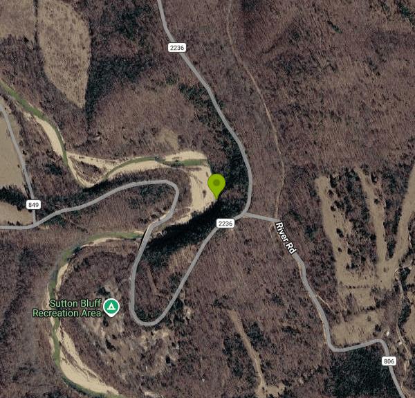
Sutton Bluff Recreation Area is a Forest Service campground and day-use site on the West Fork of the Black River, managed by the Salem Ranger District of Mark Twain National Forest in western Reynolds County, Missouri. The river makes a tight S-bend here below Sutton Bluff, the rock face that gives the area its name, and the campground sits on the wooded flat inside the southern loop. The swimming spot is the day-use area on the far side of the Forest Road 2236 bridge, where a broad gravel bar slopes into a deep pool.
From Centerville, drive about 3 miles northeast on Highway 21, turn left onto County Road 907 and follow it roughly 7 miles northwest, then turn left on County Road 849 and go about 3 miles south to the campground. That is about 13 road miles. Cross the bridge to reach the gravel bar. The day-use pavilion lot holds about four vehicles, and the Ozark Trail trailhead lot on the north side of the river takes about ten vehicles with trailers.
The riverbed is the loose mix of cobble and gravel found in most Ozark streams, and the water is clear. Much of this stretch is shallow enough to wade, with a few deeper holes, and the pool beside the gravel bar is where people swim. The Forest Service rates the water as warm in summer. This is not a managed beach: there are no lifeguards, no depth or hazard markers, and the water is not tested. The current is normally too gentle to float a boat, but it can turn strong when the river rises after heavy rain.
Day use costs $2 per vehicle per day ($10 per bus), paid by cash or check at the fee tube on site; there are no card machines. Annual and lifetime Forest Service passes cover the day-use fee. Day-use hours are 6 a.m. to 10 p.m. The area runs on a season from early April to November 1 and is closed the rest of the year, so check the Forest Service page before driving out. Campsites run $10 to $30 a night and the group site $40, with reservations on Recreation.gov at least five days ahead and a few first-come sites.
Sutton Bluff lies in the Southeast Missouri lead district. The West Fork Mine, a lead and zinc mine, operates near Centerville, and the Forest's page for this site carries an alert on lead exposure at campgrounds. In 2014 the Forest Service and the Missouri Department of Natural Resources sampled every campsite and day-use area in the region for lead in soil and gravel, and in 2015 they capped contaminated ground at 100 sites. The agency calls the risk low for people who visit a few times a year. ATVs and UTVs ride through the campground to reach the trails but are barred from the river and gravel bars, and dogs must be on a leash no longer than six feet.
The campground has 33 sites, 14 of them with electric hookups, plus flush toilets, showers, drinking water and a picnic pavilion with ten tables. A trailhead less than a mile away leads onto the 25-mile Karkaghne Section of the Ozark Trail. The Sutton Bluff ATV and motorcycle trail system covers about 45 miles and needs a Forest Service riding permit, and individual trails close at times for flood, bridge and storm damage. Anglers fish the river for smallmouth bass and sunfish, and the Missouri Department of Conservation's Centerville Access downstream has another gravel bar.
More Information
Be courteous, informed, and prepared. Read trailhead guidelines, stay on the trail, and don't feed the wildlife.
Read More
- Plan Ahead and Prepare
- Travel & camp on durable surfaces
- Dispose of waste properly
- Leave what you find
- Minimize campfire impacts
- Respect wildlife
- Be considerate of other visitors
Directions
From Centerville
- Head west on E 100 N toward 400 E (43 ft)
- Turn right onto 400 E (0.2 mi)
- Turn left onto E 400 N/
E Parrish Ln (0.9 mi) - Turn right to merge onto I-15 N (4.4 mi)
- Take exit 324 for US-89 N toward I-84 E/
S Ogden (0.3 mi) - Continue onto US-89 N (10.3 mi)
- Take exit 406 to merge onto I-84 E toward Morgan/
Evanston/ Cheyenne (31.7 mi) - Take exit 120A on the left to merge onto I-80 E toward CheyennePassing through WyomingEntering Nebraska(827 mi)
- Take exit 397 to merge onto US-77 S/
Homestead Expy toward NE-2/ Beatrice/ Nebraska City (9.3 mi) - Slight left onto NE-2Entering Iowa(48.9 mi)
- Continue onto IA-2 E (2.9 mi)
- Turn right to merge onto I-29 S toward Kansas CityEntering Missouri(88.3 mi)
- Keep left to stay on I-29 S (46.1 mi)
- Merge onto I-29 S/
I-35 S (4.4 mi) - Continue onto US-71 (0.2 mi)
- Merge onto I-70 E/
US-71 S (0.3 mi) - Slight left onto I-70 E/
US-24 E/ US-40 E (signs for St Louis) Continue to follow I-70 E(124 mi) - Slight right (0.5 mi)
- Merge onto I-70 E (1.8 mi)
- Take the exit onto US-63 S (27.8 mi)
- Merge onto US-54 W/
US-63 S via the ramp to Jefferson City (1.6 mi) - Take the US-50 W exit (0.2 mi)
- Slight left to merge onto US-50 E/
US-63 S/ Rex M Whitton Expy Continue to follow US-50 E/(12.1 mi)US-63 S - Take the US-63 S ramp to Rolla (0.4 mi)
- Continue onto US-63 S/
N Hwy 63 (49.0 mi) - Turn left onto N Walnut St (0.1 mi)
- Continue onto E 18th St (0.2 mi)
- Turn right onto Holloway St (0.9 mi)
- Turn left onto Salem Ave (0.7 mi)
- Turn left onto MO-72 E (24.4 mi)
- Turn left onto MO-72 E/
State Hwy 32 E/ Scenic Rivers Blvd Continue to follow MO-72 E/State Hwy 32 E Pass by Burger King (on the right in 1 mi)(13.7 mi) - Slight left onto State Hwy 32 E (12.2 mi)
- Turn right onto State Hwy KK (7.4 mi)
- Turn left onto State Hwy J (8.8 mi)
- Turn right onto Co Rd 822 (0.4 mi)
- Turn left to stay on Co Rd 822 (0.7 mi)
- Turn right to stay on Co Rd 822 (1.6 mi)
- Turn right onto Karkaghne Scenic Dr (1.4 mi)
- Turn left onto Co Rd 2236 (0.2 mi)
- Continue onto Karkaghne Scenic Dr (0.4 mi)
- Continue onto Forest Rte 2236/
River Rd Continue to follow Forest Rte 2236Destination will be on the right(1.6 mi)


Other Swimming Holes and Hiking Trails Nearby
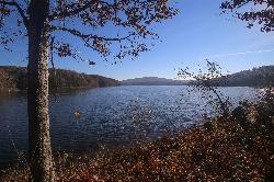
Chapel Hill Beach
Belgrade
18.2 miles NForest Service sand beach on 440-acre Council Bluff Lake in the Mark Twain National Forest near Belgrade, with a bathhouse and concession stand. Seasonal; day use is $5 per vehicle.
Camp, Canoe, Hike, Kayak, Swim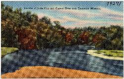
Two Rivers Access
Eminence
24.9 miles SWFree National Park Service river access where the Jacks Fork joins the Current River near Eminence, with cold, clear gravel-bar swimming, boat launches, a small campground and seasonal canoe and tube rentals.
Camp, Canoe, Hike, Kayak, Swim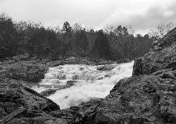
Rocky Falls
Winona
28.9 miles SWA free NPS swimming hole in Ozark National Scenic Riverways where Rocky Creek slides 40 feet down pink rhyolite into a pool, a few steps from the parking lot east of Winona.
Hike, Swim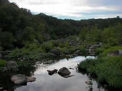
Silver Mines Recreation Area
Fredericktown
31.5 miles EA Forest Service day use area on the boulder-strewn St. Francis River west of Fredericktown, Missouri, where wading and dipping in the pools is allowed at your own risk for a $5 per vehicle fee.
Camp, Canoe, Hike, Kayak, Swim
Alley Spring Swimming Hole (Jacks Fork)
Eminence, Missouri
33.3 miles SWGravel-bar swimming hole on the spring-fed Jacks Fork at Alley Spring in Ozark National Scenic Riverways, a short walk from the campground and the red 1894 Alley Mill.
Camp, Canoe, Hike, Kayak, Swim
Monsanto Lake Beach
Park Hills
35.8 miles NEFree sand swim beach on 25-acre Monsanto Lake at St. Joe State Park in Park Hills, with a change house, accessible water-entry ramp and no lifeguards. Open Memorial Day weekend through Labor Day.
Camp, Canoe, Hike, Kayak, SwimNearby Campsites
Chapel Hill Beach
Belgrade
18.2 miles NForest Service sand beach on 440-acre Council Bluff Lake in the Mark Twain National Forest near Belgrade, with a bathhouse and concession stand. Seasonal; day use is $5 per vehicle.
Camp, Canoe, Hike, Kayak, Swim
Two Rivers Access
Eminence
24.9 miles SWFree National Park Service river access where the Jacks Fork joins the Current River near Eminence, with cold, clear gravel-bar swimming, boat launches, a small campground and seasonal canoe and tube rentals.
Camp, Canoe, Hike, Kayak, Swim
Round Spring Campground
Eminence, Missouri
25.9 miles SWTwo of America's most beautiful spring-fed rivers meet in forested Ozark National Scenic Riverways at Round Spring — offering swimming, canoeing, hiking, horseback riding, and wildlife viewing.
Camp, Canoe
Silver Mines Recreation Area
Fredericktown
31.5 miles EA Forest Service day use area on the boulder-strewn St. Francis River west of Fredericktown, Missouri, where wading and dipping in the pools is allowed at your own risk for a $5 per vehicle fee.
Camp, Canoe, Hike, Kayak, Swim
Alley Spring Swimming Hole (Jacks Fork)
Eminence, Missouri
33.3 miles SWGravel-bar swimming hole on the spring-fed Jacks Fork at Alley Spring in Ozark National Scenic Riverways, a short walk from the campground and the red 1894 Alley Mill.
Camp, Canoe, Hike, Kayak, Swim
Monsanto Lake Beach
Park Hills
35.8 miles NEFree sand swim beach on 25-acre Monsanto Lake at St. Joe State Park in Park Hills, with a change house, accessible water-entry ramp and no lifeguards. Open Memorial Day weekend through Labor Day.
Camp, Canoe, Hike, Kayak, Swim


