


135 Things to do near Blackrock #447
first prev 1 2 3 4 5 6 7 next lastShowing results within 50 miles Distance miles of Blackrock #447 near Glenville, North Carolina City, Zip, or Address
Panthertown Valley
Glenville, North Carolina
0.2 miles EA 35-mile trail network in Panthertown Valley near Glenville with 19 miles of mountain biking, granite cliff vistas, mixed terrain from fire roads to tight singletrack, and rock climbing on the cliffs.
Mountain Bike
Devils Elbow #448
Lake Toxaway, North Carolina
2.7 miles EA mountain bike trail connecting to Panthertown Valley's main thoroughfare, with sections of old forest road and narrow singletrack climbing to Devils Elbow Knob.
Mountain Bike
Big Creek Area
Tuckasegee, North Carolina
5.5 miles NSeveral remote swimming holes near the TN-NC border in the Big Creek Recreation Area of the Great Smoky Mountains — very secluded, and dogs are not allowed on the trail.
Swim
Bear Creek Area
Tuckasegee, North Carolina
5.5 miles NSeveral remote swimming holes in lakes along Route 281 southeast of Sylva and Cullowhee — bathing suits optional at most spots, given how far off the beaten path they are.
Swim 1.4 mi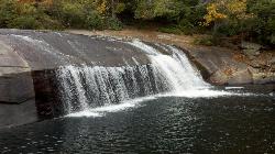
Turtleback Falls
Lake Toxaway, North Carolina
6.9 miles SETurtleback Falls' dome-shaped slide drops riders 10 feet into the Chug Hole pool, but wait for calm currents — strong flows have swept swimmers downriver over 125-foot Rainbow Falls.
Backpack, Hike, Swim 1.0 mi
Hidden Falls
Lake Toxaway, North Carolina
7.2 miles SEJust a few steps off the Horsepasture River trail, Hidden Falls drops less than ten feet into an idyllic boulder-rimmed pool — a serene and easy family swimming hole.
Hike, Swim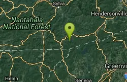
Cashiers Area
Woodleaf, North Carolina
7.4 miles SWSwim near Woodleaf, North Carolina
Swim 1.3 mi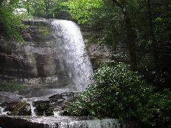
Rainbow Falls
Lake Toxaway, North Carolina
7.4 miles SEA 150-foot spectacular cascade on the Horsepasture River can be admired from front, side, bottom, and top — one showstopper in a 2-mile series of incredible falls.
Hike, Swim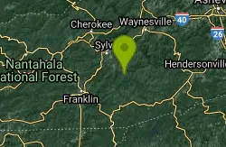
Big Creek
Waynesville, North Carolina
8.3 miles NWBig Creek is a crystalline mountain stream tumbling through the quiet northeastern corner of Great Smoky Mountains National Park, and it may be the single best swimming creek in the Smokies. Cold,...
Swim
Midnight Hole
Waynesville, North Carolina
8.3 miles NWMidnight Hole is the most beloved swimming hole in Great Smoky Mountains National Park, an emerald-green pool of startling clarity sitting at the base of a six-foot waterfall, ringed by house-sized...
Swim
Snaggy Creek Trail
Cullowhee, North Carolina
10.5 miles NWA 5-mile mountain bike climb from 2,300 to 5,500 feet near Cullowhee, descending halfway back before branching onto ATV trails back to town.
Mountain Bike
Courthouse Falls
11.1 miles NE
A gorgeous 45-foot waterfall streams into a stunning blue-green pool in a greenery-covered cliff cove — just a 3/4-mile easy hike from the parking lot, open year-round.
Hike, Swim
Jackson County Rec Center Disc Golf Course
Cullowhee, North Carolina
11.4 miles NWA very short, flat free disc golf course at the Jackson County Rec Center in Cullowhee, with a pond hole, soccer fields, basketball courts, and walking trails all on site.
Disc Golf
Catamount Links
Cullowhee, North Carolina
11.7 miles NWA free disc golf course on the beautiful Western Carolina University campus with open fairways, elevation, challenging target placements, and water in play on several holes.
Disc Golf
New Vista Rd
Brevard, North Carolina
12.9 miles EA general fire road with a nice view across the valley near Brevard, NC.
Mountain Bike
Buckhorn Gap / 103
Brevard, North Carolina
13.0 miles EClassic Pisgah singletrack with technical sections, creek crossings, and old road beds — a 5.2-mile one-way trail combinable with nearby routes like Avery Creek.
Mountain Bike
Buckwheat Knob / 122
Brevard, North Carolina
13.0 miles EThe final pitch of Satan's Staircase near Brevard — a 1.5-mile crazy-steep push to Buckwheat Knob, then a fast and furious descent to Avery Creek.
Mountain Bike
WCU Trails
Cullowhee, North Carolina
13.0 miles NWAn intermediate mountain bike trail on steep WCU campus hillside near Cullowhee with lots of ups and downs despite a modest overall elevation change.
Mountain Bike 1.8 mi
Flat Laurel Creek
13.4 miles NE
A 3.18-mile multi-use trail following Flat Laurel Creek through colorful rock formations and forest, with distant views of Sam Knob and a small waterfall — open year round.
Hike, Horseback, Mountain Bike, Swim 7.1 mi
Daniel Ridge Loop
Canton, North Carolina
14.6 miles NEA classic short Pisgah loop with moderate technical riding, a rocky downhill roller coaster, two waterfalls, and multiple route options to tailor the adventure.
Hike, Mountain Bike


