


Turtleback Falls
Lake Toxaway, North Carolina
| Address: | 976 Grassy Ridge Road, Lake Toxaway, NC 28747, USA |
| GPS: |
35°5'33.0"N 82°57'58.0"W Maps | Directions |
| State: | North Carolina |
| Trail Length: | 3.90 miles |
| Trail Type: | Out & Back |
| Hike Difficulty: | Intermediate |
| Elevation Gain: | 770 feet |
| Trails/Routes: | 1.4 mi |
Restrooms Rivers Waterfalls Trails Rocks Wildflowers
Backpack, Hike, and Swim
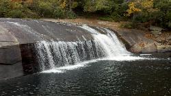
Turtleback Falls was named for its domed shape, similar to the back of a turtle. It's also called "umbrella falls" for the same reason. Visitors slide down Turtleback as the river flows over the slab of rock and drop into an open pool basin, also known as the Chug Hole. This great swimming hole is a quarter mile upstream from the 150' Rainbow Falls.
Located near Brevard on the Horsepasture River in the Pisgah National Forest, Turtleback Falls is an open slip-in-slide waterfall for the summer months. Visitors go down Turtleback falls and drop roughly 10 feet into an open pool basin.
Although Turtleback is a great swimming spot, it can also be dangerous. The water currents can be very strong and visitors have either drowned or have been swept downriver and over 125' rainbow river. If you want to slide, it's best to wait until the water currents aren't strong so it's safer to swim. If you want to find a calmer swimming hole, then go 1/3 of a mile down the river at Hidden Falls.
Turtleback falls is mostly a calm place to slip and swim and a great summer activity!
More Information
Rainbow Falls & Turtleback Hike | Explore Asheville
Gorges State Park is located on the Blue Ridge Escarpment, where the mountains end and the Piedmont begins. From the Grassy Ridge parking lot, the Rainbow Falls trail starts out as gravel, but then starts to descend toward the Horsepasture River. With a few creek crossings here, prepare to get your feet wet. While it doesn’t affect your hike, you should know that the trail switches from Gorges State Park to Pisgah National Forest about 20 minutes after you leave the parking lot. The trail gets narrower as you pass through a hardwood forest, but you’ll follow along the side of the river most of the way to the falls.
https://www.exploreasheville.com/article/rainbow-falls-turtleback-hikeSite is not available
The domain name in the URL is not associated with any active site on the WP Engine platform.
https://cchikes.wpengine.com/rainbow-falls-turtleback-falls/Turtleback Falls NC
Turtleback Falls NC is an awesome swimming hole, sliding rock, and water plunge located in Pisgah National Forest. A great option for summer time fun!
https://blueridgemountainlife.com/turtleback-falls-nc/Turtleback Falls | RomanticAsheville.com
Turtleback Falls in Pisgah National Forest is accessed by a hike from Gorges State Park in North Carolina.
https://www.romanticasheville.com/turtleback-fallsBe courteous, informed, and prepared. Read trailhead guidelines, stay on the trail, and don't feed the wildlife.
Read More- Plan Ahead and Prepare
- Travel & camp on durable surfaces
- Dispose of waste properly
- Leave what you find
- Minimize campfire impacts
- Respect wildlife
- Be considerate of other visitors
Directions
From Lake Toxaway, North Carolina
- Head southeast on NC-281 S toward Toxaway Point (0.5 mi)
- Turn right onto US-64 W (2.7 mi)
- Turn left onto NC-281 S (1.6 mi)
1. Go onto highway 281 South near Sapphire NC. From Brevard, NC-take 64 South, turn left onto 281 South.
2. Gorges State Park will be on your left.
3. Follow the road to the Grassy Ridge back parking lot.
kwhitfield
5/7/20 12:04 pm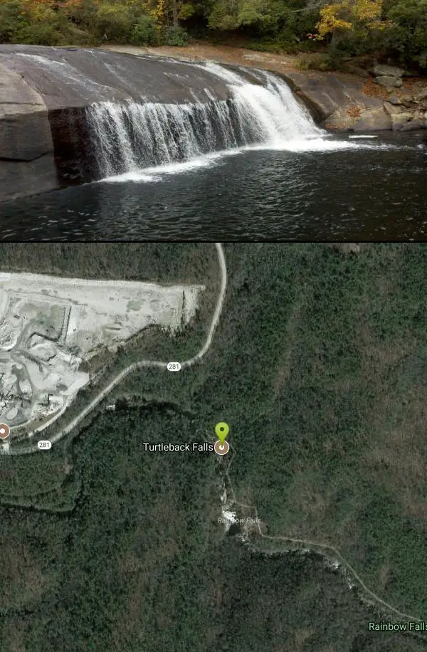


Other Swimming Holes, Hiking Trails, and Backpacking Trails Nearby

Hidden Falls
Lake Toxaway, North Carolina
0.3 miles SEJust a few steps off the Horsepasture River trail, Hidden Falls drops less than ten feet into an idyllic boulder-rimmed pool — a serene and easy family swimming hole.
Hike, Swim 1.3 mi
Rainbow Falls
Lake Toxaway, North Carolina
0.6 miles SEA 150-foot spectacular cascade on the Horsepasture River can be admired from front, side, bottom, and top — one showstopper in a 2-mile series of incredible falls.
Hike, Swim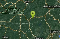
Cashiers Area
Woodleaf, North Carolina
8.2 miles WSwim near Woodleaf, North Carolina
Swim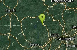
Moonshine Falls Area
Bishopville, South Carolina
10.0 miles SESwim near Bishopville, South Carolina
Swim
Big Creek Area
Tuckasegee, North Carolina
10.9 miles NSeveral remote swimming holes near the TN-NC border in the Big Creek Recreation Area of the Great Smoky Mountains — very secluded, and dogs are not allowed on the trail.
Swim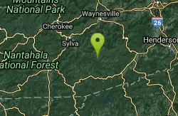
Bear Creek Area
Tuckasegee, North Carolina
10.9 miles NSeveral remote swimming holes in lakes along Route 281 southeast of Sylva and Cullowhee — bathing suits optional at most spots, given how far off the beaten path they are.
Swim
Courthouse Falls
13.0 miles N
A gorgeous 45-foot waterfall streams into a stunning blue-green pool in a greenery-covered cliff cove — just a 3/4-mile easy hike from the parking lot, open year-round.
Hike, Swim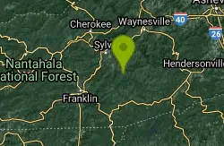
Big Creek
Waynesville, North Carolina
15.1 miles NWBig Creek is a crystalline mountain stream tumbling through the quiet northeastern corner of Great Smoky Mountains National Park, and it may be the single best swimming creek in the Smokies. Cold,...
Swim
Midnight Hole
Waynesville, North Carolina
15.1 miles NWMidnight Hole is the most beloved swimming hole in Great Smoky Mountains National Park, an emerald-green pool of startling clarity sitting at the base of a six-foot waterfall, ringed by house-sized...
Swim 3.1-4.3 mi
Farlow Gap
Canton, North Carolina
15.4 miles NEOne of Pisgah's most technical downhills — a minefield of boulders dropping 2,000 feet in 3 miles, best ridden as part of the Fish Hatchery loop.
Hike, Mountain Bike 7.1 mi
Daniel Ridge Loop
Canton, North Carolina
15.4 miles NEA classic short Pisgah loop with moderate technical riding, a rocky downhill roller coaster, two waterfalls, and multiple route options to tailor the adventure.
Hike, Mountain Bike
Whaleback Swimming Hole
Asheville, North Carolina
15.6 miles NEA horseshoe of massive bedrock around a deep, green swimming hole where Cove Creek meets the Davidson River — locals' quiet answer to crowded Sliding Rock.
Swim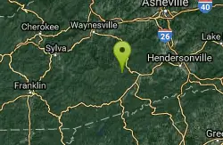
Cove Creek Tubs
Brevard, North Carolina
15.8 miles NEThree perfectly rounded pot holes — the Pisgah Forest's finest — stack up to 12 feet deep in sun-drenched pools that are best described as nature's own jacuzzi collection.
Swim 0.8 mi
Daniel Ridge Falls
Brevard, North Carolina
16.5 miles NEAn easy half-mile hike in Pisgah National Forest near Brevard to a 150-foot waterfall known by three names — most impressive after rain, modest in dry spells, with an optional 4-mile loop to the top.
Hike, Mountain Bike, Swim
Butter Gap / Trail #123
Brevard, North Carolina
16.5 miles NEButter Gap Trail in Pisgah Forest climbs about 1,000 feet and connects to FS 471D — the western fork is open to mountain bikes, with seasonal bike access on part of the route.
Hike, Mountain Bike 1.8 mi
Flat Laurel Creek
16.6 miles N
A 3.18-mile multi-use trail following Flat Laurel Creek through colorful rock formations and forest, with distant views of Sam Knob and a small waterfall — open year round.
Hike, Horseback, Mountain Bike, Swim 0.2-2.8 mi
Graveyard Fields
Brevard, North Carolina
17.1 miles NETwo cascading waterfalls — a swimmable Lower Falls just 1/3 mile from the road, and a more challenging Upper Falls on a 3.5-mile wildflower loop — make this a must-see hike.
Hike, Swim
Skinny Dip Falls
Brevard, North Carolina
17.6 miles NEA cascading waterfall with multiple clear pools for wading and swimming, a 6-foot jumping spot, and an easy 3/4-mile forested walk from the Blue Ridge Parkway — swimmers should mind fast water and slippery rocks.
Hike, Swim
Coontree Recreation Area
Brevard, North Carolina
17.7 miles NEA scenic picnic area on the Davidson River with direct access to calm, deep water for swimming and fishing — plus the 3.7-mile Coontree Loop Trail through Pisgah National Forest.
Hike, Mountain Bike, Swim
Looking Glass Falls
Brevard, North Carolina
17.9 miles NEA cascading 60-foot waterfall over mossy stone with a wading pool below — just a short, beautiful walk from Pisgah Highway in Brevard, stunning in any season.
Hike, SwimNearby Campsites

Davidson River Campground
Pisgah Forest, North Carolina
18.9 miles NEA year-round campground in Pisgah National Forest just four miles from Brevard and less than an hour from Asheville, with shaded loops, hiking trails, waterfalls, and fishing spots nearby.
Camp, Hike, Swim
War Woman Dell Wildlife Management Area
Clayton, Georgia
26.2 miles SWA short 0.8-mile out-and-back hike near Clayton, Georgia through a nature trail to a waterfall — good for all skill levels and accessible year-round.
Camp, Hike, Horseback
Mt. LeConte Lodge
Sylva, North Carolina
26.5 miles NWThe highest guest lodge in the eastern United States at 6,400 feet, with spectacular Smokies views from an open glade just below the Mt. LeConte summit in Great Smoky Mountains NP.
Camp, Hike, Horseback, Rock Climb
Cosby Campground
Cosby, Tennessee
47.9 miles NCamp and Swim near Cosby, Tennessee
Camp, Swim


