226 Things to do near Pyramid Trail
first prev 1 2 3 4 5 6 7 8 9 10 next lastShowing results within 50 miles Distance miles of 1825 W Chandler Blvd, Phoenix, AZ 85045, USA City, Zip, or Address

Crosscut Canal Trail
Tempe, Arizona
13.7 miles NECrosscut Canal Trail is a concrete, sidewalk multi-use trail for walking, biking, wheelchairs, scooters, and skateboards. This two mile long path follows a canal and links Tempe Town Lake to...
Hike
Los Olivos
Phoenix, Arizona
14.1 miles NFlat, grassy neighborhood park (used to be an olive orchard). Lots of trees. Busy on weekends. Easy to navigate. Public (No Fee)
Disc Golf
Chandler Skatepark
Chandler, Arizona
14.6 miles EChandler, an outdoor 33,000-square-foot park, has been reported to be the best skatepark in Arizona. Designed by SITE Systems Design Group, it features ledges, two bowls, banks, quarterpipes,...
Skateboard
Vista del Camino Park
Scottsdale, Arizona
15.2 miles NEThe Shelly Sharpe Memorial Disc Golf Course at Vista del Camino was installed in 1984 and redesigned in 1997 by PDGA Hall of Fame member Dan Ginnelly. It is a pretty level and open course - water...
Disc Golf
The Wedge Skate park
Scottsdale, Arizona
15.5 miles NEThe Wedge Skatepark is a part of the Scottsdale Park System. The Wedge is located at Eldorado Park - 2311 N. Miller Rd. (roughly Miller & McDowell) The skatepark is open from daylight till...
Skateboard
Arizona Canal Trail
Phoenix, Arizona
15.7 miles NMulti-purpose canal trails set apart from normal city traffic and noise. The Arizona Canal is one of the many canals used to supply the valley with its water needs (irrigation). These canals were...
Hike, Horseback 2.9 mi
Coldwater Trail
Goodyear, Arizona
16.2 miles WThe Cold Water Trail #27 is a seldom visited, remote backcountry destination along the backdrop of the rugged Verde Rim with healthy mixed vegetation and unique geology. The trail was originally used...
Hike, Horseback, Mountain Bike 13.8 mi
Butterfield to Gadsen Loop Trail
Goodyear, Arizona
16.2 miles WAs with other trails in Estrella, the trail is wide and the surface tends to be rather benign, varying from mostly smooth, to occasionally strewn with small rocks, sandy in the washes. Butterfield...
Hike, Horseback, Mountain Bike
Paseo Vista Recreation Area
Chandler, Arizona
16.4 miles EMulti-use park on a former land fill site. 11 holes have dual tees and 1 hole has 2 baskets. Mostly wide open with some OB. Features 2 concrete culvert mandos through pipe. Multiple berms and a...
Disc Golf 3.6 mi
Toothaker Trail
Goodyear, Arizona
16.4 miles WToothaker is an easy roller coaster of a trail. It crosses numerous washes ranging from small to large and can be a tad loose and/or rocky in some sections. The end reward is a nice view of Rainbow...
Hike, Horseback, Mountain Bike
Estrella Mountain Park
Goodyear, Arizona
16.4 miles WNice mix of singletrack and doubletrack. One way loops, long loop and tech loop. A few mild climbs and some mild rock gardens, just let it ride. There is a lot of loose rocks on the...
Mountain Bike
Dysart Trail
Goodyear, Arizona
16.4 miles W$6 entry fee per car.
Hike, Horseback, Mountain Bike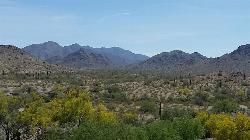
Rainbow Valley to Toothaker Loop Trail
Goodyear, Arizona
16.4 miles WEstrella Mountain Regional Park has many trails within it, a great beginner to intermediate friendly trail is the Rainbow Valley to Toothaker Loop Trail. This 6.6 mile hike is mostly flat with a few...
Hike, Horseback, Mountain Bike
Baseline Trail
Goodyear, Arizona
16.5 miles WThe Baseline trail is a 2.6 mile loop at Estrella Mountain Regional Park. This listing is based on access from a spur trail (33.378981, -112.371072) off of the Gila trail. Access is...
Hike
Papago Park Area Mountain Bike Trail
Scottsdale, Arizona
16.6 miles NEMountain Bike near Scottsdale, Arizona
Mountain Bike 1.7 mi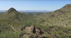
Quartz Ridge Trail
Phoenix, Arizona
16.6 miles NThis is a very popular trail on weekend mornings. Casual hikers can get great views of Phoenix with moderate effort. Good place to bring out of town visitors The Quartz Ridge Trail is a short,...
Hike, Mountain Bike 1.0-1.2 mi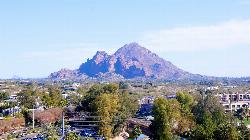
Camelback Mountain
Phoenix, Arizona
16.7 miles NEHiking After Camelback became a park in 1968, TripAdvisor advertised the hikes as one of the top 10 things to do when in Phoenix. Located right in the middle of Phoenix, Scottsdale and...
Hike, Rock Climb 4.6 mi
Perl Charles Memorial Trail (#1A)
Phoenix, Arizona
16.8 miles NThis is a technical singletrack loop with some very steep up and down sections located in the Phoenix Mountain Preserves. This trail is for advanced riders who like to bleed and leave their skin on...
Hike, Horseback, Mountain Bike 3.8 mi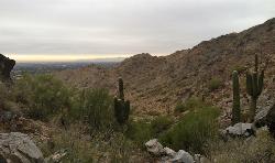
Freedom Loop Trail (#302)
Phoenix, Arizona
16.9 miles NFreedom Trail (#302), also known as Piestewa Circumference, is a 3.8 mile, moderate loop trail. You can access this trail from all the inner trailheads. The easiest and least...
Hike 2.2 mi
Piestewa Peak Summit Trail #300
Phoenix, Arizona
16.9 miles NSome people still refer to the Peak by its original name of "Squaw Peak" before its name changed to "Piestewa Peak" in honor of Lori Piestewa who died serving her country in the...
Hike


