


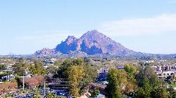
Camelback Mountain
Phoenix, Arizona
| Address: | ~5700 N Echo Canyon Dr, Phoenix, AZ 85018, USA |
| GPS: |
33°31'16.9"N 111°58'25.1"W Maps | Directions |
| State: | Arizona |
| Trail Length: | 3.00 miles |
| Trail Type: | Out & Back |
| Hike Difficulty: | Intermediate |
| Elevation Gain: | 1280 feet |
| Trails/Routes: | 1.0-1.2 mi |
Pet Friendly
Hike and Rock Climb
Hiking
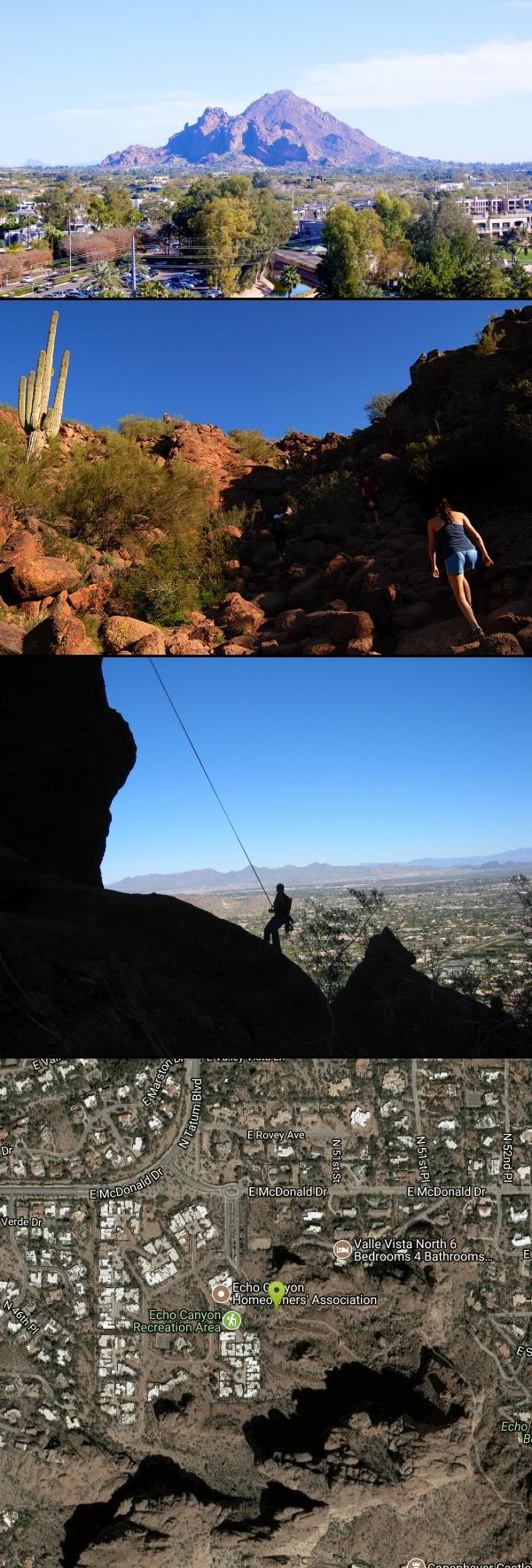
After Camelback became a park in 1968, TripAdvisor advertised the hikes as one of the top 10 things to do when in Phoenix. Located right in the middle of Phoenix, Scottsdale and Paradise Valley, Camelback Mountain is a hike that both locals and tourists enjoy regularly. Camelback Mountain has 2 primary trails that hike to the summit, and both offer fantastic views of the valley and of the many species of flora, including a few different types of cactus.
- Echo Canyon Trail: Echo Canyon trail is the steeper of the 2 trails up Camelback, although slightly shorter at 1.23mi to the summit. This trail is well-managed but steep and is a great challenge for hikers, taking 2-3 hours round trip, depending on the pace. The phenominal views along the way make the hike well worth the challenge. For this trail, parking is available at the Echo Canyon Recreation Area, but very limited on the weekends after 7am, so plan accordingly. Unfortunately , the parking is only available dawn to dusk, so don't plan on hiking for any sunrises or sunsets on the summit. Spectacular views of the sunrise and sunset can be seen along the trail, however, which is okay as long as you obey the parking hours.
- Cholla Trail: Cholla trail is longer than Echo Canyon at 1.4mi but is a little easier for those still eager for a refreshing workout outside without too much huffing and puffing. The first mile hikes on a fairly maintained trail and the second mile or so gets a little steeper and may require intense hiking and scrambling. Along the Cholla trail, there will likely be some of Arizona's wildlife posing for pictures if hikers are quiet. Popular creatures include hawks, road runners, chuckwallas, harris antelope squirrels, and quail. Rattlesnakes are also common on the trail, so be alert. Parking for this trail is available all along Invergordon Road (64th St) and a walk to the trailhead, resulting in less limited space and more flexible hours than at Echo Canyon
Climbing
The climbing at Camelback mountain has a particular style loaded with easier climbing, sparse protection, and falling rock. There are still a few classics that both locals and visitors can enjoy on the "petrified mud" that is desert climbing. There are 42 total climbing routes spread over 11 areas, making up 5 boulders, 24 sport routes, 11 trad routes, and 1 Top-rope. Of these climbs, the majority are in the 5.6 or easier range with 17 or so moving into the moderate 5.8-easy 5.11 range. One of the classics at the crag is Chimera on Gargoyle Wall, a 2-pitch 5.9 PG-13 sport route worth 4 stars.
Parking for climbing at Camelback mountain is available at the Echo Canyon Recreation Area lot or on Invergordon Road (64th St) on the other side of the mountain
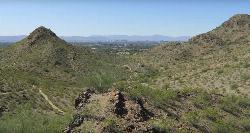
Mapped Route/Trail Distances
| Echo Canyon (out-and-back) | 1.0 miles |
| Cholla (out-and-back) | 1.2 miles |
More Information
Be courteous, informed, and prepared. Read trailhead guidelines, stay on the trail, and don't feed the wildlife.
Read More- Plan Ahead and Prepare
- Travel & camp on durable surfaces
- Dispose of waste properly
- Leave what you find
- Minimize campfire impacts
- Respect wildlife
- Be considerate of other visitors
Directions
From Phoenix, Arizona
- Head west on W Washington St toward 1st Ave (0.5 mi)
- Turn right onto N 7th Ave (0.8 mi)
- Turn right to merge onto I-10 E toward Tucson (2.3 mi)
- Take exit 147A-147B for AZ-51 N (0.6 mi)
- Continue onto AZ-51 N (4.9 mi)
- Take exit 5 toward Lincoln Dr (0.3 mi)
- Turn right onto E Glendale Ave (0.3 mi)
- Continue onto E Lincoln Dr (3.8 mi)
- Turn right onto N Tatum Blvd (0.5 mi)
- Turn left onto E McDonald Dr (0.1 mi)
- At the traffic circle, take the 2nd exit (0.2 mi)
- Turn left (220 ft)
- Slight rightDestination will be on the left(49 ft)


Trails
Distance ?
1.0 milesElevation Gain ?
1,159 feetReal Ascent ?
1,203 feetReal Descent ?
44 feetAvg Grade (13°)
23%Grade (-18° to 34°)
-32% to 66%Distance ?
1.2 milesElevation Gain ?
1,112 feetReal Ascent ?
1,142 feetReal Descent ?
30 feetAvg Grade (10°)
18%Grade (-5° to 29°)
-8% to 54%Elevation differences are scaled for emphasis. While the numbers are accurate, the cut-away shown here is not to scale.
Other Rock Climbing Walls and Hiking Trails Nearby
Quartz Ridge Trail
Phoenix, Arizona
2.3 miles WThis is a very popular trail on weekend mornings. Casual hikers can get great views of Phoenix with moderate effort. Good place to bring out of town visitors The Quartz Ridge Trail is a short,...
Hike, Mountain Bike 1.9 mi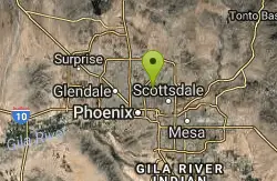
Ruth Hamilton Trail
Phoenix, Arizona
2.4 miles NWHike and Mountain Bike near Phoenix, Arizona
Hike, Mountain Bike
Arizona Canal Trail
Phoenix, Arizona
2.9 miles WMulti-purpose canal trails set apart from normal city traffic and noise. The Arizona Canal is one of the many canals used to supply the valley with its water needs (irrigation). These canals were...
Hike, Horseback 1.4 mi
Mohave Trail (#200)
Phoenix, Arizona
2.9 miles NWAn invigorating swift hike is what Mohave Trail 200 provides for anyone looking for a free and quick escape. Though the main attraction of the Phoenix Mountain’s Preserve is the larger Piestewa...
Hike, Horseback 3.6 mi
Charles M. Christiansen Memorial Trail
Phoenix, Arizona
3.0 miles NPhoenix, Arizona is home to some of the best and largest city parks in the country and the Charles M. Christiansen Memorial Trail is a great introduction to this fantastic park system. Also known as...
Hike, Horseback, Mountain Bike 7.1 mi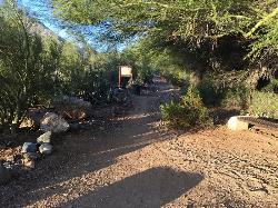
Trail 100
Phoenix, Arizona
3.0 miles NMountain Bikers and Hikers in Phoenix, Arizona can rejoice in the challenge that is Trail 100. Trail 100, or Charles M. Christensen Memorial Trail, is a little over 14 miles out and back in the...
Hike, Mountain Bike 2.2 mi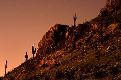
Piestewa Peak Summit Trail #300
Phoenix, Arizona
3.1 miles NWSome people still refer to the Peak by its original name of "Squaw Peak" before its name changed to "Piestewa Peak" in honor of Lori Piestewa who died serving her country in the...
Hike 3.8 mi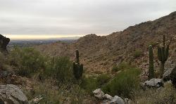
Freedom Loop Trail (#302)
Phoenix, Arizona
3.1 miles NWFreedom Trail (#302), also known as Piestewa Circumference, is a 3.8 mile, moderate loop trail. You can access this trail from all the inner trailheads. The easiest and least...
Hike 2.6 mi
L.V. Yates Trail (#8)
Phoenix, Arizona
3.5 miles NThe trail is strewn with large rocks and gulleys from recent torrential rains. Not impassable on foot, but definitely some hike-a-bike areas. Keep in mind there's no ridge hiking...
Hike, Horseback, Mountain Bike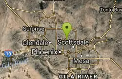
L.V. Yates to "Two Bit" Peak Loop
Phoenix, Arizona
3.5 miles NWell this time of the year there really was not a lot of wild life to see, just to hot. Starting from the 40st trailhead gave me a different view of the preserve. I really enjoyed...
Hike, Horseback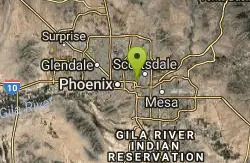
Papago to Tempe Town Lake
Phoenix, Arizona
4.1 miles SThere are many paths that interconnect within Papago park and the nearby Tempe Town Lake. Any of these in combination provide a good walk or bike riding experience with a variety of views. Papago...
Hike 4.6 mi
Perl Charles Memorial Trail (#1A)
Phoenix, Arizona
4.2 miles WThis is a technical singletrack loop with some very steep up and down sections located in the Phoenix Mountain Preserves. This trail is for advanced riders who like to bleed and leave their skin on...
Hike, Horseback, Mountain Bike 1.3 mi
Dreamy Draw Loop Trail
Phoenix, Arizona
4.3 miles NWThe Dreamy Draw Nature Trail is a short multi-access loop trail that provides a true Sonoran Desert experience. The trail crosses a number of desert washes and, at times, becomes somewhat rocky....
Hike, Horseback, Mountain Bike
Double Butte Loop Trail
Phoenix, Arizona
4.7 miles SDouble Butte Loop Trail is one of the trails within Papago Park in Phoenix, Arizona. The Double Butte Loop Trail is a natural trail that traverses the circumference of both the small butte...
Hike, Mountain Bike
Crosscut Canal Trail
Tempe, Arizona
5.5 miles SCrosscut Canal Trail is a concrete, sidewalk multi-use trail for walking, biking, wheelchairs, scooters, and skateboards. This two mile long path follows a canal and links Tempe Town Lake to...
Hike 4.9 mi
Tempe Town Lake Trail
Tempe, Arizona
6.1 miles SOn the lake's south side, the trail connects Arizona State University's main Tempe campus with Tempe Beach Park, as well as the Tempe Marketplace retail mecca. A newer extension on the...
Hike 2.0 mi
Loma and Canal Trails
Tempe, Arizona
6.1 miles STrails open to mountain biking and hiking that wind through the Papago Park in Tempe, Arizona. The Loma Trail winds around lots of uphill and downhill paths, and leads to a park with a small lake and...
Hike, Mountain Bike
Hayden Butte And Tempe Town Lake Trail
Tempe, Arizona
6.8 miles SHike near Tempe, Arizona
Hike
Indian Bend Bike Trail
Scottsdale, Arizona
6.9 miles NEIndian Bend Wash Greenbelt is a urban, concrete paved path, primarily used for biking and walking/jogging, in Scottsdale, Arizona. This point A to point B, 11 mile long trail takes you past parks,...
Hike, Mountain Bike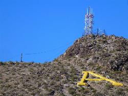
'A' Mountain at Hayden Butte
Tempe, Arizona
7.0 miles S'A' Mountain aka Hayden Butte, is a popular hike in downtown in Tempe, Arizona. This hike located partially on Arizona State University's campus, is a short, easy walk, though it's...
HikeNearby Campsites

Lower Salt River Nature Trail
Fort McDowell, Arizona
18.1 miles EThe Lower Salt River Nature Trail is a scenic walk to take at the Tonto National Forest. This trail provides stunning views as you walk alongside the Salt River. This rustic trail is older and less...
Camp, Hike
Buckhorn Campground Nature Trail
Apache Junction, Arizona
20.6 miles ECamp and Hike near Apache Junction, Arizona
Camp, Hike


