


229 Things to do near Quakie Ridge
first prev 1 2 3 4 5 6 7 8 9 10 next lastShowing results within 50 miles Distance miles of 3300 E Alta Ski Hill Rd, Moose, WY 83012, USA City, Zip, or Address
Allen Canyon-Pole Canyon Trail (014)
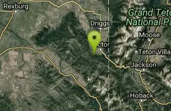
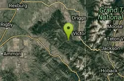
Victor, Idaho
18.2 miles SWThis trail is locally known as the Pole Canyon Trail. Just South of Victor, ID, the Allen Canyon-Pole Canyon Trail (014) is a popular destination for local motorbikers, horseback...
Mountain Bike 0.6 mi
Packsaddle Lake
Tetonia, Idaho
18.9 miles WPacksaddle is one of the less well known lakes/trails in the area. If you've got a good offroad vehicle, you can probably make it all the way to the end of the road, otherwise, it's just an...
Dive, Hike, Mountain Bike, Snowshoe, Swim 4.6 mi
Coal Creek Trail
Alta, Wyoming
19.1 miles SEnjoy outstanding views from upper Coal Creek Meadows, this hike description travels just beyond the meadows to the top of Coal-Mesquite Divide where you'll enjoy some rather dramatic views of...
Hike, Mountain Bike
Pine Creek Campground
Victor, Idaho
19.3 miles SWThe Pine Creek Campground has 10 single units and has restrooms.
Camp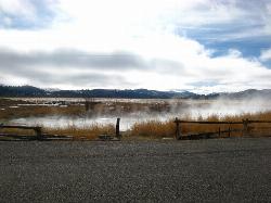
Kelly Warm Spring
Kelly, Wyoming
20.0 miles SEThese are more of a warm spring but it's still a pretty good soak and with a beautiful view of the Tetons from the Jackson Hole side.
Hot Springs
Red Creek Via Spooky Trail
Victor, Idaho
20.1 miles SWTrail starts on the Spooky trail segment. About 1.2 up you'll see a trail on your left. This is where you will be coming out at. Continue straight. At about 2.6 from the car you'll...
Mountain Bike 1.2 mi
Spooky
Victor, Idaho
20.1 miles SWTrail serves as the stem to Red Creek or access to Corral Creek as well as other possibilities in the big hole mountains. Nice fun singletrack to run as an out n back if your time is...
Mountain Bike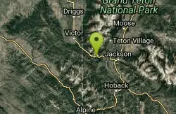
Fuzzy Bunny/Power Line Jumps/Parallel
Wilson, Wyoming
20.2 miles SThis is a steep, fast, rugged downhill trail with some freeride features that are also "ride-around-able." At the end of Fuzzy Bunny, look for Power Line Jumps off the Old Pass Road...
Mountain Bike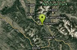
Phillips Ridge
Wilson, Wyoming
20.5 miles STrail is recommend to be done as a shuttle but can be done as an out and back from trailhead on Fish Creek Road. Shuttle is easiest by parking a vehicle and the Stagecoach bar or the...
Mountain Bike
Black Canyon
Wilson, Wyoming
20.5 miles STrail starts at the parking lot ontop of the pass. Take the service road on the west side of the parking lot. The road will turn into singletrack when you reach a service building...
Mountain Bike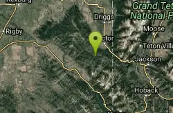
Sheep Driveway
Irwin, Idaho
21.1 miles SWOHVs, mountain biking, day hiking, horse riding. source: fs.usda.gov
Mountain Bike
Wright Creek Trail
Tetonia, Idaho
21.2 miles WOpen to MTB, horseback riding, snowshoeing, and hiking. source: fs.usda.gov
Mountain Bike
Sheep Falls on Fall River
Ashton, Idaho
21.3 miles NThe lesser known Sheep Falls on Fall River is a local treasure off of Cave Falls road. There are primitive campsites and beautiful views for a great picnic spot. The water splits and comes down in...
Camp
Loon Lake
Ashton, Idaho
22.6 miles NCamp, Kayak, and Swim near Ashton, Idaho
Camp, Kayak, Swim
West Pine Creek Trail
Ririe, Idaho
23.2 miles SWNon-motorized use. source: fs.usda.gov
Mountain Bike
Trail Canyon Trail
Ririe, Idaho
23.2 miles SWThe Trail Canyon trail begins at Trail Canyon Parklot, T8s R43e Sec28 and ends at Intersect Trail 5251,t8s R43e Sec28. source: fs.usda.gov
Mountain Bike 1.1 mi
Fish Lake
Ashton, Idaho
23.3 miles NHike near Ashton, Idaho
Hike 15.9-16.6 mi
Union Falls & Ouzel Pool
Grant Village, Yellowstone National Park
23.3 miles NBackpack, Hike, Hot Springs, and Swim near Grant Village, Yellowstone National Park
Backpack, Hike, Hot Springs, Swim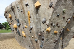
Phil Baux Park
Jackson, Wyoming
23.9 miles SEPhil Baux park has your typical park equipment such as a playground, swing set, small picnic shelter, 8 picnic tables, horseshoe pits and plenty of green grass for other recreational...
Rock Climb
Falls River, Lower Run
Ashton, Idaho
24.1 miles NWFall River rises on the Madison and Pitchstone plateaus in the southwest corner of Yellowstone National Park, Wyoming and flows approximately 64 miles (103 km) to its confluence with the Henrys Fork...
Whitewater


