


262 Things to do near Rob's Trail
first prev 4 5 6 7 8 9 10 11 12 13 next lastShowing results within 50 miles Distance miles of 2505 Bear Hollow Dr, Park City, UT 84098, USA City, Zip, or Address
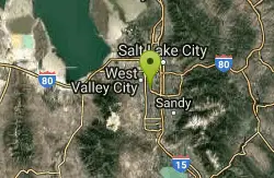
Valley Regional Park Disc Golf Course
Salt Lake City, Utah
20.6 miles WLined with trees and a paved jogging path. Front 9 is flat with young trees and grass. Maturing back 9. The rec center has softball fields, and a swimming pool. Good signs - easy navigation....
Disc Golf
Beaver Creek Trail
Kamas, Utah
20.6 miles EMost of the trail is easy hard-packed dirt, perfect for a first-time alpine bike ride. Except for a not-to-tough hill right at the beginning, the trail is fairly flat. More technical...
Mountain Bike 0.6 mi
Potato Hill Trail
Draper, Utah
20.6 miles SWLocated in Draper, UT, Potato Hill Trail start at the trailhead on Transverse Mountain Road. and goes down to the (BST) or Bonneville Shoreline Trail west of Coyote Hollow. There are some trails that...
Hike, Mountain Bike
Little Valley Trail
Draper, Utah
20.8 miles SWOne of the best places in the Salt Lake valley to take kids mountain biking is the Little Valley Instructional Trails. Fortunately, these superbly constructed “flow” trails are just as...
Hike, Mountain Bike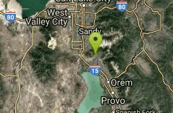
Beacon Hill Park Disc Golf
Highland, Utah
20.8 miles SWIncredible views of Utah Valley, Utah Lake, and the surrounding Rockies. Nestled on a large expanse of natural fields at the base of Hog Hollow Canyon, the course has a (usually) dry creek and a few...
Disc Golf 1.3 mi
Eagle Crest Trail
Draper, Utah
21.0 miles SWEagle Crest trail is a beginner level trail mountain bike in Draper, Utah along the north side of Traverse Mountain. From the trail, riders can see the Salt Lake Valley, the Northern end of Utah...
Hike, Mountain Bike 0.8 mi
Red Rock Trail
Draper, Utah
21.1 miles SWThe Red Rock trail located in Draper, Utah is a short loop trail just down the road from the Draper LDS Temple. The hike itself may be short, but since it is along the cliffs of the southern end of...
Hike, Mountain Bike, Rock Climb
Bennion Park
Salt Lake City, Utah
21.2 miles WThe park is open from 7:00 a.m. to 10:00 p.m. It's a pretty flat and straight hill that's smaller on the North side but gets pretty big as it goes South.
Sled
Archie's Loop
Sundance, Utah
21.2 miles SArchie's Loop Trail, a 2.2 mile stretch of mountain biking/hiking trail, recently opened up totally new country. The intermediate-level trail runs from Scott's Pond loop to connect with...
Mountain Bike
Bountiful City Park
Bountiful, Utah
21.4 miles NWLength: ~100-200ft Slope: ~45°
Sled
Mills Park
Woods Cross, Utah
21.7 miles NWShort recreational course in multi-use park. Public (No Fee)
Disc Golf
Parrish Canyon Trail
Centerville, Utah
22.0 miles NWParrish Canyon Trail goes long the Wasatch Mountains; from the top of the mountain, this trail has beautiful views of Salt Lake City from a distance and interconnects with the Barnard Creek. It's...
Hike, Mountain Bike
Western Hills Elementary
Kearns, Utah
23.4 miles WSled near Kearns, Utah
Sled

Grove Creek Trail
Pleasant Grove, Utah
23.5 miles SThe Grove Creek Trail falls from the upper shoulder of Mount Timpanogos down Grove Creek Canyon to Pleasant Grove. It's usually ridden as a shuttled downhill -- because the climb up this...
Hike, Mountain Bike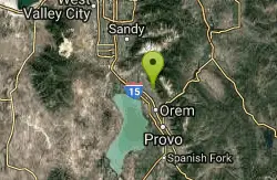
Bonneville Shoreline Trail - Cedar Hills to Grove Creek Canyon
Pleasant Grove, Utah
23.6 miles SThe Cedar Hills to Grove Creek Canyon portion of the Bonneville Shoreline Trail is an intermediate level trail. There are some flat spots that are on old dirt roads, as well as single track...
Mountain Bike
Provo River Parkway Trail
Provo, Utah
23.7 miles SThis isn't quite as much mountain biking as it is an easy downhill bike ride. The whole trail is paved. One of the best ways to do it is to take two vehicles and park one at Will's Canyon...
Hike, Mountain Bike
Freedom Hills Park
Centerville, Utah
23.7 miles NWShort open course in a well kept park. Tee signs are plaques in the ground near the tee markers. Public (No Fee)
Disc Golf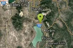
Art Dye Disc Golf Park
American Fork, Utah
24.0 miles SWTechnical with a variety of lengths. Plays mostly in trees with tight fairways and minor elevation. Tees are brick tiles, except #13 (rubber), and #12 and #15 (dirt). Course Map at 1st tee. Public...
Disc Golf 1.2 mi
Battle Creek Falls
Pleasant Grove, Utah
24.2 miles SBattle Creek Falls, located near Pleasant Grove, Utah, is a scenic waterfall that also has a rappelling and rock climbing area nearby. Hikers are allowed to see the falls from two view points, below...
Canyoneer, Hike
G Mountain Trail
Pleasant Grove, Utah
24.2 miles SThe trail starts at Kiwanis Park which is south of the 'G' at the end of Battle Creek Road. The trail starts out a little steep for about .25 mile and the very last bit is a...
Hike


