


233 Things to do near Sunrise Peak via Sunrise Trail
first prev 1 2 3 4 5 6 7 8 9 10 next lastShowing results within 50 miles Distance miles of Sunrise Trail, Scottsdale, AZ 85259, USA City, Zip, or Address

Saguaro Loop and Nature Trail
Scottsdale, Arizona
6.4 miles NWHike near Scottsdale, Arizona
Hike 0.6 mi
Horseshoe Trail
Scottsdale, Arizona
6.4 miles NWHorseshoe trail is a short, fun singletrack with a lot of quick turns created by wash areas and rocks. It's a nice warm-up heading to Gateway Loop Trail. In some areas there are a lot of cactus,...
Hike, Horseback, Mountain Bike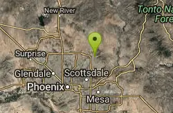
Phoenix Mcdowell / Wingate Pass / Bell Pass
Scottsdale, Arizona
6.4 miles NWThe trailhead has water, bathrooms, etc. The trail starts off shared with other short walking trails and such, then quickly becomes a steep and rocky ascent, with some nice flowing...
Mountain Bike
Gateway Loop
Scottsdale, Arizona
6.4 miles NWThe trailhead has water, bathrooms, etc. The trail starts off shared with other short walking trails and such, then quickly becomes a steep and rocky ascent. The climb is challenging...
Mountain Bike
Indian Bend Bike Trail
Scottsdale, Arizona
6.6 miles WIndian Bend Wash Greenbelt is a urban, concrete paved path, primarily used for biking and walking/jogging, in Scottsdale, Arizona. This point A to point B, 11 mile long trail takes you past parks,...
Hike, Mountain Bike
Tom's Thumb, Feldspar, and Marcus Landslide Loop
Scottsdale, Arizona
7.1 miles NHike near Scottsdale, Arizona
Hike
Tom's Thumb Trail
Scottsdale, Arizona
7.1 miles NTom's Thumb Trail is a popular trail on the McDowell Sonoran Preserve due to its unique thumb-like granite rock formation. This is a 4.7 out-and-back, intermediate trail because of its 1,200...
Hike, Mountain Bike, Rock Climb
Tortoise and Hilltop Trails
Fort McDowell, Arizona
7.1 miles NBe on the lookout for wildlife like jackrabbits and lizards on the initial stretch of trail (Tortoise Trail) and for mountain bikers as this trail joins the Pemberton Trail for a bit as...
Hike 2.2 mi

Marcus Landslide Trail
Scottsdale, Arizona
7.1 miles NThe Marcus Landslide Trail is named after ASU professor Melvin Marcus, a renouned geographer, after the discovery and recognition of the interesting geographical area in 2002. More than 500,000...
Hike, Horseback, Mountain Bike, Rock Climb
Pemberton Loop
Fort McDowell, Arizona
7.1 miles NEThere are many places to start this loop from really as it crosses other trails and the main road twice. The 15 mile loop can be cut in half or about more by either the Tonto Tank tr or...
Mountain Bike
Wagner-Granite-Bluff Trails
Scottsdale, Arizona
7.1 miles NHike and Mountain Bike near Scottsdale, Arizona
Hike, Mountain Bike
Wagner Trail
Scottsdale, Arizona
7.1 miles NWagner Trail is a 2.2 mile, beginner to intermediate loop trail located in the McDowell Sonoran Preserve. The trail is well-marked and easy to follow; this wide, but rugged...
Hike, Horseback, Mountain Bike 2.1 mi
Lower Salt River Nature Trail
Fort McDowell, Arizona
7.1 miles SEThe Lower Salt River Nature Trail is a scenic walk to take at the Tonto National Forest. This trail provides stunning views as you walk alongside the Salt River. This rustic trail is older and less...
Camp, Hike
McDowell Mountain Park
Fort McDowell, Arizona
7.1 miles NEThis trail is great. It is not as rocky as other Phoenix area trails( ie: Trail 100, National, Estrella Mtn Park). Twisty singletrack on rolling contour. The surface consists of small...
Mountain Bike 1.5 mi
The Saddle
Mesa, Arizona
7.9 miles SESaddle trail is an intermediate mountain biking trail that connects to the greater Hawes trail network. The trail is 1.5-2mi long and it offers beautiful views of the neighboring Salt River and Red...
Hike, Mountain Bike 1.3 mi
Ridge Trail
Mesa, Arizona
7.9 miles SEThe trails within the Hawes loop system were originally built by mountain bikers for mountain bikers, so the trails feature fantastic singletrack that twist and turn for miles. Be warned,...
Mountain Bike 7.5 mi
Hawe's Loop
Mesa, Arizona
7.9 miles SEMost of the trails in the Phoenix metropolitan area were originally built by mountain bikers, and the Hawe's loop trail system and trail are no exeptions. This trail features fantastic...
Hike, Mountain Bike
Vista Del Camino Park - 2009 Memorial Layout
Scottsdale, Arizona
9.0 miles SWAlso known as Shelly Sharpe Memorial DGC. Plays long. Basically level with some hills. Lots of trees. Three small lakes come into play on 7 holes. Hotels nearby. Public (No Fee)
Disc Golf
Desert Trails Bike Park
Mesa, Arizona
9.6 miles SEHike and Mountain Bike near Mesa, Arizona
Hike, Mountain Bike
Pinnacle Peak Trail
Scottsdale, Arizona
10.5 miles NWPinnacle Peak is a 3.5 mile out-and-back, moderate hiking trail, that includes rock climbing routes (for experienced climbers), within the Sonoran Desert. This trail, and park, in...
Hike, Horseback, Rock Climb


