


233 Things to do near Tom's Thumb, Feldspar, and Marcus Landslide Loop
first prev 3 4 5 6 7 8 9 10 11 12 next lastShowing results within 50 miles Distance miles of 12941 E Paraiso Dr, Scottsdale, AZ 85255, USA City, Zip, or Address
South Mountain National Trail
Phoenix, Arizona
25.3 miles SWThe National Trail crosses South Mountain Park from the east to the west ends and intersects with most of the other trails in the park. A very scenic hike with moderate ups and downs...
Hike, Mountain Bike 2.1 mi
Marcos de Niza & Pima
Phoenix, Arizona
25.3 miles SWIf you're looking to: get off the tourist highway trail, enjoy killer South Mountain views, take a rollercoaster for a hike with an easy stroll or jog back to the start - this is a loop you...
Hike
Sunrise Mountain Trail
Peoria, Arizona
25.8 miles WThe Sunrise Mountain Trail can be found within the suburban area of Peoria, Arizona; it is made of up 3 sequential loops; each loop harder than the last. The trail is easy to find, as...
Hike, Mountain Bike
West Wing Mountain Advanced Trail
Peoria, Arizona
25.9 miles WHike near Peoria, Arizona
Hike
Peoria Skatepark
Peoria, Arizona
26.0 miles Wwide open tons of room, good for street, two clover bowls look fun but no vert if you want vert go to Goodyear park.
Skateboard
Tempe Skatepark
Tempe, Arizona
26.1 miles SPark has a really fun bowl section, also a couple nice kinked rails and some stairs, weird lines but really fun.
Skateboard 2.3 mi
Hidden Valley Trail Via Mormon Trail
Phoenix, Arizona
26.2 miles SWHidden Valley Trail via Mormon Trail is a 2-4 mile hike, depending on the route you choose to take and how much additional exploring you do. This hike offers a natural rock tunnel, petroglyphs,...
Hike, Mountain Bike
Slate Creek Divide Loop
Phoenix, Arizona
26.7 miles NEVarious routes available - Alternative #1 (From above): 13 Mi. (22 km) Alternative #2 (From above): 10 Mi. (16 km) Loop top half only (Inc. dirt. to 8 from SR 87): 12 Mi. (19 km) Figure eight: 16 Mi....
Mountain Bike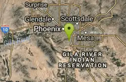
Old Man Trail
Phoenix, Arizona
27.5 miles SWRanger Office Phone: (602) 262-7393 Hours for all trailhead areas and entrances: 5 a.m. to 7 p.m. (entrance gates close). Trails remain open until 11 p.m.
Hike
X-Court BMX Park
Glendale, Arizona
27.6 miles SWA no-fee, 26,000-square-foot, concrete multi-use (bikes, boards, blades) facility. Site Design Group, a leader in skate park design, created a facility that will provide challenges for skaters and...
Skateboard
Desert West Skateboard Plaza
Phoenix, Arizona
27.6 miles SW25,000 sq.feet: concrete bowl, street course, ramps, pads and helmets required, free. Open every day 7am to 10pm. one of the first parks built in phoenix, fun for beginners, boring if you really...
Skateboard 2.5 mi
Hidden Valley from Buena Vista Trail
Phoenix, Arizona
28.0 miles SWFor an easily accessible trail, butting right up against Phoenix’s southern border, it is truly surprising how special, quiet and natural the hike through Hidden Valley is! The path...
Hike, Mountain Bike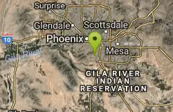
Corona Loop
Phoenix, Arizona
28.1 miles SWThis is a good hike, take plenty of water and a map or gps would be a very good ideal. I went up the day after we got over a inch of rain so lot of places were washed out. i looked like...
Hike

Holbert-Hidden Valley-Mormon Trail Shuttle
Phoenix, Arizona
28.3 miles SWHolbert- Hidden Valley- Mormon Trail is a combination trail hike on the north side of South Mountain near Phoenix, Arizona. This trail is approximately 6.5 miles long, and is suitable for...
Hike, Mountain Bike 0.2-5.0 mi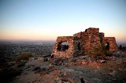
Holbert Trail to Dobbins Lookout
Phoenix, Arizona
28.3 miles SWStart out at the main entrance to South Mountain and make a left past the vistor's center. Go to the end of the road to the beginning of Holbert Trail. Get to the top and make a right to Dobbins...
Hike
Max Delta
Phoenix, Arizona
28.3 miles SWThis trails follows close to San Juan Rd. Part of the trail is rocky while other parts are well just dirt. Max Delta Trail is a 2.7 mile trail within Phoenix, Arizona on the South Mountain...
Hike 5.4 mi
Denton Trail #69
Tonto Basin, Arizona
28.4 miles EFrom FR 421, the trail climbs steadily up the east face of the mountain. Some sections are quite steep. The trail eventually tops out at 5,760 feet elevation and then descends to Big Pine Flat for...
Hike, Mountain Bike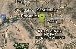
Corona de Loma Trail
Phoenix, Arizona
28.5 miles SWquick climb to the top of Buena Vista lookout. Great view of the east vally
Hike
Sycamore Trail #68
Tonto Basin, Arizona
28.5 miles EFrom FR 421, the trail climbs steadily through lower Sonoran Desert and riparian vegetation up the arroyo formed by Sycamore Creek. It turns northward and continues to climb along a...
Mountain Bike
Park Trail #66
Tonto Basin, Arizona
29.0 miles NEFrom the Park Creek Trailhead, the trail crosses Park Creek and climbs gradually through lower Sonoran Desert and riparian vegetation for ½ mile. The trail then ascends steeply...
Mountain Bike


