


Old Man Trail
Phoenix, Arizona

| Address: | ~11827 S Montezuma Ct, Phoenix, AZ 85044, USA |
| GPS: |
33°20'18.6"N 112°0'47.7"W Maps | Directions |
| State: | Arizona |
| Trail Length: | 4.90 miles |
| Elevation Gain: | 1299.00 feet |
| Hike Difficulty: | Intermediate |
| Trail Type: | Out & Back |
Pet Friendly
Hike
The Old Man Trail is a short but steep and rocky route in South Mountain Park and Preserve, the vast Phoenix mountain park on the city's south side, best known as one of the park's more technical connector trails. Climbing and dropping across the rugged desert flanks of the range, it links the lower trails with the higher country around the Mormon and National trails, and it is especially popular with mountain bikers, who prize it as a genuinely challenging, boulder-strewn descent, as well as with hikers after a stout workout.
The trail packs a lot of rugged desert into a short distance: loose rock, ledges and steep pitches amid saguaro, cholla and volcanic outcrops, with fine views out over the Phoenix valley. Because it connects into South Mountain's huge trail network, it is usually done as part of a longer loop rather than on its own, paired with the Mormon Trail, National Trail and others.
This is exposed low desert with no shade and no water, and South Mountain's summer heat is dangerous, so the cooler months and early starts are the way to go, and riders and hikers alike should carry plenty of water. Rugged, steep and rewarding, the Old Man Trail is a favorite of those who like their South Mountain outings with a technical edge.
More Information
Mountain biking - Wikipedia
Mountain biking (abbr. MTB) is a sport of riding bicycles off-road, often over rough terrain, usually using specially designed mountain bikes. Mountain bikes share similarities with other bikes but incorporate features designed to enhance durability and performance in rough terrain, such as air or coil-sprung shocks used as suspension, larger and wider wheels and tires, stronger frame materials, and mechanically or hydraulically actuated disc brakes. Mountain biking can generally be broken down into distinct categories: cross country, trail, all mountain, enduro, downhill and freeride.[1]
https://en.wikipedia.org/wiki/Mountain_bikingSonoran Desert - Wikipedia
Saguaro National Park in Arizona
https://en.wikipedia.org/wiki/Sonoran_DesertSouth Mountain Park - Wikipedia
South Mountain Park in Phoenix, Arizona, is the largest municipal park in the United States,[1] and one of the largest urban parks in North America and in the world. It has been designated as a Phoenix Point of Pride.[2]
https://en.wikipedia.org/wiki/South_Mountain_ParkSouth Mountains (Arizona) - Wikipedia
The South Mountains (O'odham: Muhaḍagĭ Doʼag, Yavapai: Wi:ki'tiyeda,[1][failed verification] Maricopa: Vii Kwxas), known locally as simply South Mountain, is a mountain range in central Arizona in south Phoenix, Arizona. The majority of the range is public land managed by the City of Phoenix as South Mountain Park, but a small portion extends into the Gila River Indian Community.
https://en.wikipedia.org/wiki/South_Mountains_(Arizona)Be courteous, informed, and prepared. Read trailhead guidelines, stay on the trail, and don't feed the wildlife.
Read More
- Plan Ahead and Prepare
- Travel & camp on durable surfaces
- Dispose of waste properly
- Leave what you find
- Minimize campfire impacts
- Respect wildlife
- Be considerate of other visitors
Directions
From Phoenix, Arizona
- Head west on W Washington St toward 1st Ave (315 ft)
- Turn left onto S 1st Ave (397 ft)
- Turn left onto W Jefferson St (1.6 mi)
- Keep right to continue on E Jefferson St (0.5 mi)
- Turn right onto the ramp to Tucson (0.3 mi)
- Merge onto I-10 E (6.3 mi)
- Keep left at the fork to stay on I-10 E (2.9 mi)
- Take exit 157 for Elliot Rd (0.4 mi)
- Turn right onto E Elliot Rd (0.8 mi)
- Continue onto E Warner Elliot Loop (0.9 mi)
- Turn right onto E Equestrian Trail (1.1 mi)
- Turn left onto S Montezuma CtDestination will be on the right(0.2 mi)


Other Hiking Trails Nearby
Corona Loop
Phoenix, Arizona
0.7 miles SA Phoenix desert hike with nice trails that are mostly unmarked — bring a map or GPS, plenty of water, and expect a washed-out path after heavy rain.
Hike 
Corona de Loma Trail
Phoenix, Arizona
1.1 miles SA quick trail climb to Buena Vista Lookout in Phoenix with great views of the east valley — a short, rewarding hike on the Corona de Loma Trail.
Hike 2.5 mi
Hidden Valley from Buena Vista Trail
Phoenix, Arizona
1.8 miles WSurprisingly quiet and natural for a trail right on Phoenix's southern border, Hidden Valley winds through granite boulders, saguaro cacti, and sandy washes with lizards and the occasional chuckwalla.
Hike, Mountain Bike 2.3 mi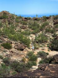
Hidden Valley Trail Via Mormon Trail
Phoenix, Arizona
2.2 miles NWA 2–4 mile hike through Phoenix's South Mountain featuring Fatman's Pass, a natural rock tunnel, petroglyphs, dry waterfalls, and sweeping desert views.
Hike, Mountain Bike 2.1 mi
Marcos de Niza & Pima
Phoenix, Arizona
2.3 miles NEA hidden gem in South Mountain Park — attack the ridgeline on the Marcos de Niza trail, connect to the National Trail fire road, and jog home for a killer loop.
Hike 
South Mountain Trails (Desert Classic Trail)
Phoenix, Arizona
2.3 miles NEHike and Mountain Bike near Phoenix, Arizona
Hike, Mountain Bike 
South Mountain National Trail
Phoenix, Arizona
2.3 miles NEA scenic traverse of South Mountain Park from east to west, passing Hidden Valley, petroglyphs, abandoned mines, and multiple lookouts — with spectacular Phoenix valley views throughout.
Hike, Mountain Bike 
National to Hidden Valley to Mormon Loop
Phoenix, Arizona
2.3 miles NEHike near Phoenix, Arizona
Hike 
Pima Wash Trail to West Loop
Phoenix, Arizona
2.3 miles NEHike near Phoenix, Arizona
Hike 1.5 mi
Desert Classic
Phoenix, Arizona
2.3 miles NEA classic 9-mile out-and-back (or 9-mile shuttle) on hardpacked sand, sandy washes, and small chunky rocks through South Mountain Park — the most accessible ride in the park.
Hike, Mountain Bike 
Desert Classic - Goat Trail
Phoenix, Arizona
2.3 miles NEHike and Mountain Bike near Phoenix, Arizona
Hike, Mountain Bike 1.8 mi
Javelina-Beverly Canyon Loop Trail
Phoenix, Arizona
2.9 miles NEA scenic, less-crowded mountain bike trail through beautiful hills and valleys that feels surprisingly remote, with fun singletrack options connecting to Bevery Canyon.
Hike, Horseback, Mountain Bike 1.9 mi
Javelina Trail
Phoenix, Arizona
2.9 miles NEA fast and fun descent on Javelina Trail at South Mountain — a great warm-up climb and crowd-free alternative to the busier Pima Canyon trail.
Hike, Horseback, Mountain Bike 3.1 mi
Goat Hill via Telegraph Pass Trail
Phoenix, Arizona
3.4 miles SWGoat Hill via the Telegraph Pass Trail is a rocky South Mountain Park climb to a sweeping 360-degree view over Phoenix.
Hike 
Holbert-Hidden Valley-Mormon Trail Shuttle
Phoenix, Arizona
3.4 miles WA 6.5-mile intermediate shuttle hike on South Mountain from ancient petroglyphs and a Hidden Valley rock playground to panoramic canyon and city views at Promontory Point.
Hike, Mountain Bike 
Telegraph Pass Trail
Phoenix, Arizona
3.4 miles SWA 2.3-mile beginner-friendly trail in South Mountain Park with petroglyphs, saguaro views of metropolitan Phoenix, and a paved first section that's wheelchair accessible.
Hike 2.5 mi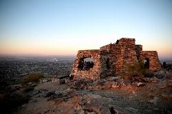
Holbert Trail to Dobbins Lookout
Phoenix, Arizona
3.4 miles WSouth Mountain's Holbert Trail climbs challenging switchbacks to Dobbins Lookout, delivering sweeping city and TV-tower views from the rooftop of Phoenix's urban mountain park.
Hike 0.8-1.1 mi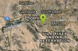
Kiwanis Trail to Telegraph Pass Lookout
Phoenix, Arizona
3.6 miles WA short, beginner-friendly hike in South Mountain near Phoenix winding through a small canyon to Telegraph Pass — best enjoyed at sunrise or just before sunset for near-constant shade.
Hike, Mountain Bike 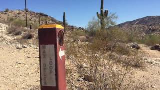
Max Delta
Phoenix, Arizona
3.7 miles WA 2.7-mile beginner trail near South Mountain Preserve with mine foundations, a standing brick fireplace, and Phoenix Valley views — remnants of a gold mine active in the early 1900s.
Hike 1.2 mi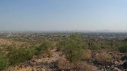
Ma-Ha-Tauk Trail
Phoenix, Arizona
5.1 miles WA mostly easy 2.5-mile out-and-back trail in South Mountain Park connecting to many other trails, with views of downtown Phoenix and the Estrella Mountains — dogs welcome on leash.
Hike, HorsebackNearby Campsites

Buckhorn Campground Nature Trail
Apache Junction, Arizona
24.5 miles ECamp and Hike near Apache Junction, Arizona
Camp, Hike 2.1 mi
Lower Salt River Nature Trail
Fort McDowell, Arizona
24.8 miles NEA 2-mile beginner loop alongside the Salt River in Tonto National Forest, with worn markers that keep things adventurous — watch for wild horses and spring cactus blooms.
Camp, Hike


