


Hidden Valley Trail Via Mormon Trail
Phoenix, Arizona

| Address: | ~Mormon Trail, Phoenix, AZ 85042, USA |
| GPS: |
33°21'59.1"N 112°1'51.8"W Maps | Directions |
| State: | Arizona |
| Trail Length: | 3.60 miles |
| Trail Type: | Loop |
| Hike Difficulty: | Intermediate |
| Elevation Gain: | 895 feet |
| Trails/Routes: | 2.3 mi |
Picnic Tables Trails Rocks Pet Friendly
Hike and Mountain Bike
Hidden Valley Trail via Mormon Trail is a 2-4 mile hike, depending on the route you choose to take and how much additional exploring you do. This hike offers a natural rock tunnel, petroglyphs, dry waterfalls, Fatman's Pass, and views of South Mountain. This hike can be done year round, but is best enjoyed in the Fall and Winter months to avoid to hot, Arizona sun.
The trail is primarily flat, most of your elevation gain happens in the first mile of the hike, after that it levels out. At about 1.1 miles you'll come to the intersection with the Mormon Loop trail, which is marked and heads off to your left. Don't take that left! Just keep going straight for another few minutes where the Mormon Trail dead-ends into the National Trail. Once you get to this point, you have the options to complete the loop either clockwise or counter-clockwise. (Some suggest that going counter-clockwise is easier to navigate to Hidden Valley Trail.)
Going counter-clockwise, one of the first thing's you will encounter is Fatman's Pass; which is a rock formation that is a narrow crack in a boulder approximately 8 feet high and 15 feet long that you will have to "squeeze through". Fatman's Pass tends to go over well with younger hikers as it gives them a fun area to explore.
After you go through Fatman's Pass, you'll be led to Hidden Valley Trail.
The Valley is about 0.5 mile long and there are numerous trails going through it. You can't really get lost, so just continue down the valley and feel free to follow whichever path suits your fancy. There are lots of little caves/nooks and tunnels to explore in the valley so feel free to take your time exploring. The exit from Hidden Valley is as spectacular as the Fatman's Pass entrance. It consists of a 40 foot natural tunnel through the rock formations, and is also a fun place to spend time exploring.
After exiting the tunnel, continue 50 yards or so to the signed connection to the National Trail. Turn left (West) and follow the National Trail for 0.1 mile to the junction with the Mormon Trail, which you then follow back down to the trailhead. If you didn't enjoy the views while you were huffing and puffing up hill, make sure you enjoy them on the more leisurely descent! Courtesy of hikearizona.com
More Information
Add ResourceNever modify trail features. Ride trails when they're dry enough that you won't leave ruts. Speak up when you see others on the trail and always yield to hikers, horses, and others coming uphill. Always ride on the established trail.
Read MoreBe courteous, informed, and prepared. Read trailhead guidelines, stay on the trail, and don't feed the wildlife.
Read More- Plan Ahead and Prepare
- Travel & camp on durable surfaces
- Dispose of waste properly
- Leave what you find
- Minimize campfire impacts
- Respect wildlife
- Be considerate of other visitors
Directions
From Phoenix, Arizona
- Head west on W Washington St toward 1st Ave (315 ft)
- Turn left onto S 1st Ave (0.6 mi)
- S 1st Ave turns slightly right and becomes S Central Ave (0.9 mi)
- Turn left onto E Watkins St (0.5 mi)
- Turn right onto S 7th St (3.3 mi)
- Turn left onto E Baseline Rd (2.0 mi)
- Turn right onto S 24th St (0.8 mi)
- Continue onto E Valley View Dr (246 ft)
- Turn right (56 ft)
Finding the trailhead is a breeze--just turn south on 24th Street from Baseline and the road essentially dead ends at the trailhead parking lot. The lot can accommodate about 30 cars, but there is "overflow" parking in the surrounding neighborhood (please obey and posted resrictions, however). There is a shaded picnic table at the trailhead, but no bathroom facilities.Courtesy of hikearizona.com


Trails
Distance ?
2.3 milesElevation Gain ?
694 feetReal Ascent ?
933 feetReal Descent ?
239 feetAvg Grade (3°)
6%Grade (-9° to 17°)
-17% to 30%Elevation differences are scaled for emphasis. While the numbers are accurate, the cut-away shown here is not to scale.
Other Mountain Bike Trails and Hiking Trails Nearby

Hidden Valley from Buena Vista Trail
Phoenix, Arizona
1.8 miles SWFor an easily accessible trail, butting right up against Phoenix’s southern border, it is truly surprising how special, quiet and natural the hike through Hidden Valley is! The path...
Hike, Mountain Bike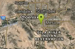
Old Man Trail
Phoenix, Arizona
2.2 miles SERanger Office Phone: (602) 262-7393 Hours for all trailhead areas and entrances: 5 a.m. to 7 p.m. (entrance gates close). Trails remain open until 11 p.m.
Hike
Holbert-Hidden Valley-Mormon Trail Shuttle
Phoenix, Arizona
2.5 miles SWHolbert- Hidden Valley- Mormon Trail is a combination trail hike on the north side of South Mountain near Phoenix, Arizona. This trail is approximately 6.5 miles long, and is suitable for...
Hike, Mountain Bike 0.2-5.0 mi
Holbert Trail to Dobbins Lookout
Phoenix, Arizona
2.5 miles SWStart out at the main entrance to South Mountain and make a left past the vistor's center. Go to the end of the road to the beginning of Holbert Trail. Get to the top and make a right to Dobbins...
Hike 2.1 mi
Marcos de Niza & Pima
Phoenix, Arizona
2.6 miles EIf you're looking to: get off the tourist highway trail, enjoy killer South Mountain views, take a rollercoaster for a hike with an easy stroll or jog back to the start - this is a loop you...
Hike
South Mountain Trails (Desert Classic Trail)
Phoenix, Arizona
2.6 miles EHike and Mountain Bike near Phoenix, Arizona
Hike, Mountain Bike
Pima Wash Trail to West Loop
Phoenix, Arizona
2.6 miles EHike near Phoenix, Arizona
Hike
National to Hidden Valley to Mormon Loop
Phoenix, Arizona
2.6 miles EHike near Phoenix, Arizona
Hike 1.5 mi
Desert Classic
Phoenix, Arizona
2.6 miles EThe Desert Classic trail is just that, a classic at the South Mountain Park area. Because it is such a classic, the trail is well marked and well worn by high traffic flow of riders and hikers....
Hike, Mountain Bike
South Mountain National Trail
Phoenix, Arizona
2.6 miles EThe National Trail crosses South Mountain Park from the east to the west ends and intersects with most of the other trails in the park. A very scenic hike with moderate ups and downs...
Hike, Mountain Bike
Desert Classic - Goat Trail
Phoenix, Arizona
2.6 miles EHike and Mountain Bike near Phoenix, Arizona
Hike, Mountain Bike 1.8 mi
Javelina-Beverly Canyon Loop Trail
Phoenix, Arizona
2.7 miles EJavelina Canyon Trail does have some beautiful hills and valleys to wander through and it feels down right remote at times. I’ve found Javelina to have less traffic that Beverly as...
Hike, Horseback, Mountain Bike 1.9 mi
Javelina Trail
Phoenix, Arizona
2.7 miles EComing down Javelina is fast and fun no doubt. It sure beats the crowded Pima Canyon trail back to the Pima lot if you parked there. Javelina is just one more sweet trail on South Mountain. Not a...
Hike, Horseback, Mountain Bike
Max Delta
Phoenix, Arizona
2.7 miles WThis trails follows close to San Juan Rd. Part of the trail is rocky while other parts are well just dirt. Max Delta Trail is a 2.7 mile trail within Phoenix, Arizona on the South Mountain...
Hike
Corona Loop
Phoenix, Arizona
2.8 miles SThis is a good hike, take plenty of water and a map or gps would be a very good ideal. I went up the day after we got over a inch of rain so lot of places were washed out. i looked like...
Hike
Corona de Loma Trail
Phoenix, Arizona
3.1 miles Squick climb to the top of Buena Vista lookout. Great view of the east vally
Hike 0.8-1.0 mi
Kiwanis Trail to Telegraph Pass Lookout
Phoenix, Arizona
3.2 miles SWAn ideal hike to take children on as the distance is short and the elevation gain is not extreme. Avid hikers have opportunities to embark on longer hikes into South Mountain. ... This short hike is...
Hike, Mountain Bike 6.1 mi
Goat Hill via Telegraph Pass Trail
Phoenix, Arizona
3.9 miles SWThe views from the top of Goat Hill are awesome on a clear day as you can enjoy a 360 view. Telegraph Trail is kind of a sidewalk part of the after that a little bit rocky until you reach the summit...
Hike
Telegraph Pass Trail
Phoenix, Arizona
3.9 miles SWTelegraph Pass Trail is a 2.3 mile beginner friendly, out-and-back trail in South Mountain Park in Phoenix. The first third or so of Telegraph Trail is paved, making it wheelchair...
Hike 1.2 mi
Ma-Ha-Tauk Trail
Phoenix, Arizona
4.1 miles WMa-Ha-Tauk Trail can be found in South Mountain Park in Phoenix. This is a 2.5 mile, out-and-back trail. Aside from a short section of steeper incline in the first part of the hike, this is an...
Hike, HorsebackNearby Campsites

Lower Salt River Nature Trail
Fort McDowell, Arizona
24.6 miles NEThe Lower Salt River Nature Trail is a scenic walk to take at the Tonto National Forest. This trail provides stunning views as you walk alongside the Salt River. This rustic trail is older and less...
Camp, Hike
Buckhorn Campground Nature Trail
Apache Junction, Arizona
24.8 miles ECamp and Hike near Apache Junction, Arizona
Camp, Hike


