


234 Things to do near Wagner Trail
first prev 1 2 3 4 5 6 7 8 9 10 next lastShowing results within 50 miles Distance miles of Wagner Trail, Scottsdale, AZ 85262, USA City, Zip, or Address
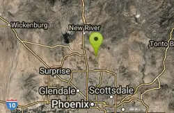
Apache Wash Trail
Phoenix, Arizona
18.9 miles WStart west on Ocitillo to Ridgeback north till you get to the crossing of Sidewinder then head west. Keep on Sidewinder toil you come to the crossing of Octillio and head east back to...
Hike
Clay Mine Trail
Cave Creek, Arizona
18.9 miles NWClay Mine Trail is a 1.6 mile out-and-back, beginner friendly trail in Cave Creek Regional Park. This is a trail that is very close to the Visitor Center. It's not too difficult but there...
Hike 1.9 mi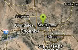
Ruth Hamilton Trail
Phoenix, Arizona
18.9 miles SWHike and Mountain Bike near Phoenix, Arizona
Hike, Mountain Bike
The Wedge Skate park
Scottsdale, Arizona
19.0 miles SWThe Wedge Skatepark is a part of the Scottsdale Park System. The Wedge is located at Eldorado Park - 2311 N. Miller Rd. (roughly Miller & McDowell) The skatepark is open from daylight till...
Skateboard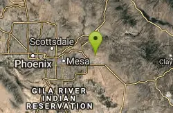
Cat Peaks Via Ruidoso
Apache Junction, Arizona
19.2 miles SEThe Ruidoso trail is a beginner ride with a few tricky dry wash crossings that will challenge you to try and stay on the pedals. This trail ends at the Spillway trail after 1.2 miles....
Mountain Bike
East Maricopa Floodway
Mesa, Arizona
19.2 miles SWith a primary entrance located at the intersection between Main Street and Higley Road, the East Maricopa Floodway provides riding to cyclists and mountain bikers. The surface of the floodway...
Mountain Bike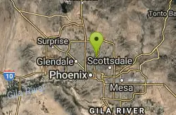
Trail #100
Phoenix, Arizona
19.3 miles SWFrom Dreamy Draw you can head NW on Trail 100 and immeadiately hit a ridge with good views. Ride on for 5 - 6 miles of nice single track and great views, to 7th and return. If you...
Mountain Bike 1.3 mi
Dreamy Draw Loop Trail
Phoenix, Arizona
19.4 miles SWThe Dreamy Draw Nature Trail is a short multi-access loop trail that provides a true Sonoran Desert experience. The trail crosses a number of desert washes and, at times, becomes somewhat rocky....
Hike, Horseback, Mountain Bike
Vista del Camino Park
Scottsdale, Arizona
19.4 miles SWThe Shelly Sharpe Memorial Disc Golf Course at Vista del Camino was installed in 1984 and redesigned in 1997 by PDGA Hall of Fame member Dan Ginnelly. It is a pretty level and open course - water...
Disc Golf 4.8 mi
Trail 1A
Phoenix, Arizona
19.4 miles SWThe trail can be accessed from the Dreamy Draw Park parking lot. From there, the trail can be ridden south towards its origin, or east (the trail makes an "L" shape). It is a mix of double...
Mountain Bike 1.4 mi
Mohave Trail (#200)
Phoenix, Arizona
19.7 miles SWAn invigorating swift hike is what Mohave Trail 200 provides for anyone looking for a free and quick escape. Though the main attraction of the Phoenix Mountain’s Preserve is the larger Piestewa...
Hike, Horseback 1.7 mi
Quartz Ridge Trail
Phoenix, Arizona
19.7 miles SWThis is a very popular trail on weekend mornings. Casual hikers can get great views of Phoenix with moderate effort. Good place to bring out of town visitors The Quartz Ridge Trail is a short,...
Hike, Mountain Bike 2.2 mi
Piestewa Peak Summit Trail #300
Phoenix, Arizona
19.9 miles SWSome people still refer to the Peak by its original name of "Squaw Peak" before its name changed to "Piestewa Peak" in honor of Lori Piestewa who died serving her country in the...
Hike 3.8 mi
Freedom Loop Trail (#302)
Phoenix, Arizona
19.9 miles SWFreedom Trail (#302), also known as Piestewa Circumference, is a 3.8 mile, moderate loop trail. You can access this trail from all the inner trailheads. The easiest and least...
Hike
Reed Skatepark
Mesa, Arizona
20.3 miles SThis nineteen acre outdoor concrete skatepark is fairly big. It features an intermediate level street course, a combi pool, hips, and a large beginners area. For more information call Mesa Reed...
Skateboard
Shaw Butte and Charles M Christiansen Loop Trail
Phoenix, Arizona
20.4 miles WWhen you say "North Mountain," I think most Arizonans know where it is or can find it. When you say "Shaw Butte," it seems like you get a lot more questioning glances and "huh?". Shaw...
Hike, Mountain Bike
North Mountain National Trail
Phoenix, Arizona
20.6 miles WNorth Mountain National Trail is a 2.3 mile moderate, loop trail near Phoenix. It's easy to travel on if you go up the paved sections. The inclines are steep in parts, making it a real...
Hike
Prospector Loop
Apache Junction, Arizona
20.6 miles SEA fast beginners to intermediate (only if youre into speed) training loop. The trail has no markings but is the only trail in the area as it is undeveloped gravel desert. The trail is...
Mountain Bike
Arizona Canal Trail
Phoenix, Arizona
20.7 miles SWMulti-purpose canal trails set apart from normal city traffic and noise. The Arizona Canal is one of the many canals used to supply the valley with its water needs (irrigation). These canals were...
Hike, Horseback
Crosscut Canal Trail
Tempe, Arizona
20.7 miles SWCrosscut Canal Trail is a concrete, sidewalk multi-use trail for walking, biking, wheelchairs, scooters, and skateboards. This two mile long path follows a canal and links Tempe Town Lake to...
Hike


