


183 Things to do near Tonto Basin, Arizona
first prev 1 2 3 4 5 6 7 8 9 10 next lastShowing results within 50 miles Distance miles of Tonto Basin, AZ 85553, USA City, Zip, or Address
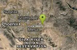
Red Mountain - North
Mesa, Arizona
35.4 miles SWThe North course is the more challenging of the two courses on site. It begins in the desert and works it way back into the park. Bring lots of water and be prepared for desert plant life, as well as...
Disc Golf
Mcdowell Ranch Skatepark
Scottsdale, Arizona
35.5 miles SWAz skateparks,Arizona skateparks, Arizona skatepark
Skateboard 1.1 mi
Christopher Creek Campground
Payson, Arizona
35.5 miles NEChristopher Creek is a popular campground situated just east of Payson, nestled between the Christopher Creek river, and the town of the same name. This site is used for both overnight and day-use...
Camp, Canyoneer, Cross-country Ski, Hike, Swim 5.7 mi
Taliesin/Quartz Loop
Scottsdale, Arizona
35.6 miles SWA quick loop that has a couple difficult climbs depending on which way you take it. Leads to a cool viewpoint and has a ton of flowing singletrack. A fun rocky trail through neighborhoods in...
Mountain Bike
Upper Tonto Creek Campground
Payson, Arizona
35.7 miles NUpper Tonto Creek Campground is a beautiful place to camp at the intersection of Tonto and Horton Creeks. In addition to camping, this is a popular destination to both fish and hike. The campground...
Camp, Hike 1.1-3.5 mi
Horton Springs
Payson, Arizona
36.0 miles NHorton Springs is a spring on the Mogollon Rim that leads into Horton Creek. There are campsites near the springs, and several hiking trails in the area that lead to the spring itself. Between the...
Backpack, Camp, Hike 4.6 mi
Gordon Creek Falls
Payson, Arizona
36.5 miles NEGordon Creek Falls is a relatively unknown little oasis in the middle of the Arizona desert--specifically, outside of the city of Payson. The falls come from Gordon Creek, which winds its way through...
Hike, Swim 21.4 mi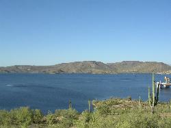
Spur Cross to Lake Pleasant
Cave Creek, Arizona
36.7 miles WStart at the Flat Tire Bike Shop and head north on Spur Cross Road. You will arrive at the Spur Cross Conservation Ranch in 3.2mi. From there enter the Maricopa Trail system and follow the signs...
Mountain Bike
Cave Creek Park
Cave Creek, Arizona
36.7 miles WMultiple singletrack loops, just explore and find what works best for you. Watch out for hikers and horses.
Mountain Bike 0.8 mi
Promontory Butte
Payson, Arizona
37.4 miles NThis destination is on the edge of Promontory Butte, providing spectacularly scenic views as part of the Mogollon Rim. There are several old forest roads on the mountain that can serve as trails to...
Hike 3.3 mi
See Canyon Trail
Payson, Arizona
37.6 miles NESee Canyon Trail #184 takes the hiker on a journey through the wooded Arizona wilderness surrounding Christopher Creek, and leading up the Mogollon Rim. This trail has trailhead markers at the...
Hike
Indian Bend Bike Trail
Scottsdale, Arizona
37.7 miles SWIndian Bend Wash Greenbelt is a urban, concrete paved path, primarily used for biking and walking/jogging, in Scottsdale, Arizona. This point A to point B, 11 mile long trail takes you past parks,...
Hike, Mountain Bike
East Maricopa Floodway
Mesa, Arizona
38.2 miles SWWith a primary entrance located at the intersection between Main Street and Higley Road, the East Maricopa Floodway provides riding to cyclists and mountain bikers. The surface of the floodway...
Mountain Bike
Aspen Campground
Payson, Arizona
39.0 miles NEAspen Campground is a large campground near Payson, Arizona. Between the proximity to Woods Canyon Lake and the seclusion of the encompassing Apache-Sitgreaves National Forest, this is a...
Camp 3.3 mi
Meadow Trail #505
Payson, Arizona
39.4 miles NEMeadow Trail #505 is a paved path that leads from the edge of Woods Canyon Lake to the scenic edge of the Woods Canyon vista. This hike is smooth enough to allow for easy access by wheelchairs,...
Hike 4.0 mi
Woods Canyon Lake
Payson, Arizona
39.5 miles NEWoods Canyon Lake is a fishing lake near Payson, Arizona located near the Mogollon Rim. The lake has a hike that loops around it, and several other hikes nearby to look at the particularly scenic...
Camp, Hike, Swim 5.8 mi
Go John Trail
Cave Creek, Arizona
39.7 miles WThe Go John Trail is a 5.8 mile loop trail outside of Cave Creek, Arizona, that is moderately trafficked, used by both hikers and mountain bikers. It is an excellent opportunity to view the desert...
Hike, Horseback, Mountain Bike
Sinkhole Campground
Payson, Arizona
39.7 miles NESinkhole Campground is a camping area near Willow Springs Lake. There are also hikes, mountain biking trails, and fishing opportunities nearby. There are 26 campsites in total at this...
Camp, Hike, Mountain Bike
Bearfoot Trail
Strawberry, Arizona
39.7 miles NHike and Mountain Bike near Strawberry, Arizona
Hike, Mountain Bike
Vista Del Camino Park - 2009 Memorial Layout
Scottsdale, Arizona
40.7 miles SWAlso known as Shelly Sharpe Memorial DGC. Plays long. Basically level with some hills. Lots of trees. Three small lakes come into play on 7 holes. Hotels nearby. Public (No Fee)
Disc Golf


