


49 Things to do near Tuba City, AZ 86045
first prev 1 2 3 next lastShowing results within 50 miles Distance miles of Tuba City, AZ 86045, USA City, Zip, or Address
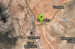
Dinosaur Tracks
Tuba City, Arizona
2.9 miles SWOne of the world's most well-known sets of dinosaur footprints embedded in rock, with hand-painted signs marking the turnoff and guides at the parking lot to point out the best prints.
Hike
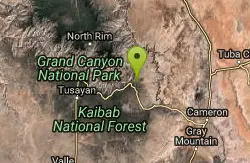
Blue Springs Trail
Grand Canyon Village, Arizona
31.7 miles WBlue Springs Trail in the Grand Canyon area — check AllTrails for current details and conditions before visiting.
Hike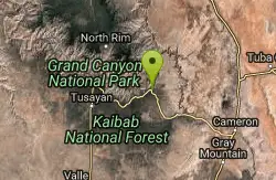
Desert View Visitor Center Trail
Grand Canyon Village, Arizona
33.4 miles WA short trail starting just west of the Desert View Visitor Center along the East Rim — a convenient walk for those arriving from the East Entrance to the Grand Canyon.
Hike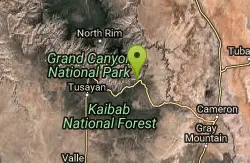
The Escalante Route Trail
Grand Canyon Village, Arizona
34.9 miles WA demanding technical route along the Colorado River from Tanner Beach to Escalante Creek — narrow traverses on steep slopes require careful footing and a calm, unhurried pace.
Backpack, Hike
Tanner Trail
Grand Canyon Village, Arizona
35.0 miles WA rigorous rim-to-river backpacking route recommended only for seasoned hikers — relentlessly steep, rocky, shadeless, and waterless until the Colorado River, with access to one of the canyon's most scenic beach campsites.
Backpack, Camp, Hike
Tusayan Ruin Walk Trail
Grand Canyon Village, Arizona
36.0 miles WA short walk to ancient Tusayan Ruin, reached about 4 miles west of the East Entrance Station along East Rim Drive.
Hike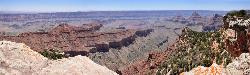
Cape Final
North Rim, Arizona
38.8 miles WA gentle climb through open ponderosa pine forest on the North Rim leads to a dramatic 180-degree canyon panorama at Cape Final — with a designated backcountry campsite right at the rim's edge.
Camp, Hike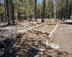
Walhalla Ruins
North Rim, Arizona
39.2 miles WA short walk to authentic 900-year-old ancestral Pueblo ruins on Grand Canyon's North Rim, surrounded by canyon vistas on three sides at the lower-elevation Walhalla Plateau.
Hike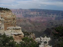
Walhalla Overlook
North Rim, Arizona
39.2 miles WHistory and geology converge at Walhalla Overlook on the Grand Canyon's North Rim, where sweeping views take in the Unkar Delta and the ancient farmland of those who once lived here.
Hike 9.1 mi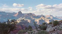
New Hance Trail
Grand Canyon Village, Arizona
39.3 miles WA 9-mile out-and-back through Red Canyon to the Colorado River — one of the most difficult Grand Canyon trails with a 4,500-ft elevation change and very limited water sources.
Backpack, Camp, Hike 0.8 mi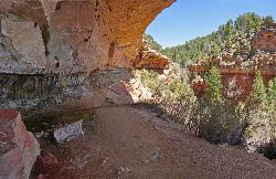
Cliff Springs
North Rim, Arizona
39.5 miles WA hike past a granary ruin, overhanging rocks, and stunning Grand Canyon views to an alcove filled with Anasazi pictograph hand prints — some unfortunately defaced.
Hike 0.5-0.8 mi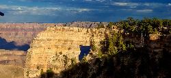
Cape Royal Trail
North Rim, Arizona
39.7 miles WA flat, paved under-a-mile stroll to the tip of the North Rim's Cape Royal peninsula with sweeping canyon views, Angels Window, and the Colorado River framed in a natural arch.
Hike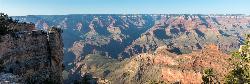
Roosevelt Point Trail
North Rim, Arizona
40.2 miles WA short 0.2-mile flat woodland loop on the Grand Canyon's North Rim delivers big views of Tritle Peak and the surrounding canyon — benches included for unhurried gazing.
Hike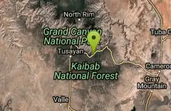
Tonto Trail: New Hance Trail to Grandview Point
Grand Canyon Village, Arizona
40.5 miles WA remote Grand Canyon hike connecting New Hance Trail to Grandview Point along the Tonto Trail — spectacular inner canyon scenery and serious backcountry adventure.
Backpack, Camp, Hike
Arizona Trail
Grand Canyon Village, Arizona
41.8 miles WThis stretch of the Arizona Trail is its most spectacular and most demanding: the Grand Canyon crossing, where the roughly 800-mile state-long trail steps off the South Rim, descends nearly a...
Hike, Horseback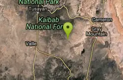
Arizona Trail: South of Grand Canyon NP
Flagstaff, Arizona
42.0 miles SWThe Arizona Trail runs about 24 miles one-way through Kaibab National Forest south of Grand Canyon National Park — a long, scenic backcountry ride near Flagstaff.
Mountain Bike 0.2 mi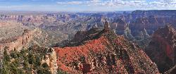
Point Imperial Viewpoint
North Rim, Arizona
42.3 miles WThe highest viewpoint on the North Rim at 8,803 feet, with sweeping eastern views, Mount Hayden's Coconino Sandstone spire, Vermilion Cliffs, and Marble Canyon stretching before you.
Hike
Ken Patrick Trail South from Point Imperial
North Rim, Arizona
42.3 miles WA North Rim hike from the Kaibab Trailhead leading to Point Imperial, with Grand Canyon views along the way.
Hike
Ken Patrick Trail North from Point Imperial
North Rim, Arizona
42.4 miles WA 4-mile out-and-back hike from Point Imperial on the Grand Canyon's North Rim with scenic views suitable for all skill levels.
Hike
Nankoweap Trail
North Rim, Arizona
42.4 miles WThe Nankoweap Trail is a remote, demanding Grand Canyon route on the North Rim — a serious undertaking for experienced backcountry hikers.
Backpack, Camp, Hike


