


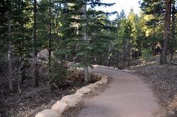
Nankoweap Trail
North Rim, Arizona

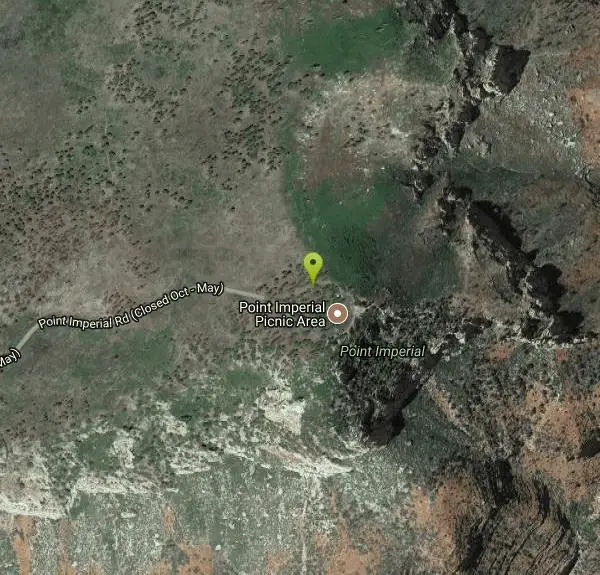
| Address: | ~Point Imperial Rd, North Rim, AZ 86052, USA |
| GPS: |
36°16'45.9"N 111°58'45.0"W Maps | Directions |
| State: | Arizona |
| Trail Length: | 30.00 miles |
| Elevation Gain: | 8362.00 feet |
| Hike Difficulty: | Advanced |
| Trail Type: | Out & Back |
Pet Friendly
Backpack, Camp, and Hike
Courtesy of AllTrails.com
More Information
Be courteous, informed, and prepared. Read trailhead guidelines, stay on the trail, and don't feed the wildlife.
Read More- Plan Ahead and Prepare
- Travel & camp on durable surfaces
- Dispose of waste properly
- Leave what you find
- Minimize campfire impacts
- Respect wildlife
- Be considerate of other visitors
Directions
From North Rim, Arizona
- Head northwest on AZ-67 N toward Bridle PathMay be closed at certain times or days(1.9 mi)
- Turn rightMay be closed at certain times or days(5.4 mi)
- Continue onto Point Imperial RdMay be closed at certain times or days(210 ft)
- Slight left to stay on Point Imperial RdParts of this road may be closed at certain times or days(2.8 mi)
Other Hiking Trails and Backpacking Trails Nearby
Ken Patrick Trail North from Point Imperial
North Rim, Arizona
0.0 miles SEPoint Imperial Trail - Grand Canyon National Park ( North Rim) is a 4 mile out and back trail located near North Rim, Arizona that offers scenic views. The trail is good for all skill...
Hike
Ken Patrick Trail South from Point Imperial
North Rim, Arizona
0.1 miles SEDirections from North Rim Entrance: Drive southward along North Rim Drive to the North Kaibab Trailhead. Turn left into the parking area and locate the trailhead on the eastern side of...
Hike 0.2 mi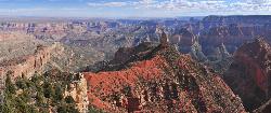
Point Imperial Viewpoint
North Rim, Arizona
0.1 miles EAt 8,803 feet (2,683 meters), Point Imperial is the highest viewpoint in Grand Canyon. With sweeping eastern views, it’s also the best place for sunrise on the North Rim. The prominent spire in...
Hike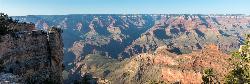
Roosevelt Point Trail
North Rim, Arizona
4.5 miles SRoosevelt Point Trail on Grand Canyon National Park's North Rim is a 0.2 mile short, relatively flat woodland loop trail offering spectacular views. Roosevelt Point Trail on Grand Canyon National...
Hike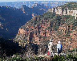
Uncle Jim Trail
North Rim, Arizona
6.0 miles SWDirections from North Rim Entrance: Drive southward along North Rim Drive to the North Kaibab Trailhead. Turn left into the parking area and locate the trailhead on the eastern side of the lot.
Backpack, Camp, Hike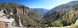
North Kaibab Trail to Supai Tunnel
North Rim, Arizona
6.1 miles SWThis is a half-day out-and-back hike traverses below the rim on the North Rim’s only maintained Inner Canyon trail. The North Kaibab Trail is the North Rim’s only maintained trail, lying...
Backpack, Hike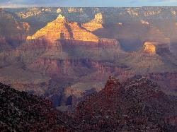
Rim-to-Rim: North Kaibab to Grand Canyon Village
North Rim, Arizona
6.1 miles SWFour days across the Grand Canyon you will never forget! There is a secret to a Grand Canyon rim-to-rim hike: Take four days to do it, even if you can do it in one. I have friends who go South to...
Backpack, Camp, Hike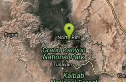
Rim-to-Rim: North to South Kaibab Trail
North Rim, Arizona
6.1 miles SWArizona Office of Tourism, 2702 N. 3rd St., Suite 4015 , Phoenix, AZ, 85004, Phone: 888-520-3434, Fax: 602-240-5432, mfioritt@pni.com
Camp, Hike, Horseback
Phantom Ranch to Ribbon Falls on North Kaibab Trail
North Rim, Arizona
6.1 miles SWCamp, Hike

North Kaibab Trail to Colorado River
North Rim, Arizona
6.1 miles SWThe North Kaibab Trail to Colorado River Trail is perfect for experienced hikers. The trail contains many elevation changes and is very steep. The trail is well maintained and well marked so you can...
Backpack, Camp, Hike 6.3 mi
Tiyo Point Trail
North Rim, Arizona
6.1 miles SWThis former road is becoming increasingly overgrown by the encroaching forest. This being said, it is generally easy to follow with some blown down trees to climb over or around. There are some old...
Backpack, Camp, Hike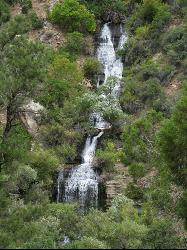
North Kaibab Trail to Roaring Springs
North Rim, Arizona
6.1 miles SWThe North Kaibab to Roaring Springs trail is a well-shaded hike which is downhill on the way out. The trail provides places to stop all along the way. The views are beautiful and perfect for...
Backpack, Hike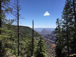
Widforss Trail
North Rim, Arizona
6.1 miles SWWidforss Trail overlooks the Grand Canyon as it leads along the beautiful North Rim. The peaceful forested trail features numerous picture perfect locations from the beginning of the trail on over to...
Backpack, Hike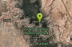
Widforss Trail - Short Option
North Rim, Arizona
6.1 miles SWHike 1.9 mi
Bridle Trail
North Rim, Arizona
7.0 miles SWThe Bridle Path located at the Grand Canyon's North Rim connects the Grand Canyon Lodge with the North Kaibab Trailhead and is lined with large rocks. The Bridle Path trail is located in the...
Hike, Horseback 0.7 mi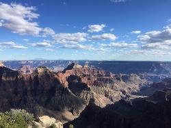
Bright Angel Point Trail
North Rim, Arizona
7.0 miles SWLocated at the North Rim of the Grand Canyon, the Bright Angel Point Trail is a steep, narrow, fully paved path leading to an incredible scenic viewpoint. The trail is conveniently located right next...
HikeTransept Trail
North Rim, Arizona
7.0 miles SWThe 3.4 mile out and back Transept Trail connects Grand Canyon Lodge to the North Rim Campground, follows the rim of a side canyon called the Transept, and offers a relaxing yet moderate hike with...
Hike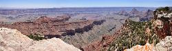
Cape Final
North Rim, Arizona
9.6 miles SThere are plenty of trails on the Grand Canyon's North Rim that have great views, but there may not be a hike more pleasant and more rewarding than the Cape Final Trail. As part of a full...
Camp, Hike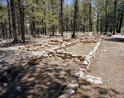
Walhalla Ruins
North Rim, Arizona
10.3 miles SWalhalla Ruin overview. Nine hundred years ago, people were living on the North Rim at Walhalla Glades. The site was a summer home for families for over 100 years. Walhalla Plateau is...
Hike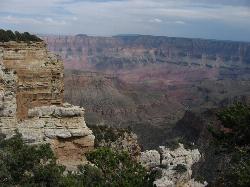
Walhalla Overlook
North Rim, Arizona
10.4 miles SHistory unfolds as you explore Walhalla Overlook on the North Rim of the Grand Canyon, with views of the Unkar Delta, farmland of the ancient people who once lived here.
HikeNearby Campsites
Uncle Jim Trail
North Rim, Arizona
6.0 miles SWDirections from North Rim Entrance: Drive southward along North Rim Drive to the North Kaibab Trailhead. Turn left into the parking area and locate the trailhead on the eastern side of the lot.
Backpack, Camp, Hike
Rim-to-Rim: North Kaibab to Grand Canyon Village
North Rim, Arizona
6.1 miles SWFour days across the Grand Canyon you will never forget! There is a secret to a Grand Canyon rim-to-rim hike: Take four days to do it, even if you can do it in one. I have friends who go South to...
Backpack, Camp, Hike
Rim-to-Rim: North to South Kaibab Trail
North Rim, Arizona
6.1 miles SWArizona Office of Tourism, 2702 N. 3rd St., Suite 4015 , Phoenix, AZ, 85004, Phone: 888-520-3434, Fax: 602-240-5432, mfioritt@pni.com
Camp, Hike, Horseback
Phantom Ranch to Ribbon Falls on North Kaibab Trail
North Rim, Arizona
6.1 miles SWCamp, Hike
North Kaibab Trail to Colorado River
North Rim, Arizona
6.1 miles SWThe North Kaibab Trail to Colorado River Trail is perfect for experienced hikers. The trail contains many elevation changes and is very steep. The trail is well maintained and well marked so you can...
Backpack, Camp, Hike 6.3 mi
Tiyo Point Trail
North Rim, Arizona
6.1 miles SWThis former road is becoming increasingly overgrown by the encroaching forest. This being said, it is generally easy to follow with some blown down trees to climb over or around. There are some old...
Backpack, Camp, Hike
Cape Final
North Rim, Arizona
9.6 miles SThere are plenty of trails on the Grand Canyon's North Rim that have great views, but there may not be a hike more pleasant and more rewarding than the Cape Final Trail. As part of a full...
Camp, Hike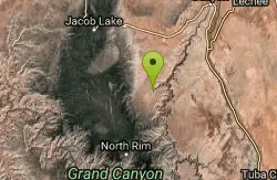
South Canyon
North Rim, Arizona
13.7 miles NA mostly trail-less route in Marble Canyon, for experienced canyoneers, suitable as a three to four day backpack. Marble Canyon is a narrow incision in the relatively flat expanse of...
Backpack, Camp, Hike
The Grand Canyon: Kaibab to Bright Angel Trail
Grand Canyon Village, Arizona
16.6 miles SExperience the Grand Canyon like few others with this unforgettable 2-3 day trip down into the canyon. If you are looking for the perfect hike in the Grand Canyon, this is it. The 2 (or 3) day hike...
Backpack, Camp, Hike
South Kaibab to Phantom Ranch to Bright Angel Trail
Grand Canyon Village, Arizona
16.7 miles SOne of the most popular hikes in Grand Canyon National Park is the South Kaibab to Phantom Ranch to Bright Angel Trail. Marked as difficult, the trail is well maintained and labeled. This Grand...
Backpack, Camp, Hike 13.6 mi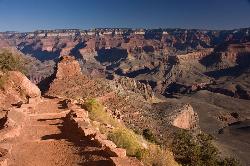
South Kaibab Trails
Grand Canyon Village, Arizona
16.7 miles SSouth Kaibab Trail is a 7 mile point-to-point trail located near Grand Canyon, Arizona that features a river and is rated as difficult. The trail is primarily used for hiking & walking and is...
Camp, Hike, Horseback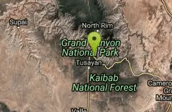
South Kaibab to North Kaibab to Bright Angel Trail
Grand Canyon Village, Arizona
16.7 miles SGenerally an early morning start and a late finish with an amazing sunrise on the way down the South Kaibab and depending on your speed, a beautiful sunset as you hike back toward (or up) Bright...
Backpack, Camp, Hike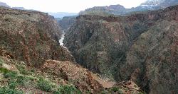
Clear Creek Trail
Grand Canyon Village, Arizona
16.7 miles SAn extended backpack trip of four to six days deep within the Grand Canyon. NOTE: The starting point for Clear Creek Trail, Bright Angel Campground, is in a remote location away from a trailhead. The...
Backpack, Camp, Hike 0.6 mi
Mather Campground Trail
Grand Canyon Village, Arizona
17.7 miles SWLocated on the South Rim of the Grand Canyon, Mather Campground Trail is a brief one mile out and back connector trail which is great for hiking, mountain biking, walking, and trail running. The...
Camp, Hike, Mountain Bike 1.4-9.8 mi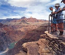
The Bright Angel Trails
Grand Canyon Village, Arizona
17.9 miles SWPrepare yourself for switchbacks as part of a tough elevation gain on the Bright Angel trail to Plateau Point trail. This trail features spectacular views as you hike along the edge of...
Backpack, Camp, Hike, Horseback 4.5 mi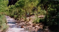
Bright Angel Trail to Bright Angel Campground and River Trail
Grand Canyon Village, Arizona
17.9 miles SWBright Angel Trail to Bright Angel Campground and River dirt trail is one of the most famous trails near Grand Canyon, Arizona. The well-maintained trail encompasses incredible views and has an...
Backpack, Camp, Hike, Rock Climb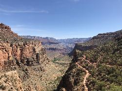
Bright Angel Trail to Three-Mile Rest house
Grand Canyon Village, Arizona
17.9 miles SWThe popular out-and-back Bright Angel Trail to Three-Mile Resthouse is 5.4 miles out in distance. The trail includes many steep switchbacks and 360 degrees of absolutely stunning views of the inside...
Backpack, Camp, Hike 4.9 mi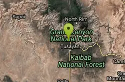
Bright Angel Trail to Tonto Trail
Grand Canyon Village, Arizona
17.9 miles SW"[T]he Tonto Trail offers a degree of civility not found elsewhere along the trail, and it is here that most hikers get their first exposure to the unique nature of this singular transcanyon...
Backpack, Camp, Hike
Tanner Trail
Grand Canyon Village, Arizona
18.4 miles SA rigorous rim-to-river backpack of three or more days, following one of the South Rim's more difficult trails. The unmaintained trail, recommended only for seasoned hikers, is...
Backpack, Camp, Hike 9.1 mi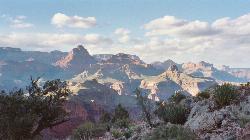
New Hance Trail
Grand Canyon Village, Arizona
19.2 miles SNew Hance Trail is a colorful hike through Red Canyon to the Colorado River. This trail is considered one of the more difficult trails in the Grand Canyon and is a challenge only prepared hikers...
Backpack, Camp, Hike


