


Tsali Recreation Area
Almond, North Carolina
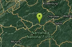
| Address: | ~8105 Tsali Rd, Stecoah, NC 28789, USA |
| GPS: |
35°24'28.3"N 83°35'6.7"W Maps | Directions |
| State: | North Carolina |
| Trail Length: | 30.00 miles |
| MTB Difficulty: | Intermediate |
| Trail Type: | Network |
| MTB Trail Type: | Singletrack |
Mountain Bike
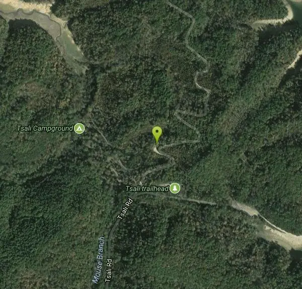
Tsali features four singletrack loops that hug the banks of Fontana Lake. The trails are super fast and flowy singletrack with mostly moderate climbs and amazing scenery.Daily usage alternates between horses and bikes so you don't have to worry about running into spooked riders (check local park maps and signage). The trailhead features a bike wash station and there's also a nice campground with showers and flush toilets. Tsali is an IMBA Epic and with good reason! Courtesy of Singletracks.com
More Information
Add ResourceNever modify trail features. Ride trails when they're dry enough that you won't leave ruts. Speak up when you see others on the trail and always yield to hikers, horses, and others coming uphill. Always ride on the established trail.
Read More- Plan Ahead and Prepare
- Travel & camp on durable surfaces
- Dispose of waste properly
- Leave what you find
- Minimize campfire impacts
- Respect wildlife
- Be considerate of other visitors
Directions
From Almond, North Carolina
- Head north on Watia Rd toward NC-28 S (0.3 mi)
- Turn left onto NC-28 N (2.4 mi)
- Turn right onto Tsali Rd (0.2 mi)
- Tsali Rd turns slightly right and becomes Tsali Campground Rd (0.5 mi)
- Tsali Campground Rd turns slightly left and becomes Tsali Rd (0.8 mi)
- Slight leftDestination will be on the left(0.2 mi)
Other Mountain Bike Trails Nearby

Tsali Thompson Loop
Almond, North Carolina
0.1 miles STight, twisting singletrack at Tsali's Thompson Loop keeps you honest with technical terrain and a couple of sneaky uphills — fast and fun in both directions.
Mountain Bike
Tsali Mouse Branch Loop
Almond, North Carolina
0.1 miles SOne of the most technical of the Tsali trails at over 8 miles, with loose rocks, fast sections, and a spectacular lake-and-mountain overlook near the high point of the loop.
Mountain Bike
Tsali Right Loop
Almond, North Carolina
0.2 miles SETsali's Right Loop delivers what the trail system is famous for — flowing singletrack past the Windy Gap Overlook — with an option to add the scenic overlook loop for extra mileage.
Mountain Bike
Flint Ridge
Bryson City, North Carolina
5.1 miles SNine switchbacks up a steep ridge rewarded with fast singletrack and Nantahala River views — a solid change of pace near the renowned Tsali trails.
Mountain Bike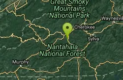
Swinging Bridge
Bryson City, North Carolina
7.0 miles SEA mostly paved river-valley ride near Bryson City with a swinging bridge crossing, beautiful river scenery, and one big hill — a scenic option when the local singletrack is limited.
Mountain Bike
Stecoah Gap
Robbinsville, North Carolina
8.3 miles SWA steady 4-mile climb from 3,165 ft up to Stecoah Bald near Robbinsville with tight singletrack, great views, and a rewarding downhill on the way back.
Mountain Bike
Deep Creek Trail
Bryson City, North Carolina
9.4 miles NETwo scenic out-and-back mountain bike trails on old logging roads — Deep Creek (2 miles one way) and Indian Creek Falls (3 miles one way, with a small waterfall) — both with creek views and easy terrain.
Mountain Bike
Winding Stairs
Topton, North Carolina
10.7 miles SWA long, steep mountain bike climb up Winding Stairs Road past Queen's Creek Reservoir to a paved descent alongside the Nantahala River back to the start near Topton.
Mountain Bike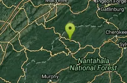
Fontana Village
Fontana Dam, North Carolina
13.6 miles WA highly technical network of mountain bike trails near Fontana Dam that earned the nickname 'Little Pisgah' — more technical than Tsali, with good climbing and multiple loop options.
Mountain Bike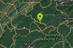
Turkey Chute
Robbinsville, North Carolina
14.1 miles WA fast, screaming downhill trail used regularly for races in Robbinsville, North Carolina — totally rideable on a regular mountain bike for a sweet, exhilarating descent.
Mountain Bike
Santeetlah Lake Trail
Robbinsville, North Carolina
16.8 miles WAn intermediate-to-difficult forest road trail around Santeetlah Lake near Robbinsville — rough terrain that benefits from repeated riding to establish a trail tread.
Mountain Bike
Cades Cove
Townsend, Tennessee
21.2 miles NWA gravel-road loop through Cades Cove — take the side roads for adventure, or cut your ride short on either of the two gravel shortcuts back to the lot.
Mountain Bike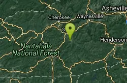
WCU Trails
Cullowhee, North Carolina
22.7 miles EAn intermediate mountain bike trail on steep WCU campus hillside near Cullowhee with lots of ups and downs despite a modest overall elevation change.
Mountain Bike
Snaggy Creek Trail
Cullowhee, North Carolina
26.9 miles EA 5-mile mountain bike climb from 2,300 to 5,500 feet near Cullowhee, descending halfway back before branching onto ATV trails back to town.
Mountain Bike
Climbworks El Regis
Gatlinburg, Tennessee
28.5 miles NEA private flow trail in Gatlinburg with a large signature wood feature — bikes available for rent, and a $25 three-hour ride fee applies (bike rental additional).
Mountain Bike
Citico Creek
Tellico Plains, Tennessee
29.2 miles WA mountain bike route that climbs high into the Tennessee mountains before returning along Citico Creek, with a beginner lake loop also available.
Mountain Bike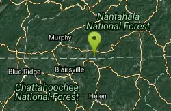
Burnt Tree Peninsula
Hayesville, North Carolina
29.6 miles SOne of the easiest trails in the Jack Rabbit system — still an absolute blast to ride in Hayesville, NC.
Mountain Bike
Jack Rabbit Trails
Hayesville, North Carolina
29.8 miles SA beginner-friendly machine-built trail network near Hayesville with a fast, twisty main loop and easy-to-navigate branches — a total blast for any level rider.
Mountain Bike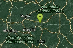
High Point
Hayesville, North Carolina
29.8 miles SThe highest point in the Tsali trail system with the biggest climb and most technical terrain — rewarded by phenomenal views of the lake and surrounding mountains from the top.
Mountain Bike
Yotee's Run
Hayesville, North Carolina
29.8 miles SPart of the Jack Rabbit trail system, Yotee's Run is a fast, flowy singletrack that captures everything great about the singletrack in this area.
Mountain BikeNearby Campsites
Cades Cove Campground
Townsend, Tennessee
17.2 miles NWOver 2 million visitors a year come to bike, hike, tour the 11-mile loop road, and watch wildlife amid wildflowers in spring and vivid fall colors in this iconic Smoky Mountain valley.
Camp
Mt. LeConte Lodge
Sylva, North Carolina
18.3 miles EThe highest guest lodge in the eastern United States at 6,400 feet, with spectacular Smokies views from an open glade just below the Mt. LeConte summit in Great Smoky Mountains NP.
Camp, Hike, Horseback, Rock Climb
Davis Branch
Tellico Plains, Tennessee
30.2 miles WA riverside campground on the Tellico River with six campsites, each with a picnic table — a peaceful Tennessee base camp for hiking, fishing, and campfire nights.
Camp, Hike, Swim
Cosby Campground
Cosby, Tennessee
32.1 miles NECamp and Swim near Cosby, Tennessee
Camp, Swim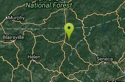
War Woman Dell Wildlife Management Area
Clayton, Georgia
38.7 miles SA short 0.8-mile out-and-back hike near Clayton, Georgia through a nature trail to a waterfall — good for all skill levels and accessible year-round.
Camp, Hike, Horseback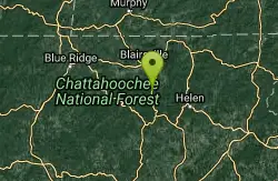
Vogle State Park
Blairsville, Georgia
48.2 miles SWA 233-acre park at the base of Blood Mountain in the Chattahoochee National Forest — one of Georgia's first state parks, founded in 1931.
Camp, Canoe, Swim
Davidson River Campground
Pisgah Forest, North Carolina
49.4 miles EA year-round campground in Pisgah National Forest just four miles from Brevard and less than an hour from Asheville, with shaded loops, hiking trails, waterfalls, and fishing spots nearby.
Camp, Hike, Swim


