


Refine Search
- disc golf 4153
- mountain bike 1330
- swim 1040
- hike 935
- skateboard 657
- camp 481
- kayak 451
- canoe 412
- horseback 111
- hot springs 80
- rock climb 76
- cave 60
- backpack 54
- cross-country ski 36
- whitewater 21
- snowshoe 14
- atv/motorcycle 12
- canyoneer 11
- kiteboard 7
- dive 7
- backcountry ski 5
- sled 4
- cycle 2
- street hockey 1
7757 locations
Add Location
 Full Listing
Show more
Camp, Canoe, Kayak, Swim
Added on 25 Oct 2026
 Full Listing
Show more
Swim
Added on 25 Oct 2026
 Full Listing
Show more
Canoe, Hike, Kayak, Swim
Added on 25 Oct 2026
 Full Listing
Show more
Canoe, Kayak, Swim
Added on 25 Oct 2026
 Full Listing
Show more
Camp, Canoe, Kayak, Swim
Added on 25 Oct 2026
 Full Listing
Show more
Hike, Swim
Added on 25 Oct 2026
 Full Listing
Show more
Canoe, Kayak, Swim
Added on 25 Oct 2026
 Full Listing
Show more
Swim
Added on 25 Oct 2026
 Full Listing
Show more
Canoe, Kayak, Swim
Added on 25 Oct 2026
 Full Listing
Show more
Swim
Added on 25 Oct 2026
 Full Listing
Show more
Swim
Added on 25 Oct 2026
 Full Listing
Show more
Hike, Swim
Added on 25 Oct 2026
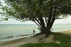 Full Listing
Show more
Swim
Added on 25 Oct 2026
 Full Listing
Show more
Canoe, Hike, Kayak, Swim
Added on 25 Oct 2026
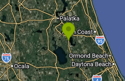 Full Listing
Show more
Canoe, Kayak, Swim
Added on 25 Oct 2026
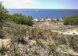 Full Listing
Show more
Hike, Swim
Added on 25 Oct 2026
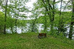 Full Listing
Show more
Canoe, Kayak, Swim
Added on 25 Oct 2026
 Full Listing
Show more
Canoe, Hike, Kayak, Swim
Added on 25 Oct 2026
 Full Listing
Show more
Camp, Hike, Kayak, Swim
Added on 25 Oct 2026
 Full Listing
Show more
Canoe, Hike, Kayak, Swim
Added on 25 Oct 2026
Holter Lake Campground
Wolf Creek
3.9 miles E of Wolf CreekHolter Lake Campground is a Bureau of Land Management recreation site on the lower end of Holter Lake, the reservoir that Holter Dam backs up on the Missouri River in Lewis and Clark County, Montana. It is run by the BLM Butte Field Office and sits a few miles east of Wolf Creek, roughly 45 miles north of Helena. Along with the 52-site campground, the site has a day-use area with a boat ramp, docks, fishing piers, picnic shelters and a designated swimming area on the lakeshore. The lake runs about 24 miles upstream from the dam, and the cliffs of the Gates of the Mountains and the Sleeping Giant formation are within view or a short boat ride away.
From Helena, take Interstate 15 north to exit 226 at Wolf Creek and follow Recreation Road toward the river. After the steel bridge over the Missouri, turn right onto Beartooth Road and drive 2.3 miles; the entrance is on the right at 1380 Beartooth Road. Coming from Great Falls, use exit 234 at Craig and follow Recreation Road south about 5 miles, turning left onto Beartooth Road just before the bridge. Day visitors can park in a small paved lot by the campground office and host site, in a larger paved lot beside the boat ramp, or in an overflow lot across Beartooth Road. A paved path leads from the day-use parking to the docks, piers and swimming area.
The swimming area is a small beach in the day-use area near the boat docks, and visitors describe it as best suited to kids and waders. Holter is a run-of-the-river reservoir, so its level holds fairly steady through summer, but the lake averages about 50 feet deep and the water stays cool into early summer. BLM warns that weather here can change drastically. No lifeguards are mentioned in any BLM material, so swim at your own risk. Stay well away from the ramp and dock lanes, where powerboats come and go all day in summer.
Day use is not free. BLM sells a Holter Lake day-use pass for $5 per private vehicle per day, which covers the passholder and everyone in the car, and a $50 annual pass that covers all the BLM day-use sites at Holter and Hauser lakes. Holders of a Senior or Access interagency pass get a 50 percent discount. Passes are sold through Recreation.gov. Camping costs $25 per tent or RV, with up to two per site, and the 52 sites are reserved through Recreation.gov, though unreserved sites may open up on a first-come basis after 2 p.m. Stays are capped at 7 nights in a row. Fees run from about mid-May to mid-October, and after the season BLM shuts off the water and pulls the docks.
Check conditions before you go. BLM sometimes closes the campground for maintenance and points visitors to Devil's Elbow, Log Gulch or White Sandy as nearby alternatives. The agency warns that prairie rattlesnakes, bull snakes, ticks and black widow spiders live in the area, and that bears may come through, so store food properly. Clean, drain and dry any boat or paddleboard to keep invasive species out.
Besides swimming, people come here to fish from the piers, launch boats toward the Gates of the Mountains, paddle a kayak or canoe, and camp. The campground has shade from poplar and green ash trees, lots of picnic tables, potable water hydrants and reservable day-use shelters. There are no hookups and no dump station.
Lighthouse Beach
Port Huron
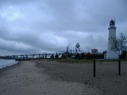
2.6 miles N of Port HuronLighthouse Beach is the city beach inside Lighthouse Park, run by the City of Port Huron's Parks and Forestry department on the Lake Huron shore at the north end of town. It sits just above the point where the lake drains into the St. Clair River, a short way north of the Blue Water Bridges, and it shares the shoreline with Fort Gratiot Light, the 1829 tower that is the oldest surviving lighthouse in Michigan. The park gives about 900 feet of sand frontage on open Lake Huron, with Sarnia and Point Edward visible across the water in Ontario.
The city lists the beach at 2900 Conger Street, and its parking notice gives the lot entrance as 2860 Omar Street. Paid parking runs from the Thursday before Memorial Day through Labor Day, but at Lighthouse Beach the booth is staffed only on weekends, from 9 a.m. to 7 p.m. When no attendant is in the booth, no payment or pass is needed. Single-use rates when the booth is open are free for City of Port Huron residents, $10 for other St. Clair County residents and $20 for visitors from outside the county, and residents need an ID, utility bill or tax bill to prove where they live. Weekdays and the off-season cost nothing. The city does not post separate beach hours.
Swimming is allowed, but this is not a gentle beach. The city says there are no lifeguards, that swimmers go in at their own risk, and that the beach is not recommended for children because the water gets deep quickly and the current is strong. Lake Huron empties into the river just south of here, so expect the water along this shore to move toward the bridges. The county, which owns the lighthouse grounds next door, warns that the beach in front of the light station has dangerous currents and asks people to swim at Lighthouse Park instead, which means the stretch north of the tower. A row of short rock groins breaks up the shoreline, and visitors describe a stony bottom close in. Lake Huron stays cold well into summer, so strong swimmers who stay near shore are the people this spot suits.
The St. Clair County Health Department samples the water through the summer and posts advisories when E. coli rises above the state limit, usually after storms or heavy wind. Lighthouse Beach was on a July 2024 advisory list along with five other county beaches. Check Michigan BeachGuard or the health department's St. Clair County Beaches Facebook page before going in after a rain.
City rules ban smoking, alcohol and pets on the sand, though leashed dogs may use the sidewalks and lawns. Charcoal and gas grills are allowed. The park has a playground, seasonal restrooms and a beach mat that runs toward the water's edge for wheelchair users. Next door, the Fort Gratiot Light Station grounds are free to walk, and Port Huron Museums runs paid tower tours there on a seasonal schedule ($12 for adults). Lake freighters pass close to shore as they line up for the river, which is half the reason people come here even when the water is too rough to swim.
Belleayre Beach at Pine Hill Lake
Pine Hill
0.4 miles SE of Pine HillBelleayre Beach at Pine Hill Lake is the summer swim beach run by Belleayre Mountain, the state-owned ski area in the central Catskills that is operated by the Olympic Regional Development Authority (ORDA). The beach sits on the southeast shore of Pine Hill Lake, a small dammed lake (mapped on some sources as Birch Creek Pond) at the eastern edge of the hamlet of Pine Hill in the Town of Shandaken, Ulster County. The surrounding land is a state Forest Preserve intensive use area, and Belleayre Mountain rises above the valley to the west.
The entrance is at 33 Friendship Manor Road, a short turn off State Route 28 just east of Pine Hill's Main Street, and the lake is visible from the highway. Cars, motorcycles and buses pay at the gate and park in the lots beside the beach and picnic grounds. Walk-in visitors pay a per-person fee instead, but parking outside the gate is limited, so most people drive in. The Belleayre Beach Trail and the Giggle Hollow Trail start from the grounds and climb toward Belleayre Mountain.
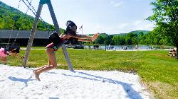
The swim area is a roped section off a white sand beach, with a diving dock and a lap lane. Lifeguards staff the beach during operating hours. Swimming and wading are allowed only inside the ropes, and swimmers may go beyond the second rope only while a lifeguard is on duty; when no guard is posted the park can stay open with the swim area unsupervised. Tubes, noodles, rafts, balls and other floats are not allowed, though U.S. Coast Guard approved life jackets are, and staff will check them at the gate. Flips off the dock are banned, and children who are not toilet trained need swim diapers. This is a small mountain lake, so expect cool water early in the season.
The beach is open from late June through Labor Day weekend. Hours are 11am to 6pm on Monday, Wednesday, Thursday and Friday, and 10am to 6pm on Saturday and Sunday. It is closed every Tuesday. Swimming ends at 5:30pm and the last boat goes out at 4:30pm. It is not free. The day-use fee is $20 per passenger vehicle for up to four people, plus $5 for each additional person, $10 per motorcycle and $5 per walk-in visitor. Drivers 70 and older pay $5 midweek and $10 on weekends and holidays, NYS Empire Passport holders pay $15 per vehicle, and Access Pass holders get in free. A season pass costs $124 per vehicle.
Pets are not allowed anywhere in the facility, including inside parked cars, so leave dogs at home. Alcohol is not allowed on the beach, glass containers are banned throughout, and the beach and buildings are smoke-free and vape-free. Weather can close the beach or change hours on short notice, and Belleayre asks visitors to call the beach office at 845-254-6195 for same-day updates. Check with the beach office for any water-quality advisory or closure before you go.
Beyond swimming, the entry fee covers the rest of the grounds: picnic pavilions, park charcoal grills (personal grills are not allowed), a playground, volleyball, basketball and horseshoes, and a snack bar. Rowboats, pedal boats and kayaks are rented first-come, first-served at the lifeguard office. You can launch your own non-motorized canoe or kayak only if it was steam cleaned within the previous 24 hours and you show the receipt, and inflatable boats are not allowed. Fishing from shore or a boat needs a New York fishing license.
Blue Mountain Lake Public Beach
Blue Mountain Lake
0.2 miles SW of Blue Mountain LakeBlue Mountain Lake Public Beach is the town swimming beach on the east shore of Blue Mountain Lake, a 1,334-acre lake in the central Adirondacks of Hamilton County. It sits in the small hamlet of Blue Mountain Lake, which belongs to the Town of Indian Lake, and the town lists the beach among its own departments alongside Chain Lakes Beach and Byron Park. At roughly 1,790 feet above sea level, the lake is one of the highest in the Adirondacks with a public beach, and the view west takes in a scatter of wooded islands with Blue Mountain rising behind the hamlet.
The beach is on NYS Route 28, about a quarter mile from the Route 28 and Route 30 intersection in the middle of the hamlet, heading toward Raquette Lake. Look for it across the road from the Adirondack Lakes Center for the Arts, beside the hamlet's fire station. Parking is limited to what fits along this short stretch of shoreline, so on a hot July weekend you may have to park a little way off and walk in. The same spot doubles as the lake's only public boat launch, a shallow shoreline put-in where canoes and kayaks are carried roughly 100 feet over grass and sand.
The swim area is small and roped off, with a swimming dock and a strip of sand and grass to spread out on. Red Cross certified lifeguards are on duty in summer from 11 a.m. to 5 p.m., seven days a week, according to Hamilton County's tourism office. There are changing rooms and restrooms at the beach, plus more public restrooms across the street. Neither the town nor the county lists an admission or parking fee. Because the lake sits so high, the water tends to stay cool well into summer, and the open lake beyond the ropes is deep, averaging about 46 feet and reaching around 100 feet in places.
Swim only inside the ropes and during guarded hours if you have children with you, since nobody is watching the water before 11 a.m., after 5 p.m. or outside the summer season. Blue Mountain Lake is a big lake shared with motorboats, and wind can kick up a real chop quickly, which matters for anyone paddling out from the launch. Much of the shoreline and many of the islands are private property, so do not plan on landing just anywhere. Hours and staffing can change from year to year; the town lists a beach phone number, 518-352-7768, for current information.
The hamlet is compact enough to make a day of it on foot. The arts center across the road runs exhibits, workshops and summer performances, and a taproom and a couple of shops are a short walk up Route 30. The Adirondack Experience museum is just outside the hamlet, and Lake Durant, a state campground, is a few minutes east on Route 28. Paddlers can follow the lake south to Eagle Lake and Utowana Lake, or stop near Castle Rock for a short hike up to a rock outcrop that looks out over the lake.
Longwood Park
Clarksville
3.5 miles S of ClarksvilleLongwood Park is a U.S. Army Corps of Engineers recreation area on John H. Kerr Reservoir, the 50,000-acre impoundment of the Roanoke River that Virginians usually call Buggs Island Lake. The park sits on the Grassy Creek arm of the lake in Mecklenburg County, just west of US 15 and roughly ten minutes south of downtown Clarksville. The Corps runs it as part of the John H. Kerr Dam and Reservoir project, with a 66-site campground on the wooded points, a day use area with a picnic shelter and playground, and a designated swimming beach in a sheltered cove at the south end of the park.
The posted address is 13500 US Highway 15, Clarksville, VA 23927. Heading south from Clarksville on US 15, watch for the brown Longwood Park sign on the right. All traffic passes the gatehouse, where the road splits toward the campground loops and the day use area. Parking near the beach is first come, first served, even for shelter renters. A separate Longwood boat ramp with its own lot sits across the cove to the south, also off US 15.
The swim area is a short, sandy beach facing a narrow, protected cove, marked off from boat traffic by a line of buoys. The sand runs down into the lake, and like most Piedmont reservoirs the water is tinted and not very clear, so you will not see the bottom once you are past wading depth. The cove is tucked away from the open lake and gets little wave action, and by midsummer the shallow water is warm enough for long swims. The Corps keeps a life jacket loaner station at the beach where you can borrow a jacket and return it when you leave. No lifeguard service is listed for this beach, so plan on swimming at your own risk and watching children closely.
Entry is not free. Every vehicle entering the day use area pays a $7 day use fee, including groups that have reserved the picnic shelter. You can pay at the fee machine or at the gatehouse, or buy a pass ahead of time through the Kerr Visitor Assistance Center at (434) 738-6143. Registered campers do not pay the day use fee, and holders of the America the Beautiful Senior or Access pass, the older Golden Age or Golden Access passports, or the Corps Annual Pass get into the day use area free. The gatehouse is open 9 a.m. to 9 p.m. Sunday through Thursday and 9 a.m. to 10 p.m. on Friday and Saturday, and the park has been staffed from April through October. Call (434) 374-2711 in season to confirm current hours.
Kerr is a flood control reservoir, so its level moves a lot. After heavy rain upstream the water can rise over much of the sand, and in dry spells the beach gets wider and you have to wade farther out to reach swimming depth. Check with the gatehouse if the lake has been high. Dogs are allowed in the park on a leash no longer than 6 feet but are banned from the designated swimming area. Alcohol, golf carts and other off-road vehicles are prohibited throughout the park. Stay inside the buoy line, since powerboats and anglers use the main Grassy Creek channel just outside the cove.
Beyond the beach, the day use area has a lakeside picnic shelter (no electricity), grills, picnic tables, a playground and vault toilets. The campground has hookups, hot showers and waterfront sites, and the quiet coves around the park are easy paddling for canoes and kayaks.
Oval Beach
Saugatuck
0.8 miles NW of SaugatuckOval Beach is the City of Saugatuck's public beach on Lake Michigan, part of a city park that runs along the lakeshore west of downtown Saugatuck in Allegan County. The village bought the lakefront land in 1902 and 1927, built a road over the dune and an oval-shaped parking lot with Works Progress Administration money, and opened the beach to the public in 1936. Wooded dunes rise behind the sand, Mount Baldhead Park sits just inland, and the city's 173-acre Saugatuck Harbor Natural Area continues north toward the old mouth of the Kalamazoo River.
By car, take Perryman Street from the west side of the Kalamazoo River and follow it over the dune to Oval Drive and the beach lots at 690 Perryman St. The lots can reach capacity for short stretches on hot summer days, and the city suggests walking or biking in instead. A popular way to arrive without a car is the hand-cranked Saugatuck Chain Ferry across the river from downtown, then either the 303 stairs over Mount Baldhead or the flatter John Woollam Trail to the sand. The local Interurban bus also runs on demand ($1 for adults, 50 cents for seniors, kids under 12 and riders with disabilities).
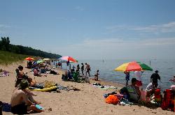
The swim area is open Lake Michigan surf over a fine sand bottom that shelves out gradually, with sandbars a short way offshore. There are no lifeguards; the city states plainly that swimming here is at your own risk. Lake Michigan water off this shore is usually cold into early July and tends to reach the upper 60s or low 70s F by August, though a strong offshore wind can turn it cold again overnight. Waves and rip currents build quickly when the wind blows onshore, so check the NOAA nearshore forecast the city links on its beach page before going in, and stay out of the water on high-surf days.
Fees and hours, stated exactly from the city: from Memorial Day weekend through Labor Day weekend the park is staffed from 8 am to 10 pm and parking costs $15 per vehicle per day (day pass sold at the beach only), $75 for a season pass, or $20 for a season pass for City of Saugatuck taxpayers (sold at City Hall only). The fee is for motor vehicle parking; arriving on foot or by bike costs nothing, and parking is free outside the summer season. The park is open year round. Dogs are banned from Memorial Day weekend through September 30, and alcohol, smoking, nudity, fires, personal grills and launching watercraft from the beach are not allowed. Stay off the dune grass and on marked trails.
The Allegan County Health Department samples Oval Beach for E. coli from Memorial Day week through the end of August and has issued no-contact advisories here when tests came back high, asking people not to swim or touch the water until a clean result. Results post on the state's MiEnviro BeachGuard site, which is worth checking the morning you go, especially after a storm. Shoreline erosion is an ongoing concern for the city, so the width of the beach changes from year to year.
The summer concession stand sells food and drinks, permanent restrooms are open in season, and the beach has no stairs to the water. A beach wheelchair and a floating wheelchair are available. For a walk, trails lead into Mount Baldhead Park and north through the dunes and interdunal wetlands of the Saugatuck Harbor Natural Area, where dogs are not allowed at any time.
Summit Lake County Park
Summit Lake
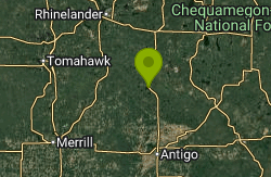
0.2 miles W of Summit LakeSummit Lake County Park is a small day-use park run by the Langlade County Forestry, Parks and Recreation Department on the east shore of Summit Lake, in the unincorporated community of Summit Lake in northern Langlade County. The park's sandy beach is the public swimming spot on the lake. Summit Lake covers 279 acres and reaches 29 feet at its deepest point. It is a drainage lake, and its water has the tea-brown, tannin-stained color common to northern Wisconsin lakes, which the county's tourism office describes as root beer colored. The lake takes its name from its high elevation, roughly 1,690 feet above sea level.
The park sits right off U.S. Highway 45, about 20 miles north of Antigo and 5 miles south of Elcho, on the west side of the highway as it passes through Summit Lake. Parking is in the park's designated lot, and county rules require every motor vehicle to stay in that lot. The walk from the car to the sand is short, and the county lists ADA accessible pathways among the park's features. Summit Lake's paved public boat landing is a separate site on Forest Road at the southwest corner of the lake, about half a mile away by water, so trailers should head there rather than to the beach.
The swim area is marked off with ropes and buoys in front of the beach. The bottom is sand and drops off gradually, which is why the county promotes the lake as a good choice for families with small children. There is no lifeguard on duty at any time, and the county's posted rule is that you swim at your own risk. Fishing is not allowed inside the roped swim area, and smoking is not allowed on the beach. The county does not publish water temperatures or a set swim season, and the lake freezes over in winter.
Entry is free. The county's park policy states there is no charge for entering the park, and there is no day-use or parking fee for the beach. Park hours are 7:00 a.m. to 10:00 p.m. daily. The one paid item is the open-air pavilion, which has electricity, a grill and six to eight picnic tables. It can be used first come, first served, or reserved for $75 per day by calling the department at 715-627-6300. A shelter marked with a yellow reserve tag is off limits to anyone without the booking.
Several rules here are stricter than at many beaches. Pets are banned from the entire park, not only the beach, including the picnic areas, pavilion, playground and restrooms. Overnight camping is not permitted, fireworks and firearms are prohibited, and fires are allowed only in a designated fire pit or a park grill. Grills are allowed but you need to bring your own. With no lifeguard, adults need to watch children in the water themselves, and swimmers should keep inside the buoys because boats and anglers use the rest of the lake. Read the signs at the beach for any closure or water quality advisory before going in.
Besides the beach, the park has picnic areas, vault restrooms, changing rooms, a playground and an ATV and UTV trail access point with its own parking. The lake holds musky, walleye, northern pike, largemouth bass and panfish, and shore fishing is allowed outside the swim area with a Wisconsin license. In winter the park serves as a snowmobile trail access and parking area, and anglers use it to reach the ice.
Packard Park and Beach
South Haven
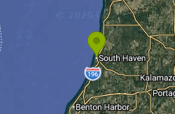
0.6 miles NW of South HavenPackard Park and Beach is a City of South Haven park at 231 North Shore Drive, one of the seven public beaches and access sites the city maintains on Lake Michigan. It sits on the north side of the Black River, about a kilometer north of downtown, in a residential stretch of North Shore Drive between the Dyckman Avenue access to the south and the Oak Street access to the north. The park itself is a shaded lawn on top of the low bluff, and the public beach lies below it on open Lake Michigan.
From downtown, cross the Dyckman Avenue bridge or follow North Shore Drive north from North Beach; the park is on the lake side of the road. There is a small city lot at the park. From May 15 to September 15, between 9 a.m. and 6 p.m., city beach parking costs $3 per hour at card-only kiosks or through the Passport Parking app (zone 49090), and a $50 weekly pass is sold at the same kiosks. The state DNR Recreation Passport does not cover city lots, and an unpaid space draws a $45 ticket. Outside those dates and hours the lot is free. Some nearby streets are signed for city sticker holders only, so read the signs before parking along North Shore Drive. Walking or biking from town is easy, and the park has a bike rack.
Getting into the park and onto the beach costs nothing. The city's park rules list park hours as sunrise to 10 p.m. and beach hours as sunrise to 11 p.m. Alcohol, glass, open flames and animals are not allowed on the beach, and camping and trailers are prohibited. The city owns only part of the frontage; private property borders the public section on both sides, so stay within the signed public stretch.
From the lot, a short path leads past a deck overlooking the lake and then down a sandy slope to the beach. The bottom is sand, and the water deepens gradually, though sandbars and troughs shift from year to year. How much beach there is depends on Lake Michigan's level; in high-water years such as 2020 the sand was very narrow. There are no lifeguards here. The city's lifeguard program covers South Beach only, from Memorial Day to Labor Day. The lake is cold well into summer, and a strong offshore wind can bring up much colder water within a day.
The main hazard is the lake itself. Waves and rip currents build quickly when the wind comes from the west or southwest, and drownings along this part of the shore have pushed South Haven to run a beach safety program with colored warning flags. Check the city's beach flag status page or text "beaches" to 888777 before going in, and stay out on red-flag days. The county health department posts bacteria sampling results for North Beach and South Beach but not separately for Packard Park, so hold off swimming for a day or so after heavy rain.
Of the smaller north-side access sites, Packard Park is the only one with amenities: public restrooms with a changing area, grills, picnic tables and a large shaded lawn, which makes it the most practical choice for a full day if you'd rather skip the crowds at North Beach. North Beach, the North Pier and downtown South Haven, including the Michigan Maritime Museum, are a short walk or bike ride south.
Freeman Lake Beach
North Chelmsford
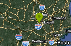
0.3 miles SW of North ChelmsfordFreeman Lake Beach is the public swimming beach on Freeman Lake in North Chelmsford, Massachusetts. It sits on the edge of Varney Playground, and the Town of Chelmsford lists the two together as Varney Playground/Freeman Lake Beach. Freeman Lake, shown on older maps as Newfield Pond, is a dammed pond beside Route 40 a few blocks west of Vinal Square. It took its current name in 1986 in honor of Bruce Freeman, who paid to rebuild the dam after it failed in 1970 and drained the pond. The beach itself is a short strip of sand on the north shore, with the playground, courts and ball field right behind it.
The park is at Adams Street and Sherman Street. From Vinal Square, where Route 3A meets Route 40, follow Newfield Street or Adams Street south a couple of blocks to the water. There is a small lot at the end of Adams Street beside the courts. A local family guide reports that some of those spaces are held for Chelmsford residents, and there is more parking on the surrounding streets. This is a quiet residential neighborhood, so keep driveways clear. LRTA buses stop at Vinal Square and at the Chelmsford Senior Center, both a short walk away.
Swimming is allowed only in the designated area off the beach. The town stopped posting lifeguards on June 29, 2024, and its beach page says there are no lifeguards and visitors swim at their own risk, so keep a close eye on children. The bath house is closed, and portable toilets are set up from Memorial Day to Labor Day. Canoes, kayaks and other small boats can be hand launched from the beach. Motorized boats are banned on the lake, which keeps the water by the beach calm.
Admission is free. The park is open from dawn to dusk to residents and non-residents alike, with no beach sticker or day pass. Town rules prohibit fishing from the beach, grills, cooking or open flames of any kind, alcohol, smoking and glass bottles, and ask visitors not to feed the ducks or geese. Dogs are allowed on a leash, and owners must clean up after them. Commercial use needs written approval from the town, and camps and other large groups are strongly discouraged.
The Chelmsford Health Department tests the water for E. coli each week from Memorial Day through Labor Day. It closes the beach to all water activities when a sample goes over 235 per 100 ml, or for harmful algal blooms, heavy animal waste, or weeds thick enough to make wading dangerous. Freeman Lake tends to test higher than the town's other beach at Heart Pond. The lake has closed for bacteria in past summers, including 2016 and twice in July 2020, and officials have blamed the geese. Testing can't be done within 24 hours of rain, so a closure that starts before a storm can drag on. Check the town's beach status page or call the Health Department at 978-250-5241 before you go.
Varney Playground was renovated in recent years and now has a modern play structure and swings, along with a basketball court, tennis courts and a baseball diamond. The town schedules the field through the School Department. The MacKay Branch Library is a few minutes' walk away on Newfield Street, and the Chelmsford Senior Center also sits on the lake.
Torpy Park
Minocqua
0.2 miles NE of MinocquaTorpy Park is the Town of Minocqua's downtown waterfront park, a roughly 4-acre lot on the shore of Minocqua Lake at 705 Oneida Street (US Highway 51) on the island that holds Minocqua's business district. The town lists it as Torpy Park & Beach and owns and runs it. It was dedicated as a park in 1945, and the small sand beach on its lake side is the main public swimming spot in town. Minocqua Lake itself covers about 1,339 acres, reaches 60 feet at its deepest point, and is part of the Minocqua and Kawaguesaga chain of lakes in Oneida County.
Getting there is easy: Highway 51 runs right past the park as Oneida Street, and the turn for Torpy Park Drive leads down to a town-run lot beside the tennis courts and playground. More town parking sits a block or two south around the downtown streets, and on summer weekends those spaces fill quickly because the park hosts festivals, craft shows, free concerts and the town's signature Beef-A-Rama event. From most downtown shops and restaurants the beach is a short walk.
The swim area is a short strip of sand on the north shore of the park, with the town's public piers just along the shoreline. It is a lake beach, not a pool, so expect a sandy bottom that shelves off into open water, weeds in places, and boat traffic not far offshore, since this part of Minocqua Lake is busy with pontoons, ski boats and rental craft all summer. Northwoods lakes like this one usually only feel comfortable from late June through August, and the water stays cool early in the season. The Town of Minocqua states plainly on its parks page that there are no lifeguards on duty at Torpy Park beach, even though some older tourism write-ups mention lifeguards. Plan to watch your own swimmers, especially children.
Swimming here is free. The town's park listing names no admission or beach fee, and the lots around the park are town-operated public parking. The town does not publish beach hours or a formal swim season, so treat it as a daylight, summer-season beach and follow any posted signs, including any rules about pets on the sand. A 2022 renovation, funded largely with a Community Development Block Grant, added ADA ramps linking the upper park to the beach, an accessible platform at the sand, and a ramp out to the piers.
Each June the park serves as the start and finish of the Minocqua Island Swim Challenge, a one-mile and 400-meter open-water race on Minocqua Lake that raises money for the Oneida County Public Safety Dive Team. On race morning the swim area and lakefront are crowded with swimmers and volunteers, so casual swimmers may want to come later in the day. Eurasian watermilfoil, an invasive aquatic plant, is present in the Minocqua chain, and the lake association runs an ongoing management program, so you may brush against plants near the edges of the swim area.
Beyond the beach, the park has restrooms, a pavilion, picnic shelters with grills and tables, tennis courts, a playground, a sand volleyball court, seasonal concessions and public Wi-Fi. In winter the town floods an ice rink on the grounds. Because the park is in the middle of downtown Minocqua, it is an easy place to combine a swim with lunch, an ice cream stop or a walk or ride on the Bearskin State Trail, which starts on the south side of downtown.
Clear Lake Beach
Sedro-Woolley
3.2 miles S of Sedro-WoolleyClear Lake Beach is the swim beach at Clear Lake Park, a small Skagit County Parks and Recreation property at 12925 South Front Street in the unincorporated town of Clear Lake, Washington. It sits on the west end of Clear Lake, a lowland lake of about 220 acres that the Washington Department of Fish and Wildlife places three miles south of Sedro-Woolley. The park is the lake's only public beach. Most of the remaining shoreline is lined with private homes, and the town itself wraps around the west and north sides of the water.
To get there, follow State Route 9 south from Sedro-Woolley for about three miles, or drive roughly 15 minutes northeast from Mount Vernon. In Clear Lake, turn onto South Front Street near its junction with Beaver Lake Road. The park has two small parking lots next to the playground, and on hot weekends they fill early. The WDFW boat launch on the north shore is a separate site and needs a state parking pass, so park at the county lot if you came to swim.
The beach itself is a short strip of sand in front of a grassy lawn, with a fishing pier off to one side. You wade in straight off the sand, and the water is usually clear, but the lake does get deep away from shore, reaching about 44 feet at its deepest point. Clear Lake is a shallow-shored lowland lake, so it warms through July and August, but it still feels cool after a dip in June. The county stopped staffing lifeguards here in 2009 for budget reasons and lists it as a non-lifeguarded beach, so everyone swims at their own risk and children need an adult watching them.
There is no entry or parking fee listed for the park, making it free to use. In the most recent posted schedule the park was open 10 a.m. to 8 p.m. daily in summer. The county treats the lake as a summer swim season, opening it for water activities around June 1, and parks staff have tested the beach water for fecal coliform before Memorial Day and the Fourth of July. Water access was closed for about 15 months during the COVID-19 pandemic and reopened in June 2021.
Check conditions before you go. Like many western Washington lowland lakes, Clear Lake can see algae growth and aquatic weeds in warm weather. If the water looks scummy or the county has posted a bacteria or algae notice at the beach, stay out and keep dogs out of the water. Anglers fish from the pier and boats launch from the north shore, so stay close to the beach and watch for lines and hooks near the pier. Clear Lake grew up as a lumber town in the 1890s, and boaters report old pilings and snags in parts of the lake away from the beach, so don't dive from the pier or swim out into unfamiliar water.
Beyond the beach, the park has picnic tables, a playground, restrooms and picnic shelters that can be reserved through the county. The pier is popular with families fishing for stocked rainbow trout, perch and bass. A coffee stand and a market sit a block south at Front Street and Beaver Lake Road, and the Mud Lake Conservation Area and the Centennial Trail are a short drive away if you want a walk after your swim.
Van Buren Park Beach
Belleville
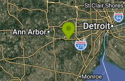
2.1 miles W of BellevilleVan Buren Park Beach is the small sand beach inside Van Buren Park, a 101-acre park run by Van Buren Charter Township's Parks Department on the north shore of Belleville Lake. The lake is a 1,270-acre reservoir on the Huron River, formed in 1925 when the French Landing Dam was built, and it runs about 8 miles through the middle of the township. The beach sits at the south edge of the park facing across the water, roughly 2 miles west of downtown Belleville. Wikipedia describes it as the only public swimming area on the lake.
The park entrance is on the South I-94 Service Drive between Belleville Road and Rawsonville Road, just south of the freeway. A park road winds down to lots near the playground and restrooms, and a separate road drops down the slope to the beach. The township's 2022 to 2026 parks plan admits that this road is rough and the slope is steep, and it lists repairing the beach road, adding guardrails and stabilizing the eroding shoreline as goals. An ADA pathway to the lake was built in 2005, and accessible parking and signs were added in 2009, when the beach was also resanded.
The swim area itself is modest: a short strip of sand that park users in the township's own survey called small and hard to reach. According to township police, a walkway leads from the beach out to a sandbar where the water is roughly knee to waist deep, but the bottom drops off into deeper water if you stray from it. Belleville Lake reaches about 30 feet at its eastern end and is shallower to the west, toward the park. None of the township pages mention lifeguards, so plan on swimming unguarded and keep children within reach.
Entry is not free. The township charges a vehicle entry fee at Van Buren Park. Under the township's fee schedule a daily pass is $6 for Van Buren Township residents and $8 for everyone else, an annual pass is $18 or $24, and seniors 65 and over pay $3 or $4 a day. Active-duty service members and veterans get in free with ID. Park hours are 10 AM to dusk Monday through Friday and 8 AM to dusk on Saturday and Sunday.
Know the hazards before you go in. In August 2012 two adults drowned after wading back from the sandbar in the dark during a power outage. They were found in about 8 feet of water some 850 feet from the beach. Stay on the sandbar route, don't swim after dark and don't go far from shore. Water quality is the other issue. The township closed the beach in August 2016 after high E. coli test results and said it would stay closed until retesting cleared it, and late-summer algae blooms on Belleville Lake are tested and posted when they occur. Skip a swim for a day or two after heavy rain, and check for posted signs or call the parks office at 734-699-8921.
The rest of the park has picnic areas and three rentable pavilions, grills, a playground, a basketball court, a community garden, a sledding hill and wooded hiking trails. The University of Michigan has a boathouse at the southeast end of the park, near the beach. A township project to restore or relocate the beach is listed in the parks plan but has no firm date, so the layout may change in coming seasons.
Starlite Beach
Alpena
1.2 miles SW of AlpenaStarlite Beach is a public park and swimming beach owned by the City of Alpena, Michigan. It sits on the western shore of Thunder Bay, the wide Lake Huron inlet that Alpena wraps around, along State Avenue (US 23) roughly a mile south of downtown. The park is a narrow strip of grass, trees and sand between the highway and the water, and it runs straight into Mich-e-ke-wis Park on its south side, so the two city parks read as one long stretch of public lakefront.
Getting there is simple. US 23 runs along the park's inland edge, and the city maintains free off-street parking lots right off State Avenue next to the beach. The paved Alpena Bi-Path also passes through, so you can walk or bike in from downtown or the neighborhoods to the north. Lee's Mini-Golf sits at the north end of the park, and a short row of restaurants and motels lines the other side of the highway.
The swim area is an open sand beach facing east across Thunder Bay. The water is Lake Huron, so it is cold in June and usually warms into the 60s Fahrenheit by late July and August, depending on wind and recent weather. Easterly winds push waves straight onto this shore, and on a breezy day the surf is noticeably rougher than on calm mornings. The city's park page does not list a lifeguard program, so plan on supervising children yourself and assume you are swimming at your own risk unless signs at the beach say otherwise.
Starlite Beach is free. The city lists the beach, public restrooms and off-street parking as park amenities and publishes no admission, day-use or parking fee for any of them. The splash park beside the beach runs from 9:00 a.m. to 9:00 p.m. daily during the summer season, and the city reopened it in June 2023 after a round of repairs. The city does not post separate swimming hours for the beach itself, so follow whatever rules are posted on site.
Water quality is the main thing to check before you go. The local health department samples Starlite Beach weekly from June 1 to September 1, and results are posted to Michigan's BeachGuard system and the Swim Guide. Alpena-area beaches occasionally get E. coli swimming advisories after heavy rain, and those notices can apply to one beach and not its neighbors, so look up Starlite by name. A regional beach guide lists it as allowing leashed dogs on the sand; confirm that against the signs at the entrance.
Beyond the water, the park has three large children's play structures, two smaller play areas, a covered pavilion, picnic tables and grills, an outdoor shower, and a small memorial garden. Mich-e-ke-wis Park next door adds sand volleyball courts, a BMX bike park and another long beach. The summer sandcastle competition is held here, and the waters offshore are part of Thunder Bay National Marine Sanctuary, known for its shipwrecks.
Burbank Park Beach
Pittsfield
2.1 miles NW of PittsfieldBurbank Park Beach is the City of Pittsfield's public swimming beach on Onota Lake, set on the lake's eastern shore inside Burbank Park at 500 Lakeway Drive. The city owns both the lake and the park and runs the beach through its parks and open space staff. Onota Lake covers about 617 acres on the west side of Pittsfield, averages around 21 feet deep and drops to roughly 72 feet at its deepest, with a causeway splitting it into north and south basins. The Taconic ridge rises along the far western shore, so the view from the sand is mostly water and wooded hills.
The park is a few minutes' drive west of downtown Pittsfield. Follow Valentine Road to Lakeway Drive, which runs into the park along the shore. Parking is free in the lots near the beach and near the boat launch at the south end of the park. The beach sits beside the park's bath house at 500 Lakeway Drive, with restrooms and changing rooms, a small playground, and an accessible ramp that leads down to the water. Leashed dogs are allowed in the park, and Pittsfield's fenced dog park is a short walk to the south.
The swim area is a sandy beach (fresh sand was funded through the city's fiscal 2020 Community Preservation Act grants) that opens onto the main body of the lake. This is a natural lake, not a pool, so depth can change suddenly and there are rocks, logs and weeds below the surface. The lake water is cold early in the season and stays cool in deeper spots well into summer. There is no fee to swim and no resident sticker or permit is required. The park is open year round, and the city's facility listing gives no separate beach hours.
Lifeguards are the big caveat. Pittsfield has had seasons when it could not hire guards, and in those years swimming at Burbank Park is at your own risk. In its no-lifeguard notices the city has warned about sudden drop-offs, cold water, underwater obstructions, unpredictable currents and a lake bottom that is not inspected or maintained, and it noted that no emergency services are stationed at the park (call 911). Children and weak swimmers should only swim with close adult supervision, and nobody should swim alone. In 2022 an 8-year-old girl drowned at this beach, which is why the city and the Berkshire District Attorney have pushed water safety here. Powerboats, water skiers and jet skis share the lake, so stay inside the swim area. In years when guards have been hired, they have worked Friday through Monday from 10 a.m. to 6 p.m. from mid-July through August, so check the city's current notice before you go.
Burbank Park has plenty besides the beach. There is a free public boat launch, a fishing pier, picnic groves with grills, the Controy Pavilion and a walking path along the shore. Paddlers can launch canoes and kayaks at the ramp, and the lake is stocked with trout and holds bass, pike and perch. The park also hosts Live on the Lake, a free summer concert series that has run on Wednesday evenings in July and August. The Lake Onota Preservation Association monitors water quality and invasive species, including zebra mussels, so clean, drain and dry any boat before you put it in.
Dexter Beach
Crescent City
0.4 miles NW of Crescent CityDexter Beach is the City of Crescent City's swimming area on Lake Stella, the smaller of the two lakes that frame this Putnam County town. The beach sits inside Thomas A. Dexter Bicentennial Park, a narrow strip of city parkland along Grand Rondo East on the lake's eastern shore that also goes by the name Lake Stella Park. A 1973 marker at the site records its dedication as Florida's first bicentennial park, named for Thomas A. Dexter. The city's Parks and Recreation page lists Dexter Beach at 325 E. Grand Rondo with picnic tables and a Lake Stella swimming area.
Crescent City lies on US 17 roughly 20 miles south of Palatka. From US 17 (Summit Street) downtown, head west a few blocks on Central Avenue to Grand Rondo East, which runs right along the lakeshore. The beach and playground are at the north end of the park strip, roughly a tenth of a mile south of Palmetto Avenue. Parking is along the roadside pull-offs and the small lot by the park. The public boat ramp, gazebo and dock are at the south end of the same strip where Central Avenue meets the water.
The swim area is a small sand beach with a short floating pier next to a playground. Lake Stella is a small, sheltered lake with marshy edges, so the water is usually calm, with no current to speak of, and it warms into the 80s F through a Florida summer. The city posts no depth or bottom information, so wade in and check before swimming, and watch for vegetation beyond the sand. The city does not list lifeguards for the beach; the one time a guarded swim area was advertised here was during a one-day Putnam County Sheriff's Office paddling event in June 2023. Swim at your own risk and keep children within reach.
There is no entry fee. The city's park rules set the same hours for all city parks: 6:00 a.m. to 9:00 p.m. from April through September, and 6:00 a.m. to 7:00 p.m. from October through March, unless a special events permit says otherwise. The city code allows use of boat ramps, docks and shorelines outside those hours only for boating and fishing.
Lake Stella is a Florida freshwater lake, and alligators can turn up anywhere in it. Do not swim at dusk or after dark, keep pets out of the water, and leave the area if you see a large gator nearby. The Florida Department of Health in Putnam County has issued blue-green algae alerts for nearby Crescent Lake, including the Sunrise boat ramp a few blocks east of this beach. Stay out of water that looks green, scummy or smells off, and check the county health alert page before a summer visit.
The rest of the park strip has a gazebo, picnic spots and the public boat ramp, and the city has used the gazebo for sunset concerts. Kayaks and canoes can launch from the ramp to explore the lake's coves and marsh edges, where wading birds, wood ducks and the occasional bald eagle turn up. The Crescent City Historic District, with more than 200 late 19th and early 20th century buildings, starts just east of the lake, and Crescent Lake's waterfront parks are a short drive across town.
North Beach Park
Ferrysburg
1.8 miles W of FerrysburgNorth Beach Park is a seven-acre Ottawa County Parks and Recreation property on the east shore of Lake Michigan, a short distance north of the Grand Haven harbor channel. The official address is 18775 North Shore Drive in Ferrysburg, though many maps and mailing addresses put it in Spring Lake. The park holds 745 feet of public sand beach with private lakefront homes on both sides, and it backs onto the wooded dunes of the county's North Ottawa Dunes property.
From US-31, take the Ferrysburg exit and head west on 3rd Street to North Shore Drive, then follow North Shore Drive west for roughly two miles to the park entrance. Parking is in a paved lot just behind the dune, and a walkway leads from the lot over the low foredune to the sand. The Idema Explorers Trail's North Shore Connector bike path runs along North Shore Drive, so you can also reach the park by bike from Ferrysburg or Grand Haven.
The swim area is open Lake Michigan surf over a sandy bottom that slopes gradually from the shore. Water is cold early in the season and usually warms to the upper 60s or low 70s (F) by late July and August, though a shift in wind can pull colder water to the surface within a day. The county lists the beach as a swimming beach with no lifeguards, so you swim at your own risk. On windy days, especially with a west or southwest wind, Lake Michigan builds waves and rip currents along this shoreline, and the pier currents near the Grand Haven channel to the south are a known danger. Check the forecast and stay out when the waves are up.
Entry is free, but a county motor vehicle permit is required to park from Memorial Day weekend through Labor Day weekend. A daily permit costs $8 and an annual permit $25, with discounted annual permits for Ottawa County residents bought online or at the county parks office. Pay stations in the lot sell daily and annual permits tied to your license plate, and unpaid vehicles are ticketed. Outside that season parking is free. Park hours are 7am to 10pm from March 1 through October 15 and 7am to 8pm from October 16 through the end of February. Dogs are not allowed in the park from May 1 through September 30.
Ottawa County's health department samples the water during the summer. In July 2023 the park was placed under a no-body-contact advisory after high E. coli counts that officials linked to dredging near the harbor. The advisory was lifted two days later, though a later sample came in just over the state limit before the dredging work ended. If a sign is posted at the entrance or the county has an advisory out, stay out of the water, and avoid swimming after heavy rain.
Beyond the beach, the park has a reservable picnic shelter, a playground, a sand volleyball court, grills and picnic tables, seasonal vending machines and modern restrooms that close for winter. A seasonal barrier-free walkway runs out onto the sand and the county keeps a beach wheelchair on site. A wooden stairway climbs the dune behind the beach to an overlook deck with a long view up and down the shoreline, and trails continue into North Ottawa Dunes for a longer hike. The county also runs a live sunset camera from the park.
Ashfield Lake
Ashfield
0.5 miles NW of AshfieldAshfield Lake is a town-owned pond near the center of Ashfield, a hilltown in western Franklin County, Massachusetts. The town's rules call it Great Pond, and its swimming beach is part of Belding Memorial Park. Milo and Annie Kirk Belding gave the land to Ashfield for $1 in 1928. An earthen dam at the southeast corner holds the lake back. The present dam dates to about 1897 and was rebuilt in 2022. Water leaves over the spillway into the South River, which flows on through Conway toward the Deerfield River.
The park sits on Main Street (Route 116), a short way east of the Route 112 junction and within walking distance of the village. The beach is at the southeast end of the lake, next to the tennis courts. It has its own small lot, and there is overflow parking across Main Street. A separate drive off Route 116 leads to the boat ramp and the upper picnic area. Parking is tight on summer weekends, and the town has asked visitors not to park along the road. Arrive early or come on a weekday.
The swim area is marked with buoys, and a dock is popular for diving. Beach season starts Memorial Day weekend. Lifeguards work weekends at first and then every day once school lets out. Guards watch only the swimmers inside the buoys, so anyone who wants to swim farther out should go in outside the roped area. Inflatables, noodles and boats must launch from the boat ramp and stay out of the buoyed area. Life jackets are allowed inside the buoys when a parent or guardian supervises. The beach has restrooms and a floating wheelchair, but you need to bring your own helper because guards on duty can't assist with it. When thunder is heard, guards clear the water until 30 minutes after the last rumble.
Swimming is free. The town lists no admission or parking fee. In July 2022 the Select Board and Parks Commission confirmed the beach is open to anyone, not just Ashfield residents, after a few residents argued the 1928 deed limited it to townspeople. Some older guides still say the beach is residents-only. That is out of date. The park's 2023 rules are headed "Where all are Welcome." Smoking, vaping, alcohol and glass are banned in the park. Dogs must be leashed and are not allowed on the beach, except service dogs. Fishing from the beach and the dock is prohibited.
The town has the water tested during the season. In August 2020 the beach closed for a week after a sample showed 608 E. coli colony-forming units per 100 milliliters, well above the state swimming limit of 235. It reopened once a retest came back clean. The town health agent said heavy rain after a dry spell washes sediment into the lake and can push bacteria up. The town has also checked the lake for blue-green algae. After a big storm, look for posted notices at the beach before you swim. The lake sits at about 1,250 feet, so expect cool water early in the season.
Beyond the beach, the park has picnic tables and grills both above the beach and in the upper park. Fires are allowed only in those grills. Canoes and kayaks put in at the boat ramp, and motors on the lake are limited to 5 horsepower, so the water stays quiet. Overnight parking and camping are not allowed. Ashfield residents get first priority for group reservations, which go through the Parks Commission.
The Beach at Lake Olathe
Olathe
2.8 miles W of OlatheThe Beach at Lake Olathe is the city of Olathe's staffed swim beach on Lake Olathe, a 170-acre reservoir built in the 1950s by damming Cedar Creek as a new water supply after the older city lake silted up. The beach sits on the east shore inside Lake Olathe Park, a 258-acre community park on the west side of Olathe run by Olathe Parks and Recreation. The city counts it as one of its outdoor aquatic facilities, alongside its pools, and it is the only place on the lake where swimming is allowed.
The listed address is 445 S. Ward Cliff Dr., Olathe, KS 66061 (phone 913-971-8973). Drivers reach the park from Dennis Avenue or Santa Fe Street, then follow Ward Cliff Drive along the east side of the lake to the beach and marina. Free paved lots sit just above the beach, with overflow parking near Eagles Landing. The park grounds are open 6 a.m. to 10 p.m., but the swim beach keeps its own shorter hours.
The swim area is a designated section of lake in front of a sand beach that staff rake each morning, with lifeguards on stands during open hours. Expect open lake water rather than a pool: the bottom is natural lakebed, and the city recommends water shoes. A floating inflatable obstacle course (the Aquapark) is anchored offshore in water 6 to 16 feet deep, with its own lifeguards and a life jacket requirement. A Mobi-Mat path crosses the sand to the water's edge for wheelchairs, walkers and strollers, and an aqua wheelchair is kept on site. Locker rooms, outdoor showers and a concession stand are behind the beach.
This is not a free swim. The city charges daily admission of $10 for Olathe residents ages 3 to 61 and $12 for non-residents in that age range, $6 for anyone 62 and older, and nothing for children 2 and under. The Aquapark costs an extra $10 per hour, and canoes, kayaks, paddle boards and pedal boats rent from the marina for $5 per 30 minutes, both only with paid beach admission. A $55 Splash Pass covers the beach and the city pools for the whole summer. Posted hours are 11 a.m. to 6 p.m. daily during the summer season, which runs roughly from Memorial Day weekend to Labor Day; the beach closes early on some holidays and event days.
Know the rules before you go. Swimming anywhere else on Lake Olathe is prohibited, and police enforce that rule and watch for people jumping off the rock bluffs around the lake. The dam spillway at one end of the lake drops about 40 feet and runs hard after heavy rain, so stay well clear of it in any boat. Children 11 and under need a guardian 15 or older, non-swimmers should wear a Coast Guard approved life jacket, and alcohol, glass, aluminum cans and pets are not allowed on the beach. The city tells swimmers not to swallow lake water and to stay out if they are sick or have open cuts. The beach sometimes closes with little notice, so check the city's page or social media on the day.
Outside the beach fence, Lake Olathe Park has a free spray ground, a nature playground, four miles of paved trail around the lake, an 18-hole disc golf course, a fishing pavilion, a boat ramp on the west shore (5 mph limit, no jet skis), and self-service kayak rentals near the fishing pavilion.
The Point Picnic Area
Sulphur
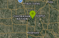
5.5 miles SW of SulphurThe Point Picnic Area is the day-use spot at the very end of the road on The Point, a wooded peninsula that juts into Lake of the Arbuckles just northeast of Arbuckle Dam in Chickasaw National Recreation Area. The National Park Service manages the lake and the land around it, and its swimming page names this picnic area as one of the most popular places on the lake to get in the water. Some swimming-hole sites list it under the informal name Arbuckle Swimming Point. Lake of the Arbuckles is a reservoir of about 2,350 acres with 36 miles of shoreline, and it doubles as a water supply for Ardmore and other towns to the south.
The Point sits about 5.5 miles southwest of downtown Sulphur. From town, head west on Oklahoma 7 and follow the park signs south onto the paved road (Charles F. Cooper Memorial Drive) that runs down the peninsula past The Point Campground and the turnoff for The Point boat ramp. Keep going until the road ends. A paved parking lot sits right beside the picnic tables, with grills, trash and recycling bins, and the lake on three sides within a short walk.
Expect open lakeshore rather than a groomed sand beach, with no lifeguards; the park says plainly that all swimming is at your own risk. Its brochure asks lake swimmers to stay inside boat exclusion areas where they are marked. The shore drops off into a deep reservoir (the state wildlife department lists a maximum depth of 82 feet), so non-swimmers and kids need a life jacket and close supervision. Unlike the cold spring-fed creeks elsewhere in the park, the lake warms up through an Oklahoma summer. During the busy season the park tests bacteria levels at its most popular swimming spots and posts the results on its Bathing Beach Monitoring page, which is worth checking before a visit.
There is no entrance fee for Chickasaw National Recreation Area, and the picnic area and parking at The Point cost nothing. The park charges only for camping and for boat launch permits at the ramps. Outdoor areas of the park are open all the time, though swimming after dark is discouraged by the park.
The main hazard here is boats. Lake of the Arbuckles is busy with motorboats, water skiers and personal watercraft in summer, and swimming is not allowed near boat ramps, courtesy docks or fishing docks, so stay close to shore at the picnic area and away from The Point ramp up the road. Never swim alone or from an unanchored boat. After heavy rain, runoff carries logs and branches into the lake, and the park warns boaters to watch for floating debris; swimmers should look before jumping in. Road and parking lot work can close areas of the park for short stretches, so check the park's conditions page before you go.
The Point Campground, with 55 sites split between an upper and lower loop, is a short drive back up the road, and a ranger station operates on The Point. Two short paths, the Lakeview Trail and the Fishing Rock Trail, follow the shore near the picnic area, and bass, crappie and catfish fishing on the lake is rated among the best in the state. For cold spring-fed creek swimming instead, Little Niagara and the Travertine Creek pools are in the park's Travertine District on the other side of Sulphur.
North Beach
McCall
5.9 miles N of McCallNorth Beach is the northern unit of Ponderosa State Park, managed by the Idaho Department of Parks and Recreation, at the head of Payette Lake about six miles north of downtown McCall in Valley County. The park's main unit sits on a peninsula much closer to town, and the two units are not connected. North Beach is where the North Fork of the Payette River finishes a long run of slow bends through a wetland meadow and empties into the lake. The sand runs along the north shore just east of the river mouth, with marsh and conifer forest behind it and the length of the lake opening up to the south.
There are two ways in. The North Beach boat ramp, on the west side of the river mouth, is about 6.5 miles from McCall: take Highway 55 into town, turn onto Warren Wagon Road and follow it up the west shore. The ramp area has a vault toilet and a parking lot. For the sand itself, take the gravel East Side Road up the lake's east shore to the small gravel day-use lots behind the beach. From there the Peter T. Johnson Trail crosses the wet meadow, partly on boardwalk, and comes out on the east end of the beach after a short walk.
The beach is sand along a gently curving shoreline, and the swimming is in open lake water with no buoyed area or lifeguards listed by the park, so you swim at your own risk. Payette Lake is a deep glacial lake (average depth about 121 feet, maximum about 304) and it is fed by mountain snowmelt, so plan on cool water even in July and August. The lake is held at its normal full level of 4,990 feet in July and drawn down about five and a half feet by December for irrigation, so the shoreline is widest late in the season. Paddlers and small boats use the river channel at the west end all summer, so swim clear of it.
North Beach is not free. Every vehicle entering an Idaho state park pays the Motor Vehicle Entrance Fee, which is $7 per day. Ponderosa is not one of the five parks where non-residents pay a doubled rate, so out-of-state cars pay the same $7. Idaho residents can skip the daily fee with the $10 Idaho State Parks Passport bought with their vehicle registration, and anyone can buy an $80 annual entrance pass. Day-use areas in Idaho state parks are open 7 a.m. to 10 p.m., and the park manager can change those hours. Dogs must be on a leash no longer than six feet.
In August 2021 a dog became ill after swimming in Payette Lake, and the Idaho Department of Environmental Quality sampled three spots, including the western edge of North Beach. The water showed no toxins, but bottom-dwelling cyanobacteria at North Beach carried low levels of cyanotoxins. DEQ issued no health advisory but asked people to use caution here and to keep dogs from eating material off the lake bottom. Check DEQ and Central District Health for newer notices.
Most visitors pair a swim with a paddle up the Meanders, the slow, non-motorized stretch of the North Fork above the lake that winds back and forth through the meadow for miles. Backwoods Adventures rents canoes, kayaks and paddleboards for the North Beach launch in summer, when the launch area can get congested. Short trails wind through the wetland behind the beach, and the park's campgrounds and visitor center are in the main unit near McCall.
×


