


Vivian Creek Trail
Forest Falls, California
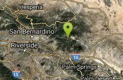
| GPS: |
34°4'55.9"N 116°53'36.8"W Maps | Directions |
| State: | California |
Camp and Hike
The Vivian Creek Trail is the classic — and most direct — route to the summit of Mount San Gorgonio, the highest peak in Southern California at 11,503 feet. Climbing out of Forest Falls into the rugged San Gorgonio Wilderness, this is a bucket-list adventure for fit hikers: a long, steep, lung-busting trek rewarded with sweeping summit views across the SoCal mountains and deserts.
Make no mistake, this is a serious hike. The full round trip runs roughly 17 to 18 miles with a staggering 5,400 feet of elevation gain, typically taking 10 to 12 hours as a (very long) day hike, or it can be split into an overnight backpack using the trail's three designated wilderness camps (Vivian Creek at 7,100 feet, Halfway Camp, and High Creek at 9,200 feet). It's the shortest route to the top, but also the steepest, gaining elevation relentlessly through forest and alpine terrain.
Permits and preparation are essential. A free wilderness permit is required year-round for both day hikes and overnights, available through the San Gorgonio Wilderness Association — and because this is one of the most popular trailheads, quotas fill up, so apply well in advance. An Adventure Pass or Interagency Pass is also needed to park at the trailhead.
Come ready for high-altitude effort: start before dawn, carry plenty of water and food, bring layers and sun protection (weather and temperatures swing dramatically up high), and watch for afternoon thunderstorms. The season runs roughly late spring through fall once the snow clears. Pace yourself for the altitude, pack out everything, and Vivian Creek rewards you with the rooftop of Southern California.
More Information
Be courteous, informed, and prepared. Read trailhead guidelines, stay on the trail, and don't feed the wildlife.
Read More
- Plan Ahead and Prepare
- Travel & camp on durable surfaces
- Dispose of waste properly
- Leave what you find
- Minimize campfire impacts
- Respect wildlife
- Be considerate of other visitors
Directions
From Forest Falls, California
- Head east on Valley of the Falls Dr (0.9 mi)
- Turn right to stay on Valley of the Falls Dr (0.6 mi)
- Continue onto Falls Rd (0.2 mi)
- Turn leftDestination will be on the left(495 ft)
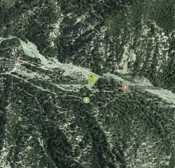
The trailhead is reached by turning east off Highway 38 to Forest Falls. Continue through Forest Falls to the top end (east end) of the Falls Picnic Area at the end of the road.
Other Hiking Trails Nearby
Apple Canyon via Devil's Slide (shuttle hike)
Mountain Center, California
30.0 miles SEHike near Mountain Center, California
Hike
Horse Thief Canyon
Corona, California
39.8 miles SWA hidden off-road playground tucked along the roadside with rocks, trees, and sandpits — a local secret for outdoor fun in the Lake Elsinore/Corona area.
Airsoft, Hike
Dripping Springs Trail/Agua Tibia Wilderness
Temecula, California
42.9 miles SA strenuous Agua Tibia Wilderness trail with immediate climbing, long switchbacks, and a high-elevation traverse — best in fall, winter, or spring; carry water and skip summer visits.
Hike
Oak Grove/High Point Trail
Warner Springs, California
48.7 miles SA steep but rewarding trail in the Palomar District near Warner Springs with great views of the San Jacinto and San Gorgonio Mountains and optional 5-mile extension to the High Point Lookout. Bring lots of water.
Hike, Mountain Bike


