


151 Things to do near 24 Rainbow Loop, Yellowstone National Park, WY 82190
first prev 1 2 3 4 5 6 7 8 next lastShowing results within 50 miles Distance miles of 24 Rainbow Loop, Yellowstone National Park, WY 82190, USA City, Zip, or Address

Porcupine Creek
Ashton, Idaho
39.0 miles SWPorcupine Creek is a hunting, fishing, camping, and swimming spot near Ashton, Idaho in Fremont County within Targhee National Forest. It's surrounded by forests, meadows, and a creek...
Camp, Swim
Hellroaring Creek Trail
Yellowstone National Park
39.1 miles NIf the name didn't scare you enough, the Hellroaring creek trail begins with an arduous descent down to the the Yellowstone River Suspension Bridge.The suspension bridge is a beautiful...
Camp, Hike, Swim 7.4 mi
Blacktail Deer Creek to Yellowstone River Trail
Mammoth Hot Springs, Yellowstone National Park
39.2 miles NBlacktail Deer Creek Trail is a 7 mile out and back trail that leads to the Yellowstone River. Hikers on this trail will enjoy seeing green open fields, boulder formations and waterfalls at the...
Hike
Forces of the Northern Range
Mammoth, Yellowstone National Park
39.4 miles NThis short 1/2 mile boardwalk located on the Blacktail Deer Plateau between Mammoth Village and Tower Junction will open your eyes and educate you about forces of nature that have sculpted the land...
Hike
The Pit
Ashton, Idaho
39.6 miles SWThis location is great because there is no one around only locals know of this area and you can shoot anything out there. Watch out for target shooters there! Also stay away from the main road.
Airsoft, Paintball 0.3-0.6 mi
Bear Gulch
Ashton, Idaho
39.8 miles SWBear Gulch is an abandoned ski hill out of operation since 1969. While the vegetation is beginning to take over, there's still some great sledding to be had. It's just far enough into the...
Camp, Cross-country Ski, Hike, Sled
Mt. Moran
Alta, Wyoming
39.9 miles SMount Moran (12,610 feet (3,840 m)) is a mountain in Grand Teton National Park of western Wyoming, USA. The mountain is named for Thomas Moran, an American western frontier landscape artist....
Hike 0.9 mi
Buffalo River Campground
Island Park, Idaho
40.0 miles WThe float here is nice and easy. It's a great early season float. Later in the season the shallow spots will force you to walk a good chunk of the float. The water is super clear and often pretty...
Camp, Canoe, Kayak, Swim 2.0 mi
Snow Pass Trail
Yellowstone National Park Wyoming
40.1 miles NSnow Pass Trail is a beautiful day hike for visitors to Yellowstone looking to escape the crowds. Located a half mile south of the Mammoth Hot Springs Upper Terraces. Parking is available at a...
Backpack, Hike 8.5 mi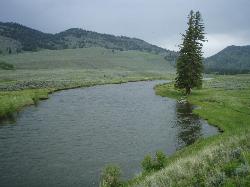
Slough Creek Trail
Tower Junction, Yellowstone National Park
40.1 miles NSlough Creek Trail is a 3.4 mile out and back trail that follows a historic wagon trail through several meadows. This trail is a fairly easy hike that has beautiful views of Slough Creek. The...
Hike
Slough Creek Campground
Tower Junction, Yellowstone National Park
40.5 miles NSlough Creek campground is a small but very popular campground on the Northeast Entrance Road. Most of the campsites are situated right on the banks of Slough Creek where fishing is a favorite...
Camp
Upper Coffee Pot Campground
Island Park, Idaho
40.6 miles WUpper Coffeepot Campground stretches along a floatable section of Henry's Fork of the Snake River. A mixed growth lodgepole pine forest provides partial shade and summer wildflowers are...
Camp, Canoe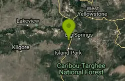
Coffee Pot Rapids Trail
Island Park, Idaho
40.6 miles WHiker and fisherman parking is available at the campground entrance. Coffee Pot Rapids trail is 2.2 miles in length, is a non-motorized trail that follows the Henry's Fork of the Snake...
Mountain Bike
Mesa Falls
Ashton, Idaho
40.7 miles WUpper Mesa Falls, aka Big Falls, is an absolutely awesome waterfall on the Henrys Fork of the Snake River. The falls drop 114 ft. and measure 300 ft. across. To get to the falls from the parking lot...
Cross-country Ski, Hike, Kayak
Falls River, Lower Run
Ashton, Idaho
40.9 miles SWFall River rises on the Madison and Pitchstone plateaus in the southwest corner of Yellowstone National Park, Wyoming and flows approximately 64 miles (103 km) to its confluence with the Henrys Fork...
Whitewater 5.3 mi
Beaver Ponds Trail
Mammoth, Yellowstone National Park
41.0 miles NBeaver Ponds Trail is a wonderful short hike accessible from Mammoth Hot Springs. The trail forms a loop between the two trailheads available at Mammoth Hot Springs. The loop is just over 5 miles...
Hike 8.1 mi

Sepulcher Mountain Trail
Mammoth Hot Springs, Yellowstone National Park
41.0 miles NSepulcher Mountain Trail is an 11 mile loop trail from Mammoth Hot Springs to the peak of Sepulcher Mountain. This is a challenging hike with a 3,500 foot ascent to the 9,652 foot peak. The...
Hike 0.1-5.2 mi
Mammoth Hot Springs
Mammoth, Yellowstone National Park
41.0 miles NMammoth Hot Springs is a unique sight in Yellowstone National Park. The soft limestone in this area allowed the water to form colorful terraces. The extremely hot running water is clear and smooth,...
Camp, Hike 4.0 mi
Lava Creek Trail
Mammoth Hot Springs, Yellowstone National Park
41.0 miles NLava Creek Trail is a 4.2 mile hike where hikers can enjoy walking along the scenic Lava Creek. The trail passes Undine Falls and the Gardner River. Undine Falls is a beautiful 60 foot...
Hike 0.6-1.5 mi
Trout Lake and Buck Lake
Tower Junction, Yellowstone National Park
41.1 miles NEThe Trout Lake trail is a steep 1/2-mile trail through a Douglas fir forest which leads to the lake. Trout Lake is also known to be called Fish Lake and Soda Butte Lake .The most difficult...
Hike


