Lava Creek Trail
Mammoth Hot Springs, Yellowstone National Park
| Address: | 25 Cedar Terrace Avenue, Yellowstone National Park, WY 82190, USA |
| GPS: |
44°58'31.8"N 110°41'33.5"W Maps | Directions |
| State: | Wyoming |
| Trails/Routes: | 4.0 mi |
Streams Trails National Park Pet Friendly
Hike
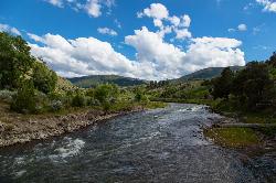
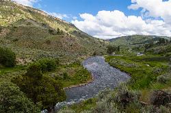
Lava Creek Trail is a 4.2 mile hike where hikers can enjoy walking along the scenic Lava Creek. The trail passes Undine Falls and the Gardner River. Undine Falls is a beautiful 60 foot tiered waterfall and a great place to take a break and enjoy the scenery.
From several spots on Lava Creek Trail hikers have a distant view of Mammoth Hot Springs. The trail also winds through beautiful meadows and past Mount Everts. Elk and Bison are frequently spotted on the ridges in this area. Look closely and you might spot them too, but be careful to keep a safe distance from any wildlife.
The Trailhead can be found on North Entrance Road, across from the Lava Creek Picnic Area or from Mammoth Campground. This trail begins and ends at different trailheads so hikers should arrange for a vehicle to be at the other end of the trail or should plan on hiking 8.4 miles out and back.
This is one of few trails in Yellowstone that can be hiked in any season. Lava Creek Trail makes for a scenic winter hike for those brave enough to weather the cold.
Lava Creek Trail is beautiful path to enjoy the wonders of Yellowstone on.
More Information
Be courteous, informed, and prepared. Read trailhead guidelines, stay on the trail, and don't feed the wildlife.
Read MoreDirections
From Mammoth Hot Springs, Yellowstone National Park
- Head northeast on US-89 N toward Stable StToll road(0.1 mi)
- Turn right to stay on US-89 NToll road(0.8 mi)
- Turn right onto Cedar Terrace AveRestricted usage roadDestination will be on the left(62 ft)
Added by tasiawhicker
Trails
Distance ?
4.0 milesElevation Gain ?
495 feetReal Ascent ?
1,036 feetReal Descent ?
541 feetAvg Grade (1°)
2%Grade (-28° to 14°)
-52% to 25%Elevation differences are scaled for emphasis. While the numbers are accurate, the cut-away shown here is not to scale.
Other Hiking Trails Nearby

Mammoth/Gardiner Back Road
Mammoth Hot Springs, Yellowstone National Park
0.4 miles WThe only road open in Yellowstone National Park is Highway 89 at Gardiner, Montana to park Headquarters at Mammoth Hot Springs and from Mammoth Hot Springs to Silver Gate and Cooke City, Montana.
Hike, Mountain Bike 0.1-5.2 mi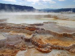
Mammoth Hot Springs
Mammoth, Yellowstone National Park
0.5 miles WMammoth Hot Springs is a unique sight in Yellowstone National Park. The soft limestone in this area allowed the water to form colorful terraces. The extremely hot running water is clear and smooth,...
Camp, Hike 5.3 mi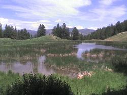
Beaver Ponds Trail
Mammoth, Yellowstone National Park
0.6 miles WBeaver Ponds Trail is a wonderful short hike accessible from Mammoth Hot Springs. The trail forms a loop between the two trailheads available at Mammoth Hot Springs. The loop is just over 5 miles...
Hike 8.1 mi
Sepulcher Mountain Trail
Mammoth Hot Springs, Yellowstone National Park
0.6 miles WSepulcher Mountain Trail is an 11 mile loop trail from Mammoth Hot Springs to the peak of Sepulcher Mountain. This is a challenging hike with a 3,500 foot ascent to the 9,652 foot peak. The...
Hike 2.0 mi
Snow Pass Trail
Yellowstone National Park Wyoming
1.5 miles SWSnow Pass Trail is a beautiful day hike for visitors to Yellowstone looking to escape the crowds. Located a half mile south of the Mammoth Hot Springs Upper Terraces. Parking is available at a...
Backpack, Hike 7.9 mi
Rescue Creek Trail
Mammoth Hot Springs, Yellowstone National Park
2.9 miles NRescue Creek Trail is an 8 mile hike that crosses the Montana/Wyoming boarder. This double trail makes for a leisurely hike through beautiful hills and colorful yellow green grasslands. This trail,...
Hike 4.0 mi
Bunsen Peak Trail
Mammoth Hot Springs, Yellowstone National Park
3.4 miles SWBunsen Peak Trail is a 4.6 mile hike to the peak of Mount Bunsen. This is an out and back trail and is considered moderately difficult because of the 1,300 foot climb in elevation. ...
Hike 7.8 mi
Osprey Falls Trail
Mammoth Hot Springs, Yellowstone National Park
3.5 miles SWOsprey Falls Trail is an 8 mile out and back trail near Mammoth Hot Springs that provides hikers with a variety of stunning views, including ravines and a waterfall. Hikers begin this hike...
Hike 0.8 mi
Wraith Falls Trail
Mammoth Hot Springs, Yellowstone National Park
4.1 miles SEWraith Falls Trail is a less than 1 mile there and back hike that can be taken in under an hour. This is a wonderful family friendly hike that is easy for hikers of all levels. The hike leads...
Hike 7.4 mi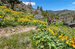
Blacktail Deer Creek to Yellowstone River Trail
Mammoth Hot Springs, Yellowstone National Park
5.0 miles EBlacktail Deer Creek Trail is a 7 mile out and back trail that leads to the Yellowstone River. Hikers on this trail will enjoy seeing green open fields, boulder formations and waterfalls at the...
Hike
Forces of the Northern Range
Mammoth, Yellowstone National Park
6.3 miles EThis short 1/2 mile boardwalk located on the Blacktail Deer Plateau between Mammoth Village and Tower Junction will open your eyes and educate you about forces of nature that have sculpted the land...
Hike
Hellroaring Creek Trail
Yellowstone National Park
12.7 miles EIf the name didn't scare you enough, the Hellroaring creek trail begins with an arduous descent down to the the Yellowstone River Suspension Bridge.The suspension bridge is a beautiful...
Camp, Hike, Swim 2.4 mi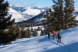
Lost Lake Trail
Tower Junction, Yellowstone National Park
14.0 miles ELost Lake Trail is a 2.8 mile hike that can be completed in less than two hours. This is an easy hike with very little elevation change. Hikers can enjoy forests, meadows and a view of Lost Lake...
Hike 8.2 mi
Garnet Hill Trail
Tower Junction, Yellowstone National Park
14.3 miles EGarnet Hill Trail is a 7.6 mile loop that follows an old, dirt stagecoach road. This trail passes through large meadows, dusty areas with sagebrush, forests and beside the Yellowstone River. This...
Hike 7.3 mi
Agate Creek Trail
Tower Junction, Wyoming
14.9 miles EAgate Creek Trail is a moderately difficult trail through some of Yellowstone's most beautiful and isolated landscapes. This 7.3 mile hike starts at the Yellowstone River Picnic Area. Parking is...
Hike 0.3 mi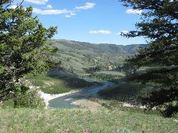
Yellowstone River Picnic Area Trail
Tower Junction, Yellowstone National Park
14.9 miles EThe Yellowstone River Picnic Area trail is 3.9 miles loop trail. It is called the Yellowstone Picnic Area trail because the beginning of the trail is in a picnic area.This hike features a...
Hike 16.9 mi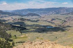
Specimen Ridge Trail (2K4)
Buffalo Ford, Wyoming
15.6 miles ESpecimen Ridge Trail is a challenging hike that requires navigational and technical skills to complete. This 17 mile hike is remote, and though it is marked by carins and blazes, it is often...
Hike
Tower Falls
Tower Junction, Yellowstone National Park
16.1 miles ETower Fall is a waterfall on Tower Creek in the northeastern region of Yellowstone National Park, in the U.S. state of Wyoming. Approximately 1,000 yards (910 m) upstream from the creek's...
Camp, Hike 3.4 mi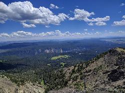
Dunraven Pass - Mount Washburn Trail
Canyon Village, Yellowstone National Park
17.6 miles SEHikers looking for a scenic hike to the peak Mount Washburn will be pleased hiking the Mount Washburn Trail via Dunraven Pass. This trail winds through quiet forests to the peak. The trailhead for...
Hike 16.3 mi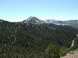
Mount Washburn Spur Trail
Canyon Village, Yellowstone National Park
17.6 miles SEWashburn Spur Trail is an exciting 8-mile trail connecting the peak of Mount Washburn to Seven Mile Hole Trail near Canyon Village. Hikers typically hike the trail starting at Mount Washburn and...
HikeNearby Campsites
Mammoth Hot Springs Campground
Mammoth Hot Springs, Yellowstone National Park
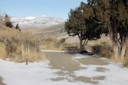
0.1 miles NWMammoth Hot Springs Campground is the only campground in Yellowstone that is open to campers year-round. Campsites cannot be reserved and are available on a first come first served basis. It is...
Camp 0.1-5.2 mi
Mammoth Hot Springs
Mammoth, Yellowstone National Park
0.5 miles WMammoth Hot Springs is a unique sight in Yellowstone National Park. The soft limestone in this area allowed the water to form colorful terraces. The extremely hot running water is clear and smooth,...
Camp, Hike
Indian Creek Campground Yellowstone
Mammoth Hot Springs, Yellowstone National Park
6.8 miles SIndian Creek Campground is a quiet and secluded wooded campground within Yellowstone National Park, ideal for tent campers. It’s close to lots of hiking and fishing, and only a few miles to...
Camp
Hellroaring Creek Trail
Yellowstone National Park
12.7 miles EIf the name didn't scare you enough, the Hellroaring creek trail begins with an arduous descent down to the the Yellowstone River Suspension Bridge.The suspension bridge is a beautiful...
Camp, Hike, Swim
Tower Falls
Tower Junction, Yellowstone National Park
16.1 miles ETower Fall is a waterfall on Tower Creek in the northeastern region of Yellowstone National Park, in the U.S. state of Wyoming. Approximately 1,000 yards (910 m) upstream from the creek's...
Camp, Hike
Norris Campground
Norris, Yellowstone National Park
16.4 miles SNorris campground is centrally located in Yellowstone National Park and offers a good spot for those planning to visit many of the most famous features in Yellowstone. Norris is a relatively short...
Camp 1.5-3.8 mi
Little Gibbon Falls
Norris, Yellowstone National Park
18.4 miles SIce Lake and Little Gibbon Falls Loop is a 4.5 mile loop trail located near Yellowstone National Park, Wyoming. The trail is good for all skill levels and primarily used for hiking, but there are...
Camp, Canoe, Hike
Slough Creek Campground
Tower Junction, Yellowstone National Park
19.0 miles ESlough Creek campground is a small but very popular campground on the Northeast Entrance Road. Most of the campsites are situated right on the banks of Slough Creek where fishing is a favorite...
Camp
Canyon Campground
Canyon Junction, Yellowstone National Park
19.4 miles SECanyon Campground is a popular choice for visitors to Yellowstone National Park, and it's easy to see why. Located in the heart of the park, the campground offers easy access to some of the...
Camp
Madison Campground
Madison, Yellowstone National Park
24.4 miles SMadison Campground is named for its proximity to the Madison River, which runs through the area in a lush mountain setting rich in wildlife. Madison Campground is at an elevation of 6,800’ and...
Camp
Pebble Creek Campground
Northeast Entrance, Yellowstone National Park
28.6 miles EPebble Creek is a popular campground for fishermen and those seeking a more quiet and smaller campground in Yellowstone National Park. The campsites can fill very early, so get there before 11 AM...
Camp
Fishing Bridge RV Campground
Lake Village, Yellowstone National Park
32.6 miles SEThe Fishing Bridge Recreational Vehicle Park is located near the mouth of the Yellowstone River as it leaves Yellowstone Lake. The RV park is named after the Fishing Bridge, a wooden vehicle bridge...
Camp
Bridge Bay
Lake Village, Yellowstone National Park
33.0 miles SBridge Bay Campground was named for its proximity to Bridge Bay Marina on Yellowstone Lake. The area is quite scenic, with wooded areas, open meadows and some limited views of the lake. Because of...
Camp 14.8 mi
Biscuit Basin to Fairy Falls and Firehole Meadows
Old Faithful, Yellowstone National Park
35.8 miles SFreight Road trail is a almost 15 mile hike that leaves from Biscuit Basin or Fountain Flats Drive. This hike is a beautiful remote hike that passes several unique landmarks, breaking up this hike...
Backpack, Camp, Hike
Grant Village
Grant Village, Yellowstone National Park
40.7 miles SGrant Village was built in 1984 and named after Ulysses S. Grant, president when Yellowstone became the world’s first national park in 1872. Located near the West Thumb of Yellowstone Lake,...
Camp, Canoe, Kayak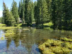
Big Springs
Island Park, Idaho
43.2 miles SWThere's also a great little walking trail along the river with placards that tell about the ecosystem and history of the area. There's about a 1/2 mile that's paved and then a 1/2 mile...
Camp, Hike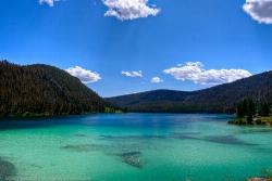
Wade Lake
Cameron, Montana
44.3 miles WCamp, Canoe, Kayak, and Swim near Cameron, Montana
Camp, Canoe, Kayak, Swim 6.9 mi
Heart Lake Trail
Grant Village, Yellowstone National Park
45.7 miles SThe trail is very clear and leads to a moderate eight mile hike to Heart Lake. This hike has many possibilities. Day hikers need to push their time to make sure they are on the trail early to allow...
Backpack, Camp, Hike, Hot Springs
Upper Coffee Pot Campground
Island Park, Idaho
47.1 miles SWUpper Coffeepot Campground stretches along a floatable section of Henry's Fork of the Snake River. A mixed growth lodgepole pine forest provides partial shade and summer wildflowers are...
Camp, Canoe 0.1 mi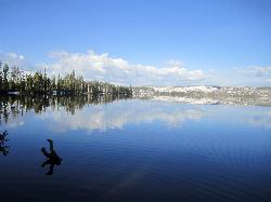
Lewis Lake Campground
Grant Village, Yellowstone National Park
48.0 miles SLewis Lake is located in the southern part of Yellowstone National Park. It is 4 miles southeast of Shoshone Lake. Lewis Lake offers a plethora great water activities. This lake offers...
Camp, Canoe, Kayak


