


Bright Angel Trail to Bright Angel Campground and River Trail
Grand Canyon Village, Arizona
| Address: | ~15 Bright Angel Trail, Grand Canyon Village, AZ 86023, USA |
| GPS: |
36°3'26.0"N 112°8'37.6"W Maps | Directions |
| State: | Arizona |
| Trail Length: | 19.00 miles |
| Trail Type: | Out & Back |
| Hike Difficulty: | Advanced |
| Elevation Gain: | 5029 feet |
| Trails/Routes: | 4.5 mi |
Restrooms Trails National Park Pet Friendly
Backpack, Camp, Hike, and Rock Climb
The Bright Angel Trail is the Grand Canyon's most storied footpath — the classic corridor route from the South Rim down to the Colorado River, walked by everyone from first-time day hikers to rim-to-rim veterans. Following a natural break in the cliffs along the Bright Angel Fault, it descends about 9.5 miles from the trailhead near Kolb Studio and Bright Angel Lodge (around 6,850 feet) to the river far below, where the River Trail leads on to Bright Angel Campground and Phantom Ranch — roughly 11 miles and nearly 4,400 feet of descent in all.
The trail is a walk through both geologic and human history. The route follows an ancient path used by the Havasupai, later widened into a toll trail around 1890 by prospectors Pete Berry and Ralph Cameron. In the first mile you pass through two tunnels blasted in the 1930s, and just below the upper one lies Mallery's Grotto, a rock alcove bearing pictographs — including deer — painted by Native peoples over many centuries. The stone resthouses at 1.5 and 3 miles were hand-built by the Civilian Conservation Corps in 1935–36 and offer shade, benches, seasonal water, and emergency phones.
At 4.5 miles the trail reaches Havasupai Gardens (long known as Indian Garden), a green oasis of cottonwoods — trees planted by Ralph Cameron — with water, a ranger station, and a campground; a side trail continues to Plateau Point and its dizzying overlook of the inner gorge. Below the gardens the trail drops through the tight switchbacks of the Devil's Corkscrew, cut into the black, roughly two-billion-year-old Vishnu Schist — the oldest rock in the canyon — before following Pipe Creek to the river and crossing the Silver Bridge to the campground and Phantom Ranch.
This is also the canyon's classic mule route. Pack trains and mule rides have used it since the late 1800s, and hikers must yield: step to the inside (uphill) edge, stand still, and follow the wrangler's instructions as the animals pass.
Do not try to hike from the rim to the river and back in a single day. The Park Service warns against it in the strongest terms — the relentless climb out, extreme heat, and roughly 4,400 feet of elevation change cause rescues and deaths here every year. Excellent day-hike turnarounds are the 1.5-Mile Resthouse (3 miles round trip), the 3-Mile Resthouse (6 miles), and Havasupai Gardens (9 miles round trip); anything below that is for very fit, prepared hikers or overnighters with a permit. Camping below the rim requires a backcountry permit.
A park entrance fee applies. Carry far more water and salty food than you think you need, use the seasonal water stations (confirm which are running before you start), begin at dawn in summer, and remember the golden rule of the canyon: going down is optional, but coming back up is mandatory.
More Information
Grand Canyon National Park Itinerary
This Grand Canyon National Park Itinerary will help you get started as you plan your vacation to Grand Canyon National Park.
https://www.justgotravelstudios.com/collections/national-park-itineraries/products/grand-canyon-national-park-itinerary?ref=9zpxis0diinBright Angel Trail (U.S. National Park Service)
The most popular hiking trail into Grand Canyon, the Bright Angel Trail lets hikers walk in the footsteps of the canyon’s Indigenous peoples, miners, and early tourists, as they descend into the canyon’s depths.
https://www.nps.gov/places/000/bright-angel-trail.htmbrightangeltrail.pdf
Day Hike - Bright Angel Trail
https://www.nps.gov/grca/planyourvisit/upload/brightangeltrail.pdfBe courteous, informed, and prepared. Read trailhead guidelines, stay on the trail, and don't feed the wildlife.
Read More
- Plan Ahead and Prepare
- Travel & camp on durable surfaces
- Dispose of waste properly
- Leave what you find
- Minimize campfire impacts
- Respect wildlife
- Be considerate of other visitors
Directions
From Grand Canyon Village, Arizona
- Head west (344 ft)
- Turn right toward Village Loop Drive (141 ft)
- Turn right onto Village Loop Drive (0.4 mi)
- Turn left to stay on Village Loop DriveDestination will be on the right(0.5 mi)
To reach the Bright Angel trailhead, located west of the Bright Angel Lodge you have two options, either park at Lot D at the Backcountry Information Center and walk 5 minutes to the trailhead, or park at the Grand Canyon Visitor Center and catch the free shuttle bus (:20 minutes one way). Courtesy of nps.gov.


Other Rock Climbing Walls, Hiking Trails, and Backpacking Trails Nearby
Bright Angel Trail to Three-Mile Rest house
Grand Canyon Village, Arizona
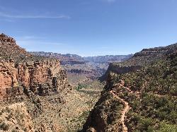
0.0 miles SWA steep 5.4-mile out-and-back trail descending into the Grand Canyon with 360-degree canyon views and extreme switchbacks — water and pit toilets at the Three-Mile Resthouse turnaround point.
Backpack, Camp, Hike 1.5-9.8 mi
The Bright Angel Trails
Grand Canyon Village, Arizona
0.0 miles NEMultiple Bright Angel Trail routes range from a 5.4-mile out-and-back to the Three-Mile Resthouse to a 19-mile trek to the river, with the 12.4-mile South Kaibab–Tonto–Bright Angel point-to-point offering over 3,000 feet of Grand Canyon grandeur.
Backpack, Camp, Hike, Horseback 4.9 mi
Bright Angel Trail to Tonto Trail
Grand Canyon Village, Arizona
0.0 miles SWA rugged 12.4-mile point-to-point through Grand Canyon's inner gorge on the South Kaibab–Tonto Trail corridor, with over 3,000 feet of elevation gain — advanced hikers only.
Backpack, Camp, Hike 8.4 mi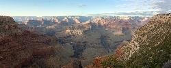
Grand Canyon Rim Village to Hermits Rest
Grand Canyon Village, Arizona
0.0 miles SWA bus-accessible, kid-friendly trail from the Grand Canyon Rim Village to the historic 1914 Hermits Rest cabin — featuring stunning river views, wildflowers, wildlife, and a gift shop and snack bar at the end.
Backpack, Hike 
South Rim Visitor Center Trail
Grand Canyon Village, Arizona
0.9 miles EA short, well-marked connector trail near the South Rim Visitor Center of Grand Canyon National Park, leading to a nearby restaurant with rock and geological timeline markers along the way — great for kids.
Hike 0.6 mi
Mather Campground Trail
Grand Canyon Village, Arizona
1.6 miles EA 1-mile connector trail adjacent to Mather Campground on the Grand Canyon South Rim — flat and easy for biking, running, or walking with pets on leash; campground has RV options nearby.
Camp, Hike, Mountain Bike 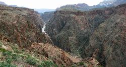
Clear Creek Trail
Grand Canyon Village, Arizona
3.3 miles EA 4–6 day Grand Canyon backpack deep into a fascinating, off-the-beaten-track drainage — bring plenty of water, as Clear Creek is the only reliable source on trail.
Backpack, Camp, Hike 13.6 mi
South Kaibab Trails
Grand Canyon Village, Arizona
3.3 miles ESeven miles of ridgeline descent from Yaki Point to the canyon floor — no shade, no water on trail, and the best unobstructed Grand Canyon panoramas you'll find on any hike.
Camp, Hike, Horseback 5.7 mi
Rim Trail
Grand Canyon Village, Arizona
3.4 miles EA mostly paved 12-mile walking path along the South Rim with spectacular Grand Canyon views, shaded areas, accessible sections for wheelchairs and strollers, and optional shuttle service.
Hike, Mountain Bike 
South Kaibab to Phantom Ranch to Bright Angel Trail
Grand Canyon Village, Arizona
3.4 miles EA difficult but spectacular multi-day Grand Canyon hike combining South Kaibab's stunning rim views with Phantom Ranch's riverside oasis and Bright Angel's shaded water stations.
Backpack, Camp, Hike 
South Kaibab to North Kaibab to Bright Angel Trail
Grand Canyon Village, Arizona
3.4 miles EThe Grand Canyon's legendary Rim-to-Rim-to-Rim route — 44 miles and 20,000 feet of elevation change combining South Kaibab, North Kaibab, and Bright Angel trails for an epic multi-day adventure.
Backpack, Camp, Hike 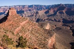
The Grand Canyon: Kaibab to Bright Angel Trail
Grand Canyon Village, Arizona
3.4 miles EAn unforgettable 2-3 day hike combining the South Kaibab's unbeatable views with the shaded, water-rich Bright Angel Trail — staring up at the canyon from the river below.
Backpack, Camp, Hike 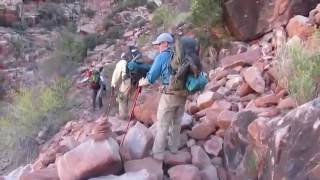
Hermit Trail
Grand Canyon Village, Arizona
3.8 miles WA strenuous, less-crowded Grand Canyon backpacking trail with 2,000 feet of descent in the first 2.5 miles, Cathedral stairs, Redwall cliffs, and fossilized animal tracks.
Backpack, Camp, Hike 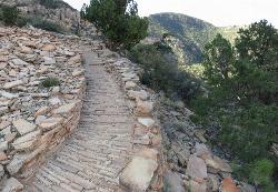
Hermit's Rest Viewpoint to Tonto Trail to Bright Angel Trail
Grand Canyon Village, Arizona
3.8 miles WA multi-day Grand Canyon backpacking route crossing the Tonto Trail from Hermit's Rest to Bright Angel — spectacular inner canyon views with limited water sources and 3,000-foot rim access by foot only.
Backpack, Camp, Hike 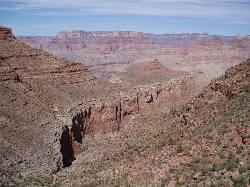
Boucher Trail to Hermit Trail Loop
Grand Canyon Village, Arizona
3.8 miles WA demanding 3–4 day backpacking loop on the Grand Canyon's South Rim — even seasoned hikers consider the Boucher Trail the most difficult and hazardous South Rim route.
Backpack, Camp, Hike 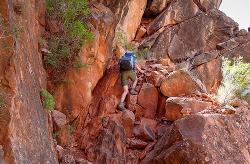
Boucher Trail
Grand Canyon Village, Arizona
3.8 miles WA remote 17.7-mile out-and-back trail to the Colorado River at the base of the Grand Canyon — recommended for very experienced adventurers only, best March through October.
Backpack, Hike 
Hermit's Rest Viewpoint to Santa Maria Spring
Grand Canyon Village, Arizona
3.8 miles WThe Hermit Trail to Santa Maria Spring is a rugged, uncrowded Grand Canyon South Rim hike with steep switchbacks and huge views.
Backpack, Hike 7.7 mi
Waldron Trail
Grand Canyon Village, Arizona
3.8 miles WA short but demanding 4.9-mile Grand Canyon hike branching off Hermit Trail, packed with views and adventure — bring a water treatment kit and prepare for dehydration, flash flooding, and overexertion.
Hike 
Hermits Rest Viewpoint to Dripping Springs Trail
Grand Canyon Village, Arizona
3.8 miles WThe hike to Dripping Springs via the Hermit Trail is a rugged, uncrowded Grand Canyon South Rim trek to a fern-fringed spring overhang.
Backpack, Hike 1.1 mi
Shoshone Point Trail
Grand Canyon Village, Arizona
4.4 miles EA nearly level 1-mile dirt road through ponderosa pine opens to a stunning canyon overlook at Shoshone Point — a quiet, uncrowded gem with canyon rim views and a cool rock formation.
HikeNearby Campsites
Bright Angel Trail to Three-Mile Rest house
Grand Canyon Village, Arizona
0.0 miles SWA steep 5.4-mile out-and-back trail descending into the Grand Canyon with 360-degree canyon views and extreme switchbacks — water and pit toilets at the Three-Mile Resthouse turnaround point.
Backpack, Camp, Hike 1.5-9.8 mi
The Bright Angel Trails
Grand Canyon Village, Arizona
0.0 miles NEMultiple Bright Angel Trail routes range from a 5.4-mile out-and-back to the Three-Mile Resthouse to a 19-mile trek to the river, with the 12.4-mile South Kaibab–Tonto–Bright Angel point-to-point offering over 3,000 feet of Grand Canyon grandeur.
Backpack, Camp, Hike, Horseback 4.9 mi
Bright Angel Trail to Tonto Trail
Grand Canyon Village, Arizona
0.0 miles SWA rugged 12.4-mile point-to-point through Grand Canyon's inner gorge on the South Kaibab–Tonto Trail corridor, with over 3,000 feet of elevation gain — advanced hikers only.
Backpack, Camp, Hike 0.6 mi
Mather Campground Trail
Grand Canyon Village, Arizona
1.6 miles EA 1-mile connector trail adjacent to Mather Campground on the Grand Canyon South Rim — flat and easy for biking, running, or walking with pets on leash; campground has RV options nearby.
Camp, Hike, Mountain Bike
Clear Creek Trail
Grand Canyon Village, Arizona
3.3 miles EA 4–6 day Grand Canyon backpack deep into a fascinating, off-the-beaten-track drainage — bring plenty of water, as Clear Creek is the only reliable source on trail.
Backpack, Camp, Hike 13.6 mi
South Kaibab Trails
Grand Canyon Village, Arizona
3.3 miles ESeven miles of ridgeline descent from Yaki Point to the canyon floor — no shade, no water on trail, and the best unobstructed Grand Canyon panoramas you'll find on any hike.
Camp, Hike, Horseback
South Kaibab to Phantom Ranch to Bright Angel Trail
Grand Canyon Village, Arizona
3.4 miles EA difficult but spectacular multi-day Grand Canyon hike combining South Kaibab's stunning rim views with Phantom Ranch's riverside oasis and Bright Angel's shaded water stations.
Backpack, Camp, Hike
South Kaibab to North Kaibab to Bright Angel Trail
Grand Canyon Village, Arizona
3.4 miles EThe Grand Canyon's legendary Rim-to-Rim-to-Rim route — 44 miles and 20,000 feet of elevation change combining South Kaibab, North Kaibab, and Bright Angel trails for an epic multi-day adventure.
Backpack, Camp, Hike
The Grand Canyon: Kaibab to Bright Angel Trail
Grand Canyon Village, Arizona
3.4 miles EAn unforgettable 2-3 day hike combining the South Kaibab's unbeatable views with the shaded, water-rich Bright Angel Trail — staring up at the canyon from the river below.
Backpack, Camp, Hike
Hermit Trail
Grand Canyon Village, Arizona
3.8 miles WA strenuous, less-crowded Grand Canyon backpacking trail with 2,000 feet of descent in the first 2.5 miles, Cathedral stairs, Redwall cliffs, and fossilized animal tracks.
Backpack, Camp, Hike
Hermit's Rest Viewpoint to Tonto Trail to Bright Angel Trail
Grand Canyon Village, Arizona
3.8 miles WA multi-day Grand Canyon backpacking route crossing the Tonto Trail from Hermit's Rest to Bright Angel — spectacular inner canyon views with limited water sources and 3,000-foot rim access by foot only.
Backpack, Camp, Hike
Boucher Trail to Hermit Trail Loop
Grand Canyon Village, Arizona
3.8 miles WA demanding 3–4 day backpacking loop on the Grand Canyon's South Rim — even seasoned hikers consider the Boucher Trail the most difficult and hazardous South Rim route.
Backpack, Camp, Hike 
Grand Canyon South Rim Area Campgrounds
Grand Canyon Village, Arizona
6.1 miles SCampgrounds at the Grand Canyon's South Rim, one of the most iconic settings in the American Southwest.
Camp 
Grandview Trail Loop
Grand Canyon Village, Arizona
9.6 miles SEA scenic Grand Canyon hiking trail — mountain bikes are illegal on Canyon trails, so lace up your boots and enjoy the views on foot.
Backpack, Camp, Cross-country Ski, Hike 
Tonto Trail from Grandview Point to South Kaibab Trailhead
Grand Canyon Village, Arizona
9.7 miles SEA rigorous four-to-five-day point-to-point backpack along the scenic, remote Tonto Trail from Grandview Point to the South Kaibab Trailhead — recommended for experienced Grand Canyon backpackers with careful water planning.
Backpack, Camp, Hike 
North Kaibab Trail to Colorado River
North Rim, Arizona
12.1 miles NEA steep, well-maintained, and well-marked trail dropping from the North Rim to the Colorado River — perfect for experienced hikers ready for serious elevation change.
Backpack, Camp, Hike 
Phantom Ranch to Ribbon Falls on North Kaibab Trail
North Rim, Arizona
12.1 miles NEA classic Grand Canyon corridor hike on the North Kaibab Trail from Phantom Ranch to Ribbon Falls.
Camp, Hike 
Rim-to-Rim: North Kaibab to Grand Canyon Village
North Rim, Arizona
12.1 miles NEA four-day rim-to-rim Grand Canyon hike with stops at Ribbon Falls, Phantom Ranch, Cottonwood Camp, and a sunset at Plateau Point that must be seen to be believed.
Backpack, Camp, Hike 
Uncle Jim Trail
North Rim, Arizona
12.1 miles NEThe Uncle Jim Trail is an easy 4.7-mile North Rim loop to Uncle Jim Point, with jaw-dropping views over Roaring Springs and Bright Angel canyons.
Backpack, Camp, Hike 6.3 mi
Tiyo Point Trail
North Rim, Arizona
12.2 miles NA lightly traveled primitive North Rim trail through encroaching forest with old markers on trees, wildflowers, gentle rolling terrain, and a single picnic area near the end.
Backpack, Camp, Hike


