


41 Backpacking Trails near South Bass Trail
first prev 1 2 3 next lastShowing Backpacking Trails within 50 miles Distance miles of Unnamed Road, Supai, AZ 86435, USA City, Zip, or Address
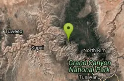
North Bass Trail
North Rim, Arizona
10.6 miles NDirections from North Rim Entrance Station: Drive northward to Forest Service Road (FSR) 422 and turn left. Follow 422 to FSR 270 and turn left. Drive approximately 3 miles to FSR 223...
Backpack, Camp, Hike
Powell Plateau Trail
North Rim, Arizona
10.6 miles NA rewarding plateau-top day hike or backpack to a remote North Rim plateau. Hikers who pack enough water can easily wander around the plateau for days, visiting various rim overlooks...
Backpack, Camp, Hike
North Bass Trail to Muav Cabin
North Rim, Arizona
10.6 miles NBackpack, Hike
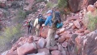
Hermit Trail
Grand Canyon Village, Arizona
12.5 miles SEThe Grand Canyon's Hermit Trail is a scenic beauty which begins at the end of Hermit Road. The rocky trail is well-marked and less busy than the Bright Angel and North Kaibab trails. While...
Backpack, Camp, Hike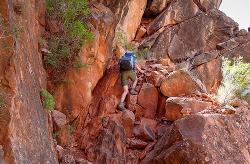
Boucher Trail
Grand Canyon Village, Arizona
12.5 miles SEBoucher Trail is a 17.7 mile moderately trafficked out and back trail located near Grand Canyon, Arizona that features a river and is only recommended for very experienced adventurers. The trail is...
Backpack, Hike
Hermit's Rest Viewpoint to Santa Maria Spring
Grand Canyon Village, Arizona
12.5 miles SELocated in Grand Canyon National Park, Hermit’s Rest Viewpoint to Santa Maria Spring trail features fantastic views in a peaceful setting. The trail is easy to follow as it is well maintained...
Backpack, Hike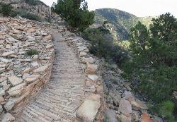
Hermit's Rest Viewpoint to Tonto Trail to Bright Angel Trail
Grand Canyon Village, Arizona
12.5 miles SEHermit’s Rest Viewpoint to Tonto Trail to Bright Angel Trailhead is perfect for hiking, backpacking, walking, and trail running. The Trail takes you across a well-established portion of the...
Backpack, Camp, Hike
Hermits Rest Viewpoint to Dripping Springs Trail
Grand Canyon Village, Arizona
12.5 miles SEThe Dripping Springs and Hermit Trail out and back contains incredible views. Once you have passed Dripping Springs there are no trail markings so be sure to know exactly where you are at. The trail...
Backpack, Hike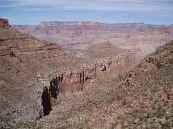
Boucher Trail to Hermit Trail Loop
Grand Canyon Village, Arizona
12.5 miles SEA demanding loop trip of three to four days, tracing one of the most difficult South Rim trails. Even seasoned Grand Canyon backpackers consider the Boucher Trail to be the most difficult, hazardous,...
Backpack, Camp, Hike
Tapeats Creek to Deer Creek
North Rim, Arizona
14.0 miles NNOTE: The beginning of this hike is in a remote location. The nearest trailhead is Bill Hall trailhead. This is an excellent route ranging from the trackless beaches of the Colorado...
Backpack, Camp, Hike 8.4 mi
Grand Canyon Rim Village to Hermits Rest
Grand Canyon Village, Arizona
15.6 miles SEGrand Canyon Rim Village to Hermits Rest is a bus accessible trail featuring stunning river views, wildlife, and wildflowers. This kid-friendly trail is perfect for hiking, backpacking, trail...
Backpack, Hike 4.9 mi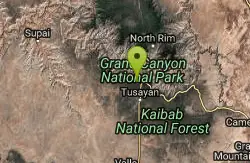
Bright Angel Trail to Tonto Trail
Grand Canyon Village, Arizona
15.6 miles SE"[T]he Tonto Trail offers a degree of civility not found elsewhere along the trail, and it is here that most hikers get their first exposure to the unique nature of this singular transcanyon...
Backpack, Camp, Hike 1.4-9.8 mi
The Bright Angel Trails
Grand Canyon Village, Arizona
15.6 miles SEPrepare yourself for switchbacks as part of a tough elevation gain on the Bright Angel trail to Plateau Point trail. This trail features spectacular views as you hike along the edge of...
Backpack, Camp, Hike, Horseback 4.5 mi
Bright Angel Trail to Bright Angel Campground and River Trail
Grand Canyon Village, Arizona
15.7 miles SEBright Angel Trail to Bright Angel Campground and River dirt trail is one of the most famous trails near Grand Canyon, Arizona. The well-maintained trail encompasses incredible views and has an...
Backpack, Camp, Hike, Rock Climb
Bright Angel Trail to Three-Mile Rest house
Grand Canyon Village, Arizona
15.7 miles SEThe popular out-and-back Bright Angel Trail to Three-Mile Resthouse is 5.4 miles out in distance. The trail includes many steep switchbacks and 360 degrees of absolutely stunning views of the inside...
Backpack, Camp, Hike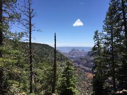
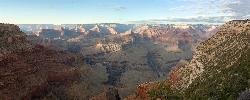
Widforss Trail
North Rim, Arizona
17.6 miles EWidforss Trail overlooks the Grand Canyon as it leads along the beautiful North Rim. The peaceful forested trail features numerous picture perfect locations from the beginning of the trail on over to...
Backpack, Hike
Thunder River and Tapeats Creek Trail
North Rim, Arizona
17.6 miles NThunder River Trail - Grand Canyon National Park (North Rim) is a 25 mile out and back trail located near North Rim, Arizona that features a river. The trail is only recommended for...
Backpack, Camp, Hike
Bill Hall Trail to Monument Point
North Rim, Arizona
17.6 miles NBackpack, Hike

Deer Creek to Colorado River
North Rim, Arizona
17.6 miles NBackpack, Camp, Hike 6.3 mi

Tiyo Point Trail
North Rim, Arizona
17.8 miles EThis former road is becoming increasingly overgrown by the encroaching forest. This being said, it is generally easy to follow with some blown down trees to climb over or around. There are some old...
Backpack, Camp, Hike


