


Blue Heron
Stearns, Kentucky
| GPS: |
36°40'6.8"N 84°32'51.6"W Maps | Directions |
| State: | Kentucky |
Restrooms Picnic Tables Rivers Trails Fishing
Swim
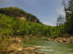
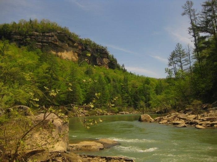
Blue Heron is a beautiful, forested swimming hole on the Big South Fork Cumberland River. The river here has cool water that is shallow at the edges, deepening in the center allowing for a true swimming experience. Visitors should exercise caution while swimming here, as there are no lifeguards and the river is moving.
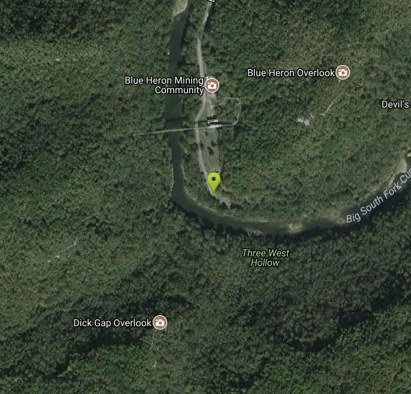
Parking for the swimming hole can be found at the picnic area at the end of Blue Heron Road just past the Mine 18 community and the footbridge. Restrooms and picnic tables are also available here.
Visitors to Blue Heron will find that swimming is not the only activity available in the area. The Big South Fork area is crawling with trails for hiking, biking and horse back riding. Visitors can also visit Mine 18, or Blue Heron Mine, an abandoned mining town that has been turned into an outdoor museum. With the museum and trails so close to the swimming hole, there is plenty to keep visitors busy all day
More Information
Exploring the Fascinating Blue Heron Mining Camp in the Big South Fork National River and Recreation
Learn about visiting one of the most fascinating coal mining camps open to the public in Kentucky.
https://www.roadtripsandcoffee.com/blue-heron-mining-camp/
- Plan Ahead and Prepare
- Travel & camp on durable surfaces
- Dispose of waste properly
- Leave what you find
- Minimize campfire impacts
- Respect wildlife
- Be considerate of other visitors
Directions
From Stearns, Kentucky
- Head south on State Hwy 1651 toward Bridge St (0.1 mi)
- Turn right onto KY-92 W/
State Hwy 1651 (0.2 mi) - Turn left onto State Hwy 1651 (0.5 mi)
- Turn right onto Ky-741 (0.7 mi)
- Turn right onto State Hwy 742 (5.9 mi)
- Continue onto Blue Heron RdDestination will be on the right(2.0 mi)
Other Swimming Holes Nearby

Gentleman's Swimming Hole
Oneida, Tennessee
13.8 miles SWClear Fork River runs slow and deep through Big South Fork, making Gentleman's Swimming Hole a rare chance for a real swim at the end of an easy 2-mile family trail.
Hike, Swim 0.7 mi
Dog Slaughter Falls
Williamsburg, Kentucky
18.5 miles NEA 15-foot waterfall plunging over a mossy overhang into a bright blue pool in Daniel Boone National Forest — a shaded two-mile round trip with creek views the whole way.
Hike, Swim
Big South Fork Area
Helenwood, Tennessee
19.9 miles SMiles of trails, multiple named swimming holes, and five campgrounds spanning the Kentucky-Tennessee border in Big South Fork National Recreation Area — including Gentleman's Swimming Hole and Station Camp.
Camp, Hike, Swim
Laurel River Lake Spillway Beach
Corbin, Kentucky
25.3 miles NEA Corps of Engineers swim beach below the dam on Laurel River Lake, one of the deepest and clearest lakes in Kentucky, ringed by the Daniel Boone National Forest.
Camp, Canoe, Hike, Kayak, Swim
Turley Hole
Pioneer, Tennessee
25.6 miles SESwim near Pioneer, Tennessee
Swim
Short Creek
Somerset, Kentucky
33.9 miles NA 150-foot stretch of 56-degree spring water emerging from underground, shockingly clear against lush green woods — swim, picnic, or peek into the cave where it disappears.
Cave, Hike, Swim
Clifty Creek
Jamestown, Kentucky
34.5 miles NWOrange slate cliffs cloaked in green trees reflect on the water's surface at this local swimming and kayaking spot — don't miss Hidden Falls at the far end, a mossy-rock cave-waterfall hidden gem.
Canoe, Kayak, Swim
Frozen Head State Park
Wartburg, Tennessee
36.9 miles SSwim near Wartburg, Tennessee
Swim
Obed Scenic River Area
Kingston Springs, Tennessee
41.9 miles SRemote swimming holes along Obed Wild and Scenic River hide in and around Wartburg — stop at the visitor center for a map before heading out, as GPS is unreliable here.
Swim
Clear Creek
Lebanon, Kentucky
45.7 miles EA wide, level three-mile multi-use trail following a beautiful creek on a former railroad route through forest — open to hikers, bikers, horses, ORVs, and anglers, with swimming allowed in the creeks.
Hike, Horseback, Mountain Bike, SwimNearby Campsites
Big South Fork Area
Helenwood, Tennessee
19.9 miles SMiles of trails, multiple named swimming holes, and five campgrounds spanning the Kentucky-Tennessee border in Big South Fork National Recreation Area — including Gentleman's Swimming Hole and Station Camp.
Camp, Hike, Swim
Laurel River Lake Spillway Beach
Corbin, Kentucky
25.3 miles NEA Corps of Engineers swim beach below the dam on Laurel River Lake, one of the deepest and clearest lakes in Kentucky, ringed by the Daniel Boone National Forest.
Camp, Canoe, Hike, Kayak, Swim


