


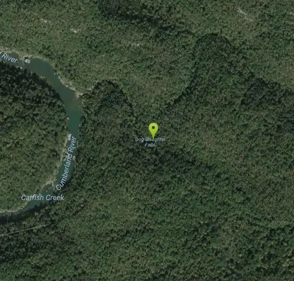
Dog Slaughter Falls
Williamsburg, Kentucky

| GPS: |
36°51'29.5"N 84°18'40.3"W Maps | Directions |
| State: | Kentucky |
| Trails/Routes: | 0.7 mi |
Rivers Waterfalls
Hike and Swim
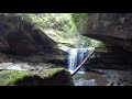
Dog Slaughter Falls is a beautiful 15-foot waterfall in the Danial Boone National Forrest. Despite it's less than pleasant name this is the perfect place to play for a picturesque day. The waterfall falls over a beautiful overhang into a bright blue pool of water below. The rich colors of the rocks and plant life make this a stunning place to reconnect with nature.
The hike to Dog Slaughter Falls starts on Forest Service Road 195, 2.7 miles from the KY 90 junction. After parking on the Forrest Service Road hikers should head toward Dog Slaughter Creek. The trail is recognizable by the footbridge crossing the creek, with the sign labeling the trail on the other side. After crossing the footbridge, the trail is about one mile to the waterfall, making the hike two miles out-and-back.
The entire hike is shaded by the surrounding forest and hikers enjoy several views of the creek before reaching the falls. The trail has some rocks and roots, making it slightly more difficult than level paved trails, but still easy enough for most hikers.
Hikers who reach the falls can enjoy cooling off in the clear waters slightly downstream from the falls. Here there are sandy beaches to lie on and the water is shallow and slow moving. Swimmers should be cautious when selecting a swimming spot, watching to make sure the current is safe for swimmers. The water here is mountain water and is very cold year round.
More Information
Be courteous, informed, and prepared. Read trailhead guidelines, stay on the trail, and don't feed the wildlife.
Read More
- Plan Ahead and Prepare
- Travel & camp on durable surfaces
- Dispose of waste properly
- Leave what you find
- Minimize campfire impacts
- Respect wildlife
- Be considerate of other visitors
Directions
From Williamsburg, Kentucky
- Head southeast on N 2nd St toward Main St (427 ft)
- Turn left at the 2nd cross street onto Cumberland Ave (0.2 mi)
- Turn left onto US-25W N (1.8 mi)
- Turn left to stay on US-25W N (8.3 mi)
- Turn left onto Devils Creek Rd (3.2 mi)
- Continue onto Daniel Boone Forest Rd 193 (1.1 mi)
- Turn left to stay on Daniel Boone Forest Rd 193 (1.2 mi)
- Continue straight onto Daniel Boone Forest Rd 88 (0.4 mi)
- Turn left (0.4 mi)


Other Swimming Holes and Hiking Trails Nearby
Blue Heron
Stearns, Kentucky
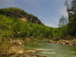
18.5 miles SWA forested swimming hole on the Big South Fork Cumberland River — shallow at the edges, deeper in the center, with a picnic area nearby and Mine 18 museum a short walk away.
Swim
Short Creek
Somerset, Kentucky
21.2 miles NA 150-foot stretch of 56-degree spring water emerging from underground, shockingly clear against lush green woods — swim, picnic, or peek into the cave where it disappears.
Cave, Hike, Swim 1.0 mi
Gentleman's Swimming Hole
Oneida, Tennessee
31.8 miles SWClear Fork River runs slow and deep through Big South Fork, making Gentleman's Swimming Hole a rare chance for a real swim at the end of an easy 2-mile family trail.
Hike, Swim
Clear Creek
Lebanon, Kentucky
33.6 miles EA wide, level three-mile multi-use trail following a beautiful creek on a former railroad route through forest — open to hikers, bikers, horses, ORVs, and anglers, with swimming allowed in the creeks.
Hike, Horseback, Mountain Bike, Swim
Turley Hole
Pioneer, Tennessee
33.8 miles SSwim near Pioneer, Tennessee
Swim
Big South Fork Area
Helenwood, Tennessee
37.0 miles SWMiles of trails, multiple named swimming holes, and five campgrounds spanning the Kentucky-Tennessee border in Big South Fork National Recreation Area — including Gentleman's Swimming Hole and Station Camp.
Camp, Hike, Swim
Clifty Creek
Jamestown, Kentucky
42.5 miles WOrange slate cliffs cloaked in green trees reflect on the water's surface at this local swimming and kayaking spot — don't miss Hidden Falls at the far end, a mossy-rock cave-waterfall hidden gem.
Canoe, Kayak, Swim


