


Bumpass Hell
| Address: | Volcanic Legacy Scenic Byway, Hat Creek, California, USA |
| GPS: |
40°27'57.7"N 121°30'52.0"W Maps | Directions |
| State: | California |
National Park
Hike
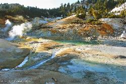
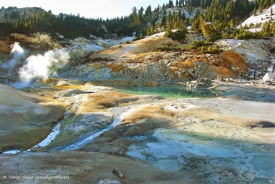
Bumpass Hell is the largest collection of hydrothermal features in Lassen Volcanic National Park. The overall 3 mile round trip hike takes visitors around some of the hottest and largest features in the park. When hiking through Bumpass Hell, visitors will be able to walk along boardwalk style trails and get close to the different features. None of the features in the area are safe for bathing, as the water is heated to extreme temperatures and is very acidic. There is a lot of steam present in the area, as well as boiling pools and mud pots. Big Boiler is the largest fumarole in the park as well as the hottest. Its water temperature has been measured at 322°F, making it one of the hottest in the world.
The trail begins at the Bumpass Hell parking lot and is about 1.5 miles out. Be careful when descending into Bumpass Hell because the trail can be slippery during the winter or after rainstorms. Most visitors will be able to smell Bumpass Hell before they really see it and that is from the sulfur gases escaping from the boiling pools.
More Information
Lassen Volcanic National Park Itinerary
This Lassen Volcanic National Park Itinerary will help you get started as you plan your vacation to Lassen Volcanic National Park.
https://www.justgotravelstudios.com/collections/national-park-itineraries/products/lassen-volcanic-national-park-itinerary?ref=9zpxis0diinHiking Bumpass Hell: Lassen Volcanic National Park - California Through My Lens
When exploring Lassen Volcanic National Park and hiking Lassen Peak, we decided to also hike Bumpass Hell, one of the park’s most well-known attractions. Bumpass Hell was named after Kendall Vanhook Bumpass, who stumbled on this area in the late 1800s while he was hiking. It is called Bumpass Hell because he fell in one…
https://californiathroughmylens.com/2011/09/hiking-bumpass-hell-lassen-volcanic-national-park/Be courteous, informed, and prepared. Read trailhead guidelines, stay on the trail, and don't feed the wildlife.
Read More
- Plan Ahead and Prepare
- Travel & camp on durable surfaces
- Dispose of waste properly
- Leave what you find
- Minimize campfire impacts
- Respect wildlife
- Be considerate of other visitors
Directions
- Get directions on Google Maps




Other Hiking Trails Nearby
Lassen Peak
Mineral, California
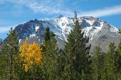
0.8 miles NEThe world's largest plug dome volcano rises to 10,457 feet in Lassen Volcanic National Park — a steep 5-mile round trip with 2,000 feet of gain and views of the Devastated Area below.
Backpack, Hike
Kings Creek Falls
Shasta County, California
2.9 miles EA 2.4-to-3-mile round trip waterfall hike in Lassen Volcanic NP with seasonal wildflowers, Mule Deer, and a dramatic cascade through fern-covered volcanic landscape.
Hike, Horseback
Lassen Volcanic National Park
Redding, California
5.2 miles NESmoking fumaroles, meadows freckled with wildflowers, clear mountain lakes, and numerous volcanoes — Lassen Volcanic is a geothermal wonderland for explorers willing to look beyond the famous sights.
Backcountry Ski, Camp, Canoe, Hike, Horseback, Hot Springs, Mountain Bike, Snowshoe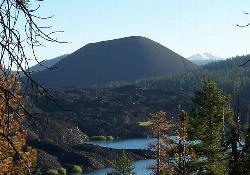
Cinder Cone and the Fantastic Lava Beds
Lassen County, California
13.1 miles NEHike a loose, sand-like 4-mile round trip to the top of a 1600s cinder cone at 6,907 ft in Lassen Volcanic NP, with Painted Dunes and the Fantastic Lava Beds spread out below.
Hike 0.3 mi
Burney Falls
Burney, California
38.6 miles NA 129-foot year-round waterfall draped in green fern curtains in Shasta County — accessible from a parking lot with multiple trail angles, best visited early morning or just before sunset.
Hike


