


Lassen Volcanic National Park
Redding, California
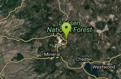
| GPS: |
40°30'33.8"N 121°25'59.1"W Maps | Directions |
| State: | California |
Backcountry Ski, Camp, Canoe, Hike, Horseback, Hot Springs, Mountain Bike, and Snowshoe
Lassen Volcanic National Park is home to smoking fumaroles, meadows freckled with wildflowers, clear mountain lakes, and numerous volcanoes. Jagged peaks tell the story of its eruptive past while hot water continues to mold the land. Lassen Volcanic offers opportunities to discover the wonder and mysteries of volcanoes and hot water for visitors willing to explore the undiscovered.
More Information
Lassen Volcanic National Park Itinerary
This Lassen Volcanic National Park Itinerary will help you get started as you plan your vacation to Lassen Volcanic National Park.
https://www.justgotravelstudios.com/collections/national-park-itineraries/products/lassen-volcanic-national-park-itinerary?ref=9zpxis0diinLassen Volcanic National Park (U.S. National Park Service)
Lassen Volcanic National Park
https://www.nps.gov/lavo/index.htmNever modify trail features. Ride trails when they're dry enough that you won't leave ruts. Speak up when you see others on the trail and always yield to hikers, horses, and others coming uphill. Always ride on the established trail.
Read MoreBe courteous, informed, and prepared. Read trailhead guidelines, stay on the trail, and don't feed the wildlife.
Read More
Be careful. Pay attention to posted signs and always test the waters before you get in. Some hot springs can get up to boiling temperatures. Be sure to drink plenty of water to combat the dehydrating effect of the spring.
Be respectful of other soakers and the hot spring. Don't hog the pool. Camp at least 200 yards away and keep fires in designated areas. Keep your pets out of the water and never pee in thermal feature. Glass bottles should never go near a hot spring.

- Plan Ahead and Prepare
- Travel & camp on durable surfaces
- Dispose of waste properly
- Leave what you find
- Minimize campfire impacts
- Respect wildlife
- Be considerate of other visitors
Directions
From Redding, California
- Head south on Market St toward Shasta St (443 ft)
- Market St turns left and becomes CA-44 E/Tehama St (signs for I-5)Continue to follow CA-44 E(46.9 mi)
- Turn right onto CA-89 SParts of this road may be closed at certain times or days(12.4 mi)
Lassen Volcanic National Park is located in Northeastern California.
Northwest Entrance:
GPS: 40°32'40"N 121°34'38"W
From Redding, California: The Northwest entrance is approximately 50 miles east on Highway 44.
From Reno, Nevada: The Northwest is approximately 180 miles west via 395 and Highway 44.
Southwest Entrance:
GPS: 40°26'08"N 121°32'02"W
From Red Bluff, California: The Southwest entrance is approximately 45 miles east on Highway 36
From Reno, Nevada: The Southwest entrance is 160 miles west of Reno, Nevada via 395 and Highway 36.
Butte Lake:
GPS: 40°33'58"N 121°17'50"W
Access to the Butte Lake area is via a dirt road off Hwy 44 east of Old Station.
Juniper Lake:
GPS: 40°27'3"N 121°17'43"W
Access to Juniper Lake is via a partially paved road north of Chester off Hwy 36.
Warner Valley:
GPS: 40°26'30"N 121°23'35"W
Access to Warner Valley is via a partially paved road north of Chester off Hwy 36. Follow the signs to Drakesbad Guest Ranch.
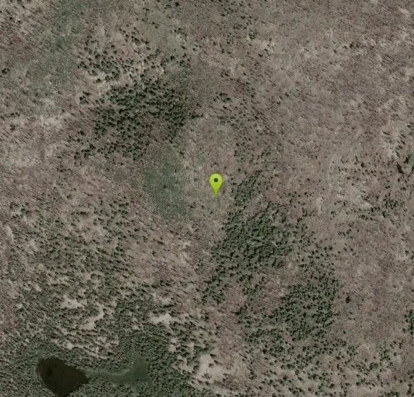
Other Mountain Bike Trails, Hiking Trails, s, Canoeing Areas, Horseback Trails, Hot Springs, and Snowshoe Trails Nearby

Kings Creek Falls
Shasta County, California
3.7 miles SA 2.4-to-3-mile round trip waterfall hike in Lassen Volcanic NP with seasonal wildflowers, Mule Deer, and a dramatic cascade through fern-covered volcanic landscape.
Hike, Horseback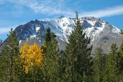
Lassen Peak
Mineral, California
4.5 miles SWThe world's largest plug dome volcano rises to 10,457 feet in Lassen Volcanic National Park — a steep 5-mile round trip with 2,000 feet of gain and views of the Devastated Area below.
Backpack, Hike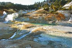
Bumpass Hell
5.2 miles SW
A 3-mile round-trip hike through Lassen Volcanic National Park's largest hydrothermal area, where boiling pools, steam vents, and mud pots including a 322°F fumarole make a dramatic — but boardwalk-only — spectacle.
Hike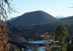
Cinder Cone and the Fantastic Lava Beds
Lassen County, California
7.9 miles NEHike a loose, sand-like 4-mile round trip to the top of a 1600s cinder cone at 6,907 ft in Lassen Volcanic NP, with Painted Dunes and the Fantastic Lava Beds spread out below.
Hike 0.3 mi
Burney Falls
Burney, California
36.7 miles NA 129-foot year-round waterfall draped in green fern curtains in Shasta County — accessible from a parking lot with multiple trail angles, best visited early morning or just before sunset.
Hike


