


35 Campsites near Deer Creek to Colorado River
first prev 1 2 next lastShowing Campsites within 50 miles Distance miles of Unnamed Road, North Rim, AZ 86052, USA City, Zip, or Address
Thunder River and Tapeats Creek Trail
North Rim, Arizona
0.0 miles SEA 25-mile out-and-back hike on the North Rim leading to Thunder River and Tapeats Creek — recommended only for very experienced outdoorsmen and primarily used for hiking and rock climbing.
Backpack, Camp, Hike
Tapeats Creek to Deer Creek
North Rim, Arizona
4.9 miles SWA remote Grand Canyon backpacking route connecting Tapeats Creek and Deer Creek Trails — from the Colorado River's trackless beaches to a high trail above Granite Narrows.
Backpack, Camp, Hike
Powell Plateau Trail
North Rim, Arizona
8.2 miles SEA rewarding plateau-top day hike or backpack to a remote North Rim plateau, where hikers with enough water can wander for days visiting rim overlooks and hidden draws.
Backpack, Camp, Hike
North Bass Trail
North Rim, Arizona
8.2 miles SEA remote North Rim backcountry trail reached via a network of forest service roads, descending to Swamp Point on the Powell Plateau in Grand Canyon NP.
Backpack, Camp, Hike
South Bass Trail
Supai, Arizona
17.6 miles SA strenuous 15.6-mile round-trip remote hike in Grand Canyon with no water at the trailhead, 4,400 feet of descent to the Colorado River, and no established campsites below the rim.
Backpack, Camp, Hike
Havasu Falls and Mooney Falls Trail
Supai, Arizona
24.6 miles SWA 12-mile trek into the Havasupai Indian Reservation drops through steep switchbacks and a narrowing canyon to turquoise waterfalls, the Indian town of Supai, and a campground along the creek.
Backpack, Camp, Hike
Havasupai Falls
Supai, Arizona
24.6 miles SWAn eight-mile hike or horseback ride through the remote western Grand Canyon to the village of Supai and Havasupai Falls — accessible only by foot, horse, or helicopter.
Backpack, Camp, Hike 6.3 mi
Tiyo Point Trail
North Rim, Arizona
25.3 miles SEA lightly traveled primitive North Rim trail through encroaching forest with old markers on trees, wildflowers, gentle rolling terrain, and a single picnic area near the end.
Backpack, Camp, Hike
North Kaibab Trail to Colorado River
North Rim, Arizona
25.7 miles SEA steep, well-maintained, and well-marked trail dropping from the North Rim to the Colorado River — perfect for experienced hikers ready for serious elevation change.
Backpack, Camp, Hike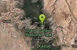
Phantom Ranch to Ribbon Falls on North Kaibab Trail
North Rim, Arizona
25.7 miles SEA classic Grand Canyon corridor hike on the North Kaibab Trail from Phantom Ranch to Ribbon Falls.
Camp, Hike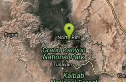
Rim-to-Rim: North to South Kaibab Trail
North Rim, Arizona
25.7 miles SEThe iconic Grand Canyon Rim-to-Rim hike from the North Rim to the South Kaibab Trail — one of the most breathtaking and demanding hikes in North America.
Camp, Hike, Horseback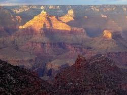
Rim-to-Rim: North Kaibab to Grand Canyon Village
North Rim, Arizona
25.7 miles SEA four-day rim-to-rim Grand Canyon hike with stops at Ribbon Falls, Phantom Ranch, Cottonwood Camp, and a sunset at Plateau Point that must be seen to be believed.
Backpack, Camp, Hike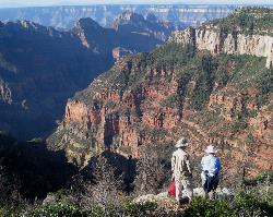
Uncle Jim Trail
North Rim, Arizona
25.7 miles SEThe Uncle Jim Trail is an easy 4.7-mile North Rim loop to Uncle Jim Point, with jaw-dropping views over Roaring Springs and Bright Angel canyons.
Backpack, Camp, Hike
Nankoweap Trail
North Rim, Arizona
27.3 miles SEThe Nankoweap Trail is a remote, demanding Grand Canyon route on the North Rim — a serious undertaking for experienced backcountry hikers.
Backpack, Camp, Hike
South Canyon
North Rim, Arizona
28.0 miles EA mostly trail-less 3-to-4-day backpacking route through narrow Marble Canyon near the North Rim, suited for experienced canyoneers — roads to the trailhead can be briefly impassable in winter.
Backpack, Camp, Hike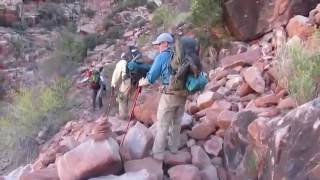
Hermit Trail
Grand Canyon Village, Arizona
28.5 miles SEA strenuous, less-crowded Grand Canyon backpacking trail with 2,000 feet of descent in the first 2.5 miles, Cathedral stairs, Redwall cliffs, and fossilized animal tracks.
Backpack, Camp, Hike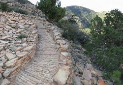
Hermit's Rest Viewpoint to Tonto Trail to Bright Angel Trail
Grand Canyon Village, Arizona
28.6 miles SEA multi-day Grand Canyon backpacking route crossing the Tonto Trail from Hermit's Rest to Bright Angel — spectacular inner canyon views with limited water sources and 3,000-foot rim access by foot only.
Backpack, Camp, Hike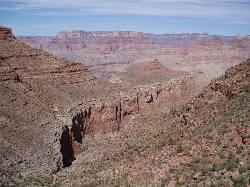
Boucher Trail to Hermit Trail Loop
Grand Canyon Village, Arizona
28.6 miles SEA demanding 3–4 day backpacking loop on the Grand Canyon's South Rim — even seasoned hikers consider the Boucher Trail the most difficult and hazardous South Rim route.
Backpack, Camp, Hike 1.5-9.8 mi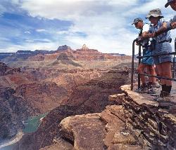
The Bright Angel Trails
Grand Canyon Village, Arizona
30.6 miles SEMultiple Bright Angel Trail routes range from a 5.4-mile out-and-back to the Three-Mile Resthouse to a 19-mile trek to the river, with the 12.4-mile South Kaibab–Tonto–Bright Angel point-to-point offering over 3,000 feet of Grand Canyon grandeur.
Backpack, Camp, Hike, Horseback 4.9 mi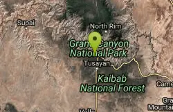
Bright Angel Trail to Tonto Trail
Grand Canyon Village, Arizona
30.6 miles SEA rugged 12.4-mile point-to-point through Grand Canyon's inner gorge on the South Kaibab–Tonto Trail corridor, with over 3,000 feet of elevation gain — advanced hikers only.
Backpack, Camp, Hike


