


China Hole
Morgan Hill, California
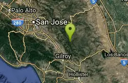
| GPS: |
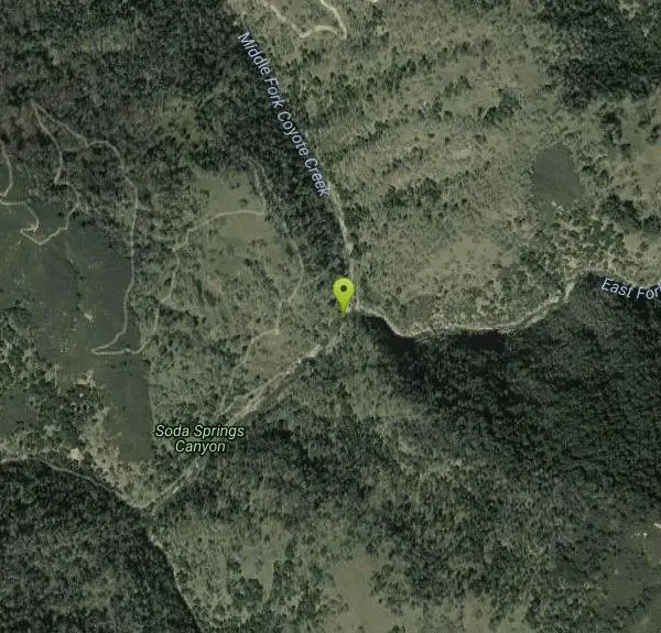
37°10'23.7"N 121°29'42.1"W Maps | Directions |
| State: | California |
Camp, Hike, and Swim
China Hole is one of the most sought-after destinations in Henry W. Coe State Park, the vast, rugged wilderness park in the hills east of Morgan Hill, California. Tucked at the bottom of a canyon where two creeks meet, it's a picturesque natural swimming hole — a deep green pool with a small sandy beach and big flat boulders made for picnicking, sunning and drying off. For the many hikers and backpackers who make the long trek in, China Hole is the classic Coe reward: a cool, quiet swim at the heart of one of the wildest state parks in the Bay Area.
Earning that swim takes real work. The most popular route is the China Hole Loop, a challenging trip of about 10 miles that starts from park headquarters, threads through grassy hills and chaparral, and drops down a canyon to creekside woodlands before reaching the pool. Expect over 2,000 feet of elevation gain, with much of the climbing saved for the last few miles on the way back out — a genuinely strenuous day that catches unprepared visitors off guard. The pool itself is often around 20 feet across and 7 to 8 feet deep when the creeks are running well, deepest and most inviting after a wet winter and into the early summer.
Season is everything here. Spring is the showpiece — green hills, wildflowers, and full creeks — while early summer brings water still deep enough to swim and air warm enough to want to. By late summer the pool can shrink and warm as the creeks drop, and by fall it may be more wading than swimming. Water levels and depth vary a great deal through the year, so it's worth checking the pool before jumping in; this is a place for a careful swim, not for diving or cannonballing into unknown depths.
Coe is famous for its heat and its remoteness, and both deserve respect. There is little reliable shade on the exposed climbs, summer temperatures in these inland hills routinely soar, and the park's sheer size means help is far away. Carry far more water than you think you'll need, and note that dogs are not allowed on these trails. The reach the headquarters trailhead, take the E. Dunne Avenue exit off Highway 101 in Morgan Hill and follow the narrow, winding road roughly 10 miles past Anderson Lake — allow a full half hour from the freeway.
Plan China Hole as the serious hike it is: an early start to beat the heat, sturdy footwear, sun protection, plenty of food and water, and a realistic sense of the climb waiting on the return. Backpackers can turn it into an overnight at the nearby trail camp and linger at the pool in the cool of the morning. Do it right and China Hole delivers one of the finest wild swims in the South Bay — hard-won, beautiful, and utterly worth it.
More Information
China Hole Loop - Henry W. Coe State Park
TrailheadCoe Ranch entrance Distance (round trip)10 miles Elevation Gain (round trip)1400 feetDescriptionThis moderately strenuous hike takes you to the site of an old mineral springs resort. A mile farther, is the park’s most popular swimming hole. China Hole is a favorite destination for hikers during late spring and early summer. The natural pool is often 20 feet wide and 7 to 8 feet deep. It has a small, sandy beach and lots of big flat boulders for picnicking, sunning, and snoozing.Madrone Soda Springs Resort was a small health spa that thrived during the horse and buggy era. There’s not much left of the resort - the buildings and the dance pavilion were dismantled during World War II. The wood was hauled to the Central Valley and used to build houses during a time when wood was hard to come by. Still remaining are a few concrete steps, fragments of foundation, and a stone cooler built into a hillside.RouteStarting at the trail head close to the stop sign, follow Corral Trail to the Springs Trail junction. Take the right fork and follow Springs Trail to its end at Manzanita Point Road. Go right on the road and keep going until you reach the Madrone Soda Springs trail head (across from Manzanita Point group campsite 7). Go right on the Madrone Soda Springs Trail, and watch your step as you hike down the trail. It’s steep and slippery in places. When you reach the creek bed, you’ve reached the site of the old resort. You might want to stay a while, look around, and picture the resort in its heyday.Continue along Madrone Soda Springs Creek on Mile Trail, which crosses the creek bed 12 times (something to consider during winter and early spring when the creek might be flowing). You’ll want to be on the lookout for poison oak, which flourishes along Mile Trail in all seasons. When you get to China Hole Trail, you can either head back up or go on about a hundred feet to China Hole, a fine place to picnic and watch birds.On your return trip, take China Hole Trail back up to Manzanita Point and then follow Manzanita Point Road to the junction with Forest Trail and Springs Trail. At that point, you can continue on the road or take one of the trails back to the visitor center.Extras: Before you start out or after you return, you might want to ask someone in the Visitor Center to show you the binder with photographs taken at the Madrone Soda Springs resort during its heyday.
https://coepark.net/hiking/china-hole-loop/Hike to a Swim Hole
Hike to China Hole Swim Hole in Henry Coe
https://www.weekendsherpa.com/stories/hike-to-china-hole-swim-hole-in-henry-coe/Be courteous, informed, and prepared. Read trailhead guidelines, stay on the trail, and don't feed the wildlife.
Read More
- Plan Ahead and Prepare
- Travel & camp on durable surfaces
- Dispose of waste properly
- Leave what you find
- Minimize campfire impacts
- Respect wildlife
- Be considerate of other visitors
Directions
From Morgan Hill, California
- Head northeast on E Main Ave toward McLaughlin Ave (1.2 mi)
- Turn right onto Condit Rd (0.8 mi)
- Turn left onto E Dunne Ave (2.8 mi)
- Turn right to stay on E Dunne Ave (3.9 mi)
- Turn left onto Dunne Ave (5.2 mi)
- Turn left onto Manzanita Point RdRestricted usage road(1.5 mi)
- Slight left onto Poverty Flat RdRestricted usage road(2.3 mi)
Starting at the trailhead close to the stop sign, follow Corral Trail to the Springs Trail junction. Take the right fork and follow Springs Trail to its end at Manzanita Point Road. Go right on the road and keep going till you reach the Madrone Soda Springs trailhead (across from Manzanita Point group campsite 7). Go right on the Madrone Soda Springs Trail, and watch your step as you hike down the trail. It's steep and slippery in places. When you reach the creekbed, you've reached the site of the old resort. You might want to stay a while, look around, and picture the resort in its heyday. Continue along Madrone Soda Springs Creek on Mile Trail, which crosses the creekbed 12 times (something to consider during winter and early spring when the creek might be flowing.)
Other Swimming Holes and Hiking Trails Nearby
Henry Coe State Park Campground
Morgan Hill, California
2.9 miles WA wild wilderness state park near Morgan Hill with spectacular spring wildflowers, year-round camping, creeks, ponds, fishing, and miles of hiking and biking on dirt roads and trails.
Camp, Hike, Horseback, Mountain Bike
Garden of Eden
Felton, California
32.7 miles WA popular Santa Cruz Mountains swimming hole with sunny beaches, blue water, and cliffs for jumping — multiple pools for all ages, with no campfires allowed in the area.
Hike, Swim 0.1-0.9 mi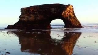
Natural Bridges State Park / Monarch Butterfly Trail
Santa Cruz, California
34.5 miles SWA coastal California trail where Monarch butterflies blanket eucalyptus trees from mid-October to mid-February, leading to a sandy beach with a dramatic rock arch and stunning sunsets.
Hike
Quarry Lakes Regional Recreation Area (Niles Beach)
Fremont, California
39.6 miles NWLifeguarded sand beach on Horseshoe Lake at Quarry Lakes Regional Recreation Area in Fremont, a 471-acre East Bay park of former gravel pits turned swimming and fishing lakes.
Hike, Kayak, Mountain Bike, Swim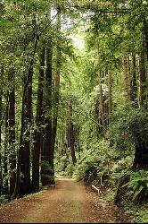
Pescadero Creek Trail Area
Loma Mar, California
44.2 miles WShady interconnected trails weave through redwoods, ridges, and rolling valleys linking four parks in the Santa Cruz Mountains — a cool escape just an hour from the Bay Area.
Hike, Horseback, Mountain Bike, Swim
Memorial Park
Loma Mar, California
44.3 miles WSwim near Loma Mar, California
Swim


