


Quarry Lakes Regional Recreation Area (Niles Beach)
Fremont, California

| GPS: |
37°34'43.1"N 122°0'18.4"W Maps | Directions |
| State: | California |
Hike, Kayak, Mountain Bike, and Swim
Quarry Lakes is the East Bay's answer to a hot Fremont weekend: a chain of old gravel pits along Alameda Creek that the East Bay Regional Park District and the Alameda County Water District turned into a 471-acre park with about 350 acres of open water. The swim beach is on Horseshoe Lake at the Niles Beach Swim Complex, a broad crescent of imported sand with a roped swim area, lifeguard towers, outdoor showers, restrooms and a lawn behind it. The park is at 2100 Isherwood Way, between the Niles district and Union City, and the lakes are also part of the water district's groundwater recharge system, so the water level moves with the season.
Lifeguards work weekends and holidays only, in 2026 from May 16 through September 27, 11 a.m. to 6 p.m. Outside those hours the beach is open to wading but the swim area is closed. Parking is $5 per car and swimming is $5 for adults and $3 for kids and seniors, all paid cashless at the kiosk; there are no private concessions and the fees go to the park district. Dogs are not allowed on the beach or in the water. The district posts blue-green algae advisories at the entrance and on its website when a bloom is detected, which happens most summers in at least one of the lakes, so check before you go if you plan to put your head under.
Beyond the beach, the park has four lakes: Horseshoe, Rainbow, Lago Los Osos and Shinn Pond. Rainbow Lake is stocked with trout in the cool months and catfish in summer and is the anglers' lake; a state fishing license plus the district's daily fishing access permit are required. Non-motorized boats and boats with electric motors launch at Horseshoe Lake, and it is a good flatwater kayak spot with a view of the Mission Peak ridge to the east. A network of flat gravel and paved trails circles the lakes for walkers and easy mountain biking, and the Alameda Creek Regional Trail runs along the north edge of the park for 12 miles between Niles Canyon and the bay.
Gravel came out of these pits for close to a century, first for railroad ballast and later for Bay Area construction, before the last operator quit in the 1970s. Conversion to a park ran from 1997 to 2000, and the district marks the 25th anniversary of the opening on November 7, 2026. It is 30 minutes from San Jose and Oakland on a quiet day and considerably more when the beach lot fills, which on a hot Saturday happens before noon. Arrive early, or come on a weekday for a long walk around water you'd never guess was once a hole in the ground.
More Information
Quarry Lakes Regional Recreation Area
The park is a beautiful water-oriented recreation area, which offers picnicking, boating, swimming and fishing, with room for hiking and wildlife viewing.
https://www.ebparks.org/parks/quarry-lakesQuarry Lakes Regional Recreation Area - Wikipedia
37°34′37″N 122°0′23″W / 37.57694°N 122.00639°W
https://en.wikipedia.org/wiki/Quarry_Lakes_Regional_Recreation_AreaSwimming
For more information about swimming lessons, junior lifeguards and other aquatic programs please visit the East Bay Lifeguards website.
https://www.ebparks.org/recreation/swimmingNever modify trail features. Ride trails when they're dry enough that you won't leave ruts. Speak up when you see others on the trail and always yield to hikers, horses, and others coming uphill. Always ride on the established trail.
Read MoreBe courteous, informed, and prepared. Read trailhead guidelines, stay on the trail, and don't feed the wildlife.
Read More
- Plan Ahead and Prepare
- Travel & camp on durable surfaces
- Dispose of waste properly
- Leave what you find
- Minimize campfire impacts
- Respect wildlife
- Be considerate of other visitors
Directions
From Fremont, California
- Head southwest on Mowry Ave toward Bell St (0.1 mi)
- Make a U-turn (0.6 mi)
- Turn left onto Paseo Padre Pkwy (2.2 mi)
- Turn right onto Isherwood Way (0.5 mi)
- Continue onto Quarry Lakes Dr (0.2 mi)
- Turn right toward Roeding Ave (446 ft)
- Turn left onto Roeding Ave (0.1 mi)
- Turn right (52 ft)
- Turn right (207 ft)
- Turn left (161 ft)
- Turn right (135 ft)
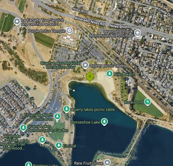 Quarry Lakes from the air, with Horseshoe Lake and the swim beach courtesy of Pi.1415926535↗ (CC BY-SA 3.0↗)

 Quarry Lakes shoreline and the Mission Peak ridge courtesy of bluesbby from Mountain View, USA↗ (CC BY 2.0↗)

 Horseshoe Lake, home of the Niles Beach swim area courtesy of Don DeBold from San Jose, CA, USA↗ (CC BY 2.0↗)

 Trail along the lakes at Quarry Lakes courtesy of Daniel Ramirez from Honolulu, USA↗ (CC BY 2.0↗)

 Get Outdoors Day on the lawn at Quarry Lakes courtesy of Pacific Southwest Region 5↗ (Public domain↗)

Other Mountain Bike Trails, Swimming Holes, Hiking Trails, and Kayaking Areas Nearby
East Ridge Trail
Oakland, California
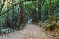
17.2 miles NWA wide, gentle ridge trail weaving through Oakland's redwood-covered hills to a waterfall — accessible all year with ladder bug clusters in the trees each winter.
Hike 0.5-0.6 mi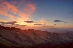
Grizzly Peak Trail
Berkeley, California
24.6 miles NWA trail through the Berkeley Hills with sweeping San Francisco Bay views at the peak — great for runners, dog walkers, and out-of-town guests on a clear day.
Hike, Mountain Bike 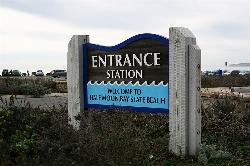
Half Moon Bay State Beach
Half Moon Bay, California
25.4 miles WA historic railroad corridor trail along the Half Moon Bay Pacific Coast with sweeping ocean views, access to multiple beaches, red-tailed hawks, herons, and a distant view of the famous Mavericks surf break.
Camp, Hike, Horseback, Swim 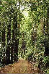
Pescadero Creek Trail Area
Loma Mar, California
26.2 miles SWShady interconnected trails weave through redwoods, ridges, and rolling valleys linking four parks in the Santa Cruz Mountains — a cool escape just an hour from the Bay Area.
Hike, Horseback, Mountain Bike, Swim 
Memorial Park
Loma Mar, California
26.3 miles SWSwim near Loma Mar, California
Swim 0.4 mi
Portola Trail
San Francisco, California
26.9 miles NWMountain Bike near San Francisco, California
Mountain Bike 0.1-0.6 mi
Mt. Sutro Open Space Reserve
San Francisco, California
27.6 miles NWA 61-acre ecological oasis on a 900-foot San Francisco hill with a historic century-old eucalyptus forest, rare native plants, and a native plant garden and demonstration area at the summit.
Hike, Mountain Bike 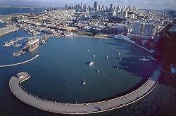
Aquatic Park
San Francisco, California
27.7 miles NWA historic San Francisco Bay swimming lagoon in the Golden Gate National Recreation Area — the water is cold and not always pristine, but devoted year-round swimmers and two open clubs keep the tradition alive.
Swim 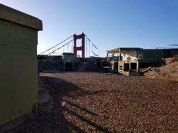
Battery Spencer
Mill Valley, California
31.3 miles NWA short 0.2-mile hike to a century-old Civil War battery with 12-inch rifled guns — now one of the best vantage points anywhere for viewing the Golden Gate Bridge.
Hike 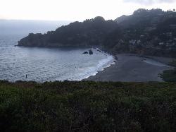
Muir Beach
Muir Beach, California
36.7 miles NWA hidden gem beach north of San Francisco with a 0.2-mile walk to the shore, informational placards for kids, sunset views over the Pacific, and access to the Coastal Trail.
Hike, Swim 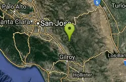
Henry Coe State Park Campground
Morgan Hill, California
37.1 miles SEA wild wilderness state park near Morgan Hill with spectacular spring wildflowers, year-round camping, creeks, ponds, fishing, and miles of hiking and biking on dirt roads and trails.
Camp, Hike, Horseback, Mountain Bike 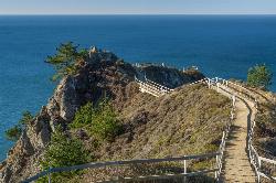
Muir Beach Overlook
Muir Beach, California
37.3 miles NWThe Muir Beach Overlook is a cliff-top Marin Headlands promontory with sweeping Pacific views, WWII fire-control bunkers, and prime gray-whale watching.
Hike 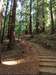
Muir Woods National Monument
Mill Valley, California
38.1 miles NWA national monument with several suggested hikes from the visitors center, including a 2-mile loop leaving the boardwalk into the towering old-growth redwoods, plus guided tours and programs.
Hike 
Garden of Eden
Felton, California
38.4 miles SA popular Santa Cruz Mountains swimming hole with sunny beaches, blue water, and cliffs for jumping — multiple pools for all ages, with no campfires allowed in the area.
Hike, Swim 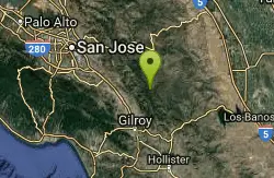
China Hole
Morgan Hill, California
39.7 miles SEA moderately strenuous hike to a historic mineral springs resort site and, a mile farther, China Hole — a 20-foot-wide, 7-to-8-foot-deep natural pool with a small sandy beach and flat boulders.
Camp, Hike, Swim 0.1-0.9 mi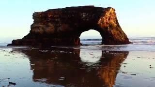
Natural Bridges State Park / Monarch Butterfly Trail
Santa Cruz, California
43.3 miles SA coastal California trail where Monarch butterflies blanket eucalyptus trees from mid-October to mid-February, leading to a sandy beach with a dramatic rock arch and stunning sunsets.
Hike 4.0 mi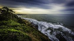
Palomarin Trail
Bolinas, California
47.3 miles NWA 5-mile northern Marin coastal hike past ocean overlooks, varying terrain, and forested paths to the stunning Alamere Falls — with an optional Bass Lake swim on the return.
Hike 0.1 mi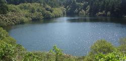
Bass Lake
Bolinas, California
48.8 miles NWBass Lake is a beloved hike-in swimming hole in Point Reyes National Seashore, tucked into the coastal hills above the Pacific near Bolinas, California. A small, tree-rimmed freshwater lake reached...
Hike, SwimNearby Campsites
Half Moon Bay State Beach
Half Moon Bay, California
25.4 miles WA historic railroad corridor trail along the Half Moon Bay Pacific Coast with sweeping ocean views, access to multiple beaches, red-tailed hawks, herons, and a distant view of the famous Mavericks surf break.
Camp, Hike, Horseback, Swim
Henry Coe State Park Campground
Morgan Hill, California
37.1 miles SEA wild wilderness state park near Morgan Hill with spectacular spring wildflowers, year-round camping, creeks, ponds, fishing, and miles of hiking and biking on dirt roads and trails.
Camp, Hike, Horseback, Mountain Bike
China Hole
Morgan Hill, California
39.7 miles SEA moderately strenuous hike to a historic mineral springs resort site and, a mile farther, China Hole — a 20-foot-wide, 7-to-8-foot-deep natural pool with a small sandy beach and flat boulders.
Camp, Hike, Swim


