


Pescadero Creek Trail Area
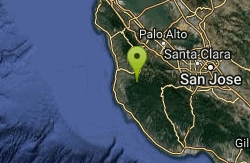
Loma Mar, California
| Address: | Parke Gulch Grove Trail, Loma Mar, CA 94021, USA |
| GPS: |
37°16'26.2"N 122°17'18.0"W Maps | Directions |
| State: | California |
| Trail Length: | 16.50 miles |
| Trail Type: | Out & Back |
| Elevation Gain: | 1335 feet |
Streams Wildflowers Pet Friendly Fishing
Hike, Horseback, Mountain Bike, and Swim
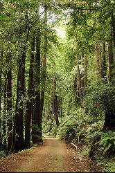
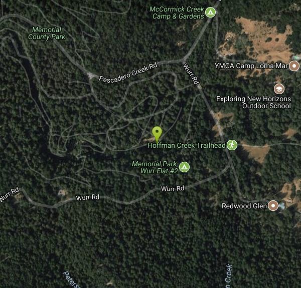
Perfect for all redwood lovers, the Pescadero Creek Park area is an incredible shady trail for a hike on a hot summer day. This is a great place to escape from city sounds and enjoy the peace of nature. Pescadero Creek Park, a San Mateo County park complex trail system, is interconnected as it encompasses Memorial Park, Heritage Grove Park, Sam McDonald Park, and Portola Redwoods State Park. Though, officially, access to the extensive trail system starts on the eastern end of Wurr Road just off Pescadero Road.
The trails are roughly an hour away from the Bay Area and each varies in level of difficulty. The trails encompass select redwood country featuring ridges, hills, rolling meadows, and valleys. Watch out for poison oak and don't forget the mosquito repellant. Equestrian and bicycles are permitted, refer to the park rangers for information about trail conditions as well as designated service roads. Motorized vehicles are prohibited in areas which are not paved.
Even though it is located is close to the ocean, the Pescadero Creek Trail Area is typically not busy and is always absolutely stunning to visit. Wild pigs can be spotted along the road. Be aware that the trails can sometimes be more difficult to find so plan accordingly.
More Information
Never modify trail features. Ride trails when they're dry enough that you won't leave ruts. Speak up when you see others on the trail and always yield to hikers, horses, and others coming uphill. Always ride on the established trail.
Read MoreBe courteous, informed, and prepared. Read trailhead guidelines, stay on the trail, and don't feed the wildlife.
Read More- Plan Ahead and Prepare
- Travel & camp on durable surfaces
- Dispose of waste properly
- Leave what you find
- Minimize campfire impacts
- Respect wildlife
- Be considerate of other visitors
Directions
From Loma Mar, California
- Head south on Loma Mar Ave toward Sylvan Way (0.1 mi)
- Turn left to stay on Loma Mar Ave (154 ft)
- Slight left onto Pescadero Creek Rd (0.1 mi)
- Turn right onto Wurr Rd (1.3 mi)
- Turn left toward Wurr Trail (82 ft)
- Continue straight (338 ft)
- Turn left onto Wurr TrailDestination will be on the right(36 ft)
The entrance to Pescadero Creek is through Memorial Park.
From 101 or 280: Take Highway #84 west of La Honda. Turn left 1/2 mile past village center in La Honda on Pescadero Road. The Park entrance in on Pescadero Road about 6 miles from turn off.
From Highway #1: Take coast highway to Pescadero Road about 11 miles to the park entrance.


Other Mountain Bike Trails, Swimming Holes, Hiking Trails, and Horseback Trails Nearby
Memorial Park
Loma Mar, California
0.1 miles WSwim near Loma Mar, California
Swim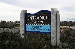
Half Moon Bay State Beach
Half Moon Bay, California
15.9 miles NWHalf Moon Bay State Park's Coastside Trail runs parallel to the Pacific Coast along what used to be the Ocean Shore Railroad. The railroad itself was in operation for just 14 years before it was...
Camp, Hike, Horseback, Swim
Garden of Eden
Felton, California
21.4 miles SEA great swimming hole in the Santa Cruz moutains of California, the Garden of Eden lives up to its name. This swimming hole is popular among all ages and offers beaches perfect for sunbathing and...
Hike, Swim 0.1-0.9 mi
Natural Bridges State Park / Monarch Butterfly Trail
Santa Cruz, California
25.6 miles SEThis trail is perfectly tucked away from the business of Santa Cruz. Monarch butterflies, during the Winter, fly here to stay warm. As you walk through the Monarch Grove, you will see trees...
Hike 0.4 mi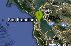
Portola Trail
San Francisco, California
34.0 miles NMountain Bike near San Francisco, California
Mountain Bike 0.1-0.6 mi
Mt. Sutro Open Space Reserve
San Francisco, California
34.7 miles NMount Sutro Open Space Reserve is a 61-acre ecological oasis in the heart of San Francisco, just south of UCSF's Parnassus Heights campus. UCSF is committed to maintaining the Reserve as a safe...
Hike, Mountain Bike 3.7 mi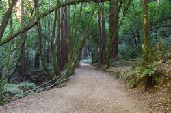
East Ridge Trail
Oakland, California
37.3 miles NThis trail is deeply tucked away up into the hills of Oakland. East Ridge is the perfect trail to deeply appreciate the beauty of the Redwoods and has many entry points. This trail weaves...
Hike
Aquatic Park
San Francisco, California
37.6 miles NIn the heart of San Francisco, in the Golden Gate National Recreation Area, is Aquatic Park: a small beach on a lagoon in the San Francisco Bay which is a historic swimming place and is still used...
Swim
Auburn Area
San Francisco, California
37.6 miles NAlongside of the North Fork of the American River in the Auburn State Recreation Area, there are several swimming holes. Located at Emigrant Gap in the Tahoe National Forest, the North...
Hike, Horseback, Kayak, Rock Climb, Swim, Whitewater
Battery Spencer
Mill Valley, California
39.8 miles NThis is easily one of the best places to view the Golden Gate Bridge. For over half a century, this was one of the most strategically important sites guarding the Golden Gate. Completed in 1897,...
Hike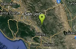
Henry Coe State Park Campground
Morgan Hill, California
41.4 miles EHenry W. Coe State Park is primarily a wilderness park. Spring is the most popular time of year to visit with fabulous displays of wildflowers. Camping is permitted all year. There are numerous...
Camp, Hike, Horseback, Mountain Bike 0.5-0.6 mi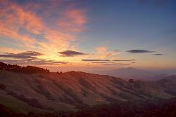
Grizzly Peak Trail
Berkeley, California
42.2 miles NGrizzly Peak Trail is located near La Loma Park in the Berkeley Hills section of the city of Berkeley, California and leads to an incredible lookout of the San Francisco Bay area....
Hike, Mountain Bike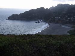
Muir Beach
Muir Beach, California
43.5 miles NMuir Beach is a little gem nestled away in the hills North of San Francisco, not far from the Muir Woods National Monument. There's a great beach and an entire network of trails. To get to the...
Hike, Swim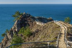
Muir Beach Overlook
Muir Beach, California
43.9 miles NHike near Muir Beach, California
Hike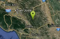
China Hole
Morgan Hill, California
44.2 miles EThis moderately strenuous hike takes you to the site of an old mineral springs resort and to the park's most popular swimming hole, a mile farther along. Madrone Soda Springs Resort was a small...
Camp, Hike, Swim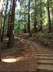
Muir Woods National Monument
Mill Valley, California
45.8 miles NThere are several suggested hikes on the main trail leaving from the visitors center. The longest, a loop, is about 2 miles. It is the only one that leaves the boardwalk. It has some elevation...
HikeNearby Campsites
Half Moon Bay State Beach
Half Moon Bay, California
15.9 miles NWHalf Moon Bay State Park's Coastside Trail runs parallel to the Pacific Coast along what used to be the Ocean Shore Railroad. The railroad itself was in operation for just 14 years before it was...
Camp, Hike, Horseback, Swim
Henry Coe State Park Campground
Morgan Hill, California
41.4 miles EHenry W. Coe State Park is primarily a wilderness park. Spring is the most popular time of year to visit with fabulous displays of wildflowers. Camping is permitted all year. There are numerous...
Camp, Hike, Horseback, Mountain Bike
China Hole
Morgan Hill, California
44.2 miles EThis moderately strenuous hike takes you to the site of an old mineral springs resort and to the park's most popular swimming hole, a mile farther along. Madrone Soda Springs Resort was a small...
Camp, Hike, Swim


