


Chinook Park
Quincy
Hike, Kayak, and Swim
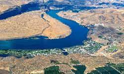
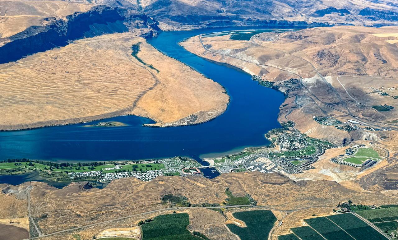
Chinook Park is the off-island day-use park of the Crescent Bar Recreation Area, a Grant County Public Utility District (Grant PUD) site on the east bank of the Columbia River about 9 miles by road west of Quincy. The river here is Wanapum Reservoir, the pool behind Wanapum Dam, and the park sits on the mainland shore facing the channel that separates Crescent Bar Island from the bank. Grant PUD owns the recreation area and Central Washington Management Group runs it day to day. Basalt cliffs rise behind the park on the east side, and open sagebrush slopes and old flood bars fill the view across the water.
From Quincy, take SR 28 west toward Wenatchee and turn south at Trinidad onto Crescent Bar Road, then follow it about 2 miles down the grade toward the river. Chinook Park is on the mainland before the bridge to the island. Its day-use lot holds 75 cars, including 6 ADA spaces, and the off-island boat launch with its own parking is next door. The lot fills on hot summer weekends, so arriving early helps.
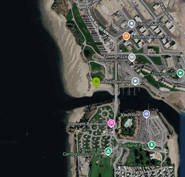
The managers list six small beaches along the Chinook Park shoreline. The largest is the south-facing strip just west of the boat launch, and that is where this listing is pinned; stay well clear of the ramp itself, because Grant PUD rules ban swimming at boat launches, moorage and other watercraft areas. Depth and bottom conditions are not published, and the reservoir level moves with dam operations, so wade in and check before swimming. Grant PUD posts the current water temperature measured at Wanapum Dam on its River Conditions page. There are no lifeguards at any Grant PUD site, and swimming is at your own risk.
Swimming and parking are free. Grant PUD lists day-use hours of 6 a.m. to 10 p.m. for Crescent Bar, the managers state that parking is free from 7 a.m. to 10 p.m. at all Grant PUD parks, and overnight parking is prohibited. No Discover Pass is required, since this is PUD land and not a state park. The park has one picnic shelter that can be reserved for $50 a day for groups under 35 (call 509-754-5002) and two more shelters that are first come, first served.
Grant PUD park rules apply: no jumping or diving into the water anywhere in its recreation areas, no glass on beaches or in swim areas, and no pets in designated swim areas, on the beach or in playgrounds. Watch for boat and personal watercraft traffic in the channel, since boats come and go from the launch next to the beach, and be aware that the river can rise or drop without warning. Waterfowl hunting is common at Chinook Park in fall and winter, so off-season visitors should expect hunters along the shore. Personal fireworks are banned at all Grant PUD sites.
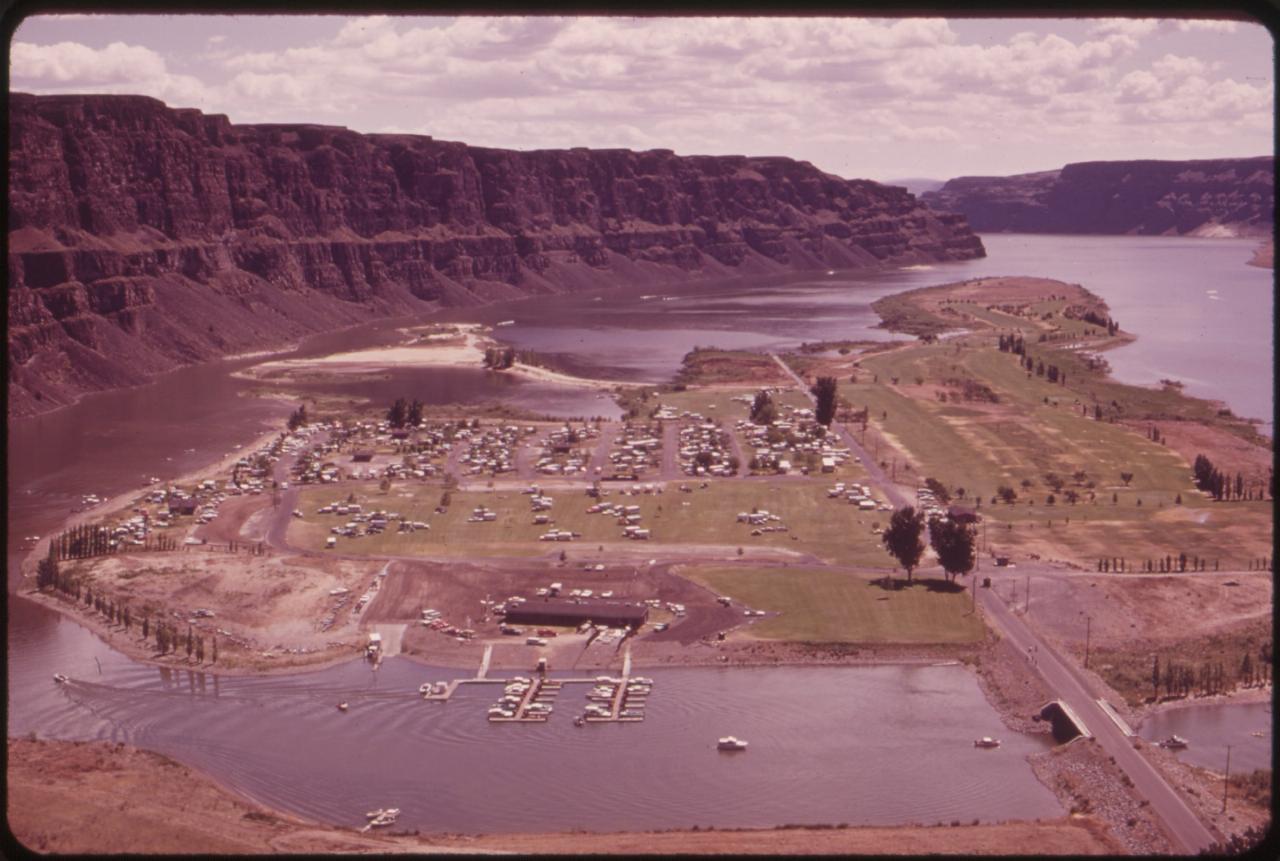
A paved walking trail runs about a mile through Chinook Park and links to another 1.5 miles of trail in Riverbend Park on the island, which has a playground and a sheltered beach of its own. The rest of the recreation area holds a 55-site RV campground, a marina with fuel and first-come day-use slips, a public nine-hole golf course and a pickleball court. The Gorge Amphitheatre and the climbing walls of Frenchman Coulee are a short drive south.
More Information
Construction projects finish up at Crescent Bar - Blog
Ribbon cutting ceremony set for June 2 to celebrate EPHRATA — Come join us in celebrating the transformation of Grant PUD
https://www.grantpud.org/blog/construction-projects-finish-up-at-crescent-barCrescent Bar Recreation Area
Welcome to the Crescent Bar Recreation Area, the hidden treasure of Central Washington. Crescent Bar is an ideal home base for catching a concert at the nearby Gorge Amphitheatre, enjoying wine tasting at the award-winning area wineries, or a day of hiking, biking, or rock climbing in the stunning Ancient Lakes and Frenchman Coulee recreation areas. There is plenty to keep you entertained while visiting our bend in the Columbia River.
https://www.crescentbarrecreation.com/Crescent Bar Recreation Area — FAQs
0 Skip to Content @supports (-webkit-backdrop-filter: none) or (backdrop-filter: none) { .header-blur-background { } } Home Camping Golf Marina/Parks Marina Parks Events Calendar Gallery CB Local FAQs .top-bun, .patty, .bottom-bun { height: 1px; } Open Menu Close Menu Home Camping Golf Marina/Parks Marina Parks Events Calendar Gallery CB Local FAQs .top-bun, .patty, .bottom-bun { height: 1px; } Open Menu Close Menu Home Camping Golf Folder: Marina/Parks Back Marina Parks Events Calendar Gallery CB Local FAQs (function() { var header = document.getElementById('header'); if (!header) { return; } function setHeaderHeightVar() { document.documentElement.style.setProperty( '--header-height', header.getBoundingClientRect().height + 'px' ); } setHeaderHeightVar(); var images = header.getElementsByTagName('img'); for (var i = 0; i < images.length; i++) { if (!images[i].complete) { images[i].addEventListener('load', setHeaderHeightVar); } } })(); //# sourceURL=reserveSpaceForHeader.js FREQUENTLY ASKED QUESTIONSClick the Links below to find out more about each of these areas #block-5d75d97c9ed26b1b13e88ce7 { } #block-5d75d97c9ed26b1b13e88ce7 .sqs-html-content { --tweak-text-block-padding: 6% 6% 6% 6%; --tweak-text-block-padding: initial; } #block-5d75d97c9ed26b1b13e88ce7 { mix-blend-mode: var(--tweak-text-block-blend ); border-radius: var(--tweak-text-block-radius); } #block-5d75d97c9ed26b1b13e88ce7 { --tweak-text-block-radius: 0px 0px 0px 0px; } #block-5d75d97c9ed26b1b13e88ce7 { } @media screen and (max-width: 767px) { #block-5d75d97c9ed26b1b13e88ce7 { } } @media screen and (max-width: 767px) { #block-5d75d97c9ed26b1b13e88ce7 .sqs-html-content { } } @media screen and (max-width: 767px) { } Most Popular Questions #block-yui_3_17_2_1_1636052214321_11818 { } #block-yui_3_17_2_1_1636052214321_11818 .sqs-html-content { --tweak-text-block-padding: 6% 6% 6% 6%; --tweak-text-block-padding: initial; } #block-yui_3_17_2_1_1636052214321_11818 { mix-blend-mode: var(--tweak-text-block-blend ); border-radius: var(--tweak-text-block-radius); } #block-yui_3_17_2_1_1636052214321_11818 { --tweak-text-block-radius: 0px 0px 0px 0px; } #block-yui_3_17_2_1_1636052214321_11818 { } @media screen and (max-width: 767px) { #block-yui_3_17_2_1_1636052214321_11818 { } } @media screen and (max-width: 767px) { #block-yui_3_17_2_1_1636052214321_11818 .sqs-html-content { } } @media screen and (max-width: 767px) { } Crescent Bar Water Level
https://www.crescentbarrecreation.com/faqsCrescent Bar Recreation Area — Parks
0 Skip to Content @supports (-webkit-backdrop-filter: none) or (backdrop-filter: none) { .header-blur-background { } } Home Camping Golf Marina/Parks Marina Parks Events Calendar Gallery CB Local FAQs .top-bun, .patty, .bottom-bun { height: 1px; } Open Menu Close Menu Home Camping Golf Marina/Parks Marina Parks Events Calendar Gallery CB Local FAQs .top-bun, .patty, .bottom-bun { height: 1px; } Open Menu Close Menu Home Camping Golf Folder: Marina/Parks Back Marina Parks Events Calendar Gallery CB Local FAQs (function() { var header = document.getElementById('header'); if (!header) { return; } function setHeaderHeightVar() { document.documentElement.style.setProperty( '--header-height', header.getBoundingClientRect().height + 'px' ); } setHeaderHeightVar(); var images = header.getElementsByTagName('img'); for (var i = 0; i < images.length; i++) { if (!images[i].complete) { images[i].addEventListener('load', setHeaderHeightVar); } } })(); //# sourceURL=reserveSpaceForHeader.js Planning a family gathering in CBRA? Daily rental rate is $50 for groups under 35 people. Hosting a larger event? A special use permit may be required and rates will vary based on the type of event.
https://www.crescentbarrecreation.com/parksGrant PUD Opening New Boat Launch
Local residents and visitors will have a number of outdoor opportunities along the Columbia River this summer recreation season. Grant PUD operates 19
https://kpq.com/grant-pud-opening-new-boat-launch/Be courteous, informed, and prepared. Read trailhead guidelines, stay on the trail, and don't feed the wildlife.
Read More
- Plan Ahead and Prepare
- Travel & camp on durable surfaces
- Dispose of waste properly
- Leave what you find
- Minimize campfire impacts
- Respect wildlife
- Be considerate of other visitors
Directions
From Quincy
- Head southwest on Hancock St/
Temple St Continue to follow Hancock St(0.1 mi) - Turn right onto Granite St (0.1 mi)
- Turn left onto Thomas Burgin Pkwy (1.1 mi)
- Slight right onto the I-93 N ramp (1.3 mi)
- Merge onto I-93 (2.9 mi)
- Keep right to continue on I-93 S (3.7 mi)
- Continue onto I-95 N (11.4 mi)
- Take exit 39A-B for I-90 W/
Mass Pike Toll road(1.5 mi) - Merge onto I-90 WToll roadEntering New York(140 mi)
- Continue onto NY-912M WToll road(6.6 mi)
- Take exit 22-61 to merge onto I-87 N toward I-90/
Albany/ Buffalo Toll road(14.2 mi) - Continue onto Governor Thomas E. Dewey Thruway/
NY State Thruway (1.2 mi) - Merge onto I-90 WToll roadPassing through PennsylvaniaEntering Ohio(446 mi)
- Keep right to stay on I-90 W, follow signs for I-271 S/
Cleveland (1.3 mi) - Keep right to stay on I-90 W, follow signs for Cleveland (3.1 mi)
- Keep left to stay on I-90 W (11.5 mi)
- Slight left to stay on I-90 W (signs for I-71) (3.2 mi)
- Take exit 170B for I-71 S toward Columbus (1.2 mi)
- Continue onto I-71 S (7.5 mi)
- Take exit 238-239 on the left to merge onto I-480 W toward Toledo (9.4 mi)
- Take the I-80 W/
Ohio Turnpike exit toward I-480 W/ Toledo Toll road(1.1 mi) - Merge onto I-80 WToll road(147 mi)
- Keep left to continue on I-90 WToll roadEntering Indiana(160 mi)
- Keep left to stay on I-90 WToll roadEntering Illinois(7.8 mi)
- Take the I-94 W/
I-90 W exit on the left toward Ryan Expy Toll road(0.3 mi) - Merge onto I-90Exp W/
I-94Exp W (4.8 mi) - Merge onto I-90 W/
I-94 W (10.7 mi) - Keep left to continue on I-90 W, follow signs for Kennedy Expwy/
O'Hare/ Rockford (4.7 mi) - Keep left to stay on I-90 WToll road(2.8 mi)
- Continue straight to stay on I-90 WToll road(23.1 mi)
- Keep left to stay on I-90 WToll roadEntering Wisconsin(196 mi)
- Keep right to continue on I-94 WEntering Minnesota(156 mi)
- Take exit 249 for I-694 S (0.7 mi)
- Merge onto I-694 N (11.5 mi)
- Slight right onto I-694 W (3.7 mi)
- Continue straight onto I-694 (7.1 mi)
- Keep left to continue on I-694 W, follow signs for I-94 W/
St Cloud (7.5 mi) - Keep right to continue on I-94 W, follow signs for St Cloud (17.0 mi)
- Keep right to stay on I-94 WPassing through North DakotaEntering Montana(801 mi)
- Continue onto I-90 WPassing through IdahoEntering Washington(673 mi)
- Take exit 151 toward WA-281 N/
Quincy/ Wenatchee (0.3 mi) - Turn right onto WA-281 (1.6 mi)
- Turn right onto WA-281 N (2.9 mi)
- Turn left onto Rd 5 NW/
White Trail Rd Continue to follow White Trail Rd(8.8 mi) - At the traffic circle, take the 3rd exit onto WA-28 W (3.4 mi)
- Turn left onto Crescent Bar Rd NW (2.5 mi)
- Turn right (164 ft)
- Turn leftDestination will be on the right(246 ft)



Other Swimming Holes, Hiking Trails, and Kayaking Areas Nearby
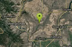
Douglas Creek
Palisades, Washington
18.0 miles NSwim near Palisades, Washington
Swim
Wanapum Lake
Royal City, Washington
20.8 miles SA secluded sandy beach and shallow swimming cove on Wanapum Lake, reached by a half-mile hike through high sage — primitive and free, with cliff walls and clothing-optional use.
Swim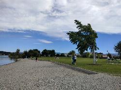
Walla Walla Point Park
Wenatchee
21.9 miles NWA Chelan County PUD park on the Columbia River in north Wenatchee with a designated swim cove and gravel beach at its north end. Free, open 7 a.m. to 10 p.m. year-round, no lifeguards listed.
Hike, Swim
Moses Lake Sand Dunes
Moses Lake, Washington
33.8 miles EThree thousand acres of rolling sand dunes on the southern tip of Moses Lake, with great fishing and water skiing right in the dunes area.
Camp, Swim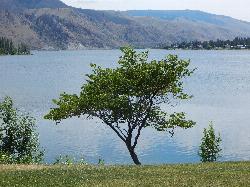
Daroga State Park
Orondo
35.6 miles NA mile and a half of Columbia River shoreline six miles north of Orondo, with a marked swim beach, a warm shallow lagoon behind the spit, and primitive campsites you can only reach on foot or by boat. Discover Pass required, open April through September.
Camp, Hike, Kayak, Swim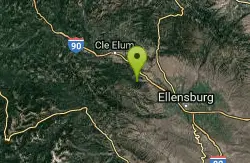
Taneum Creek
Thorp, Washington
39.6 miles WA popular swimming hole with a deep front pool and a wide, shallow play area directly above and across the creek — a great combo for mixed groups of swimmers.
Swim
Chelan Falls Park
Chelan Falls, Washington
40.4 miles NFree Chelan County PUD park on the Columbia River with a roped swim area, two-lane boat launch, docks, showers and ball fields, four miles below the town of Chelan.
Hike, Kayak, Swim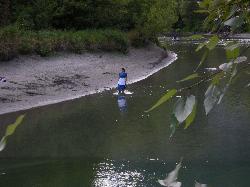
Waterfront Park
Leavenworth
40.5 miles NWFree city park on the Wenatchee River a few blocks from downtown Leavenworth, with small gravel and sand beaches, Blackbird Island trails and Barn Beach, where tubers end their float. Cold, fast water until late summer.
Hike, Swim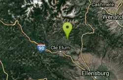
Teanaway River
Cle Elum, Washington
40.9 miles WSwim near Cle Elum, Washington
Swim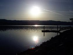
Lake Chelan State Park
Chelan
46.4 miles NWashington State Parks swim beach on the south shore of Lake Chelan, about 9 miles west of Chelan, with a roped swim area below the day-use lot. Discover Pass required ($10 day, $45 annual).
Camp, Hike, Kayak, Swim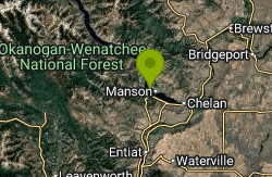
Willow Point Park
Manson
47.7 miles NA free, 2-acre Manson Park and Recreation District beach on Lake Chelan's north shore with a designated swim area (no lifeguards), playground and picnic lawn. Open dawn to dusk, no pets.
SwimNearby Campsites
Moses Lake Sand Dunes
Moses Lake, Washington
33.8 miles EThree thousand acres of rolling sand dunes on the southern tip of Moses Lake, with great fishing and water skiing right in the dunes area.
Camp, Swim
Daroga State Park
Orondo
35.6 miles NA mile and a half of Columbia River shoreline six miles north of Orondo, with a marked swim beach, a warm shallow lagoon behind the spit, and primitive campsites you can only reach on foot or by boat. Discover Pass required, open April through September.
Camp, Hike, Kayak, Swim
Lake Chelan State Park
Chelan
46.4 miles NWashington State Parks swim beach on the south shore of Lake Chelan, about 9 miles west of Chelan, with a roped swim area below the day-use lot. Discover Pass required ($10 day, $45 annual).
Camp, Hike, Kayak, Swim


