


Lake Chelan State Park
Chelan
Camp, Hike, Kayak, and Swim
Lake Chelan State Park is a 139-acre park run by the Washington State Parks and Recreation Commission on the south shore of Lake Chelan, about 9 miles west of downtown Chelan. The lake is a 50-mile glacial trough that State Parks calls the deepest in Washington, and the park sits on its lower basin a few miles below The Narrows. The state bought the old Stevenson and Barrin homesteads here in 1943 to keep a stretch of this fast-developing shoreline open to the public, and it has been one of the busiest parks in the system ever since.
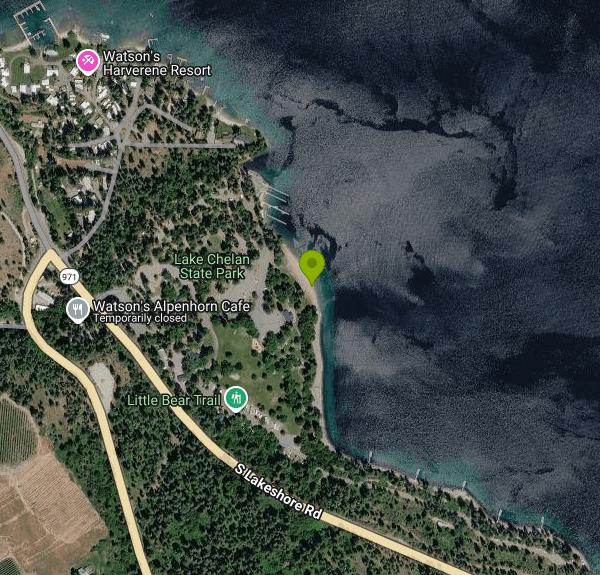
From Chelan, follow South Lakeshore Road west along the water to the entrance at 7544 S Lakeshore Road. Coming from Wenatchee on US 97A, take SR 971 (Navarre Coulee Road) over the ridge and it drops straight into the park. The swim beach is in the middle of the park, a short walk east of where First Creek enters the lake. A small day-use lot sits just above the sand, with steps down to the beach, a playground and a sand volleyball court close by. The lot is small for a park with a campground this size, so arrive early on summer weekends.
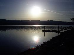
The designated swim area is a roped section of sandy beach roughly 100 meters long in front of the day-use lawn. The water is clear and cold. Lake Chelan is fed by snowmelt from the North Cascades and reaches 1,486 feet at its deepest point, so expect cold water away from the shallows even in August. The park page lists no lifeguard service, so swimming is at your own risk and kids need an adult close by. The boat ramp and dock are just north of the swim area, and motorboats, paddleboards and rental kayaks use the water right outside the ropes.
A Discover Pass is required to park for the day: $10 for a one-day pass or $45 for an annual pass. That is Washington's state day-use fee, and there is no separate charge to swim. Launching a boat costs $7 per day, and overnight moorage is $12 a night for guests with a campsite reservation. Park hours are 6:30 a.m. to dusk year round. The day-use area stays open in winter, while the campground loops close in stages after September.
The lake level is set by Chelan County PUD's hydroelectric project and normally moves between 1,084 and 1,100 feet above sea level, drawn down through fall and winter to make room for spring runoff. The PUD has warned that the lake may sit lower than in recent years during winter and early spring 2027 because of planned maintenance at the project, which means more exposed shoreline and a longer walk to the water here. As of late September 2026 the park was under a Level 2 burn ban, with wood fires limited to the fire pits. Dogs must be on a leash.
The campground has more than 100 tent and utility sites spread over the Beach, West and Trailer loops, plus a hiker-biker site, showers and a trailer dump. Paninis in the Park sells hot food, espresso, ice cream, ice and firewood from 8 a.m. to 8 p.m. daily through Labor Day, and the rental stand beside it has kayaks, SUPs and hydro bikes. The short Little Bear Trail loops through the forest above the campground with interpretive signs, and a monument one mile east of the park marks the 1945 school bus accident on South Lakeshore Road. Twenty-Five Mile Creek State Park is farther up the same shore.
More Information
Be courteous, informed, and prepared. Read trailhead guidelines, stay on the trail, and don't feed the wildlife.
Read More
- Plan Ahead and Prepare
- Travel & camp on durable surfaces
- Dispose of waste properly
- Leave what you find
- Minimize campfire impacts
- Respect wildlife
- Be considerate of other visitors
Directions
From Chelan
- Head east on E Johnson Ave toward E Johnson Ave (0.1 mi)
- Turn right onto N Sanders St (0.5 mi)
- Continue onto Webster Ave (0.3 mi)
- Continue onto US-97 ALT S/
W Woodin Ave Continue to follow US-97 ALT S(3.1 mi) - Slight right onto WA-971 S/
S Lakeshore Rd (5.9 mi) - Turn rightRestricted usage road(0.2 mi)
- Slight rightRestricted usage road(23 ft)
- Slight leftRestricted usage roadDestination will be on the left(125 ft)


Other Swimming Holes, Hiking Trails, and Kayaking Areas Nearby

Chelan Falls Park
Chelan Falls, Washington
11.1 miles SEFree Chelan County PUD park on the Columbia River with a roped swim area, two-lane boat launch, docks, showers and ball fields, four miles below the town of Chelan.
Hike, Kayak, Swim
Daroga State Park
Orondo
11.3 miles SA mile and a half of Columbia River shoreline six miles north of Orondo, with a marked swim beach, a warm shallow lagoon behind the spit, and primitive campsites you can only reach on foot or by boat. Discover Pass required, open April through September.
Camp, Hike, Kayak, Swim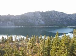
Alta Lake State Park
Pateros
15.9 miles NEWashington state park beach on the north shore of Alta Lake, two miles southwest of Pateros, with a day-use swim area below tall rock cliffs. Discover Pass required; open April through October.
Camp, Hike, Kayak, Swim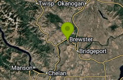
Columbia Cove Park
Brewster
24.1 miles NEA free City of Brewster river park on Lake Pateros (the Columbia River above Wells Dam) with a small swim beach in a cove beside the boat launch, picnic shelters and a lawn.
Kayak, Swim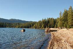
Lake Wenatchee State Park South Beach
Leavenworth
25.2 miles WThe designated swim beach at Lake Wenatchee State Park, a sandy stretch of cold, clear glacier-fed lake in the eastern Cascades about 20 road miles from Leavenworth. Discover Pass required ($10 per day).
Camp, Canoe, Hike, Kayak, Swim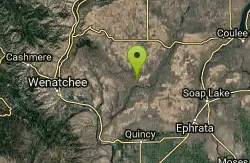
Douglas Creek
Palisades, Washington
32.2 miles SESwim near Palisades, Washington
Swim
Rock Island
Leavenworth, Washington
38.3 miles SWSwim near Leavenworth, Washington
Swim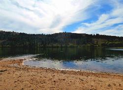
Pearrygin Lake State Park
Winthrop
42.3 miles NA marked sand swim beach on the warm southeast shore of Pearrygin Lake, a mile and a half from Winthrop, with a shaded day use lawn and a bathhouse with hot showers. Washington State Parks posts no lifeguards, and day use takes a Discover Pass.
Camp, Canoe, Hike, Kayak, Swim
Jade Lake
Skykomish, Washington
47.8 miles WA 26-mile overnight backpacking route through the Snoqualmie region past wildflower meadows, Marmot Lake, and a steep talus scramble to a remote alpine lake for swimming.
Backpack, Camp, Swim
Steamboat Rock State Park Swim Beach
Electric City, Washington
49.8 miles ESandy roped swim beach on Banks Lake below the 800-foot basalt butte of Steamboat Rock State Park, 14 miles south of Grand Coulee Dam in the Washington desert.
Camp, Hike, Kayak, Mountain Bike, SwimNearby Campsites
Daroga State Park
Orondo
11.3 miles SA mile and a half of Columbia River shoreline six miles north of Orondo, with a marked swim beach, a warm shallow lagoon behind the spit, and primitive campsites you can only reach on foot or by boat. Discover Pass required, open April through September.
Camp, Hike, Kayak, Swim
Alta Lake State Park
Pateros
15.9 miles NEWashington state park beach on the north shore of Alta Lake, two miles southwest of Pateros, with a day-use swim area below tall rock cliffs. Discover Pass required; open April through October.
Camp, Hike, Kayak, Swim
Lake Wenatchee State Park South Beach
Leavenworth
25.2 miles WThe designated swim beach at Lake Wenatchee State Park, a sandy stretch of cold, clear glacier-fed lake in the eastern Cascades about 20 road miles from Leavenworth. Discover Pass required ($10 per day).
Camp, Canoe, Hike, Kayak, Swim
Pearrygin Lake State Park
Winthrop
42.3 miles NA marked sand swim beach on the warm southeast shore of Pearrygin Lake, a mile and a half from Winthrop, with a shaded day use lawn and a bathhouse with hot showers. Washington State Parks posts no lifeguards, and day use takes a Discover Pass.
Camp, Canoe, Hike, Kayak, Swim
Jade Lake
Skykomish, Washington
47.8 miles WA 26-mile overnight backpacking route through the Snoqualmie region past wildflower meadows, Marmot Lake, and a steep talus scramble to a remote alpine lake for swimming.
Backpack, Camp, Swim
Steamboat Rock State Park Swim Beach
Electric City, Washington
49.8 miles ESandy roped swim beach on Banks Lake below the 800-foot basalt butte of Steamboat Rock State Park, 14 miles south of Grand Coulee Dam in the Washington desert.
Camp, Hike, Kayak, Mountain Bike, Swim


