


Colusa National Wildlife Refuge
Colusa, California
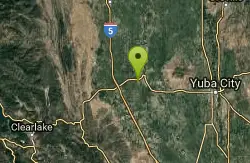
| GPS: |
39°11'17.8"N 122°2'42.5"W Maps | Directions |
| State: | California |
Hike
Colusa National Wildlife Refuge is one of five refuges in the Sacramento Refuge Complex located in the Sacramento Valley of north-central California. The refuge is about 70 miles north of the metropolitan area of Sacramento. The 4,507-acre refuge primarily consists of intensively managed wetland impoundments, with some grassland and riparian habitat. The Sacramento Valley is one of the most important wintering areas for waterfowl in North America. Colusa Refuge typically supports wintering populations of more than 200,000 ducks and 50,000 geese.
More Information
Colusa National Wildlife Refuge | U.S. Fish & Wildlife Service
Colusa National Wildlife Refuge is part of the SACRAMENTO NWR COMPLEX. Colusa NWR offers many visitor activities: drive the auto tour, take photos, watch wildlife, go for a hike, or take part in a waterfowl hunt.
https://www.fws.gov/refuge/colusaBe courteous, informed, and prepared. Read trailhead guidelines, stay on the trail, and don't feed the wildlife.
Read More
- Plan Ahead and Prepare
- Travel & camp on durable surfaces
- Dispose of waste properly
- Leave what you find
- Minimize campfire impacts
- Respect wildlife
- Be considerate of other visitors
Directions
From Colusa, California
- Head east on Market St toward 6th St (20 ft)
- Turn right at the 1st cross street onto 6th St (0.1 mi)
- Turn right at the 2nd cross street onto Oak St (0.3 mi)
- Turn left onto State Hwy 20 W/10th StContinue to follow State Hwy 20 W(2.0 mi)
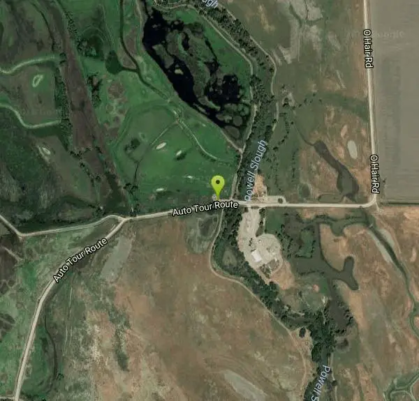
- Turn left onto O Hair Rd (0.7 mi)
- Continue onto Auto Tour RouteDestination will be on the right(262 ft)
For the wildlife viewing area: from Colusa, drive one-half mile west on Highway 20 to the Refuge entrance. From Williams, exit Interstate 5 on exit 578 for Highway 20 Clear Lake/Colusa turn east. Travel approximately six miles on Highway 20 to graveled Ohair Road.
Other Hiking Trails Nearby
Delevan National Wildlife Refuge
Colusa, California
9.0 miles NA 5,797-acre national wildlife refuge in California's Sacramento Valley with over 4,500 acres of managed wetlands — a major bird habitat 80 miles north of Sacramento.
Hike
Sutter National Wildlife Refuge
Meridian, California
17.0 miles SEA 2,600-acre Sacramento Valley wildlife refuge 50 miles north of Sacramento, managing wetland impoundments and riparian habitat as critical wintering grounds for waterfowl.
Hike
Sacramento National Wildlife Refuge
Willows, California
18.3 miles NWPart of a multi-refuge complex in California's Sacramento Valley, this national wildlife refuge offers protected habitat and wildlife viewing in a rich wetland landscape.
Hike
The Gravel Pits
Willows, California
25.1 miles NA scenic float on the Sacramento River between Redding and Red Bluff with mostly moving class-I water, occasional eddy lines, a few class-II rapids, and fast downstream travel.
Canoe, Hike
Blue Gum Grove
Willows, California
29.3 miles NA 10-acre nature park in Seal Beach with native shrubs, mature Eucalyptus trees, wildlife, and spring and summer wildflowers — a quiet green escape between two neighborhoods.
Hike
Stony Gorge Reservoir
Elk Creek, California
37.6 miles NWSandy beaches against oak-and-chaparral foothills frame this mid-sized low-elevation reservoir, where warm calm water is ideal for waterskiing, jet skiing, and paddling.
Camp, Canoe, Hike, Swim
Bidwell Park
Chico, California
42.1 miles NOne of the largest municipal parks in the United States at nearly 3,670 acres, stretching almost 11 miles through the heart of Chico along Big Chico Creek.
Hike, Horseback, Mountain Bike, SwimNearby Campsites
Stony Gorge Reservoir
Elk Creek, California
37.6 miles NWSandy beaches against oak-and-chaparral foothills frame this mid-sized low-elevation reservoir, where warm calm water is ideal for waterskiing, jet skiing, and paddling.
Camp, Canoe, Hike, Swim
Harbin Hot Springs
Middletown, California
43.0 miles SWA well-established, clothing-optional hot spring retreat in Lake County with multiple pools, overnight lodging, a restaurant, workshops, and conference facilities — fees apply.
Camp, Hot Springs, Swim


