


The Gravel Pits
Willows, California
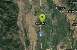
| GPS: |
39°32'17.1"N 122°10'9.9"W Maps | Directions |
| State: | California |
Canoe and Hike
This semi-remote section of the Sacramento between Redding and Red Bluff could hardly be described as a creek, but it makes an interesting float that can help you decide whether you like big water or not. Although most of this section is moving water without whitecaps (class I), eddy lines and whirlpools can make things exciting at times. With so much water in the river, boats move quickly downstream. There are a few class II rapids here and there. If you have just one day, the section from Bend to Red Bluff is recommended for its scenery and excitement.
More Information
California Creeks - Sacramento River below Redding
Sacramento River below Redding Stretch: Anderson River Park to Ide Adobe Park Difficulty: class I (some II) big water Distance: 11.4 or 35.8 miles, 1 or 2 days Flows: rafts and kayaks 5000 - 20000 cfs or higher Gauge: measured at Bend Bridge (BND) Gradient: 3.5 fpm average Put-in: Anderson river park near gravel pits, 420' Take-out: William B. Ide Adobe State Historical Park, 294' Shuttle: 22 miles (20 minutes) one-way Maps: Delorme Atlas, AAA Northern California, Topo Season: year round, from dam release Agency: BLM, private Notes: © 1998, 2002, 2024 Bill Tuthill, CreeksYahoo, thanks to Jim Ham This semi-remote section of the Sacramento between Redding and Red Bluff could hardly be described as a creek, but it makes an interesting float that can help you decide whether you like big water or not. Although most of this section is moving water without whitecaps (class I), eddy lines and whirlpools can make things exciting at times. With so much water in the river, boats move quickly downstream. There are a few class II rapids here and there. If you have just one day, the section from Bend to Red Bluff is recommended for its scenery and excitement. Although much of the time you float past suburban backyards, camping is allowed in many places, sometimes on both sides of the river. A Sheriff travels up and downriver in a jetboat, so help is never far away. At low flows, which seem high for creek boaters, there are many beaches. The water temperature is cold even after warm weather. Because summer temperatures are generally hot, this run is best in autumn, or late winter when the grass is green. Fishing can be good; trout fishing is better upstream because of colder water, and (hatchery) salmon fishing is better downstream, allowed only in season. You can put in as far upstream as Redding diversion dam near the highway 273 bridge in downtown Redding, for about 15 more river miles (at the gravel pits below Redding, the easy run is right of the islands). mile 0 Boat access at Anderson river park, near gravel pits. Just downstream are many channels and islands; most of the water goes left. 2.1 Deschutes Road crosses on a bridge overhead. Until near Balls Ferry, the river flows thru a developed area with many houses. 3 Below an island, Cow Creek enters on the left. 4.2 High-tension powerline crosses overhead; China Gardens on the left. 5.5 Bear Creek enters on the left. 6.1 Ash Creek enters on the left. 6.9 Large salmon holding area. 7.1 Balls Ferry at highway A17 bridge with river access just downstream on the left. Jet boaters appear at times. Good alternate put-in, because after this point the river seems more remote. 7.2 Class II- rapid, easiest on the left (2002). 8.9 Gover Road boat access on the left. Alternate put-in. 9.4 Anderson Creek enters on the right. 9.9 Cottonwood Creek, a river at times, enters on the right, marking the Shasta-Tehama county line. 10.1 Class II rapid, relatively new, enter right of center (2002). Many views of Mount Lassen from river Some strange Battle Creekian butterfly 11.9 Battle Creek enters on the left. Public land just downstream on the left bank, called Bloody Island although it isn't really an island. 13 Public land on the left bank, then both banks, continuing on the left for more than a mile. The river bends right (west) and passes Wildcat Point, Juniper Point, then Round Mountain. 15 Jellys Ferry Road bridge. Public land on the left, with river access. Over the next few miles, the river bends gradually north. 17.2 Inks Creek enters on the left at the northernmost point of the bend. Tadpole haven, in season. The left bank is public land for many miles, until houses of Bend. 18.2 After a left bend, a nice campsite appears on the left bank, with low-water beach, high-water bench, and outhouse in the oak woods. This is called Massacre Flat, probably due to some Indian battle. The river bends east, south, and west around Table Mountain. 18.8 Table Mountain Lake outlet enters on the right. 24.4 Bend Ferry Road bridge, with boat access downstream on the left. Recommended put-in for one day trips. Gaging station nearby, source of BND flow numbers. 26.8 Southernmost point of big bend on which Bend is located. Public land on right bank starts in less than a mile. One of many scenic riverside cliffs Raft and kayak entering China Rapids 28.2 China Rapids begins, class II. Above 8000 cfs, this rapid consists of waves with few rocks. Bedrock formations begin to appear at flows under 8000 cfs, often causing trouble for drunken jetboaters. Alert kayakers should have no problem maneuvering around these rocks, which are visible from above. Wear your lifejacket at all times, especially on large rivers, and most importantly in rapids. “A buddy [floated this section] in canoes with an inexperienced no-PFD-needed sort of group. They capsized at an eddy line and nearly drowned due to wearing heavy jackets and assorted late-fall outfits. Other than that he said the trip was uneventful but pretty. The near death experience happened at China Rapid, which I believe is a long class II.” 28.9 End of China Rapids. Public land on both sides. Pleasant camping with mixed sun and shade is afforded by several spots on the left. Campsites on the right bank are generally shaded by Bald Hill. 29.2 Paynes Creek enters on the left, marking the start of Iron Canyon, a lava flow thru which the river has carved a channel. Remote but steep campsites are available in this canyon. Stringy but not slimy Paynes Creek algae Good side hikes abound in Iron Canyon 29.7 Lava tube on river right, worth a stop. Bald Hill on the right. 30.4 River turns sharp right and heads south by southeast. 32.4 Gaging station on left. Suburbs begin; no more wilderness. 35.8 Take out at Ide Adobe State Park on the right bank. 37 Hazard! Red Bluff diversion dam (seasonal, summer and fall) is not navigable. Take out or portage on the left bank at the recreation area and Discovery Center near Sycamore Grove campground. Below the Red Bluff diversion dam, there is another ~ 25 mile class I run; take out at a riverside fisherman's bar on the east bank near Hamilton City. Reports from long-distance sea kayakers indicate that the Sacramento River is very scenic all the way to Colusa. Shuttle Directions To reach take-out, exit I-5 at Red Bluff and take Adobe Road east (north of the river crossing). Ide Adobe State Park is about a mile from the freeway. To reach put-in from there, continue east on Adobe Road to the intersection with Jellys Ferry road, and turn north. This leads into a freeway entrance. Continue north to Anderson, and exit I-5 on North Street. Follow North Street straight down to the river access. The alternate put-in at Ball's Ferry is reached thru the town of Cottonwood, where Fourth Street reaches an intersection with Ball's Ferry road. Oddly enough, to reach Ball's Ferry you leave this road, bearing right onto Ash Creek road. Creeks Navigation Home Recommended Runs Map of Rivers Alphabetic Index Alphabetic Table Text Search Sponsored Links (adsbygoogle = window.adsbygoogle || []).push({});
https://cacreeks.com/sac-red.htmBe courteous, informed, and prepared. Read trailhead guidelines, stay on the trail, and don't feed the wildlife.
Read More
- Plan Ahead and Prepare
- Travel & camp on durable surfaces
- Dispose of waste properly
- Leave what you find
- Minimize campfire impacts
- Respect wildlife
- Be considerate of other visitors
Directions
From Willows, California
- Head west on Biggs-Willows Rd/E Wood St toward N Tehama St (108 ft)
- Turn right at the 1st cross street onto Interstate 5 Business/N Tehama St (1.0 mi)
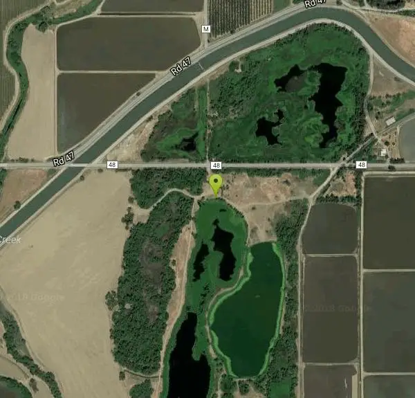
- Turn right onto Co Rd 48Destination will be on the right(1.3 mi)
You can put in as far upstream as Redding diversion dam near the highway 273 bridge in downtown Redding, for about 15 more river miles (at the gravel pits below Redding, the easy run is right of the islands).
Other Hiking Trails and Canoeing Areas Nearby
Blue Gum Grove
Willows, California
4.3 miles NA 10-acre nature park in Seal Beach with native shrubs, mature Eucalyptus trees, wildlife, and spring and summer wildflowers — a quiet green escape between two neighborhoods.
Hike
Sacramento National Wildlife Refuge
Willows, California
7.5 miles SPart of a multi-refuge complex in California's Sacramento Valley, this national wildlife refuge offers protected habitat and wildlife viewing in a rich wetland landscape.
Hike
Ord Bend Park
Glenn, California
11.3 miles NEA Glenn County riverfront park with one of the few Sacramento River boat launches in the area — a great spot for picnicking and nature viewing next to the Sacramento National Wildlife Refuge.
Canoe
Delevan National Wildlife Refuge
Colusa, California
16.1 miles SA 5,797-acre national wildlife refuge in California's Sacramento Valley with over 4,500 acres of managed wetlands — a major bird habitat 80 miles north of Sacramento.
Hike
Stony Gorge Reservoir
Elk Creek, California
19.3 miles WSandy beaches against oak-and-chaparral foothills frame this mid-sized low-elevation reservoir, where warm calm water is ideal for waterskiing, jet skiing, and paddling.
Camp, Canoe, Hike, Swim
Colusa National Wildlife Refuge
Colusa, California
25.1 miles SA 4,507-acre wildlife refuge in California's Sacramento Valley that regularly hosts more than 200,000 wintering ducks and 50,000 geese — one of North America's premier waterfowl destinations.
Hike
Bidwell Park
Chico, California
25.5 miles NEOne of the largest municipal parks in the United States at nearly 3,670 acres, stretching almost 11 miles through the heart of Chico along Big Chico Creek.
Hike, Horseback, Mountain Bike, Swim
Sutter National Wildlife Refuge
Meridian, California
38.4 miles SEA 2,600-acre Sacramento Valley wildlife refuge 50 miles north of Sacramento, managing wetland impoundments and riparian habitat as critical wintering grounds for waterfowl.
Hike


