


Bidwell Park
Chico, California
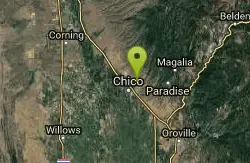
| GPS: |
39°45'55.7"N 121°47'25.3"W Maps | Directions |
| State: | California |
Hike, Horseback, Mountain Bike, and Swim
Bidwell Park was established July 20, 1905 through the donation by Annie Bidwell of approximately 2,500 acres of land to the City of Chico. Since that time, the City has purchased additional land, such as Cedar Grove in 1922, and 1,200 acres of land south of Big Chico Creek in Upper Park in 1995. Today, the total Park size is 3,670 acres (nearly 11 miles in length), making it one of the largest municipal parks in the United States.
Never modify trail features. Ride trails when they're dry enough that you won't leave ruts. Speak up when you see others on the trail and always yield to hikers, horses, and others coming uphill. Always ride on the established trail.
Read MoreBe courteous, informed, and prepared. Read trailhead guidelines, stay on the trail, and don't feed the wildlife.
Read More
- Plan Ahead and Prepare
- Travel & camp on durable surfaces
- Dispose of waste properly
- Leave what you find
- Minimize campfire impacts
- Respect wildlife
- Be considerate of other visitors
Directions
From Chico, California
- Head northeast on E 5th St toward Wall St (0.4 mi)
- Turn left onto Cypress St (276 ft)
- Continue onto Woodland Ave (433 ft)
- Slight right onto Mangrove Ave/Pine St (417 ft)
- Turn right onto Vallombrosa Ave (2.8 mi)
- At the traffic circle, take the 2nd exit onto Manzanita Ave (0.2 mi)
- At the traffic circle, continue straight to stay on Manzanita Ave (0.4 mi)
- At the traffic circle, take the 1st exit onto Wildwood Ave (0.9 mi)
From Hwy 99 take the Hwy 32 Chester Exit
Head northeast on CA-32 East toward Chester/E 9th St. for one or two blocks toward Fir St.
Take a left onto Fir St.
Fir St. turns into E 8th St. There will be a sign for the Bidwell Park Info Center (Nature Center).
The Chico Creek Nature Center will be .75 miles on the left

Other Mountain Bike Trails, Swimming Holes, Hiking Trails, and Horseback Trails Nearby
Chico Area
Ramona, California
0.2 miles SWSwim near Ramona, California
Swim
Blue Gum Grove
Willows, California
24.6 miles SWA 10-acre nature park in Seal Beach with native shrubs, mature Eucalyptus trees, wildlife, and spring and summer wildflowers — a quiet green escape between two neighborhoods.
Hike
The Gravel Pits
Willows, California
25.6 miles SWA scenic float on the Sacramento River between Redding and Red Bluff with mostly moving class-I water, occasional eddy lines, a few class-II rapids, and fast downstream travel.
Canoe, Hike
Sacramento National Wildlife Refuge
Willows, California
31.4 miles SWPart of a multi-refuge complex in California's Sacramento Valley, this national wildlife refuge offers protected habitat and wildlife viewing in a rich wetland landscape.
Hike
Delevan National Wildlife Refuge
Colusa, California
35.5 miles SWA 5,797-acre national wildlife refuge in California's Sacramento Valley with over 4,500 acres of managed wetlands — a major bird habitat 80 miles north of Sacramento.
Hike
Stony Gorge Reservoir
Elk Creek, California
41.0 miles WSandy beaches against oak-and-chaparral foothills frame this mid-sized low-elevation reservoir, where warm calm water is ideal for waterskiing, jet skiing, and paddling.
Camp, Canoe, Hike, Swim
Colusa National Wildlife Refuge
Colusa, California
42.2 miles SA 4,507-acre wildlife refuge in California's Sacramento Valley that regularly hosts more than 200,000 wintering ducks and 50,000 geese — one of North America's premier waterfowl destinations.
Hike
Sutter National Wildlife Refuge
Meridian, California
47.1 miles SA 2,600-acre Sacramento Valley wildlife refuge 50 miles north of Sacramento, managing wetland impoundments and riparian habitat as critical wintering grounds for waterfowl.
Hike


