


Desoto State Park
Fort Payne, Alabama
| Address: | 7104 Desoto Pkwy NE, Fort Payne, AL 35967 |
| GPS: |
34°30'0.4"N 85°37'24.6"W Maps | Directions |
| State: | Alabama |
Restrooms Picnic Tables Waterfalls Trails Wildflowers Bicycles Fishing State Park
Hike, Kayak, Mountain Bike, Rock Climb, and Swim
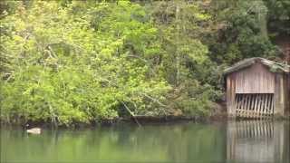
Desoto State Park is located on the gorgeous Lookout Mountain in the scenic northeast of Alabama. It is conveniently located 8 miles northeast from Fort Payne. With many rushing waterfalls and fragrant wildflowers scattered throughout the park, visiting this state park will be a breathtaking experience.
There is a myriad of amenities at the park which includes, a restaurant, meeting rooms, pavilions, a picnic area with a playground, an Olympic-size swimming pool, and a nature center which feature interpretive programs and live animals. You can take further advantage of these amenities by staying a few nights in the chalets, rustic cabins, motel rooms, or the campground containing 94 sites with full RV hookups.
This family-friendly park has many activities to keep everyone of all ages entertained. Whether you're an outdoor enthusiast or a sports fanatic, you'll enjoy many of the opportunities that Desoto State Park has to offer. Kayaking, fishing, hiking, cycling, mountain biking, rappelling, bouldering, picnicking, and camping are many of the wonderful activities you can enjoy here. This is the perfect place to get out into nature and go on a wildflower expedition or just go exploring for the fun of it!
More Information
Alabama State Parks | Alapark
Official Website of the Alabama State Parks a division of the Alabama Department of Conservation and Natural Resources.
https://www.alapark.com/De Soto State Park
In the rustic tradition of the Civilian Conservation Corps (CCC), Desoto State Park is accented by rushing waterfalls and fragrant wildflowers. The atmosphere of the CCC further enhances the restaurant, lodge and cabin facilities.
https://stateparks.com/de_soto_state_park_in_alabama.htmlDeSoto State Park and DeSoto Falls - Fort Payne, Alabama
DeSoto State Park is a beautiful scenic and recreational area near Fort Payne, Alabama. The park features waterfalls, walking trails, cabins, a lodge, restaurant, picnic areas, camping and more. There are numerous historic sites.
https://www.exploresouthernhistory.com/desotopark1.htmlNever modify trail features. Ride trails when they're dry enough that you won't leave ruts. Speak up when you see others on the trail and always yield to hikers, horses, and others coming uphill. Always ride on the established trail.
Read MoreBe courteous, informed, and prepared. Read trailhead guidelines, stay on the trail, and don't feed the wildlife.
Read More
- Plan Ahead and Prepare
- Travel & camp on durable surfaces
- Dispose of waste properly
- Leave what you find
- Minimize campfire impacts
- Respect wildlife
- Be considerate of other visitors
Directions
From Fort Payne, Alabama
- Head northeast on Gault Ave N toward 5th St (26 ft)
- Turn right at the 1st cross street onto 5th St (0.4 mi)
- Turn left onto Wallace Ave NE (2.0 mi)
- Turn left onto Desoto Pkwy NE (5.7 mi)
- Turn left onto Desoto Pkwy (0.5 mi)
- Turn left at Desoto State Park (0.2 mi)
- Continue straight (417 ft)
- Turn right (131 ft)

Other Rock Climbing Walls, Mountain Bike Trails, Swimming Holes, Hiking Trails, and Kayaking Areas Nearby
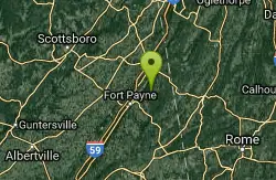
Desoto Area
Oxford, Alabama
0.3 miles ESwim near Oxford, Alabama
Swim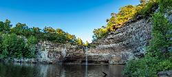
Desoto Falls
Mentone, Alabama
3.9 miles NEAlabama's tallest waterfall, a 104-foot cascade with its own small canyon inside Desoto State Park — rich in Native American history and Spanish explorer legends, with upper and lower viewing areas.
Hike, Swim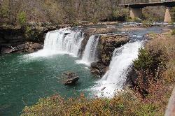
Little River Falls
Fort Payne, Alabama
7.5 miles SLittle River Falls is the dramatic centerpiece at the head of the Little River Canyon National Preserve near Fort Payne, Alabama, on the line between DeKalb and Cherokee counties. Here the Little...
Swim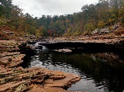
Martha's Falls
Fort Payne, Alabama
8.1 miles SMartha's Falls, also called Little Falls and known to locals as the "Hippie Hole," is the most beloved swimming hole in the Little River Canyon National Preserve near Fort Payne, Alabama, and one of...
Swim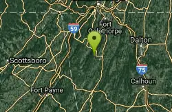
Blue Hole Pigeon
LaFayette, Georgia
21.3 miles NEA small, deep blue-green spring-fed pool — possibly a cave entrance — with divided pools, primitive camping nearby, and spelunking in the area; a Georgia Outdoor Recreational Pass is required.
Swim
Guntersville Area
Oxford, Alabama
23.8 miles WSwim near Oxford, Alabama
Swim
Conasauga Area
Cave Spring, Georgia
31.6 miles SESwim near Cave Spring, Georgia
Swim
Cave Spring
Cave Spring, Georgia
31.6 miles SEA cave-fed spring flows into a Georgia-shaped swimming pool in Rolator Park — then explore the cave itself for a one-of-a-kind small-town splash.
Swim
Walls Of Jericho
Estillfork, Alabama
43.4 miles NWA massive 200-foot limestone waterfall in a wild Southern Cumberland Plateau amphitheater preserved by the Nature Conservancy — a strenuous 3.5-mile each-way hike to a clear green pool that may be deep enough to swim at higher water levels.
Swim
Grundy Forest Area
Tracy City, Tennessee
47.2 miles NSwim near Tracy City, Tennessee
Swim
Rockmart
Rockmart, Georgia
48.1 miles SEA concrete pump station platform over a dammed stretch of Thompson Creek on the Silver Comet Trail — reports say rocky water at low levels makes it best when the creek runs high.
Swim
Farmers Lake
Cohutta, Georgia
49.6 miles NESwim near Cohutta, Georgia
Swim


