


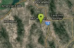
Garden Creek Gap
McCammon, Idaho
| Address: | ~McCammon, ID 83250, USA |
| GPS: |
42°34'23.5"N 112°19'1.2"W Maps | Directions |
| State: | Idaho |
Cross Country Ski, Hike, Horseback, and Rock Climb
Garden Creek Gap is the defile Garden Creek cuts through as it flows toward Marsh Creek on the east side of the Bannock Range after draining a sizable chunk of territory on the west side of those mountains. Climbing nerd type people may have noticed it off to the west while traveling I-15 south of Pocatello. In the gap the stream has cut into a resistant layer of quartzite and thus exposed some rock climbing. If you do not rock climb but like to scramble, this has the best class 3, 3+ and 4 scrambling near Pocatello.
More Information
Be courteous, informed, and prepared. Read trailhead guidelines, stay on the trail, and don't feed the wildlife.
Read More- Plan Ahead and Prepare
- Travel & camp on durable surfaces
- Dispose of waste properly
- Leave what you find
- Minimize campfire impacts
- Respect wildlife
- Be considerate of other visitors
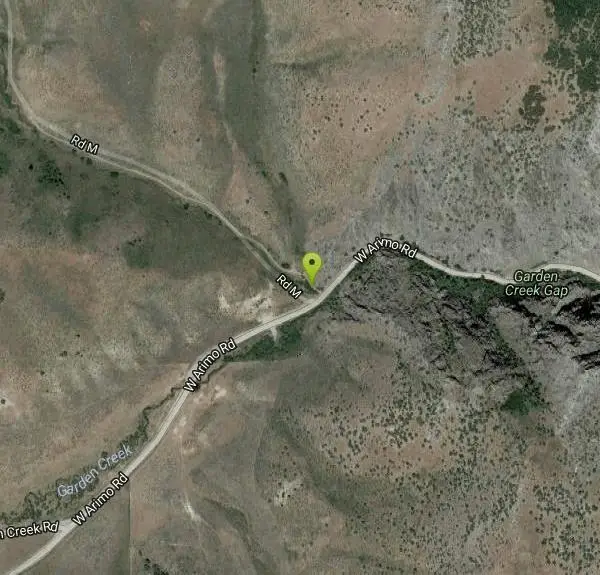
Directions
From McCammon, Idaho
- Head east on 6th St toward Center St (89 ft)
- Turn right at the 1st cross street onto Center St (0.7 mi)
- Continue onto State St (1.7 mi)
- Turn right onto E Jensen Rd (1.7 mi)
- Merge onto S Robin Rd (3.4 mi)
- Turn right onto W Arimo RdDestination will be on the right(3.6 mi)
I-15 to McCammon, south of Pocatello approx. 25 mile. Visible from I-15.
Other Rock Climbing Walls, Hiking Trails, Cross Country Ski Trails, and Horseback Trails Nearby
Scout Mountain Campground
Pocatello, Idaho
8.6 miles NA scenic campground at 6,900 feet on beautiful Scout Mountain, 13 miles south of Pocatello, with birding, wildlife viewing, and a variety of multi-use trails nearby.
Camp, Hike
East Fork Mink Creek Trail
Pocatello, Idaho
10.7 miles NWAn early-season cross-country skiing destination near Pocatello on the East Fork Road leading to Justise Park — access depends on seasonal gate closures and snowpack conditions.
Cross-country Ski, Hike, Horseback, Mountain Bike
South Fork Of Mink Creek Trail
Pocatello, Idaho
10.7 miles NWCross Country Ski, Hike, Mountain Bike, and Snowshoe near Pocatello, Idaho
Cross-country Ski, Hike, Mountain Bike, Snowshoe
West Fork Mink Creek Trail
Pocatello, Idaho
11.6 miles NWA 3.5-mile shaded singletrack trail near Pocatello popular with hikers, horseback riders, and mountain bikers, climbing gradually to Elk Meadows Road with connections to further trails beyond.
Hike, Horseback, Mountain Bike
Valve House Draw
Pocatello, Idaho
11.6 miles NWA motorized doubletrack trail in Pocatello that climbs through forest to the top before a 2-mile stretch of very sweet downhill singletrack — short but worth the 10-mile loop.
Cross-country Ski, Hike, Horseback, Mountain Bike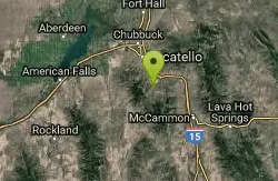
Cherry Springs
Pocatello, Idaho
13.0 miles NThick green vegetation, abundant birds, and wildlife viewing along a picnic-table-lined trail just a short distance from Pocatello, Idaho — a peaceful nature escape close to town.
Hike 3.2 mi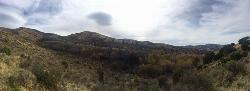
Kinney Creek Trail
Pocatello, Idaho
13.6 miles NA 6.4-mile out-and-back to Indian Mountain Summit in Caribou-Targhee National Forest near Pocatello, with Idaho backcountry views and exceptional birdwatching — raptors, waterfowl, and songbirds.
Hike
Slate Mountain/Gibson Jack Trail
Pocatello, Idaho
16.3 miles NA beautiful Gibson Jack loop in Pocatello with aspen, pines, sage, and meadow views — clockwise is the preferred direction, but watch for a steep creek-bottom fork at mile 5 that can sink a tire.
Hike, Horseback, Mountain Bike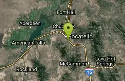
Sunnyside Cliffs at Ross Park
Pocatello, Idaho
19.0 miles NNumbered top-rope climbing routes on the Sunny Side cliffs at Ross Park in Pocatello — newer routes fill in between older numbers with letter suffixes like 17A.
Rock Climb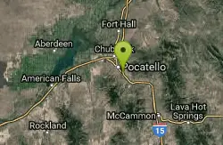
Shady Side Cliffs at Ross Park
Pocatello, Idaho
19.4 miles NNumbered bouldering and top-rope routes on the Shady Side cliffs at Ross Park, with countless contrived variations and eliminations to challenge climbers of all levels.
Rock Climb 0.2-9.7 mi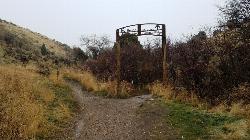
City Creek
Pocatello, Idaho
20.5 miles NPocatello's city-maintained trail network packs over six miles of singletrack into City Creek Canyon, with everything from casual loops to a downhill-only expert run.
Hike, Horseback, Mountain Bike
Sportsman's Park American Falls Reservoir
Aberdeen, Idaho
34.9 miles NWA 30-acre multi-use park on the American Falls Reservoir with two boat ramps, picnic shelters, RV hookups, playgrounds, volleyball courts, and a 1.1-mile paved trail along the reservoir rim.
Camp, Canoe, Hike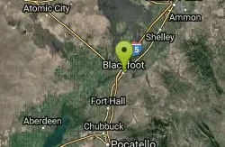
Blackfoot, ID 83221, United States
Blackfoot, Idaho
42.7 miles NHike and Mountain Bike near Blackfoot, Idaho
Hike, Mountain Bike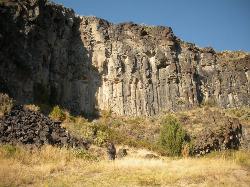
The Playground
Shelley, Idaho
49.6 miles NA moderate-to-hard basalt sport climbing wall east of Idaho Falls with nine routes from 70 to 80 feet — including classics like 'Tied to the Whipping Post' and 'Anchored to the Sky,' best April through September.
Rock ClimbNearby Campsites

Hawkins Reservoir Campground
Arimo, Idaho
4.3 miles SFourteen campsites on a small Idaho impoundment that punches above its weight — spring through fall, plovers, sandpipers, geese, sharp-tailed grouse, mule deer, coyote, and red fox all call it home.
Camp, Canoe
Scout Mountain Campground
Pocatello, Idaho
8.6 miles NA scenic campground at 6,900 feet on beautiful Scout Mountain, 13 miles south of Pocatello, with birding, wildlife viewing, and a variety of multi-use trails nearby.
Camp, Hike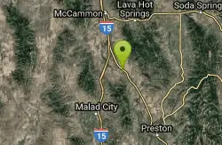
Downata Hot Springs
Downey, Idaho
17.4 miles SEA full-service hot springs resort south of Pocatello with a large naturally heated pool, four water slides, a water playground, hot tub, volleyball, six cabins, yurts, and ATV trails nearby.
Camp, Hot Springs, Swim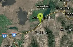
Pipeline Campground
American Falls, Idaho
31.8 miles WFive campsites on the Snake River near American Falls Reservoir — fishing for trophy brown and rainbow trout, with 30-plus species of migratory shorebirds and winter bald eagles overhead.
Camp
Sportsman's Park American Falls Reservoir
Aberdeen, Idaho
34.9 miles NWA 30-acre multi-use park on the American Falls Reservoir with two boat ramps, picnic shelters, RV hookups, playgrounds, volleyball courts, and a 1.1-mile paved trail along the reservoir rim.
Camp, Canoe, Hike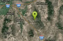
Sublett Creek Campground
Malta, Idaho
40.6 miles SWNine campsites at 5,500 feet on Sublett Creek, two miles from Sublett Reservoir, with horse facilities, a boat ramp, and trails into the Sublette Range for hiking and riding.
Camp, Canoe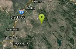
Blackfoot River Crossing at Trail Creek Road
Firth, Idaho
43.7 miles NEA remote Blackfoot River crossing accessed via a network of gravel roads near Firth, Idaho — multiple parking areas along a wildlife management area stretch of the river.
Camp


