


South Fork Of Mink Creek Trail
Pocatello, Idaho
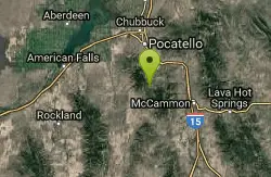
| Address: | 1523 Forest Rd 163, Idaho, USA |
| GPS: |
42°42'25.8"N 112°25'20.4"W Maps | Directions |
| State: | Idaho |
Cross Country Ski, Hike, Mountain Bike, and Snowshoe
The South Fork of Mink Creek Trail is a quiet, four-season route in the Mink Creek drainage of the Caribou-Targhee National Forest, tucked into the Scout Mountain country roughly twelve miles south of Pocatello, Idaho. It's one of the anchors of a beloved local trail network that gives Pocatello residents a genuine mountain escape within a half-hour of town, threading a creek-bottom canyon through conifer and aspen with the Bannock Range rising on either side. Depending on the season, the same corridor serves hikers, mountain bikers, cross-country skiers and snowshoers.
The route follows South Fork Mink Creek Road, running about 5 miles with a gentle 890 feet of elevation gain and climbing from roughly 5,354 feet to 6,225 feet. That easy grade is the trail's charm: it's a steady, forgiving climb rather than a lung-buster, making it approachable for families, casual riders, and skiers looking for a mellow track. As a seasonal forest road it is typically open to motor vehicles from May 15 through November 15, which shapes how the corridor gets used through the year, and it becomes a peaceful non-motorized route once the snow arrives.
Winter may be when the drainage shines brightest. The Mink Creek area is a longtime favorite for Nordic skiing and snowshoeing around Pocatello, with the gentle grades and sheltered canyon making for pleasant tracks when the snow is good. In summer and fall, the same corridor is a pretty hike or ride, with aspens turning gold in September and October and reliable creek sounds most of the way.
Access runs southeast from Pocatello on Bannock Highway about 3.7 miles, then onto North Mink Creek Road for another 5.8 miles into the drainage. The nearby Mink Creek Group Campground makes it easy to base here, and the surrounding network is rich with options: the West Fork Mink Creek Trail begins just outside the campground and is popular with hikers, mountain bikers and horseback riders, and Corral Creek and Valve House trails add more mileage.
This is a shared, multi-use corridor, so a bit of trail courtesy goes a long way, particularly where bikes, horses and hikers mix. Mountain weather changes fast here and the road is seasonal, with snow lingering into spring and arriving early in fall, so conditions can differ sharply from what the calendar suggests. Carry water, layers, and bug spray in early summer, watch for vehicles during the open-road season, and let the creek and the aspens set the pace. For Pocatello locals and visitors alike, it's an easy, honest slice of Idaho mountain country close to home.
More Information
Caribou-Targhee National Forest | Mink Creek Group Campground | Forest Service
Mink Creek Group Campground is located 12 miles south of Pocatello, Idaho, within the Caribou-Targhee National Forest’s Westside Ranger District. Situated at an elevation of 5,159 feet, it is accessible by heading southeast from Pocatello on Bannock Highway for approximately 3.7 miles, then continuing onto North Mink Creek Road for 5.8 miles to the campground entrance.Natural Features:The campground is situated along Mink Creek in the scenic Bannock Mountain Range of southeastern Idaho. A grove of ponderosa pines borders one side of the site, offering partial shade, while aspens and additional pines dot the surrounding mountainsides. The area is a haven for birdwatchers, with species such as Western Scrub-Jay, Juniper Titmouse, Bushtit, Blue-gray Gnatcatcher, Mountain Bluebird, and Calliope Hummingbirds commonly spotted.Recreation:Mink Creek Group Campground offers access to a variety of outdoor activities. The West Fork Mink Creek Trail begins just outside the campground, popular with hikers, mountain bikers, and horseback riders. Additional nearby trails, including Corral Creek Trail and Valve House Trail, provide further exploration opportunities. The Mink Creek area is known for birding and wildlife viewing, while the nearby Cherry Springs Nature Area offers a namesake spring, a fishing stream, and paved self-guided nature trails. In winter, the Mink Creek Nordic Center provides groomed cross-country ski trails.Facilities:The campground features one large, accessible group site that can accommodate up to 200 people, making it ideal for family reunions, weddings, or group retreats. The site includes a 40x80-foot picnic pavilion with a concrete base, night lighting, and two electrical outlets, along with 12 large picnic tables, two serving tables, a large fire ring, and a paved parking area. Amenities include two accessible vault toilets and four potable water hydrants. The entrance is secured with a locked gate, and the campground is monitored by hosts and periodic sheriff patrols. The access road is paved, ensuring easy entry for RVs and cars.This campground has 1 groupsite and is open all year. In the summer is also has a hook-up. Reservations only.Season: Late May-Early September
https://www.fs.usda.gov/r04/caribou-targhee/recreation/mink-creek-group-campgroundSouth Fork Mink Creek Hiking Trail, Pocatello, Idaho
It's pretty neat. Near Pocatello, Idaho.
https://www.hikingproject.com/trail/7106860/south-fork-mink-creekNever modify trail features. Ride trails when they're dry enough that you won't leave ruts. Speak up when you see others on the trail and always yield to hikers, horses, and others coming uphill. Always ride on the established trail.
Read MoreBe courteous, informed, and prepared. Read trailhead guidelines, stay on the trail, and don't feed the wildlife.
Read More
- Plan Ahead and Prepare
- Travel & camp on durable surfaces
- Dispose of waste properly
- Leave what you find
- Minimize campfire impacts
- Respect wildlife
- Be considerate of other visitors
Directions
From Pocatello, Idaho
- Head southeast on N 7th Ave toward E Wyeth St (0.2 mi)
- Turn right onto E Clark St (0.2 mi)
- Turn left onto N 4th Ave (0.3 mi)
- Turn right onto E Benton St (171 ft)
- Continue straight to stay on E Benton St (0.4 mi)
- Turn left onto S Arthur Ave (0.3 mi)
- Continue onto W Putnam St (0.1 mi)
- Continue onto S Main St (1.3 mi)
- Continue onto Bannock Hwy (6.7 mi)
- Continue onto S Mink Creek Rd (4.0 mi)
- Turn left onto S Fork Mink Creek RdDestination will be on the left(0.4 mi)

Other Mountain Bike Trails, Hiking Trails, Cross Country Ski Trails, and Snowshoe Trails Nearby

East Fork Mink Creek Trail
Pocatello, Idaho
0.0 miles SAn early-season cross-country skiing destination near Pocatello on the East Fork Road leading to Justise Park — access depends on seasonal gate closures and snowpack conditions.
Cross-country Ski, Hike, Horseback, Mountain Bike
West Fork Mink Creek Trail
Pocatello, Idaho
1.1 miles NA 3.5-mile shaded singletrack trail near Pocatello popular with hikers, horseback riders, and mountain bikers, climbing gradually to Elk Meadows Road with connections to further trails beyond.
Hike, Horseback, Mountain Bike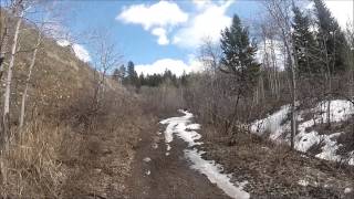
Valve House Draw
Pocatello, Idaho
1.1 miles NA motorized doubletrack trail in Pocatello that climbs through forest to the top before a 2-mile stretch of very sweet downhill singletrack — short but worth the 10-mile loop.
Cross-country Ski, Hike, Horseback, Mountain Bike
Slate Mountain Trail
Pocatello, Idaho
2.0 miles NA multi-use trail in Pocatello open year-round to mountain bikers, hikers, cross-country skiers, snowshoers, and horseback riders — a versatile all-season destination.
Mountain Bike
East Fork Crestline
Pocatello, Idaho
3.0 miles EA strenuous 6.2-mile climb with 2,200 feet of gain followed by a quick downhill from Scout Mountain to the trailhead — a solid workout combining singletrack and ATV trail.
Mountain Bike
Scout Mountain Campground
Pocatello, Idaho
3.4 miles EA scenic campground at 6,900 feet on beautiful Scout Mountain, 13 miles south of Pocatello, with birding, wildlife viewing, and a variety of multi-use trails nearby.
Camp, Hike
Cherry Springs
Pocatello, Idaho
3.4 miles NEThick green vegetation, abundant birds, and wildlife viewing along a picnic-table-lined trail just a short distance from Pocatello, Idaho — a peaceful nature escape close to town.
Hike 3.2 mi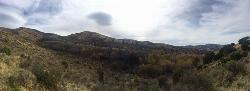
Kinney Creek Trail
Pocatello, Idaho
3.9 miles NA 6.4-mile out-and-back to Indian Mountain Summit in Caribou-Targhee National Forest near Pocatello, with Idaho backcountry views and exceptional birdwatching — raptors, waterfowl, and songbirds.
Hike
Gibson Jack/west Fork
Pocatello, Idaho
5.5 miles NA 1,500-foot climb on mixed singletrack and doubletrack with fantastic scenery, finishing with a fast singletrack descent on Gibson Jack — better than it sounds, much better.
Mountain Bike
Slate Mountain/Gibson Jack Trail
Pocatello, Idaho
5.9 miles NA beautiful Gibson Jack loop in Pocatello with aspen, pines, sage, and meadow views — clockwise is the preferred direction, but watch for a steep creek-bottom fork at mile 5 that can sink a tire.
Hike, Horseback, Mountain Bike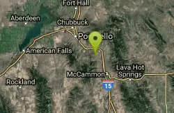
Driveway Canyon Trail
Inkom, Idaho
7.7 miles NEA motorcycle-converted singletrack trail in Driveway Canyon near Inkom, Idaho — multi-use with forest service origins.
Mountain Bike 0.2-9.7 mi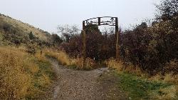
City Creek
Pocatello, Idaho
10.2 miles NPocatello's city-maintained trail network packs over six miles of singletrack into City Creek Canyon, with everything from casual loops to a downhill-only expert run.
Hike, Horseback, Mountain Bike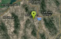
Garden Creek Gap
McCammon, Idaho
10.7 miles SEA sandstone rock climbing area in a scenic mountain gap west of I-15, with great Class 3-4 scrambling and some of the best technical routes in the Pocatello area.
Cross-country Ski, Hike, Horseback, Rock Climb
Cave Trail
Pocatello, Idaho
11.4 miles NMountain Bike near Pocatello, Idaho
Mountain Bike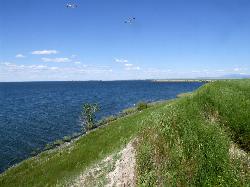
Sportsman's Park American Falls Reservoir
Aberdeen, Idaho
24.5 miles NWA 30-acre multi-use park on the American Falls Reservoir with two boat ramps, picnic shelters, RV hookups, playgrounds, volleyball courts, and a 1.1-mile paved trail along the reservoir rim.
Camp, Canoe, Hike
Blackfoot, ID 83221, United States
Blackfoot, Idaho
33.6 miles NHike and Mountain Bike near Blackfoot, Idaho
Hike, Mountain Bike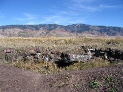
Niter Ice Cave
Grace
37.4 miles EA 500,000-year-old lava tube three miles south of Grace, Idaho, where ice forms on the cave floor much of the year. It is free, ungated and a short walk from a roadside pullout on Ice Cave Road.
Cave, Hike
Summit Canyon Trail
Malad City, Idaho
38.8 miles SEA multi-season trail near Malad City open to hikers, mountain bikers, snowmobilers, equestrians, cross-country skiers, and snowshoers — a true year-round outdoor corridor.
Mountain Bike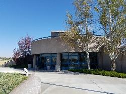
Hell's Half Acre Northbound Rest Stop
Blackfoot, Idaho
41.9 miles NA well-kept I-15 rest area near Blackfoot features lava-flow interpretive signs, walking paths, picnic tables, and vending machines — a worthwhile stop on any road trip.
Hike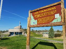
Hell's Half Acre Southbound Rest Stop
Blackfoot, Idaho
42.0 miles NA well-maintained Interstate 15 rest stop on a lava flow area with a great walking path, informational signs about the formations and wildlife, picnic tables, and vending machines.
HikeNearby Campsites
Scout Mountain Campground
Pocatello, Idaho
3.4 miles EA scenic campground at 6,900 feet on beautiful Scout Mountain, 13 miles south of Pocatello, with birding, wildlife viewing, and a variety of multi-use trails nearby.
Camp, Hike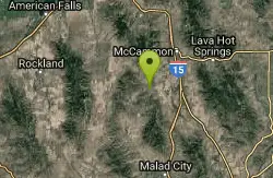
Hawkins Reservoir Campground
Arimo, Idaho
14.2 miles SFourteen campsites on a small Idaho impoundment that punches above its weight — spring through fall, plovers, sandpipers, geese, sharp-tailed grouse, mule deer, coyote, and red fox all call it home.
Camp, Canoe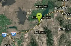
Pipeline Campground
American Falls, Idaho
24.4 miles WFive campsites on the Snake River near American Falls Reservoir — fishing for trophy brown and rainbow trout, with 30-plus species of migratory shorebirds and winter bald eagles overhead.
Camp
Sportsman's Park American Falls Reservoir
Aberdeen, Idaho
24.5 miles NWA 30-acre multi-use park on the American Falls Reservoir with two boat ramps, picnic shelters, RV hookups, playgrounds, volleyball courts, and a 1.1-mile paved trail along the reservoir rim.
Camp, Canoe, Hike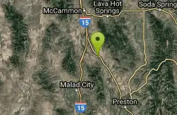
Downata Hot Springs
Downey, Idaho
28.0 miles SEA full-service hot springs resort south of Pocatello with a large naturally heated pool, four water slides, a water playground, hot tub, volleyball, six cabins, yurts, and ATV trails nearby.
Camp, Hot Springs, Swim
Blackfoot River Crossing at Trail Creek Road
Firth, Idaho
39.0 miles NEA remote Blackfoot River crossing accessed via a network of gravel roads near Firth, Idaho — multiple parking areas along a wildlife management area stretch of the river.
Camp
Sublett Creek Campground
Malta, Idaho
40.8 miles SWNine campsites at 5,500 feet on Sublett Creek, two miles from Sublett Reservoir, with horse facilities, a boat ramp, and trails into the Sublette Range for hiking and riding.
Camp, Canoe
Firth River Bottoms
Firth, Idaho
43.0 miles NA community riverside park in Firth with horseback riding, picnicking, fishing, and baseball — something for the whole family along the river bottoms.
Camp, Canoe, Hike


